Author Archives: susanfgould

Exploring “bottom up” approaches to ecosystem repair in Victoria’s Central Goldfields

Chris Pocknee

Figure 1. An example of severely degraded box-ironbark. (Photo Paul Foreman)

Introduction. Box-Ironbark forests are an important ecosystem for biodiversity in southern Australia providing critical habitat for threatened species including Swift Parrots and Regent Honeyeaters. With over 83% of the original box-ironbark forests cleared and much of the remaining area degraded, the box-ironbark forests are one of the most endangered ecosystems in Australia. The box-ironbark forests of the Central Goldfields in Victoria have been severely degraded by gold mining in the 1900s and by forestry activities (Fig. 1).

This project explores a suite of interventions including nest box installation, ecological thinning, soil contour ripping, targeted revegetation and gully ponding. The interventions are intended to restore the hydrology and begin to repair the function of the entire ecosystem from the bottom up (Fig. 2). Biolinks Alliance collected baseline ecological data. These data and the BACI (Before-After-Control-Impact) experimental design will allow thorough assessment of the impacts of the interventions.

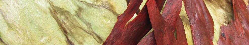
Figure 2. An example of the desired outcome. (Photo Paul Foreman)

The project site is within Spring Plains Nature Conservation Reserve (NCR) less than 10 km south-east of the town of Heathcote and is managed by Parks Victoria. Peter’s Gully, the treatment site  is 138 Ha and the control site, White’s Gully, is 140 Ha (Fig. 3).

Figure 3. The project site within Spring Plains NCR .

Works undertaken. To address the lack of natural tree hollows across the site, 200 nest boxes were installed, 100 in both the control and the treatment gully. These boxes are specifically designed for use by brush-tailed phascogales (Phascogale tapoatafa) and Krefft’s gliders (Petaurus notatus) and have been monitored every three months since their installation in August 2022.

Ecological thinning was undertaken across 76.7 ha of the treatment site, with an approximate reduction in tree basal area of 40-75% within thinned areas. Thinning is intended to increase the amount of light reaching the understorey, and decrease the amount of competition for soil nutrients and water, thereby increasing the growth rate of the remaining trees to enhance their natural habitat value. Thinnings were laid down along contour lines where possible to impede overland water flow and create microsites for organic material and seeds to build up. The woody debris also created ground-level habitat for small animals (Fig. 4).

Figure 4. Before (above) and after (below) photos taken in September of 2022 and 2023 showing ecological thinning in Peter’s Gully. (Photo Cameron O’Mara).

Contour lines were ripped to a depth of approximately 30 cm along 71.6 km within the treatment gully, and seeds of local provenance wallaby-grasses (Joycea pallida and Rytidosperma spp.) were directly sown into the rip-lines (Fig. 5). Ripping along contour lines is intended to increase water infiltration into the soil rather than running off downslope, and creates areas with much higher rates of seed germination.

Figure 5.  Seed germination rates in rip lines are high compared to adjacent areas (Photo Cameron O’Mara).

Twenty-one small, shallow ‘ponds’ with leaky weirs were constructed through the gully bottom using timber felled during thinning. This is intended to slow water movement, increase moisture availability to the ecosystem, minimise the loss of top-soil and leaf litter to fast flowing water, and reduce the erosion that occurs during heavy rains. Semi-aquatic rushes and grasses were planted around the ponds to promote stability and re-establish these species across the site.

Results to date. It is too early to have meaningful data on ecological outcomes, as the first round of post-intervention monitoring is still in progress and we expect to see changes unfold over a number of years. We have already observed reduced run-off of water and sediment following heavy rain in the treatment site compared with the control site, although this has not yet been formally quantified.

Recent post-treatment reptile survey results are promising. We recorded 7 individuals from two skink species (Lerista bougainvillii and Lampropholis guichenoti) in tile surveys in the treatment site compared with one individual L. bougainvillii in the control site. Nest box monitoring has revealed a high occupancy rate across the 12 months since installation, with 94% of boxes showing signs of small mammal occupancy (i.e. either animals present or a nest) within 6 months, and 99% after 12 months. We counted a minimum of 604 Krefft’s gliders using these boxes in September 2023, and 22 boxes being used by phascogales.

Lessons learned and future directions. The biggest hurdle to implementing this project was the approval process. We have now been through the process successfully and have a clear idea of how to best approach it in the future. This project requires ongoing monitoring to assess impacts on ecosystem function. There may be a role for targeted threatened species work, such as the reintroduction of missing threatened flora to the site.

Stakeholders and Funding bodies. This project has been funded by the R. E. Ross Trust, Brian D. Newman Foundation, Ian Potter Foundation, private philanthropists, DEECA Nature Fund, and Parks Victoria Volunteer Innovation Fund. We acknowledge Parks Victoria as a partner on this project, and the support from Taungurung Land and Water Council, City of Greater Bendigo, the Victorian Department of Energy, Environment and Climate Action (DEECA), Goulburn-Murray Water and the North-Central Catchment Management Authority.

Contact: Chris Pocknee, Ecologist – Biolinks Alliance. Email: chris.pocknee@biolinksalliance.org.au

Eradicating weeds along the Tasmanian Wilderness World Heritage Area coastline

Jon Marsden-Smedley

Figure 1. The project supports multiple bird species including the vulnerable (a) Hooded Plover, (b) Australian Pied Oystercatcher, (c) Sooty Oystercatcher and (c) the critically endangered Orange-bellied Parrot. (Photos J. Marsden-Smedley)

Introduction. The Tasmanian Wilderness World Heritage Area (TWWHA) in the southwest of Tasmania is an important area for conservation. The coastline of this region has high natural integrity and is a major stronghold for a number of shore-nesting and feeding birds including the vulnerable Hooded Plover (Thinornis cucullatus), Australian Pied Oystercatcher (Haematopus longirostris), Sooty Oystercatcher (Haematopus fuliginosus) and the critically endangered Orange-bellied Parrot (Neophema chrysogaster) during its migration (Fig. 1). Three ecosystem-transforming weed species: Sea Spurge (Euphorbia paralias), Marram Grass (Ammophila arenaria) and Blackberry (Rubus fruticosus aggregate) have the potential to transform the coastline’s geomorphic structure and have been identified as major threats to environmental and cultural value. It is estimated that about 425 km of the 850 km coastline in the TWWHA is susceptible to Sea Spurge and / or Marram Grass invasion.

The WildCare volunteer group SPRATS (Sea sPurge Remote Area TeamS) has been undertaking annual weed management works along the TWWHA coastline between Cape Sorell (Macquarie Harbour) and Cockle Creek since 2006 (Fig. 1). SPRATS is a self-managing volunteer group working in partnership with the Tasmanian Parks and Wildlife Service (PWS). The primary goal of the program is to initially control and then eradicate Sea Spurge and Marram Grass from the coastline (Figs 2-4). The secondary goal is to eradicate any Blackberry infestations found and monitor for other weeds.

Figure 2. The SPRATS work area.

Logistics. The SPRATS weeding program has divided the coastline into eight sectors. At the start of each weeding season, detailed maps are prepared showing weeding sites, campsites and walking routes. These data are uploaded into GPS units so that all groups can efficiently and easily locate previously recorded weed sites, campsites and walking routes. Teams of SPRATS volunteers walk each section of the coastline of the TWWHA annually. While undertaking weed control and monitoring, volunteers also record information on rare and threatened shorebird species, assist with research into the ecology of the region (e.g., collection of Tasmanian Devil scats for genetic analysis), record the location of Aboriginal cultural sites (e.g., petroglyphs, stone arrangements, middens and hut sites) and the usage of the area by other groups (e.g., quad bike riders).

Works undertaken. In the first three years of the program, weeding efforts were concentrated in the southernmost susceptible areas. Once these Sea Spurge infestations had been given an initial knock-down, efforts moved to very large infestations along 45 km of coast south of Cape Sorell. Work then expanded to include about 160 km of coastline in Macquarie Harbour.

Trials were conducted in 2009-2010 to compare both the kill rates of target species and impacts on non-target species of different herbicide treatments. These trials identified glyphosate mixed with Pulse® as the best herbicide treatment for Sea Spurge.

Different strategies have been utilised at different stages of the program. Heli-spraying operations have been used to knock down very large Sea Spurge infestations (i.e., infestations of > 250,000 plants) and the subsequent massive seed germination event. Two rounds of heli-spraying reduced the number of Sea Spurge plants by 90% and enabled subsequent hand weeding. The optimum technique identified for treating Marram Grass was to spot spray with Haloxyfop-R methyl ester and penetrant. This is followed up by hand weeding once weed densities are reduced.

A feature of the SPRATS work program is collection of geo-referenced data on all weeds removed,  along with targeted research into the most effective treatment methods. These data are used to demonstrate work effectiveness, plan annual work programs and report back to the PWS and other funding bodies.

A major development in the past two seasons has been testing and spreading the Sea Spurge biocontrol recently developed by the CSIRO. This biocontrol has the potential to provide a long term solution to the issues associated with Sea Spurge. From 2006 to 2022-23, 8504 work days have been completed, most of which has been volunteer effort.

Figure 3. A SPRATS volunteer standing in a patch of Sea Spurge at the Sassy Creek site in 2007. (Photo J. Marsden-Smedley)

Figure 4. The Sassy Creek site in 2021. (Photo J. Marsden-Smedley)

Results to date. Prior to the start of the program it was estimated that the TWWHA region contained about 11.1 million Sea Spurge plants and about 124 000 Marram Grass clumps located in over 700 sites. By 2022-2023 weeds had been mapped from over 850 sites, made up of about 700 Sea Spurge, 150 Marram Grass, four Blackberry, three Great Mullein and one Slender Thistle. To date the SPRATS program has removed over 14.4 million Sea Spurge plants (about 99.7%). In the 2022-2023 weeding season about 2795 clumps of Marram Grass were sprayed representing a 98% reduction on the pre-SPRATS number of marram grass clumps. The region’s known blackberry infestations have been eradicated.

Challenges. A major challenge is missed Sea Spurge sites. In its second year of growth, Sea Spurge produces a large number of seeds which then germinate or replenish seed banks. Seedlings from these reactivated sites are responsible for between a third and half of Sea Spurge plants treated and the rate at which SPRATS is reducing the number of Sea Spurge is slowing. It appears likely that there are an increasing number of Sea Spurge seeds washing in from very large infestations to the north of the TWWHA and also along the east coast of Tasmania. If the Sea Spurge biocontrol is found to be effective, this issue should be addressed by large scale spreading of the biocontrol agent which should reduce these very large infestations. It may also be necessary to do targeted releases of the biocontrol within the TWWHA.  

In the early years of SPRATS operations, treating Marram Grass was rated as a lower priority than Sea Spurge. Marram Grass identification and weeding is also slower, more laborious and difficult than sea spurge weeding. Marram Grass weeding involves spraying, wiping of individual leaves with herbicide or digging out entire clumps. In recent seasons, improved training in Marram Grass identification and the use of the monocotyledon specific herbicides has resulted in a significant increase in the rate of Marram Grass removal.

Stakeholders and Funding bodies:  The SPRATS program has been supported by theTasmanian Parks and Wildlife Service, WildCare, and in the early part of the project, the Australian  government’s Caring for Country program.

Contact information: Jon Marsden-Smedley, SPRATS (M) 0456 992 201 (E) jon.marsdensmedley@gmail.com  / sprats.tas@gmail.com