
Key words. Wildlife bridge, habitat creation, storm recovery, forest management, Fauna canopy bridge
Joanne Isaac
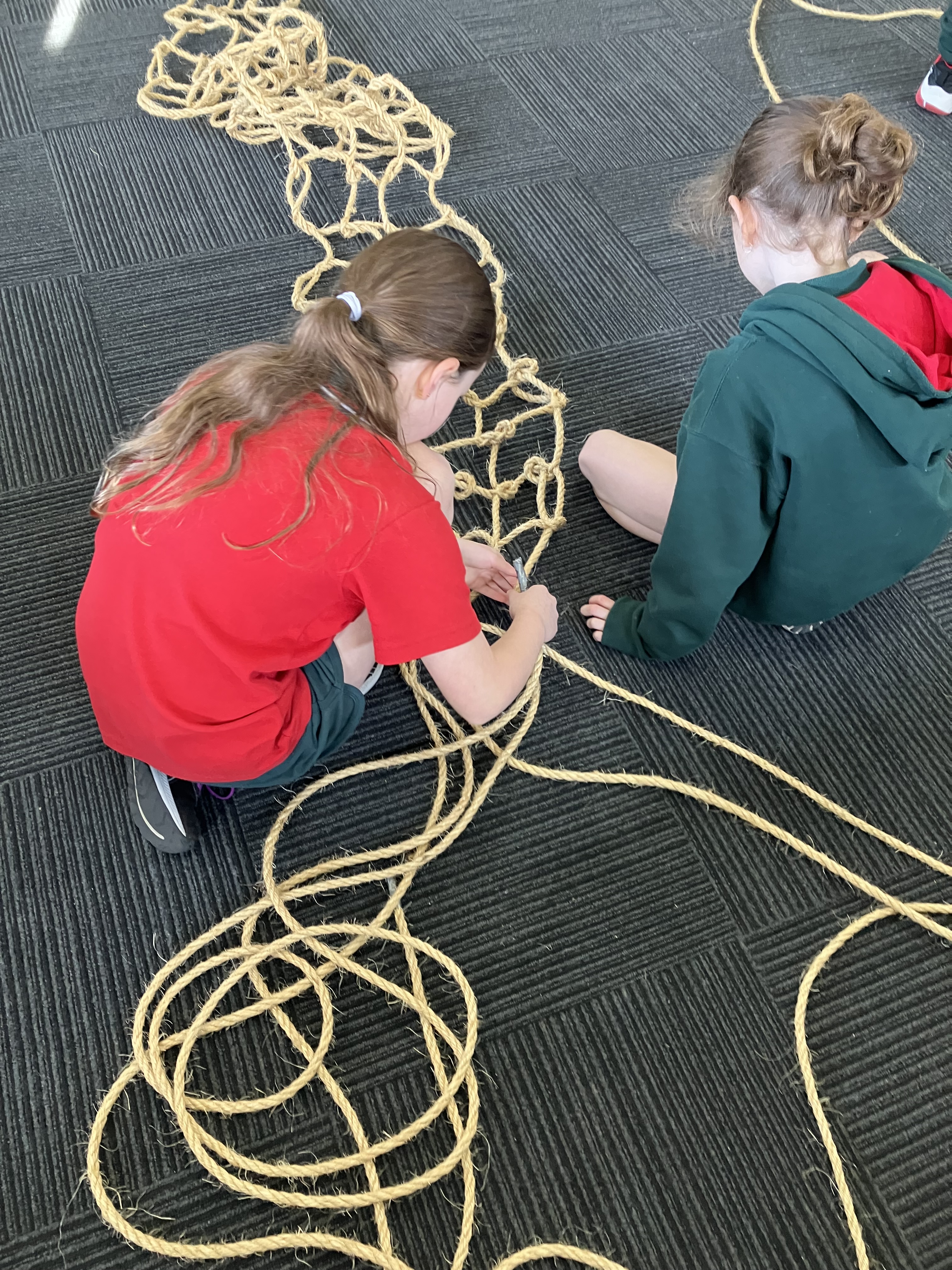
Figure 1. Bridge creation workshop at primary school. © ERA
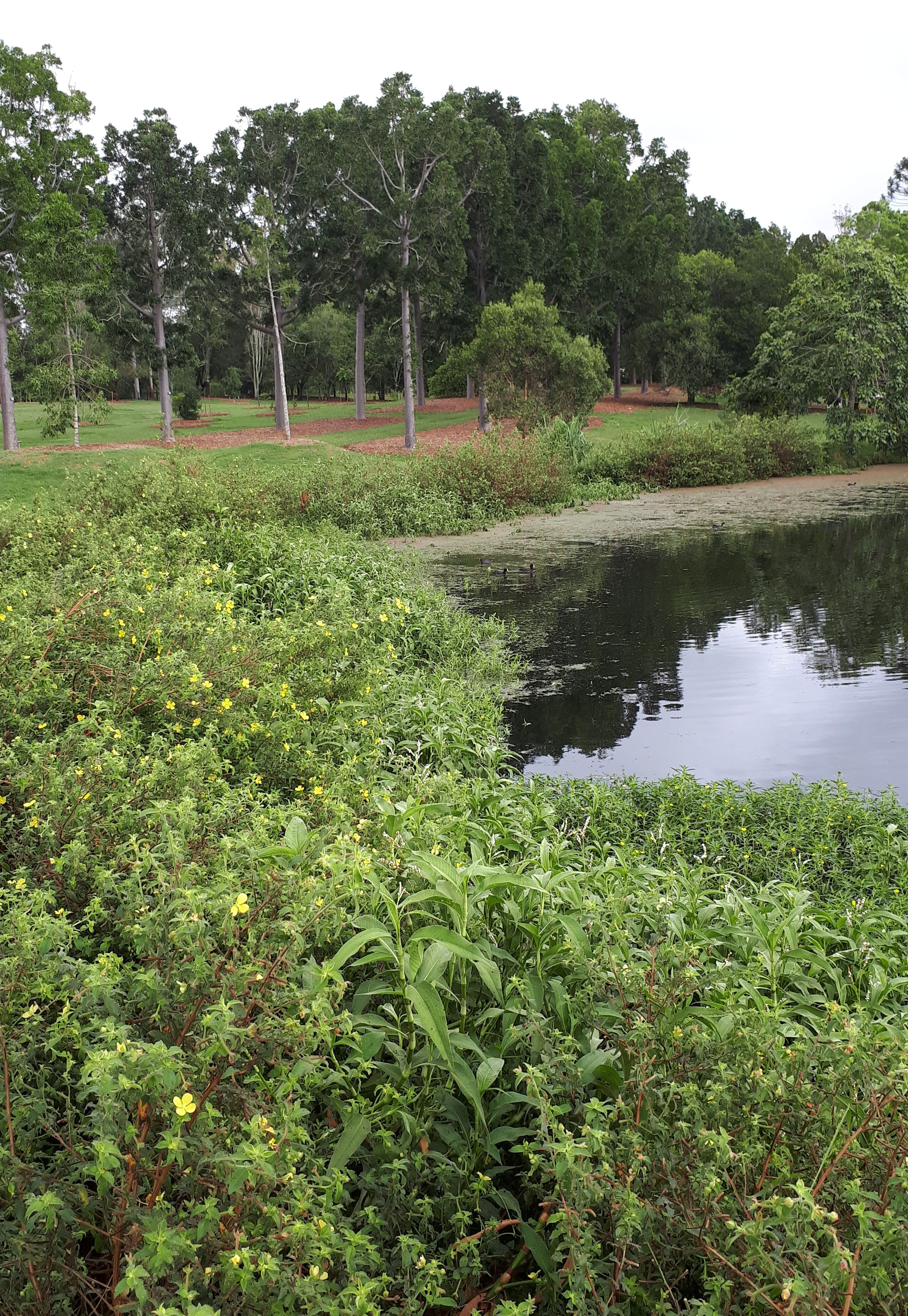
Introduction. In June 2021, severe storms impacted large areas of the state of Victoria, Australia. A number of forested areas important for their biodiversity were damaged including the Yarra Ranges National Park, and Wombat State Forest – much of which is designated to become a national park in 2030.
The strong winds associated with the storms resulted in severe windthrow and wind-snap of trees, with many thousands of trees impacted and large areas of canopy lost across the forests.
The Wombat State Forest has a unique arboreal marsupial fauna, including the most south-westerly population of the endangered Southern Greater Glider (Petauroides volans) in Australia, and other threatened and declining arboreal species including the Brush-tailed Phascogale (Phascogale tapoatafa) and Eastern Pygmy-Possum (Cercartetus nanus). In addition, the area is home to more common species, such as Brush-tailed Possums (Trichosurus spp.) and Ring-tailed possums (Pseudocheirus peregrinus) which are important within the food chain for predators including Powerful Owl (Ninox strenua).
Areas of severe windthrow and canopy loss represent a substantial movement barrier to arboreal marsupials, most of whom prefer not to come to the ground where they are at risk of predation by cats and foxes, and potentially also car collision.
One possible temporary solution is fauna canopy rope bridges. Canopy bridges are often used in road projects when a road bisects habitat. Studies across Australia have demonstrated that a wide range of species will utilise these canopy bridges, including Ring-tailed Possums (Pseudocheirus spp.) and Leadbeater’s Possum (Gymnobelideus leadbeateri). Birds are also often recorded using bridges as perches.
However, pre-made canopy bridge can be extremely expensive, and cost prohibitive for many conservation projects which have limited funds available. In this project, we developed a simple technique to create temporary, biodegradable, fauna rope bridges for installation in storm-impacted habitat in the Wombat State Forest. We partnered with the Department of Energy, Environment and Climate Action (DEECA) and multiple local councils to involve the local community in workshops to create sections of bridge, which were then installed in strategic locations across the forest.
Preliminary works. Our team began by developing a simple method of rope bridge creation based on published accounts of pre-made fauna bridges. Unlike fauna bridges in road projects, these bridges were made to be temporary – to only last as long as it takes for the canopy to re-grow. As such, we chose natural sisal rope, which is biodegradable, but more resistant to ultraviolet light and wet than other natural rope such as manila.
In addition, we developed a method of attachment to standing trees which does not require additional infrastructure, and which also allows easy adjustment of attachment ropes to ensure host trees are not impacted into the future.
A prototype bridge was installed and monitored using a remote wildlife camera in order to test the design for suitability; within one week Krefft’s Glider (Petaurus notatus) were recorded using the bridge, and a number of birds used it as a perch.
Together with local councils, community events were organized in a variety of indoor and outdoor venues for rope bridge making workshops. These were advertised on social media and individual council websites.
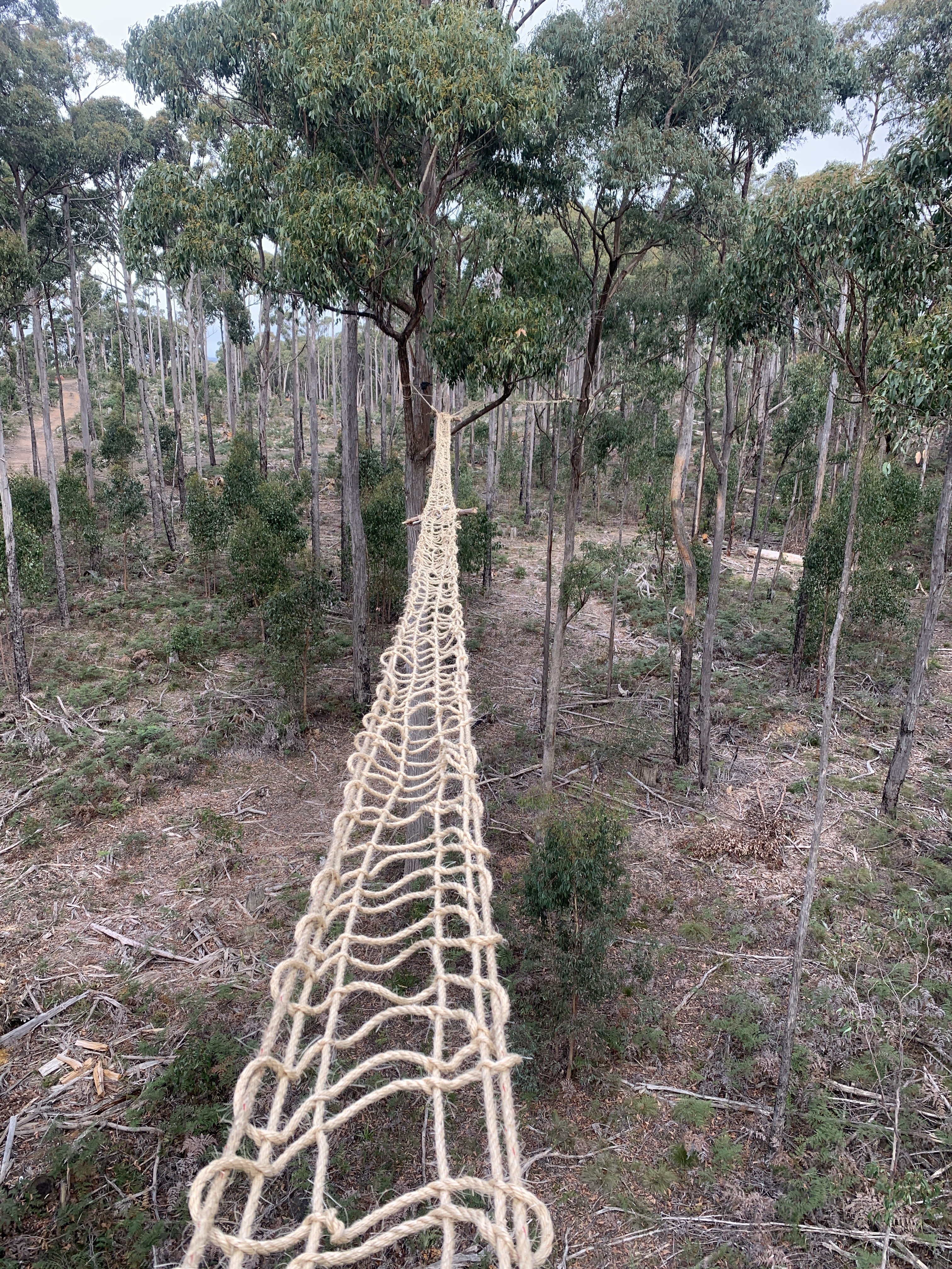
Sections of bridge, approximately 10 meters long, were created by the community during workshops using a simple knotting technique (Fig. 1).
Bridges were installed in strategic locations in storm-damaged forest, determined through liaison on with the relevant local council and DEECA. Installations were completed by professional arborists (Fig. 2); sections of bridge were woven together and secured in order to create the required length for the installation site.
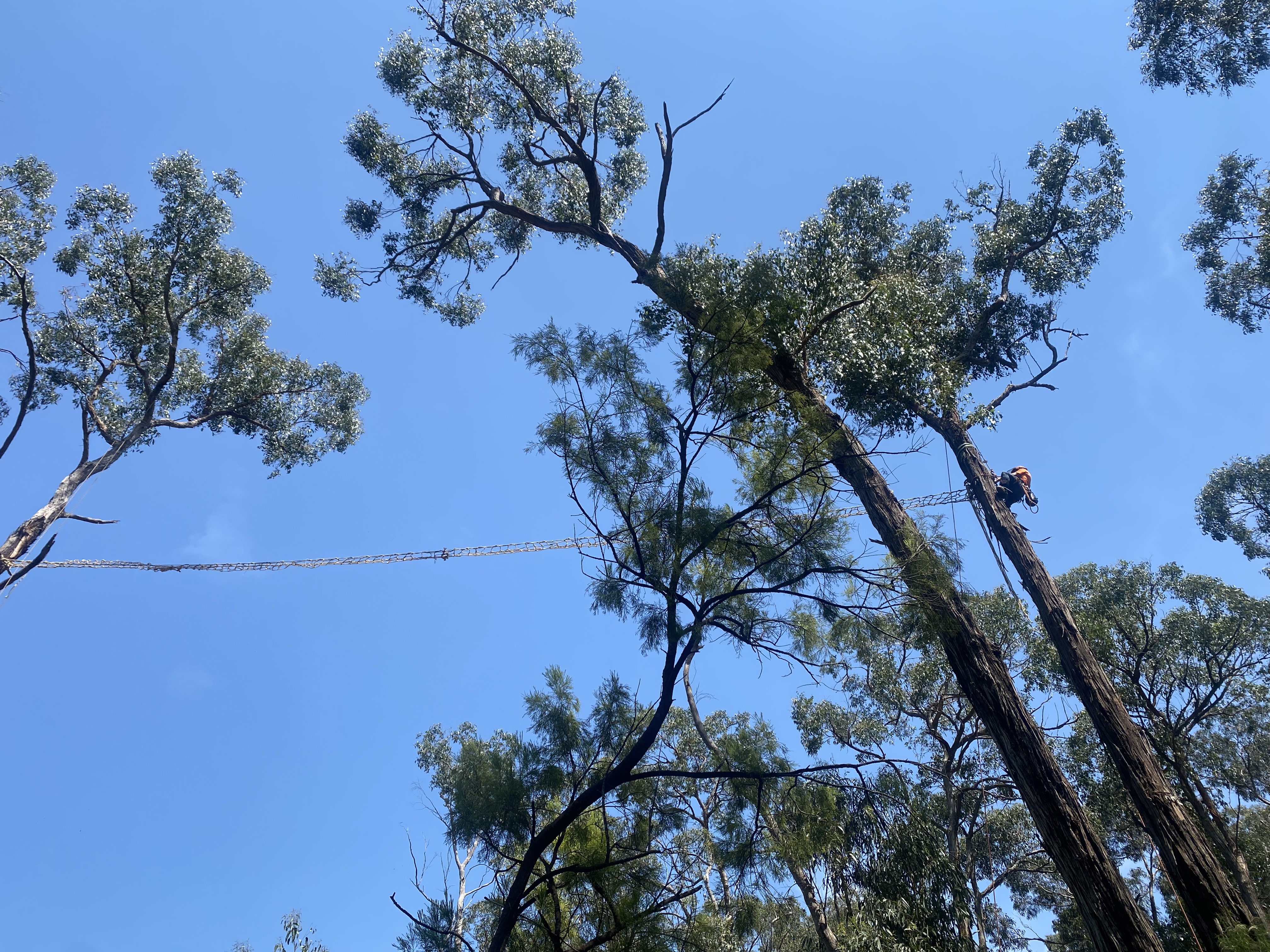
Figure 2. Bridge installation. © ERA
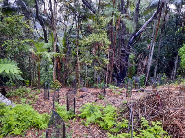
In the past year, more than 300m of rope bridge has been created as a result of these projects and four bridges have been installed in the Yarra Ranges area, and four in the Wombat State Forest area (Fig. 3). A number of bridges are being monitored using Reconyx cameras and three cameras on Hepburn Council bridges.
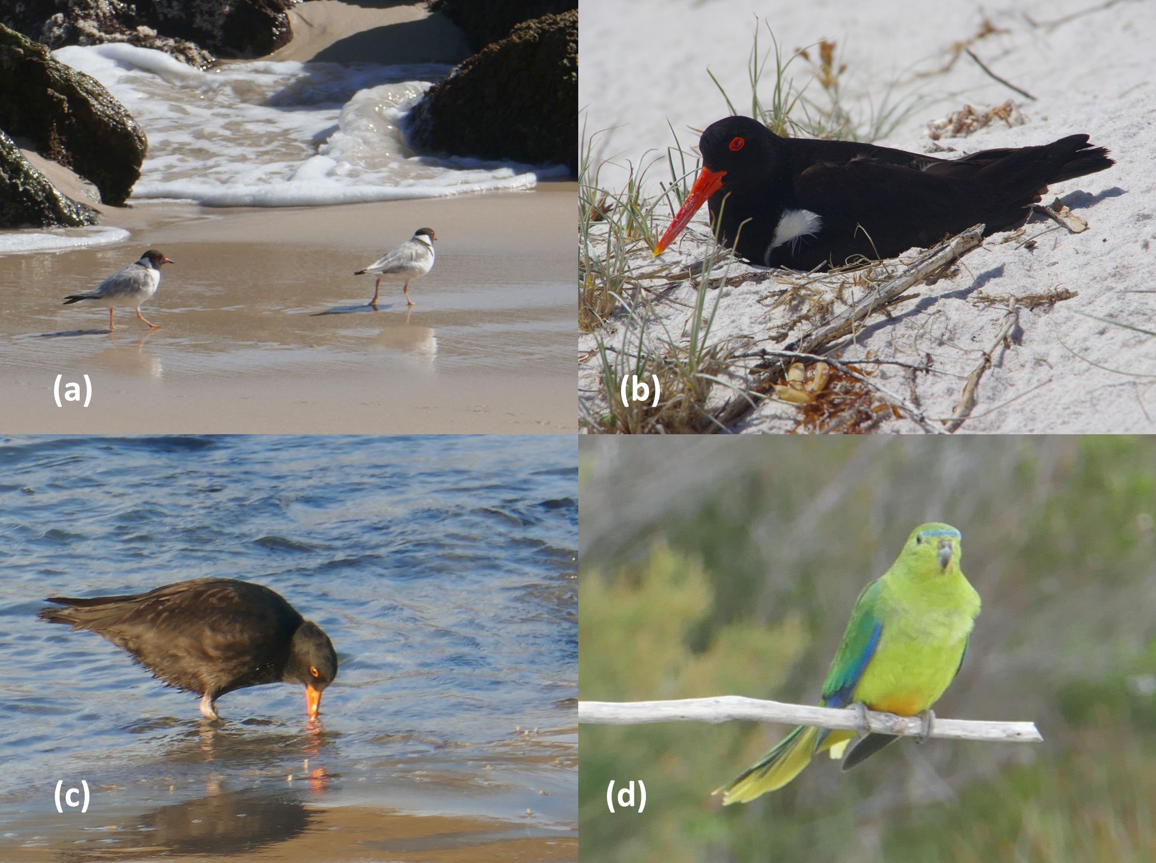
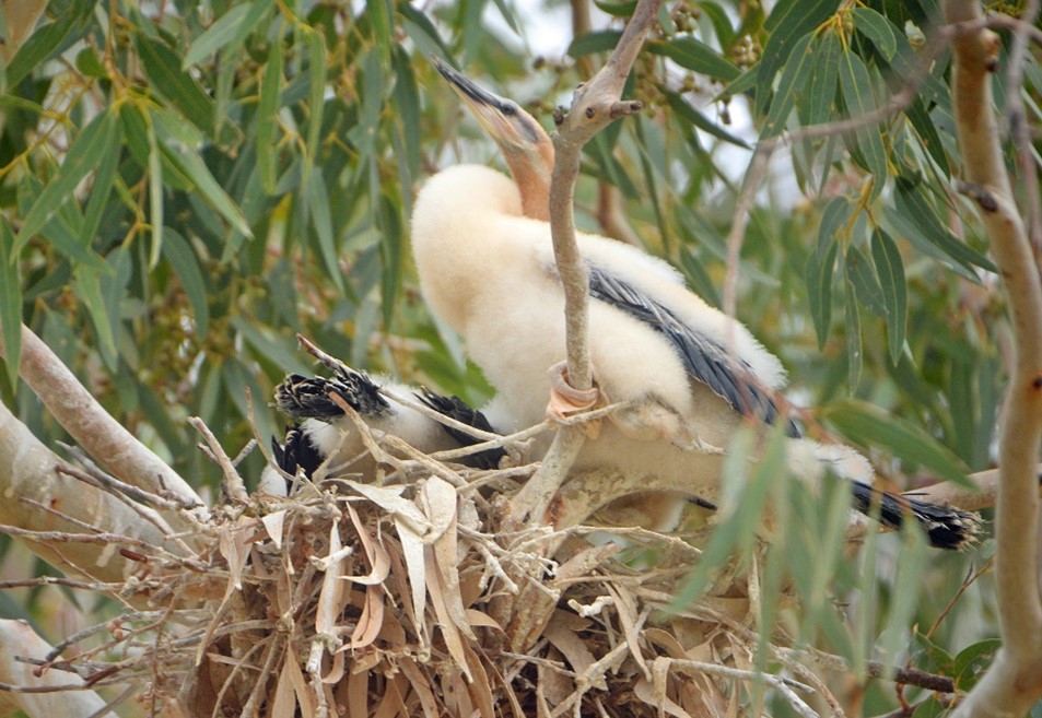
0Figure 3. Bridge following installation in the Wombat State Forest. © ERA.A variety of species have already been recorded using the rope bridges, including Feather-tailed gliders (Acrobates spp.) and Eastern Ring-tailed possums (Fig. 4), and birds including Crimson Rosella (Playcercus elegans) and Laughing Kookaburra (Dacelo novaeguineae) are using them as perches.

Figure 4. Ring-tailed Possum using a bridge in the Wombat State Forest. © ERA.
More bridges are planned for installation in the near future. We are currently also undertaking experiments to determine the lifespan of sisal rope in the environment, and decomposition rates.
Preliminary Results. Calculations estimate that the cost was around $20 per meter of completed rope bridge, as compared to upwards of $200 per meter for pre-made bridge. In terms of community engagement and involvement, a wide variety of individuals and groups attended workshops and made bridges. Local Scout groups and schools and the Youth Justice Centre were also involved. Preliminary results from a questionnaire indicate that participants welcomed the opportunity to contribute to helping the environment, and all participants would attend another workshop in the future.
Stakeholders and Funding bodies. The project has been funded by DEECA, Yarra Ranges and Hepburn Shire Councils. Its partners are Hepburn, Macedon Ranges and Moorabool Shire Councils, and Eco Warriors Australia. Ecology & Restoration Australia is supported by the Department of Energy, Environment and Climate Action, Yarra Ranges Council, Macedon Ranges Shire Council, Hepburn Shire Council, Moorabool Shire Council, and Eco Warriors Australia.
Contact information. Dr Jo Isaac, Principal Ecologist, Ecology & Restoration Australia, 10 View Street, Avonsleigh, Vic, 0459403286, jo.isaac@eraus.com.au
See also: video made by Yarra Ranges Council who recently promoted the project funded by themselves https://www.youtube.com/watch?v=t_Yc_nqLrdg


