By Tom Clarke

Figure 1. Contractors felling mangrove trees to restore migratory shorebird habitat structure at Stockton Sandspit.
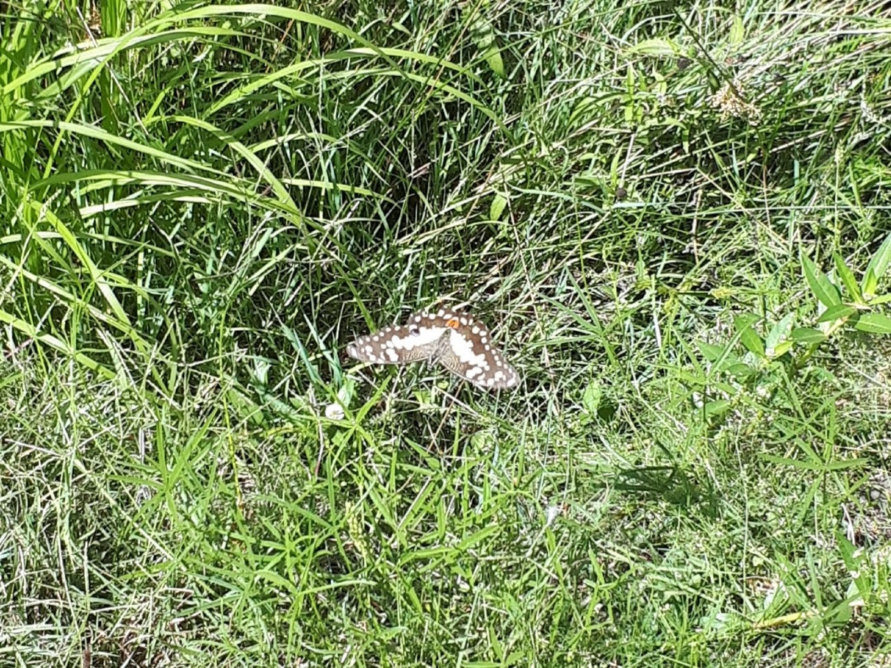
Introduction. Thirty-seven species of migratory shorebirds regularly visit Australia, with all but one spending up to 6 months of each year here. Globally, populations of some migratory shorebirds have declined by 80% over the last 30 years largely due to habitat destruction and disturbance along the East Asian-Australasian Flyway. Within Australia, degradation of feeding and roosting habitats and disturbance are the major threats. Shorebirds need access to safe roosting places. Typically, a favoured roost is close to feeding areas, has a wide-open space and a clear view of the water. A clear view is needed for predator avoidance. A major issue for shorebirds in the Hunter Estuary, indeed for the entire flyway, is having access to several roosts so that alternative sites are available when conditions and levels of disturbance become intolerable at the preferred roost.
In the late 1990s it became obvious that vegetation encroachment was degrading major roost sites in the Hunter Estuary. Of particular concern was the viability of Stockton Sandspit, a shorebird roost site of national importance. Mangrove encroachment along the beachfront was creating a wall of vegetation and effectively blocking the view of the water. Woody weeds were also encroaching on the roost area resulting in a large decline in shorebird numbers using the roost site.
Mangrove encroachment has been documented in several estuaries along the east coast of Australia. Halting encroachment is not an option but managing specific areas that are important for shorebirds is achievable. This project involves the removal of mangroves adjacent to favoured roosting sites to maintain low, open spaces with a clear view of the water, with the intent of maintaining the sites for shorebirds as long as they keep turning up. The potential recovery of coastal saltmarsh in these sites is an added bonus as saltmarsh is an endangered ecological community.

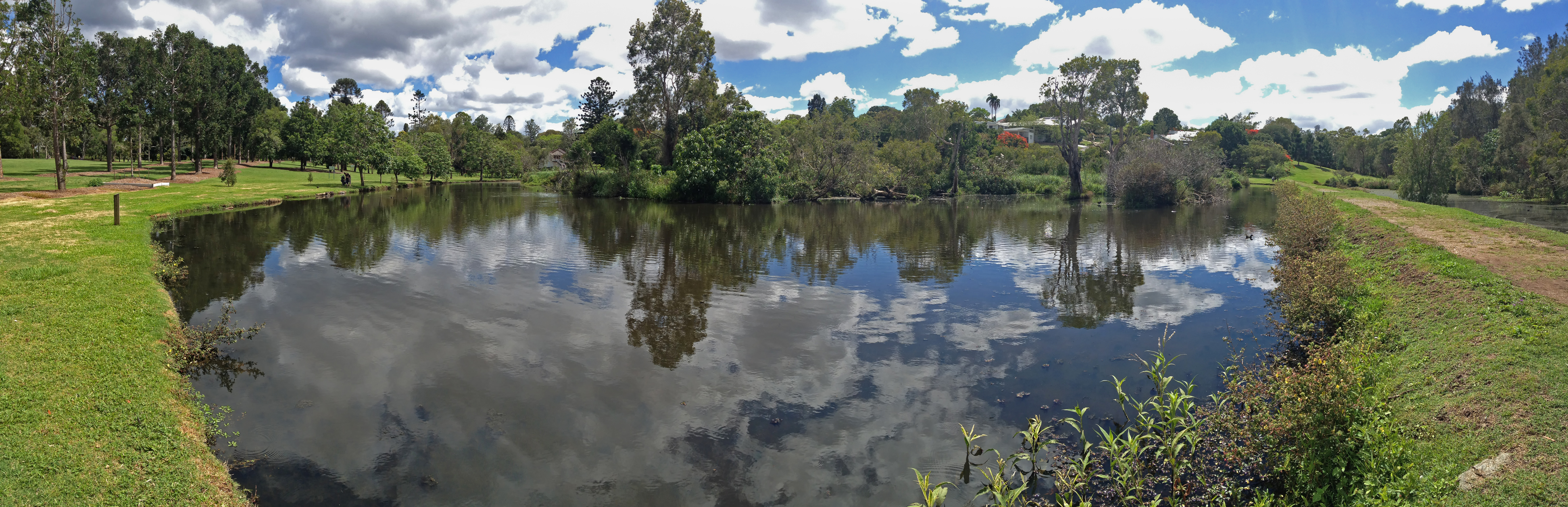
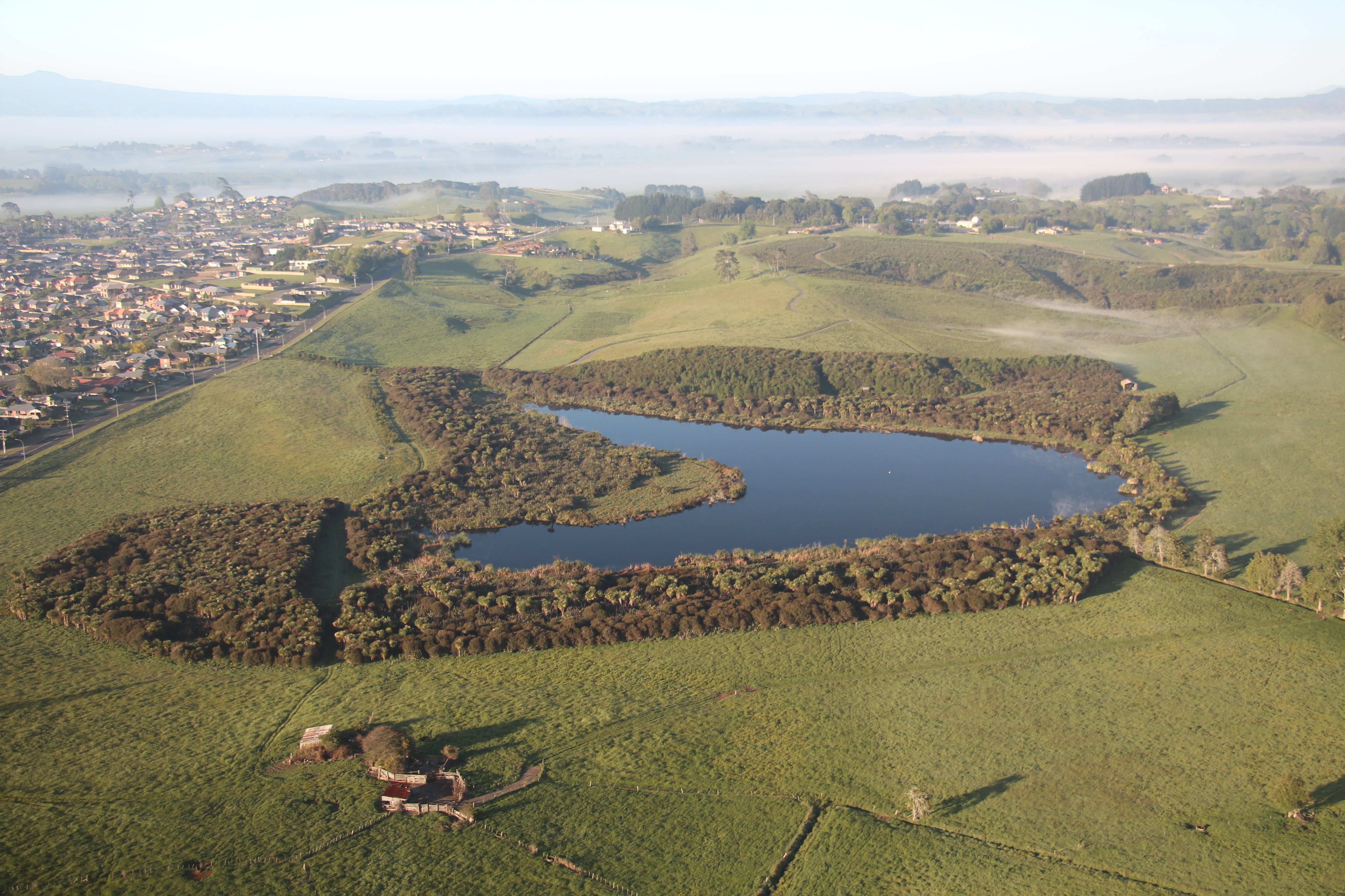
Figure 2. Main shorebird habitat restoration sites in Hunter Wetlands National Park.
Works undertaken. Mangroves are normally protected vegetation by law. After it was agreed by various stakeholders that mangroves should be cleared from Stockton Sandspit, a permit to remove mangroves was applied for from Department of Primary Industries (Fisheries). The initial permit allowed for the removal of mature mangroves from an area of less than 1 hectare. This primary work was carried out by contractors (Fig. 1). The funding agreement required matching volunteer effort. Initially, volunteer work involved Hunter Bird Observer’s Club (HBOC) monitoring the shorebirds, but this was quickly augmented by on-ground work to remove woody weeds (including Lantana Lantana camara, Bitou Bush Chysanthemoides monilifera ssp. rotundata and Telegraph Weed Heterotheca grandiflora) and reduce the density of native shrubs (including Acacia spp, Banksia spp. and Leptospermum spp.) from the roost area. Weeding also aimed to remove exotic rushes from a small area of saltmarsh. Following initial success, other shorebird roost sites in the Hunter Estuary with similar threats were added to the program (Fig. 2). These additional areas were selected using data from the shorebird monitoring being conducted by HBOC. At each site, an initial primary effort by contractors is followed up by HBOC volunteers and others. The project has been running continuously since 2002 and represents the HBOC commitment to caring for these endangered birds.
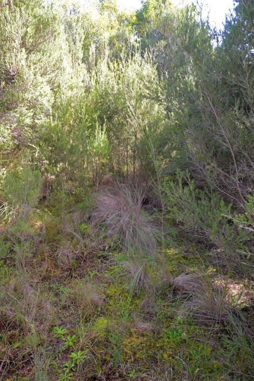
Over 10,900 volunteer hours has been accrued to date through the efforts of over 480 persons and the program is ongoing. Today, the project maintains nearly 150 hectares of shorebird habitat in Hunter Wetlands National Park. From March through to July each year, a program of works is scheduled to take advantage of favourable tides to access work areas. These cooler months are better for working in exposed areas and are when the population of migratory shorebirds is at its lowest. Removal of mangrove seedlings takes up most of the ongoing volunteer effort (Figs 3-6). The level of recruitment of mangrove seedlings varies from year to year and site to site. Factors such as tide height, wind direction and flood levels at the time of seed-drop affect the distribution of the seeds. Seed-drop usually occurs from the end of August through to early November with the majority falling through September. However, over the eighteen months of wet weather following the prolonged drought that ended in early 2020, mangrove seeds were washing up every month of the year. This required a massive effort to clear mangrove seedlings from all the sites in 2022. Thankfully the effort required in 2023 was back at a sustainable level.

Figure 3. Intrepid Landcarers cutting mangroves on Smith Island. (Photo T. Clarke)

Figure 4. Volunteers sweeping the marshes at Stockton Sandspit. (Photo T. Clarke)
Results to date. Removal of fringing mangroves and woody weeds from the roost area had an immediate positive effect. Most of the shorebirds quickly re-occupied Stockton Sandspit. This continues to be the case with Stockton Sandspit being one of the main daytime roosts used in the Hunter Estuary. Similar success has occurred at other sites but has not been quite as outstanding. These sites tend to be used by smaller aggregations of birds but are complementary to the Stockton Sandspit as different shorebird species prefer them. Some of the additional sites are frequently used as back-up roost sites when the preferred site is suffering unusually high levels of disturbance, often due to human activity.

Figure 5. Final sweeps over Milham Pond by Hunter Bird Observers Club volunteers in 2022. (Photo T. Clarke)

Figure 6. Mass drop of mangrove seeds happens every year at Stockton Sandspit and other places. Six months later the surviving seedlings are removed by volunteers. (Photo T. Clarke)
Lessons learned and future directions. Working on the inter-tidal areas has required that we develop an understanding of how the estuary system operates. In the early years lots of tide notes were collected for each site as well as shorebird movements. Utilising favourable tides gives better access and improves efficiency. Understanding certain shorebird behaviours also improves our efficiency. Quite often, a couple of forward scouts in the form of godwit or curlew will fly over a roost site on an inspection loop prior to the main rush of the various flocks. This is the signal for workers that it is time to vacate the site.
Many techniques and a variety of hand tools have been trialled with differing levels of success. Hand-pulling the seedlings has proven to be the most efficient. We have found that it is possible to manage the mangroves without the use of chemicals. Cutting stems lower than the next high tide results in the stumps being immersed and the tree dies. This also works for seedlings that are snapped-off. In situations where the substrate is firm enough, seedlings can be snapped off at ground level using a hoe. However, this method doesn’t work in soft mud as the plant bends away rather than breaking. Where seedling recruitment is dense, a battery-powered brush cutter has been utilised. This method was very useful during the year of continuous seeding.
While the initial work was motivated by a sense of obligation to intervene, the ongoing work provides positive feedback that maintains the energy and brings much satisfaction to the carers. This happens on every occasion that we witness the arrival of the shorebirds to the places that are restored each year, a positive joy. Maintenance of the various roost sites has become a wonderful opportunity to introduce people to shorebirds.
Stakeholders and funding bodies. At each stage of the project an initial effort of primary works was carried out by contractors and funded through various Government programs including the Australian Government’s Caring for Our Country, Envirofund and Threatened Species Recovery Fund. The following have supported the works in some manner over the last twenty years; Twitchathon, Bird Interest Group Network (BIGNet), Birdlife Australia, Conservation Volunteers Australia, the NSW Departments of Primary Industries and Fisheries, and Planning and Environment (and their predecessors), Hunter Bird Observers Club, Hunter Catchment Management Authority, Hunter Local Land Services, Hunter Regional Landcare Network, Kooragang Wetlands Rehabilitation Project, NSW National Parks & Wildlife Service, Newcastle Kayak Tours, Newcastle City Council, Newcastle Coal Infrastructure Group, NSW Government, Toolijooa, Trees In Newcastle, University of Newcastle.
The volunteer effort has been led by members of HBOC that make up the core team. Additional contributions have been made from other groups from time to time including: Better Earth Teams, Green Army, International Student Volunteers, TAFE students, Koora Gang, Intrepid Landcare, Worimi Green Team, Stockton Scouts, Raymond Terrace Scouts, Al Gazzali and Rigpa Buddists.
Contact information. For more information contact Tom Clarke thomas.clarke7@bigpond.com and project reports can be viewed on the HBOC website Rehabilitation Projects – Hunter Bird Observers Club (hboc.org.au).