Category Archives: Ecosystem services

Regeneration of indigenous vegetation at Third Reedy Lake as it has dried over summer and autumn 2022

Damien Cook

Introduction.  Third Reedy Lake is a freshwater wetland in the Kerang region in north central Victoria. It is part of the Kerang Wetlands Ramsar Site, which means that it is recognised as being of international significance for wetland conservation as it supports threatened plant and animal species and ecological communities and rookeries of colonial nesting wetland birds.

Prior to European occupation this wetland, along with Middle Lake and Reedy Lake, would have been inundated only when floodwaters came down the Loddon River and caused the intermittent Wandella and Sheep Wash Creeks to flow. At that time the wetland experienced a natural wetting and drying cycle, filling up from floodwaters and drying out completely between floods, which occurred on average once every 3 to 4 years.

In the 1920s, however, this natural wetting and drying cycle was discontinued. Third Reedy Lake became part of the Torrumbarry Irrigation Scheme. Water was diverted out of the Murray River at Torrumbarry Weir and made to flow through a series of natural wetlands including Kow Swamp, the Reedy Lakes, Little Lake Charm and Kangaroo Lake to deliver water to irrigate farms. The lakes and swamps became permanently inundated.  While this meant farmers had a reliable supply of water it also profoundly altered the ecology of the wetlands (Fi. 1).

Figure 1. Third Reedy Lake in February 2013 prior to being bypassed. Continuous inundation for around a century had drowned the native vegetation, leaving only skeletons of trees. (Photo D. Cook)

Trees such as River Red Gum (Eucalyptus camaldulensis) and Black Box (E. largiflorens) were drowned, lake bed plants that relied on a drying cycle could no longer grow and the ecological productivity of the wetlands was massively reduced. The density of wetland birds has been found to be positively correlated to wetland productivity and this metric has been used in a variety of ecological studies to compare the use of different habitats by wetland birds. During bird counts conducted in 2018 the highest density of birds on Third Reedy Lake was about 5 birds/hectare. In contrast the naturally intermittent Lake Bael Bael supported over 60 birds/hectare, a density 12 times higher. While Third Reedy Lake supported a maximum of 17 wetland bird species Lake Bael Bael supported a maximum 38 wetland bird species.

Works undertaken

Hydrological works.  Third Reedy Lake was deemed to be inefficient for moving water due to losses caused by evaporation and so it was intentionally bypassed by the irrigation scheme in 2020. The lake therefore dried for the first time in one hundred years over the summer of 2022. Environmental water will be periodically delivered to the wetland in the future to mimic its natural wetting and drying cycle and assist ecological recovery.

Revegetation works. Over 2000 River Red Gum trees and 1000  understorey plants, including Tangled Lignum (Duma florulenta) and Southern Cane-grass (Eragrostis infecunda), have been planted across the centre of the lake where no natural regeneration was likely to occur in the short to medium term. Members of the local Barapa Barapa and Wemba Wemba Traditional owner communities were employed to plant the trees and other plants (Fig. 2). The Barapa Barapa and Wemba Wemba Traditional Owners have a strong interest in the wetland because of its cultural values.


Figure 2. Uncle Trevor Kirby with a Red Gum he has just planted and guarded at Third Reedy Lake April 2022. . Virtually no native vegetation remained visible on the lake bed immediately after the long inundation. (Photo T. McDonald)

The River Red Gum seedlings have been planted next to dead River Red Gum stumps to replicate the original woodland structure of the wetland (Fig  3). Planting next to the stumps has other advantages; they provide shelter from the wind and sun and soil carbon and moisture levels are highest close to the rotting wood.

Figure 3. River Red Gum seedling planted next to an old red gum stump, Third Reedy Lake May 2022. (Photo D. Cook)

Results to date.  In the first 3 months without inundation the lakebed muds dried out, followed by deep cracking (Fig 2). Planted trees thrived as there was still ample moisture in the sub-soil.  Site inspections in May 2022 revealed that substantial natural regeneration of the wetland has begun (Fig. 4).

After 100 years without drying it was not known if any seed bank of the original lakebed vegetation would have survived. However, 46 native species have been recorded growing on the lakebed since the last of the water evaporated from the lake in April 2022. This includes two threatened species: Floodplain Groundsel (Senecio campylocarpus) and Applebush (Pterocaulon sphacelatum) (Fig. 5) . The germination of Applebush is particularly surprising given that this is only the fourth record of this plant in Victoria, the species being more common in the arid centre of Australia. Other indigenous species that have regenerated on the lakebed are shown in Figs 6 and 7.

Figure 4. Lake bed herbs regenerating after the drying phase, at Third Reedy Lake, May 2022 . A total of 46 native species have been recorded as having regenerated on the lakebed since the last of the water evaporated from the lake in April 2020 (Photo D. Cook)

Figure 5. Among the 46 native species regenerating is Applebush (Pterocaulon sphacelatum) which is particularly surprising as it is listed as endangered in Victoria and known to occur in only three other locations. (Photo Dylan Osler)

Figure 6. Spreading Nut-heads (Sphaeromorphaea littoralis), Third Reedy Lake May 2022. This species is uncommon in the Kerang region, the closest records to Third Reedy Lake being from the Avoca Marshes. (Photo D. Cook)

Figure 7. Golden Everlasting (Xerochrysum bracteatum) and Bluerod (Stemodia florulenta) make an attractive display of wildflowers. These species are uncommon at present but if weeds are controlled adequately, they should recolonise much of the wetland floor. (Photo D. Cook)

River Red Gum regeneration has been localised on the bed of the lake and has mainly occurred on the fringes close to where living Red Gum trees have shed seed. The densest Red Gum regeneration has occurred on a sandy rise close to the inlet of the lake, where the trees have grown rapidly (Figs 8 and 9). Many of the seedlings that have germinated on the edge of the lakebed are being heavily grazed by rabbits or wallabies.

Figure 8. Regenerating Red Gums and native grasses and sedges on a sandy rise near the inlet of Third Reedy Lake, May 2022.(Photo D. Cook)

Figure 9. River Red Gum seedling on cracking clay soil that has germinated near the lake edge. Many of these seedlings are being heavily grazed, probably by rabbits or wallabies. (Photo D. Cook)

The young trees will take many years to develop the hollows required by many species of wildlife, but hopefully the old stumps will persist for some time to provide this important habitat feature (Fig 10). When these trees grow large enough, they will provide shady nesting sites for colonial nesting wetland birds such as Australasian Darter (Anhinga novaehollandiae) (Fig. 10) and Great Cormorant  (Phalacrocorax carbo) and replace the dead standing trees as they rot and fall over.

Figure 10. Australasian Darter chicks on a nest in a live River Red Gum in the creek that joins Middle Lake to Third Reedy Lake. (Photo D. Cook)

Stakeholders: Barapa Barapa, Wemba Wemba, Goulburn-Murray Water, North Central Catchment Management Authority and Kerang Wetlands Ramsar Site Committee

Contact:  Damien Cook, restoration ecologist, Wetland Revival Trust, Email: damien@wetlandrevivaltrust.org

Biological and cultural restoration at McDonald’s Swamp in northern Victoria, Australia

Dixie Patten (Barapa Wemba Working for Country Committee) and Damien Cook (Wetland Revival Trust.

Introduction. McDonald’s Swamp is a 164-ha wetland of high ecological and cultural significance, and is one of the Mid Murray Wetlands in northern Victoria. The restoration this wetland is part of broader project, led by the Indigenous Barapa Wamba Water for Country Committee in collaboration with the Wetlands Revival Trust, to address the loss of thousands of wetland trees and associated understorey  plants that were killed by poor agricultural and water management that caused prolonged water logging and an elevated the saline water table.

Figure 1. Laura Kirby of the Barapa Wamba Water for Country restoration team beside plantings of two culturally important plants that are becoming well established; Common Nardoo (Marsilea drummondii) and Poong’ort (Carex tereticaulis). (Photo D. Cook.)

The project has a strong underpinning philosophy of reconciliation as it is a collaboration between the Wetland Revival Trust and Aboriginal Traditional Owners on Country – access to which was denied to our people for a long time, disallowing us to practice our own culture and have places to teach our younger generations.  One of the main aims of the project is  to employ Barapa and Wemba people on our own land (Fig 1), not only to restore the Country’s health but also to provide opportunities for a deeper healing for us people. Many of the species we are planting are significant cultural food plants or medicine plants. Indeed it’s actually about restoring people’s relationships with each other –Indigenous and non-Indigenous Australians – and maintaining our connection to  Country.

Over recent years the hydrology of many wetlands in the Kerang region has been vastly improved by a combination of drought, permanently improved irrigation practices in the catchment and the delivery of environmental water.  This has restored a more natural wetting and drying cycle that will enable regeneration of some prior species, largely through colonisation from the wetland edges and through reintroduction by waterbirds.

However, supplementary planting is needed to accelerate the recovery of keystone species at all strata and the ~50 ha of the wetland that has been assessed as highly degraded with little potential f or in-situ recovery from soil-stored seedbanks.

Figure 2. Aquatic species planted at McDonald’s Swamp, including Robust Water-milfoil (Myriophyllum papillosum), Common Water Ribbons (Cycnogeton procerum) and the endangered Wavy Marshwort (Nymphoides crenata). (Photo D. Cook)

Works undertaken: To date the project has employed 32 Traditional Owners, planting out and guarding canopy trees to replace those that have died, undertaking weed control, and replanting wetland understorey vegetation.

Over a period of 5 years,, around 60% of the presumed pre-existing species, including all functional groups, have been reintroduced to the site, involving 7000 plants over 80 ha of wetland. This includes scattered plantings of the canopy species River Red Gum (Eucalyptus camaldulensis), Black Box (Eucalyptus largiflorens) and Eumong (Acacia stenophylla).  Dense nodes have also been planted of a wide diversity of herbaceous wetland species including water ribbons (Cycnogeton spp.), Nardoo (Marsilea drummondii) and Old Man Weed (Centipeda cunninghamii). These nodes have been protected from waterbird grazing by netting structures for 3-6 months, after which time they have reproduced and spread their seeds and begun recruiting throughout the broader wetland..

Some areas of the swamp are dominated by overabundant native reeds due extended inundation in the past.  Such reeds – including Cumbungi (Typha orientalis) and Common Reed (Phragmites australis) – will be future targets for burning or cutting followed by flooding by environmental watering to reduce their abundance prior to reintroduction and recolonization by other indigenous species.

Figure 3. Prolific regeneration of the nationally endangered Stiff Grounsel (Senecio behrianus). The species is presumed extinct in South Australia and New South Wales and is now only known only from 5 wild and 6 re-introduced populations in Victoria. (Photo G Little)

Outcomes to date: Very high establishment and growth rates have been attained for the canopy tree species, many individuals of which have flowered and set seed within the 6 years since project commencement.  All the planted understorey species are now recruiting very well – particularly the Water Ribbons (Cycnogeton procerum and C. multifructum), Floating Pondweed (Potamogeton  cheesmannii), Common Nardoo (Marselia drummondii), Wavy Marshwort (Nymphoides crenata), Water Milfoils (Myriophyllum papillosum  and M. crispatum), Forde Poa (Poa fordeana), Swamp Wallaby-grass  (Amphibromus nervosus), River Swamp Wallaby-grass (Amphibromus fluitans) and the nationally endangered Stiff Groundsel (Senecio behrianus) (Fig.  3.).  The important Brolga (Antigone rubicunda) nesting plant Cane Grass (Eragrostis infecunda) has also spread vegetatively.  Where hundreds of individuals were planted, there are now many thousands recruiting from seed, building more and more potential to recruit and spread within the wetland.

After 7 years of a more natural wetting and drying regime, natural regeneration has also occurred of a range of native understorey species including populations of the important habitat plant Tangled Lignum (Duma florulenta), Lagoon Saltbush (Atriplex suberecta) and Common Spike-rush (Elaeocharis acuta) (Fig 4.).

Figure 4. Planted River Red Gum (Eucalyptus camaldulensis) and naturally regenerating Tangled Lignum (Duma florulenta) and a range of other native colonisers and some herbaceous weed at McDonald’s Swamp some6 years after hydrological amendment and supplementary planting. (Photo T McDonald)

Stakeholders:  Barapa Land and Water, Barapa Wamba Water for Country Committee, Parks Victoria, Department of Environment, Land, Water and Planning and the North Central Catchment Management Authority.

Contact: Damien Cook, Wetland Revival Trust, Email: damien@wetlandrevivaltrust.org

Waterponding the Marra Creek, NSW rangelands – UPDATE of EMR feature

Ray Thompson and Central West Local Land Services

[Update of EMR feature – Thompson, Ray F (2008) Waterponding: Reclamation technique for scalded duplex soils in western New South Wales rangelands. Ecological Management & Restoration 9:3, 170-181. https://onlinelibrary.wiley.com/doi/10.1111/j.1442-8903.2008.00415.x]

Figure 1.  Scalded country with 30cm of sandy loam topsoil swept away by wind after extensive overgrazing. (Photos NSW SCS)

Introduction. Overgrazing of native pastures in the second half of the 19th Century stripped vegetation and led to the wind erosion of sandy topsoil during inevitable dry periods.  By the 1960s, tens of thousands of square kilometres of rangeland sites in western NSW had a legacy of moderate or severely bare or ‘scalded’ lands. This left bare and relatively impermeable clay subsoil which prevents water penetration and is very difficult for plants to colonize (Fig 1.)

Waterponding is the holding of water on the scald in surveyed horseshoe-shaped banks, each covering 0.4 ha. The ponds retain up to 10 cm of water after rain which leaches the soluble salts from the scalded surface. This improves the remaining soil structure, inducing surface cracking, better water penetration and entrapment of wind-blown seed. Consequently, niches are formed for the germination of this seed and recovery of a range of (typically around 15 out of a total of about 30) locally native chenopod (saltbush) grassland species on the sites.

The original 2008 EMR feature described how barren scalds at a range of properties in Marra Creek, near Nyngan in semi-arid NSW were transformed during the 1980s and 1990s into biodiverse native pastures through a technique called ‘waterponding’ developed after five decades of work by consecutive soil conservation officers exploring a range of prototype treatments.  Over time, a wide range of machines have been used to construct waterponding banks including standard road graders (ridged frame and articulated) or similar. Pre-1985 road graders were generally too small to construct banks of sufficient size, which resulted in too many breached banks. Over a 4-year period, the Marra Creek Waterponding Demonstration Program, backed by committed landowners, researched different horsepower road graders, constructing different size banks, winning the dirt from different locations, and evaluating the economics of construction methods. The results showed that the higher-powered articulated road graders exceeding 200 HP proved to be the most economical and efficient for waterpond construction. This type of machine has the power to  form the bank with one pass on the inside of the bank and two passes on the outside, achieving a bank with well over 2 m base width and over 60 cm in height (Fig. 2).

Figure 2. The process of of waterponding including (a) ute-mounted laser levelling to design the waterpond for a particular site, (b) bulldozing the pond walls to the designed levels, (c) rainfall filling the pond to allow deep watering and cracking of the clay subsoil and (d) resulting revegetation within the walls of the pond. (Photos NSW SCS)

Update and the broader program.  Photos and pasture measurements undertaken on ‘Billabong’ Marra Creek NSW, till 2014 show that the waterponding site had increased ground cover (predominantly native species) from 1% in 2005 to 84 % in 2014. After five to seven rainfall years a typical treatment can result in recovery of up to 15 native species from a range of up to 31 species (Table 1). The method in the last 20 years has also included broadcasting seed of some of the more important perennial species of healthy native chenopod grasslands including  Oldman  Saltbush  (Atriplex nummularia), Bladder Saltbush (Atriplex vesicaria) and Mitchell Grass (Astrebla   lappacea) (Fig 3).  Landholders in the Marra Creek district observe a range of fauna frequently on and between the ponds, including Western Grey Kangaroo (Macropus fuliginosus), Red Kangaroo (Macropus rufus), Emu (Dromaius novaehollandiae), Brolga (Grus rubicunda) and the Eastern Bluetongue Lizard (Tiliqua scincoides). A species of Monitor (Varanus sp.) also sometimes traverses the waterponds. Formal monitoring of smaller reptile and invertebrate use of waterponded sites is yet to occur.

Figure 3. Curly Mitchell Grass (Astrebla lappacea) sown on pond banks. (Photo NSW SCS)

Marra Creek was not the first series of waterponding programs in the Nyngan area – nor the last. The outputs of the entire program by 2019 included over 80,000 waterponds laid out and constructed, resulting in 40,000 hectares returned to local native vegetation. A total of 164 properties in the rangelands area are now using waterponding, the majority of landholders in the Marra Creek district and representing an increase from 17 landholders back in 1984 when we first ran the waterponding.

Figure 4. Landholders themselves are teaching the Waterponding technique to other landholders. (Photos NSW SCS)

Economic model of waterponding. The primary driver for land reclamation was not biodiversity conservation but returning the natural capital of rangelands. As such the program has returned a clear profit to the landholders in terms of increased native pastures that can be grazed, improving ecologically sustainable income sources for farming families.

With the reinstatement of vegetation, there have be increases in total stock feed, resulting in an increase in lambing percentages and wool cuts, as well as the ability to carry stock further into prolonged dry periods with overhead cost per head remaining static. Once rehabilitation has been completed, stocking  rates have been raised from zero to one sheep to 1.5 ha. This iseffectively the long-term grazing average for  saltbush pastures in the Nyngan district.

A treatment involving the full design and survey, pond construction and revegetation cost the landholder about $144.00 per hectare. (This includes approximately $25 a hectare for seed.) If the landholder does all the work the cost is reduced to $72/ha. The type of land involved was calculated in 2008 to normally  have  a  resale  value  of  about $365.00 per hectare In its unproductive state.  Scalded land does not contribute to the farm income yet still incurs rates. Investment in rehabilitation, in contrast, improves carrying capacity thus reducing hand-feeding costs, improving lambing percentages and avoiding forced stock sales. This allows landholders to pass the property to the next generation in a far better condition than it has been previously.

Research has found that the scalds store approximately 18.7 t/h of soil organic carbon to a depth of 30 cm. Once the landscape has been restored by waterponding and revegetation, we have found there is a rapid increase in soil organic carbon up to 25 t/ha within five years. The results are indicating that land in the rangelands that has been rehabilitated using waterponds does sequester carbon. This could lead on to waterponding being eligible for a carbon abatement activity and hopefully lead to Carbon Farming Initiative activity for carbon credits.

Figure 5. Australian National University students attending ‘21 years of participation in Rangelands Waterponding’. (Photos NSW SCS)

Potential for further application. After decades of field days and uptake of the methodologies by local graziers (Fig. 4), waterponding now forms part of standard district farming methodologies and landholders are now passing on knowledge to new generations, including through universities (Fig. 5). The methodologies have also been applied at one national park and one Trust For Nature site in Victoria, and are being applied in the Kimberley, with potential for far greater application in desert conservation reserves throughout Australia and the rest of the world (See Fig. 6 and https://justdiggit.org/approach-2/#).

Contact. Kyra Roach, Central West Local Land Services, Nyngan, 2825 Australia. Email: kyra.roach@lls.nsw.gov.au

Figure 6. A total of 79 trainees from 26 Africa countries (including Ghana, Tunisia, Rwanda, Burundi and Djibouti) over a three year period were sponsored by AusAid to study waterponding in Nyngan. Resullting work in African countries is making a big difference to degraded lands particularly in North Sudan and Kenya (Photo NSW SCS)

Table 1. Species found in waterponds after standard revegetation treatments and five to seven rainfall years. The species found by Rhodes (1987b) are still commonly found, with additional species (marked with a diamond +) observed by Ray Thompson. (Plant names are consistent with the New South Wales Herbarium database PlantNet, http://plantnet.rbgsyd.nsw.gov.au/ and  growth forms are consistent with Cunningham et al. (1981) (Exotics are marked with an asterisk)

Scientific name Common name Growth form
Alternanthera denticulata Lesser Joyweed Annual forb
Astrebla lappacea+ Curly Mitchell Grass Perennial grass
Atriplex leptocarpa Slender-fruited Saltbush Perennial subshrub
Atriplex lindleyi+ Eastern Flat Top Saltbush Annual subshrub
Atriplex nummularia+ Oldman Saltbush Perennial shrub
Atriplex pseudocampanulata Mealy Saltbush Annual subshrub
Atriplex semibaccata+ Creeping Saltbush Perennial subshrub
Atriplex spongiosa Pop Saltbush Annual forb
Atriplex vesicaria Bladder Saltbush Perennial subshrub
Centipeda thespidioides Desert Sneezeweed Perennial forb
Chamaesyce drummondii Caustic Weed Annual or short-lived perennial forb
Chloris truncata Windmill Grass Annual or perennial grass
Diplachne fusca Brown Beetle Grass Perennial grass
Eragrostis parviflora Weeping Lovegrass Annual or short-lived perennial grass
Eragrostis setifolia Neverfail Perennial grass
Hordeum leporinum* Barley Grass Annual grass
Hordeum marinum* Sea Barley Annual grass
Maireana pentagona Hairy Bluebush Perennial subshrub
Malacocera tricornis Soft Horns Perennial subshrub
Marsilea drummondii Common Nardoo Perennial forb
Medicago minima* Woolly Bur Medic Annual forb
Medicago polymorpha* Burr Medic Annual forb
Osteocarpum acropterum+ Water Weed Perennial subshrub
Phalaris paradoxa* Paradoxa Grass Annual grass
Pimelea simplex Desert Rice-flower Annual forb
Portulaca oleracea Common Pigweed Annual forb
Salsola kali var. kali Buckbush Annual or biennial forb
Sclerolaena brachyptera Short-winged Copperburr Short-lived perennia
Sclerolaena calcarata+ Red Copperburr Perennial subshrub
Sclerolaena divaricata+ Pale Poverty Bush Perennial subshrub
Sclerolaena muricata Black Roly-poly Short-lived perennial
Sclerolaena trycuspis Streaked Poverty Bush Perennial subshrub
Sporobolus actinocladus Katoora Grass Perennial grass
Sporobolus caroli Fairy Grass Perennial grass
Tragus australianus Small Burr Grass Annual grass
Tripogon loliiformis+ Five Minute Grass Perennial grass


Still repairing wetlands of the Lower Murray: continuing the learning – UPDATE of EMR feature

Anne Jensen

[Update to EMR feature – Jensen, Anne (2002) Repairing wetlands of the Lower Murray: Learning from restoration practice. Ecological Management & Restoration, 3:1, 5-14. https://onlinelibrary.wiley.com/doi/10.1046/j.1442-8903.2002.00092.x]

Key words:         Environmental water requirements, regeneration, wetlands, black box seedlings, Lower Murray Valley

Figure 1. Location of the Lower Murray Valley in South Australia (Map A. Jensen)

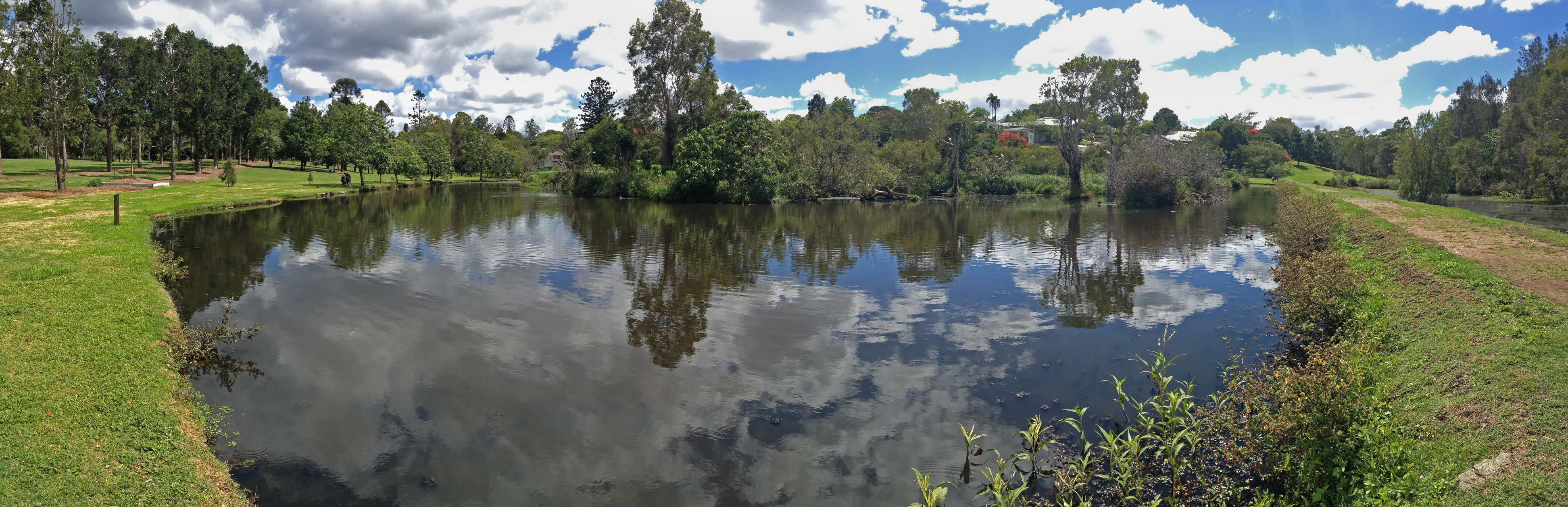
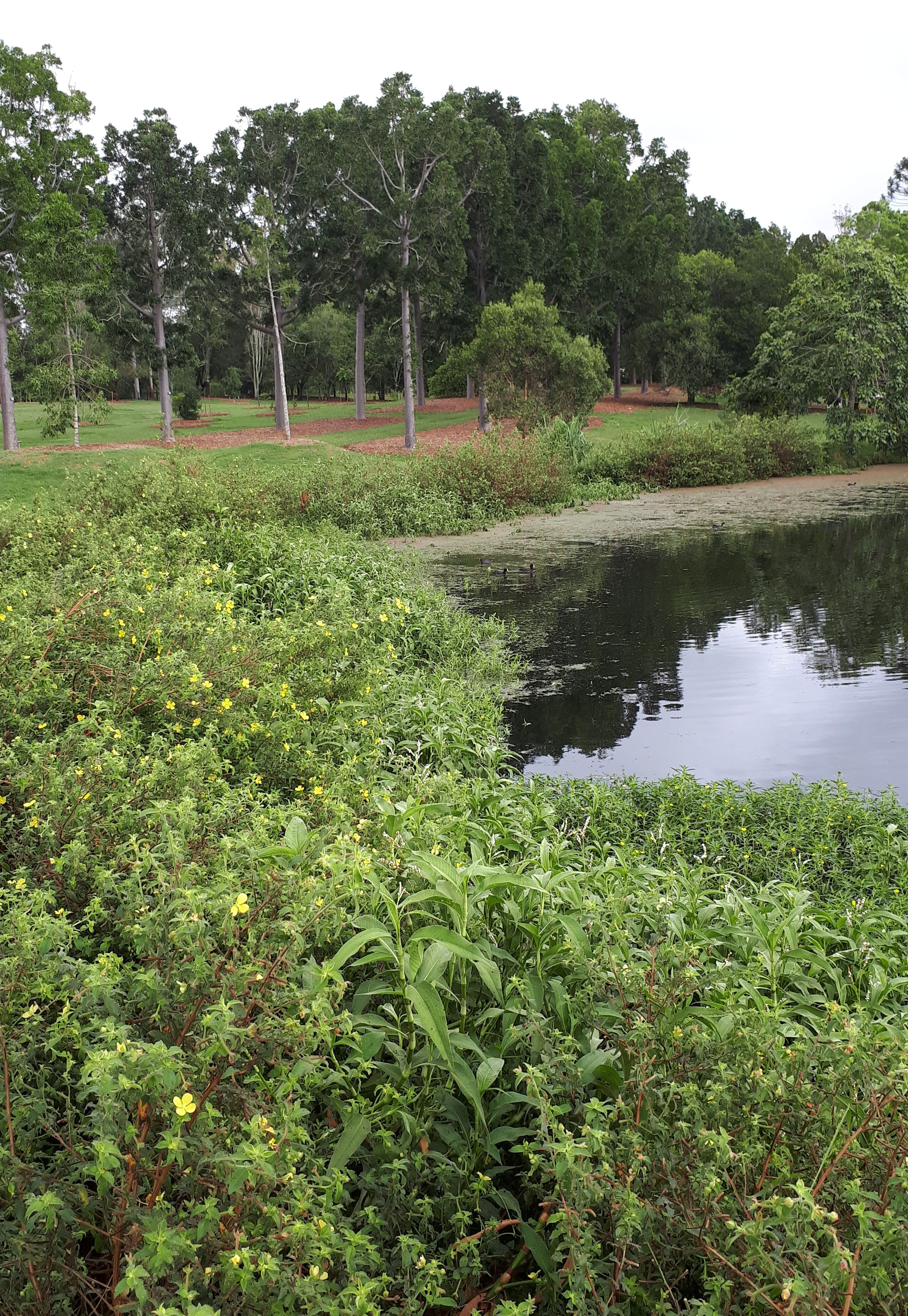
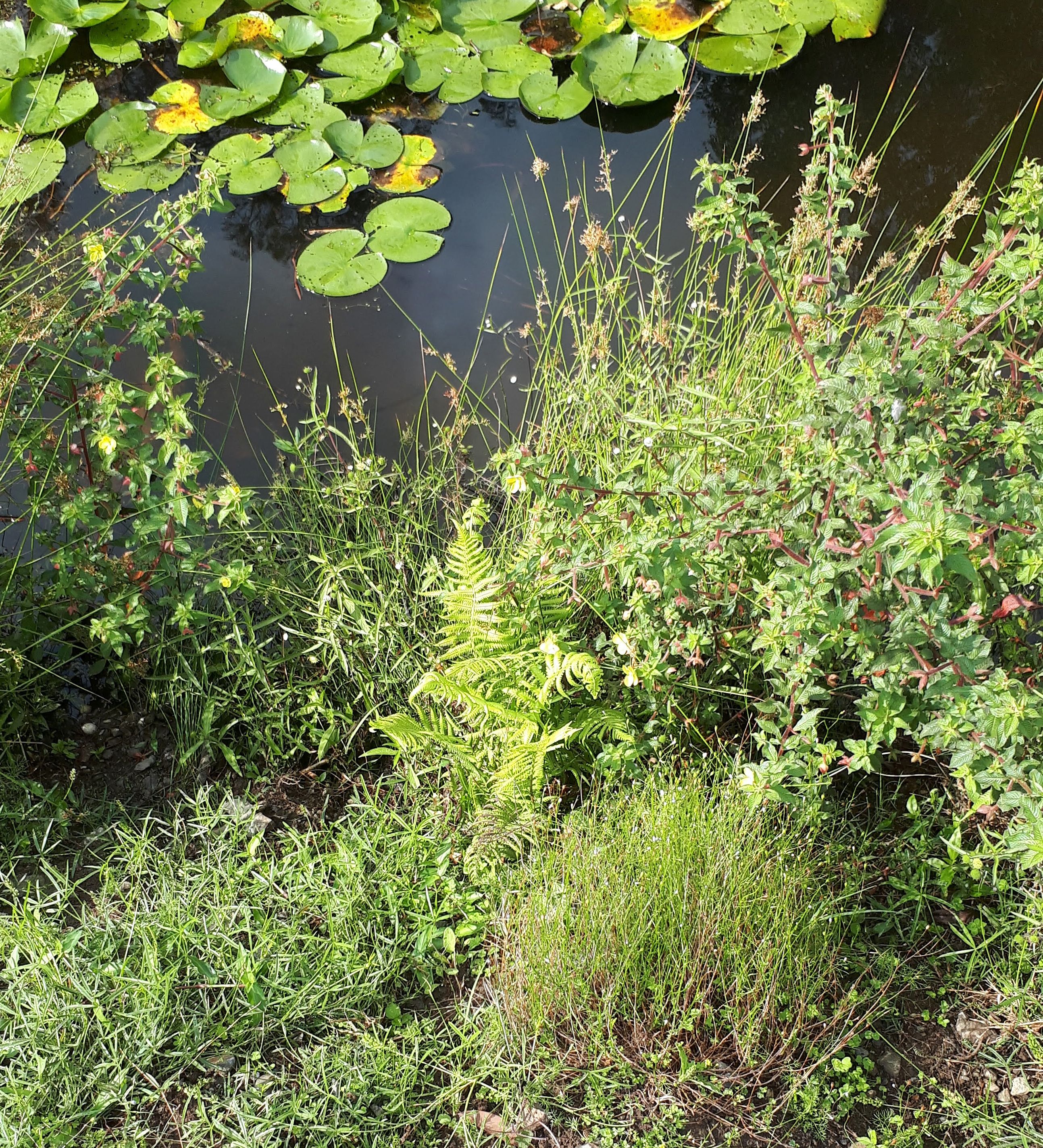
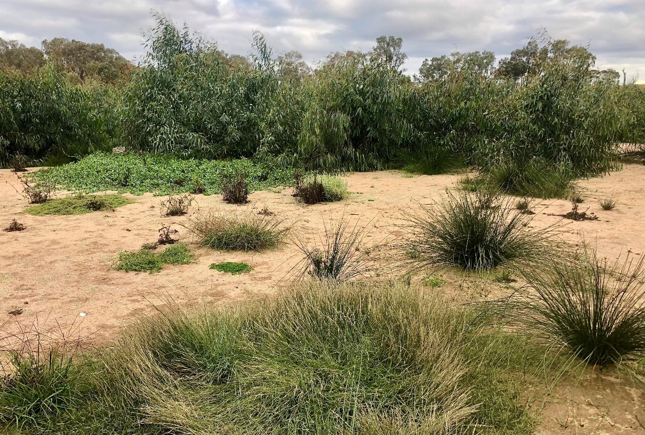
Introduction. As highlighted in the original EMR feature this summary is updating, in the Lower Murray Valley 1100 wetlands have been identified in 250 hydrologically-linked complexes (Fig. 1). They have undergone major changes to their water regime over the last 100 years, altering the timing, frequency and duration of floods. Wetlands at lower elevations have become permanently flooded by stable river levels and wetlands at higher elevations are ‘droughted’ by much reduced flooding. All would benefit from environmental watering, to fill gaps in breeding and regeneration cycles.

Our 2002 feature showed that, from 1998 to 2002, the not-for-profit conservation company Wetland Care Australia coordinated on-ground projects to repair priority wetlands in the Lower Murray. The Gurra Gurra project was the largest of these projects, with engineering works at 17 sites to restore multiple flowpaths through the 3000 ha floodplain complex.

Key funding from the National Heritage Trust terminated in 2002 and Wetland Care Australia relocated in 2003 to northern New South Wales, where project funding for wetland projects was still available. However, individuals involved with the Wetland Care Australia projects remained in the Lower Murray Valley in other jobs, so the intellectual property was retained and wetland conservation activities continued.

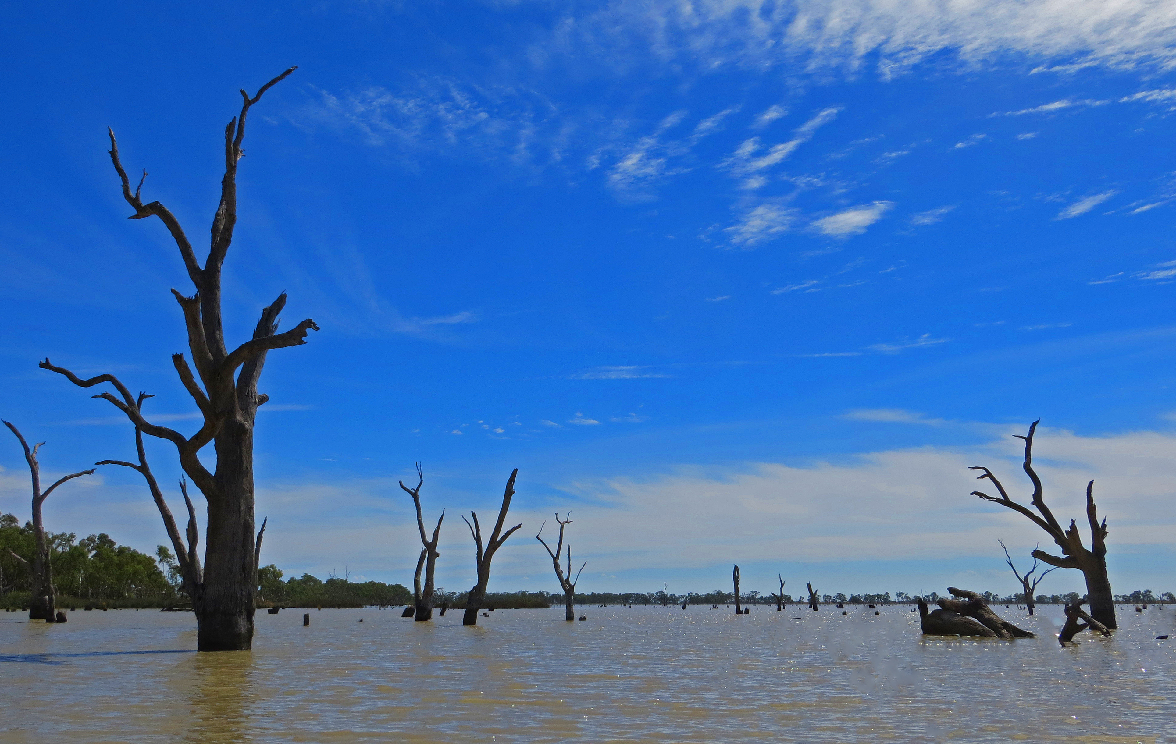
In 2002, the extent and severity of drought conditions in the Murray River Valley were just being recognised. By 2004, a survey estimated that >75% of the two main tree dominants in floodplain woodlands –  River Red Gum (Eucalyptus camaldulensis) and Black Box (E. largiflorens)  – were dead, dying or extremely stressed along 700 km of the Murray River Valley . The Millenium Drought (2000-2010) caused extreme stress to both ecological and human communities. Government agencies commenced emergency environmental watering from 2004 through the Living Murray program to limit catastrophic damage at eight iconic sites but millions of mature eucalypts were lost from floodplain woodlands along river valleys.

The Millenium Drought changed the governance context radically, with the Water Act 2007 establishing a new Murray-Darling Basin Authority and the Basin Plan. The Commonwealth Environmental Water Holder (CEWH) was able to purchase water for environmental use.

Nature delivered life-saving floods in 2010-12, which broke the drought and sent flows through the Gurra Gurra complex flowpaths, so the works completed back in 2000 finally fulfilled their function (Fig. 2). Water flowed through the pipes at Tortoise Crossing for 170 days in 2010-11 and again for 71 days in 2012.

Figure 2. The sign at the key Tortoise Crossing flow path explains that replacing three pipes with 160 pipes back in 2000 now allows 50 times more flow when the river floods, as seen at the flood peak in December 2016 (Photos A. Jensen)

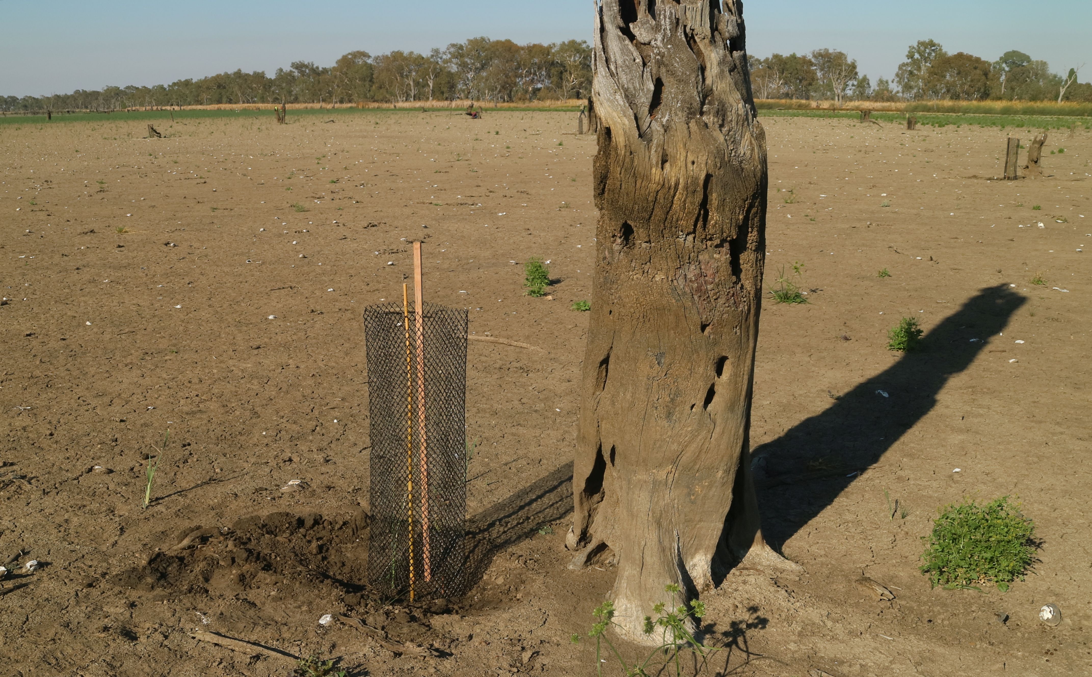
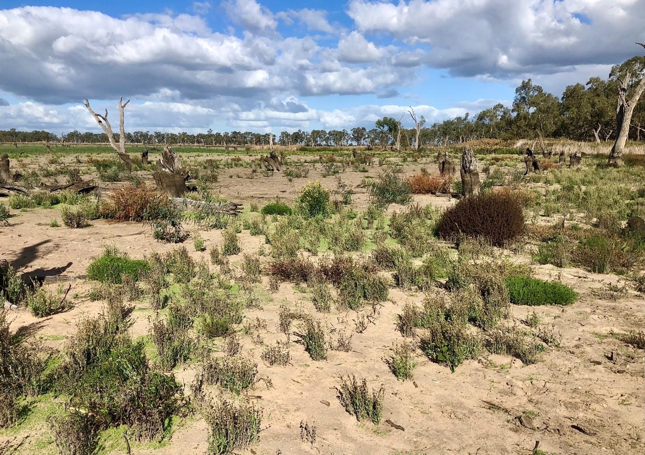
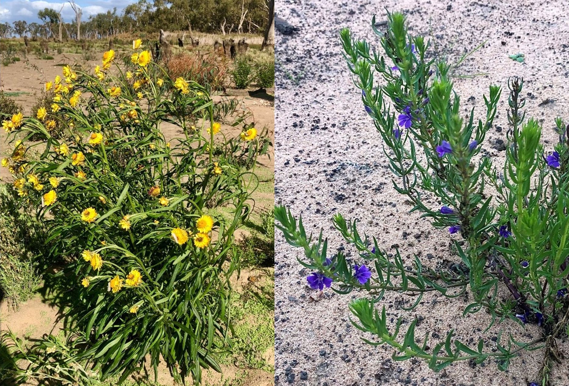
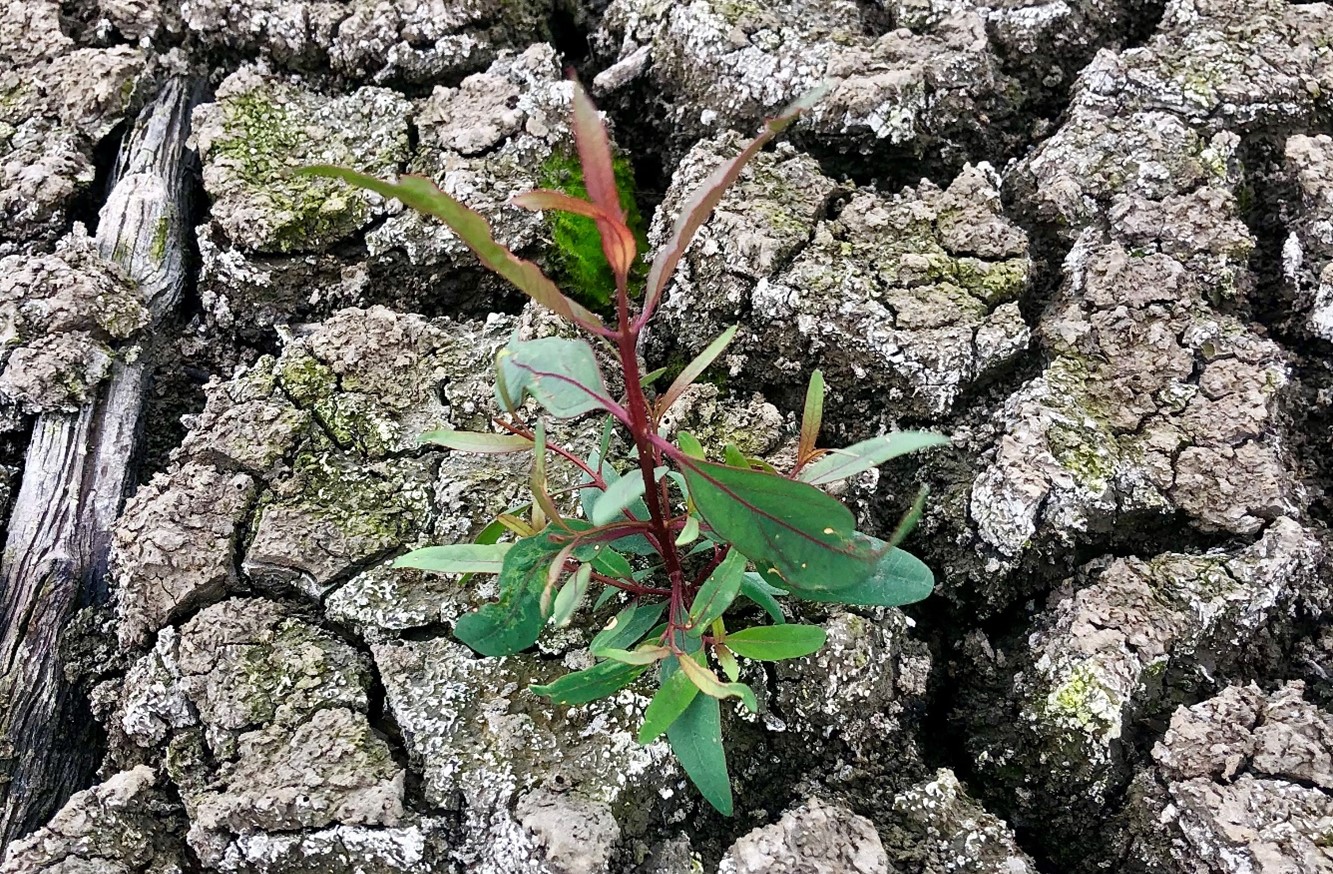
The sequence of floods led to mass germination of Black Box at medium floodplain elevations, with mass River Red Gum seedlings at lower elevations. A range of studies show that the survival of these seedlings is critical to fill age gaps and replace the losses from the Millenium Drought, as survival rates from germination events in the 1970s and 1990s were very poor and the last successful mass recruitment of Black Box in the Lower Murray Valley was from the 1955-56 floods.

Following the floods in 2010-2012, conditions were dry in 2013-15 and the fields of mass seedlings began to dry out and die. A further short flood in 2016 watered the surviving fields of Black Box seedlings for at least two weeks, adding to prospects of survival and flowing through the Tortoise Crossing pipes for 75 days. However, conditions in 2018-19 and into summer 2019-20 are once again extremely dry, with stress appearing in mature trees and saplings dying off. The Lower Murray Valley is still recovering from the Millenium Drought, thus needing more frequent watering over a sequence of years to bring mature trees back to health and full seed production, so this is a significant setback.

Further works and activities since 2002. Since 2008, the environmental charity Nature Foundation SA (NFSA) has been undertaking environmental watering projects on smaller, privately-owned sites in the Lower Murray, many from the original Wetland Care Australia list. In the Lower Murray Valley, water needs to be lifted up to 3 m from the river channel to reach wetlands on the floodplain, requiring costly energy. This is done using irrigation techniques, including pumps, pipes and sprinklers. These smaller projects complement government agency projects using major infrastructure to deliver environmental water to much larger wetland complexes.

In 2008-09, the primary purpose was to acquire water and use it to limit extreme environmental damage in the drought. In 2009 NFSA provided supplementary water for Little Duck Lagoon, one of the sites from the Wetland Care Australia Gurra Gurra project.

From 2012-19, NFSA has held a contract partnered with the Commonwealth Environmental Water Holder (CEWH) to deliver up to 10 GL/y of environmental water to selected sites. A priority for the NFSA Water for Nature program has been to sustain the mass germination triggered by the 2010-12 floods, watering fields of seedlings and saplings so they can fill the very large gap in age structure of Black Box populations. Stressed mature Black Box trees are being watered to improve their condition and volumes of seed produced. While delivering water to a defined wetland is relatively simple, with water pumped to an inlet point and allowed to pool in the wetland, watering scattered fields of seedlings and saplings on relatively flat floodplain land is a challenge, especially when they are in gaps between mature trees. The solution has been to use high-throw sprinklers (simulating rainfall) and operating them at night, to allow soakage into clay soils and to avoid evaporative loss during the day.

Since 2008, NFSA has delivered almost 13 GL of water to 97 watering sites in 20 wetland complexes, covering 27 different ecological targets across 12 habitat types. A total of 4.9 GL was delivered to 15 sites in 2017-18 and 1.55 GL was delivered in 2018-19 to 25 sites covering 126 ha. Rolling 5-year watering plans have been developed for each site, able to respond to annual water availability, Basin-wide priorities, environmental water requirements, climatic conditions, site watering history and feasibility of delivery.

One of the NFSA sites is Lyrup Lagoon in the Gurra Gurra complex, being watered to reduce accumulated salinity from groundwater inflows. Importantly, the infrastructure of the Central Irrigation Trust was used to deliver water to the lagoon. Thus, local irrigators are partners in delivery of water for regional environmental benefits and river health.

Figure 3. Watering guidelines developed by the Water For Nature program for stressed and healthy woodlands, for (a) River Red Gum and (b) Black Box (Water for Nature).

Further Results. The initial watering guidelines reported in the original EMR feature have been expanded through research and monitoring of responses to watering events, developing guidelines for timing and frequency of wetting and drying cycles to promote recovery in mature trees and support germination and survival of seedlings. These have been applied for each site in the rolling 5-year watering plans, which then determine the annual list of sites due for watering (see NFSA 5 year strategy and Fig. 3).

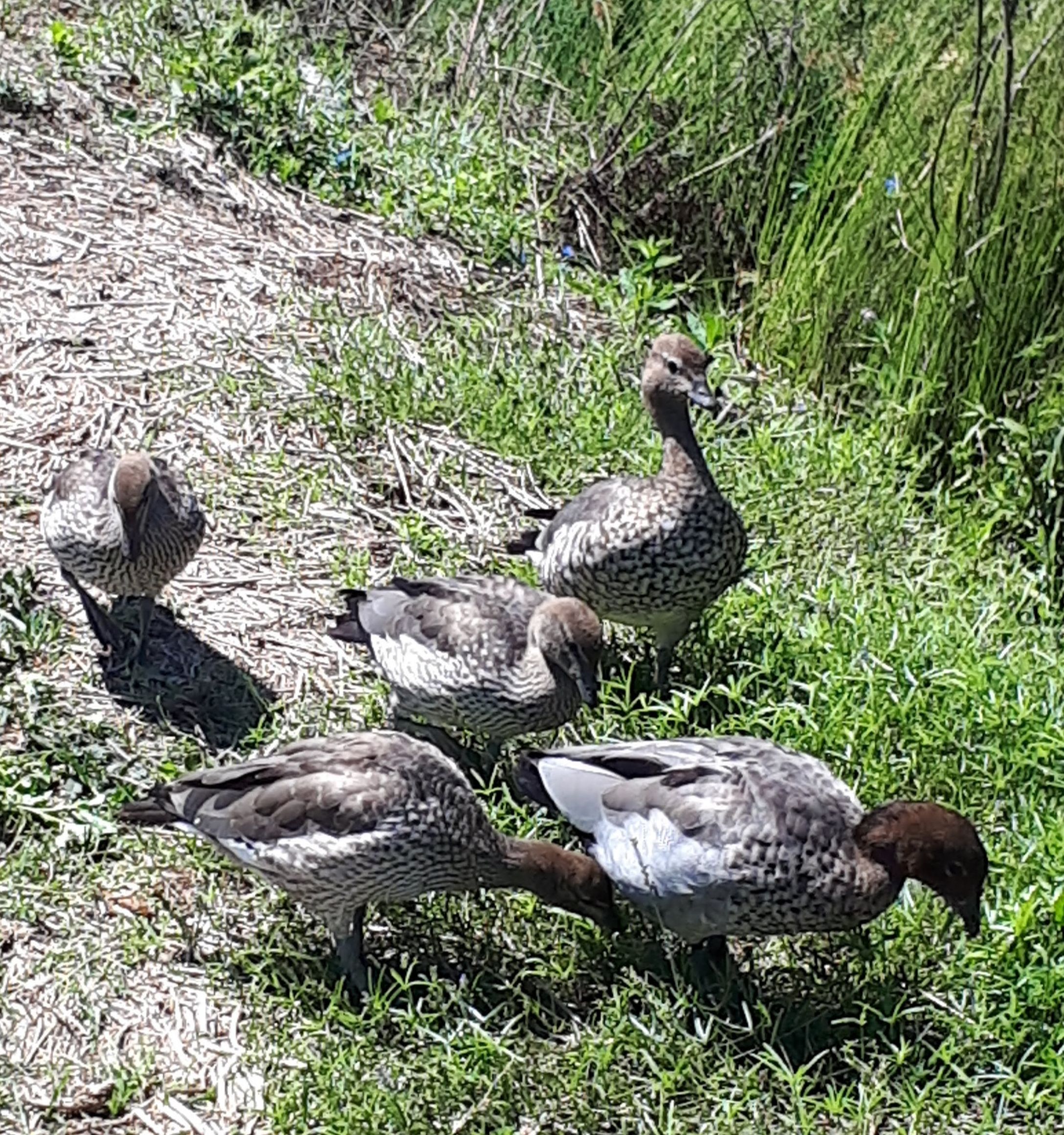
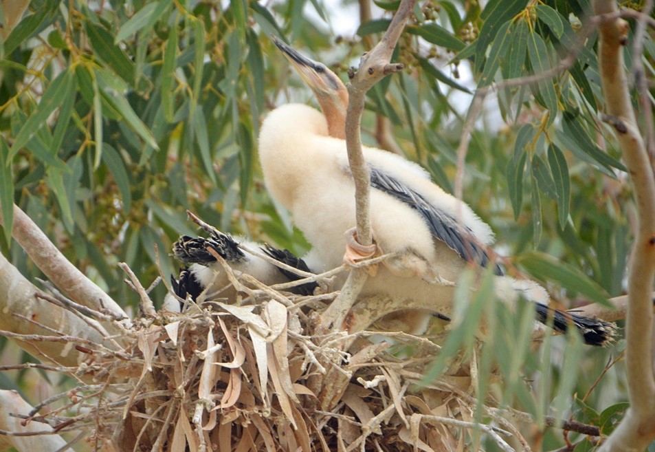
Watering by NFSA 2013-2019 has sustained Black Box seedlings and saplings through four dry summers, with watered plants 2-3 times taller than non-watered plants (Fig. 4). The Water For Nature monitoring report shows that, at NFSA sites, mature Black Box trees that have received periodic environmental water as determined by their 5-year watering plan during 2015-2019 were 21-46% (average 36%) better in health than adjacent non-watered sites, with denser, more vigorous canopies and the relative improvement was greatest during hotter and drier periods. The watering events thus provided water between natural floods to sustain growth in saplings and crop cycles in mature trees. Watering at other NFSA sites has provided vital habitat for vulnerable and endangered fauna including the Murray Hardyhead (Craterocephalus fluviatilis), Southern Bell Frog (Litoria raniformis), Regent Parrot (Polytelis anthopeplus) and Latham’s Snipe (Gallinago hardwickii).

Figure 4. Watered River Red Gum saplings at Thiele Flat, Loxton; November 2013 (top) and March 2018 (bottom). Note 2016 flood level mark on foreground trees (Photos A. Jensen)

Lessons learned and future directions. The significant benefits of environmental water have been demonstrated at NFSA’s Water For Nature sites, for floodplain vegetation communities and in temporary wetlands. Evolving research indicates that watering in late spring-early summer mimics peak flows in the natural water regime, coinciding with highest chances of breeding and germination events and thus ecologically ideal timing (See bibliography). Benefits are increased if seasonally filled wetlands are topped up in early summer, to ensure sufficient duration to sustain frog and waterbird breeding.

As well as ideal timing, studies have shown that watering at any time of the year can be beneficial, including enhancing soil moisture storage in the unsaturated zone and sustaining volume in bud and fruit crops. A key finding has been that watering in late autumn-early winter sustains soil moisture, priming sites to give an enhanced response to watering in the following spring-summer.

However, dry climatic conditions and political pressures to minimise water recovery volumes are combining to reduce availability of environmental water, with only very highest priority sites likely to receive water in the 2019-20 water year. Environmental water cannot create floods, it can only provide water to selected priority sites during dry times and enhance the benefits of any natural floods. Current volumes can only meet the requirements of a limited number of sites, leaving many sites without the water needed to sustain them through dry times or to recover from the severe impact of the Millenium drought.

Bureaucratic processes for approvals also hinder effective delivery of environmental water. With the water year coinciding with the financial year from July to June, water delivery stops in June to allow water accounts to be finalised. Approval to water in the following year can take 2-3 months, meaning no water can be delivered during the winter months for priming, missing the advantage of low evaporation rates and higher chances of piggy-backing on rainfall events.

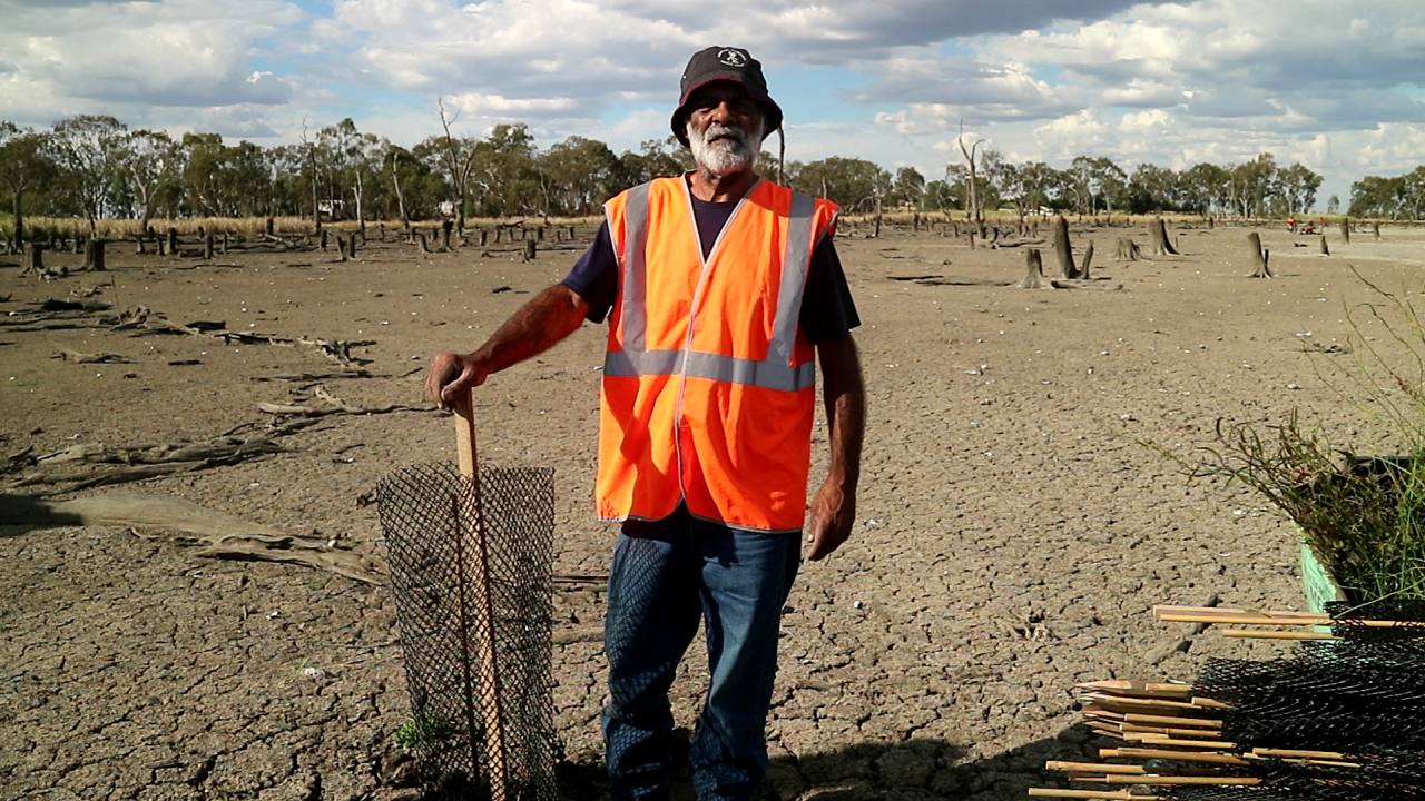
Funding for environmental projects tends to be short term, leading to job insecurity for project managers, loss of continuity and project knowledge, and inability to complete watering sequences. Very significant volunteer resources are required to make these watering projects happen, including inputs from landholders who have donated electricity connections to the floodplain, transported diesel to re-fuel pumps, loaned pumps, tractors and irrigation equipment, plus use of irrigation and local government infrastructure to deliver water, and physical assistance and maintenance from local volunteer groups.

Practical on-ground watering knowledge is maturing well; what is needed now is sufficient water and ongoing consistent funding to support projects to deliver minimum environmental water requirements for the wetlands of the Lower Murray Valley. The pipes at Tortoise Crossing, installed in 2000 and only flooded twice, are more than ready for the next high flows to pour through!

Stakeholders and Funding bodies. The monitoring project was supported as part of the project Ecological Responses to Environmental Watering in the South Australian River Murray Valley, assessing the benefits of salinity interception schemes on floodplain vegetation, coordinated by Australian Water Environments for SA Water from March 2015 to June 2017. Continuing funding for monitoring in 2017-2019 was provided in a grant from the Ian Potter Foundation to Nature Foundation SA, as well as funding from the Commonwealth Environmental Water Holder (2018-19). Water for the environmental watering projects studied here was provided through annual allocations of water from the Commonwealth Environmental Water Office to Nature Foundation SA.  Water delivery was managed by the NFSA Water For Nature program through Program Manager Natalie Stalenberg. Practical support and site access was provided by Steve Clark, landholder and committee member for Water for Nature program, and landholders John and Bronwyn Burford.

Contact. Dr Anne Jensen, Environmental Consultant; Volunteer member, Water for Nature Committee, Nature Foundation SA; part-time consultant Wetland Ecologist for Water for Nature Program of Nature Foundation SA (7 Ford Street, Maylands SA 5069, Australia; Tel: +61 407 170 706; Email: ajensen@internode.on.net

Ku-ring-gai Flying-fox Reserve Habitat Restoration Project at Gordon, 2000 – 2019 UPDATE of EMR feature

Nancy Pallin

[Update to EMR feature –  Pallin, Nancy (2001) Ku-ring-gai Flying-fox Reserve Habitat restoration project, 15 years on.  Ecological Management & Restoration 1:1, 10-20. https://onlinelibrary.wiley.com/doi/10.1046/j.1442-8903.2000.00003.x]

Key words:         bush regeneration, community engagement, wallaby browsing, heat events, climate change

Figure 1. Habitat restoration areas at Ku-ring-gai Flying-fox Reserve within the urban area of Gordon, showing areas treated during the various phases of the project. Post-2000 works included follow up in all zones, the new acquisition area, the pile burn site, the ecological hot burn site and sites where vines have been targeted. (Map provided by Ku-ring-gai Council.)

Introduction. The aim of this habitat restoration project remains to provide self-perpetuating indigenous roosting habitat for Grey-headed Flying-fox (Pteropus poliocephalus) located at Ku-ring-gai Flying-fox Reserve in Gordon, NSW Australia (Fig 1).  The secondary aim was to retain the diversity of fauna and flora within the Flying-fox Reserve managed by Ku-ring-gai Council. Prior to works, weed vines and the activity of flying-foxes in the trees had damaged the canopy trees while dense weed beneath prevented germination and growth of replacement trees.  Without intervention the forest was unable to recover.  Natural regeneration was assisted by works carried out by Bushcare volunteers and Council’s contract bush regeneration team.  The work involved weed removal, pile burns and planting of additional canopy trees including Sydney Bluegum (Eucalyptus saligna), which was expected to cope better with the increased nutrients brought in by flying-foxes.

Figure 2. The changing extent of the Grey-headed Flying-fox camp from the start of the project, including updates since 2000. (Data provided by KBCS and Ku-ring-gai Council)

Significant changes have occurred for flying-foxes and in the Reserve in the last 20 years.

In 2001 Grey-headed Flying-fox was added to the threatened species lists, of both NSW and Commonwealth legislation, in the Vulnerable category.  Monthly monitoring of the number of flying-foxes occupying the Reserve  has continued monthly since 1994 and, along with mapping of the extent of the camp, is recorded on Ku-ring-gai Council’s Geographical Information System. Quarterly population estimates contribute to the National Monitoring Program to estimate the population of Grey-headed Flying-fox.  In terms of results of the monitoring, the trend in the fly-out counts at Gordon shows a slight decline.  Since the extreme weather event in 2010, more camps have formed in the Sydney basin in response to declining food resources.

In 2007, prompted by Ku-ring-gai Bat Conservation Society (KBCS), the size of the Reserve was increased by 4.3 ha by NSW Government acquisition and transfer to Council of privately owned bushland. The Voluntary Conservation Agreement that had previously established over the whole reserve in 1998 was then extended to cover the new area.   These conservation measures have avoided new development projecting into the valley.

From 2009 Grey-headed Flying-fox again shifted their camp northwards into a narrow gully between houses (Fig 2).  This led to human-wildlife conflict over noise and smell especially during the mating season. Council responded by updating the Reserve Management Plan to increase focus on the needs of adjoining residents.  Council removed and trimmed some trees which were very close to houses. In 2018 the NSW Government, through Local Governments, provided grants for home retrofitting such as double glazing, to help residents live more comfortably near flying-fox camps.

Heat stress has caused flying-fox deaths in the Reserve on five days since 2002. Deaths (358) recorded in 2013, almost all were juveniles of that year.  KBCS installed a weather station (Davis Instruments Vantage Pro Plus, connected through a Davis Vantage Connect 3G system) and data loggers to provide continuous recording of temperature and humidity within the camp and along Stoney Creek.  The station updates every 15 minutes and gives accurate information on conditions actually being experienced in the camp by the flying-foxes. The data is publicly available http://sydneybats.org.au/ku-ring-gai-flying-fox-reserve/weather-in-the-reserve/Following advice on the location and area of flying-fox roosting habitat and refuge areas on days of extremely high temperatures (Fig 3.) by specialist biologist Dr Peggy Eby, Council adopted the Ku-ring-gai Flying-fox Reserve 10 Year Management and Roosting Habitat Plan in 2018.  Restoration efforts are now focused on improving habitat along the lower valley slopes to encourage flying-foxes to move away from residential property and to increase their resilience to heat events which are predicted to increase with climate change.

Figure 3. Map showing the general distribution of flying-foxes during heat events, as well as the location of exclosures. (Map provided by Ku-ring-gai Council)

Further works undertaken.  By 2000 native ground covers and shrubs were replacing the weeds that had been removed by the regeneration teams and Bushcare volunteers.  However, from 2004, browsing by the Swamp Wallaby (Wallabia bicolor) was preventing growth of young trees and shrubs.  Bushcare volunteers, supported by KBCS and Council responded by building tree cages made from plastic-mesh and wooden stakes. Reinforcing-steel rods replaced wooden stakes in 2008.   From 2011, the Bushcare volunteers experimented with building wallaby exclosures, to allow patches of shrubs and groundcovers to recover between trees (Figs 3 and 4).  Nineteen wallaby exclosures have been built. These range in size from 7m2 to 225m2 with a total area of 846m2.   Wire fencing panels (Mallee Mesh Sapling Guard 1200 x 1500mm) replaced plastic mesh in 2018.  Silt fence is used on the lower 0.5m to prevent reptiles being trapped and horizontally to deter Brush Turkey (‎Alectura lathami) from digging under the fence.

The wallaby exclosures have also provided an opportunity to improve moisture retention at ground level to help protect the Grey-headed Flying-fox during heat events.  While weed is controlled in the exclosures south of Stoney Creek, those north of the creek retain Trad and privets, consistent with the 10 Year Management and Roosting Habitat Plan.

Madeira Vine (Anredera cordifolia) remained a threat to canopy trees along Stoney Creek for some years after 2000, despite early treatments.  The contract bush regen team employed sInce 2010 targeted 21 Madiera Vine incursions.

A very hot ecological burn was undertaken in 2017 by Council in order to stimulate germination of soil stored seed and regenerate the Plant Community Type (PCT) – Smooth-barked Apple-Turpentine-Blackbutt tall open forest on enriched sandstone slopes and gullies of the Sydney region (PCT 1841).  This area was subsequently fenced. The contract bush regeneration team was also employed for this work to maintain and monitor the regeneration in the eco-burn area (720 hours per year for both the fire and Madiera Vine combined).

Figure 4. Exclusion fence construction method. Pictured are Bushcare volunteers, Jill Green and Pierre Vignal. (Photo N Pallin).

Figure 5. Natural regeneration in 2018 in (unburnt) exclosure S-6 (including germination of Turpentines). (Photo N. Pallin)

Further results to date. The original canopy trees in Phase 1 and Phase 2 (1987 -1997) areas have recovered and canopy gaps are now mostly closed. Circumference at breast height measurements were taken for seven planted Sydney Blue gum trees.  These ranged from 710 to 1410mm with estimated canopy spread from 2 to 6m.  While original Turpentine (Syncarpia glomulifera) had circumferences from 1070 and 2350mm with canopy spread estimated between 5and 8m, those planted or naturally germinated now have circumference measurements between 420 and 980mm with canopy spread estimated from 1.5 to 3m.  A Red Ash (Alphitonia excelsa) which naturally germinated after initial clearing of weeds now has a circumference of 1250mm with a canopy spread of 5m.  Also three Pigeonberry Ash (Elaeocarpus kirtonii) have circumference from 265 to 405mm with small canopies of 1 to 2m as they are under the canopies of large, old Turpentines.  As predicted by Robin Buchanan in 1985 few Blackbutt (Eucalyptus pilularis) juveniles survived while the original large old trees have recovered and the Sydney Bluegum trees have thrived.

In the Phase 3 (1998 – 2000) area south of Stoney Creek the planted Sydney Blue Gum now have circumferences measuring between 368 and 743 (n7) with canopy spread between 2 and 6 m.  in this area the original large trees have girths between 1125 and 1770mm (n7) whereas trees which either germinated naturally or were planted now range from 130 to 678mm (n12).  These measurement samples show that it takes many decades for trees to reach their full size and be able to support a flying-fox camp.

Wallaby exclosures constructed since 2013 south of Stoney Creek contain both planted and regenerated species.  Eight tree species, 11 midstorey species, 27 understorey species and eight vines have naturally regenerated.  Turpentines grew slowly, reaching 1.5m in 4 years.  Blackbutts thrived initially but have since died. In exclosures north of the creek,  weeds including Large-leaved Privet,  Ligustrum lucidum,  Small-leaved privet,  L. sinense,  Lantana, Lantana camara,  and Trad, Tradescantia fluminensis) have been allow to persist and develop to maximise ground moisture levels for flying-foxes during heat events. Outside the exclosures, as wallabies have grazed and browsed natives, the forest has gradually lost its lower structural layers, a difference very evident in Fig 6.

Figure 6. Visible difference in density and height of ground cover north and south of Stoney creek. (Photo P. Vignal)

Coachwood (Ceratopetalum apetalum) were densely planted in a 3 x 15m exclosure under the canopies of mature Coachwood next to Stoney Creek in 2015. In 4 years they have reached 1.5m.  In this moist site native groundcovers are developing a dense, moist ground cover.

Madiera Vine, the highest-threat weed, is now largely confined to degraded edges of the reserve, where strategic consolidation is being implemented with a view to total eradication.

In the hot burn area, which was both fenced and weeded, recruitment has been outstanding. One 20 x 20m quadrat recorded 58 native species regenerating where previously 16 main weed species and only 6 native species were present above ground. A total of 20 saplings and 43 seedlings of canopy species including Eucalyptus spp., Turpentine and Coachwood were recorded in this quadrat where the treatment involved weed removal, burning and fencing  (S. Brown, Ku-ring-gai Council, July 2019, unpublished data).  Unfortunately, however, the timing and location of the burn did not take into account its impact on the flying-fox camp and there was some damage to existing canopy trees. It will be many years before the canopy trees, which are regenerating, will be strong enough to support flying-foxes.

Monitoring from the weather station and data loggers has shown that close to Stoney Creek on a hot day it is typically 2-3° C cooler, and 5-10% higher in humidity, than in the current camp area (pers. comm. Tim Pearson). During heat events the flying-foxes move to this cooler and moister zone, increasing their chances of survival.

Fauna observed other than flying-foxes includes a pair of Wedge-tail Eagle ( Aquila audax plus their juvenile, a nesting Grey Goshawk (Accipiter novaehollandiae) and a Pacific Baza (Aviceda subcristata).  Powerful Owl (Ninox strenua) individuals continue to use the valley. The presence of raptors and owls indicate that the ecosystem processes appear to be functional. Despite the decline of the shrub layer outside fenced areas, the same range of small bird species (as seen prior to 2000) are still seen including migrants such as Rufous Fantail ( Rhipidura rufifrons) which prefers dense, shady vegetation. The first sighting of a Noisy Pitta (Pitta versicolor) was in 2014.  Long-nosed Bandicoot (Perameles nasuta) individuals appear and disappear, while Swamp Wallaby remains plentiful.

Lessons learned and future directions. Climate change is an increasing threat to Pteropus species. On the advice of Dr Eby, Flying-fox Consultant, Council, KBCS and Bushcare Volunteers agreed to retain all vegetation including weeds such as Large-leaved Privet and Small-leaved Privet, patches of the shrub Ochna (Ochna serrulata) and Trad as a moist ground cover in the camp area and areas used by the flying-foxes during heat events.

Building cheap, lightweight fencing can be effective against wallaby impacts, provided it is regularly inspected and repaired after damage caused by falling branches. This style of fencing has the additional advantage of being removable and reusable.  It has been proposed that, to provide understory vegetation to fuel future burns in parts of the reserve away from the flying-fox camp, further such temporary fencing could be installed.

Ku-ring-gai Council has commenced a  program to install permanent monitoring points to annually record changes in the vegetation, consistent with the state-based  Biodiversity Assessment Method.

Stakeholders and Funding bodies. Members of KBCS make donations, volunteer for monthly flyout counts, Bushcare and present educational events with live flying-foxes. KBCS hosts the website www.sydneybats.org.au. Ku-ring-gai Council which is responsible for the Reserve has been active in improving management to benefit both residents and flying-foxes.  Ku-ring-gai Environmental Levy Grants to KBCS have contributed substantially to purchase of fencing materials and the weather station. http://www.kmc.nsw.gov.au/About_Ku-ring-gai/Land_and_surrounds/Local_wildlife/Native_species_profiles/Grey-headed_flying-fox

Thank you to Jacob Sife and Chelsea Hankin at Ku-ring-gai Council for preparing the maps and to volunteer Pierre Vignal for assistance with tree measurements, downloading data loggers and a photo.  Researcher,  Tim Pearson installed the weather station.

Contact information. Nancy Pallin, Management Committee member, Ku-ring-gai Bat Conservation Society Inc.  PO Box 607, Gordon 2072  Tel 61 418748109. Email:  pallinnancy@gmail.com

Is revegetation in the Sheep Pen Creek area, Victoria, improving Grey-crowned Babbler habitat? – UPDATE of EMR feature

Doug Robinson

[Update of EMR feature Robinson, Doug (2006) Is revegetation in the Sheep Pen Creek area, Victoria, improving Grey‐crowned Babbler habitat?  Ecological Management & Restoration, 7:2, 93-104.  https://doi.org/10.1111/j.1442-8903.2006.00263.x]

Key words: (<5 words): Monitoring, restoration, population ecology, woodland conservation

Figure 1. Location of babbler project works and other landcare works implemented since 1996 in the Sheep Pen Creek Land Management Group area and the two sub-districts used for the babbler study. (Source TFNVic)

Introduction: The Grey-crowned Babbler (Pomatostomus temporalis) (babbler) is a threatened woodland bird (classified as Endangered in the state of Victoria) that has declined substantially in overall distribution and abundance across much of its former range in southeastern Australia since European settlement.  Sheep Pen Creek Land Management Group area, in northern Victoria (Fig 1), was fortuitously the location of the largest known remaining babbler population in Victoria in the early 1990s (when this project began); and the focus of extensive land restoration programs from the 1980s onwards to help mitigate the impacts of erosion and dryland salinity, as well as biodiversity decline.  The original study, published in 2006, investigated the overall changes in tree cover across the district between 1971 and 1996 as a result of different land-management actions and responses of local babbler populations to those habitat changes.  The key finding was that in the Koonda sub-district which had a 5% overall increase in tree cover to 14% from 1971 to 2001, showed an increase in babbler numbers by about 30% (Table 1).   In the Tamleugh sub-district, tree cover increased by 1.3% to a total of 9%, with no change in babbler numbers.  The findings also showed that new babbler groups were preferentially colonizing new patches of vegetation established that suited their habitat needs.  Building on this research, the study concluded that future conservation programs needed to scale-up the extent of habitat restoration, target areas which were suitable for babbler colonization, and tailor incentive programs to assist with conservation of particular species.

Table 1. Changes in Grey-crowned Babbler numbers over time

Year Koonda Tamleugh
number of groups number of birds number of groups number of birds
1992 20 78 11 39
1993 20 89 10 34
1996 24 96 9 35
1997 24 102 8 30
1998 25 99 10 40
2000 26 97 10 43
2005 23 99 8 34

Further revegetation works undertaken. Since the initial study’s assessment of vegetation changes between 1971 and 1996, an additional 133 ha of vegetation has been restored or established as babbler habitat in Koonda district and 37 ha in the Tamleugh district (Figs 2 and 3, Table 2).  Extensive natural regeneration, supplemented by broadscale revegetation, has also occurred over more than 350 ha on five private conservation properties in the Koonda district,, contributing to substantial landscape change.  The wider landscape has also been identified as a statewide priority for nature conservation on private land, leading to increased conservation investment in permanent protection there by Victoria’s lead covenanting body – Trust for Nature.

Monitoring of outcomes: The monitoring that was carried out prior to the 2006 publication has not continued, leaving a knowledge gap as to how the population has fared in the context of the Millenium Drought and ongoing climate-change impacts. However, based on the original research’s initial findings, we conducted an experimental study with University of Melbourne to evaluate the effectiveness of habitat restoration in maintaining babbler survival. The study, published by Vesk and colleagues in 2015, compared the persistence and group size of babbler groups present in 1995 and subsequently in 2008 at a randomly selected set of stratified sites which had either had habitat works or none.  This study was conducted across a larger landscape of about 200,000 hectares which included Sheep Pen Creek Land Management Group area.  The study found that babbler group size decreased by about 15% over the 13 years at sites without restoration works.   At sites with restoration, average group size increased by about 22%, thereby effectively compensating for the overall reduction in numbers reported over that time.This increase also influenced subsequent demographic performance, with groups at restoration sites having higher breeding success and more fledglings than groups at control sites.

Another useful finding from this experimental study was the confirmation of the importance of particular habitat and landscape variables on babbler persistence.  In particular, abundance of large trees was a positive predictor of occupancy over time; and distance from the next nearest group was a negative predictor.

Figure 2. Changes in tree cover in the Koonda sub-district between 1971 (top),  and 2018 (bottom). (Source TFNVic).. (Source TFNVic)

Figure 3. Changes in tree cover in the Tamleugh sub-district between 1971 (top) and 2018 (bottom). (Source TFNVic)

Table 2.  Summary of additional habitat established or restored as part of the Sheep Pen Creek Grey-crowned Babbler project from 1996-2018, following the initial study period from 1971-1996.

District Number of sites Area (ha)
Koonda 62 133
Tamleugh 28   37
Other parts of landcare group and local babbler population area 29 103
Totals 119 273

Expansion of lessons to other districts: Building on the fundamental research conducted in Sheep Pen Creek Land Management Group area, similar habitat, landscape and babbler population assessments were subsequently undertaken in northwest Victoria near Kerang for the babbler populations found there.  Key results from these studies relevant to the initial Sheep Pen study were that the number of babbler groups in each sampled district was positively related to the proportion of woodland cover, especially the proportion of Black Box (Eucalyptus largiflorens) woodland habitat – the babblers’ preferred habitat in this region.  Conversely, the number of babbler groups was negatively associated with the proportion of land under intensive agriculture.  At the site scale, key positive predictors of babbler presence in Black Box habitat again included the abundance of large trees (> 60 cm dbh)

Lessons learned and future directions: The most valuable lesson learned since the initial paper was published was the power of the structured research project described above to evaluate the effectiveness of the babbler conservation program and inform future design and planning. The study further demonstrated the importance of taking a demographic approach to the species’ conservation needs, understanding what is happening across the whole population over time  and how habitat interventions can assist.  These lessons have since been applied usefully to other babbler projects  and more broadly to conservation of woodland birds.

The initial paper noted the importance of achieving landscape-scale change in vegetation extent, particularly in more fertile habitats. This has occurred to some extent within the Koonda district through a range of incentive programs, tender programs, covenanting programs and land purchase, but continues to achieve most gains on more infertile land. On fertile land, by contrast, there has been rapid land-use change to cropping over the past fifteen years, leading to reduced likelihood of those properties providing suitable habitat for babblers, as found in the study conducted in northwest Victoria.

The initial paper also suggested the benefit of developing tailored incentive programs for babblers and other threatened species with particular requirements to maximize potential conservation gains  and we suggest, based on Australian and overseas experiences,  that more specific incentive programs or more detailed criteria could assist.

Another important lesson learned was the difficulty in maintaining community-driven citizen-science monitoring, even with the best will in the world, without some over-arching organizational support and oversight.  We know that community monitoring for biodiversity conservation needs scientific input at the design and analysis stages; hence additional resources may also be required in terms of equipment or guidelines to help groups monitor effectively.  Modest government investments to conservation organisations with established biodiversity monitoring programs could usefully help address this issue.

Finally, the learnings from the Sheep Pen Creek Land Management babbler conservation project over nearly thirty years are that the landscape changes and that these changes are not always positive.  Land-use change is placing more pressure on  potential babbler habitat; and the eucalypt regrowth which was established and provided new nesting resources for a few years is now too tall to provide nesting habitat, but too dense and immature to provide suitable foraging habitat for another one hundred years.  Climate change is rapidly imposing constraints on the availability of food resources and breeding opportunities, exacerbated by increased competition for the same limited resources by exotic and native species.  For the Grey-crowned Babbler, the solution to all of these factors depends on ongoing commitment to the establishment or maintenance of their essential habitat needs and life-history requirements so that their life-cycle is provisioned for from generation to generation.

Stakeholders and Funding bodies:   Most of the targeted habitat works achieved for babblers in this landscape has occurred through funding support from the Australian government through its Natural Heritage Trust and Caring for our Country programs.  Broader habitat protection and restoration has occurred primarily with funding support to landholders from the Goulburn Broken Catchment Management Authority (GBCMA).  The Norman Wettenhall Foundation, along with GBCMA, was instrumental in enabling the research by University of Melbourne, which was also aided by the extensive voluntary support of Friends of the Grey-crowned Babbler.  Not least, local landholders continued to support the project and continue to protect or restore parts of their properties to assist with babbler conservation.

Contact information: [Doug Robinson, Trust for Nature, 5/379 Collins Street Melbourne, Victoria 3000, Australia.  dougr@tfn.org.au, (03) 86315800 or 0408512441; and  School of Life Sciences, La Trobe University, Bundoora, Victoria, Australia.


Ecological restoration and rehabilitation at Sydney Olympic Park – UPDATE to EMR feature

Jennifer O’Meara and Kerry Darcovich

[Update to EMR feature – O’Meara, Jennifer and Kerry Darcovich (2015) Twelve years on: Ecological restoration and rehabilitation at Sydney Olympic Park, Ecological Management & Restoration, 16:1, 14-28. https://onlinelibrary.wiley.com/doi/10.1111/emr.12150 ]

Keywords: Environmental management, ecological management, threatened species, Habitat management , woodland birds, Green and Golden Bell Frog

Introduction. The 2015 EMR feature described ecological restoration and management works at Sydney Olympic Park, a large urban park containing both remnant and constructed landscapes that underwent significant restoration in preparation for the 2000 Olympic Games. Sydney Olympic Park supports a rich natural environment that includes over 250 native animal species, over 400 native plant species and three endangered ecological communities.  The high ecological values of the Park have resulted in 304 hectares (nearly half of the Park) being zoned under NSW planning legislation for environmental conservation and management.  Key habitats include estuarine and freshwater wetlands, remnant eucalypt forest, saltmarsh meadows and woodland bird habitats.

The Park’s biodiversity is of high conservation significance, and makes a significant contribution to the social and economic values of the Park.  The Park’s natural environments enrich visitor experience, provide a living classroom for environmental education programs, and attract businesses and residents seeking proximity to nature. This project began in 2000 when management transferred from a construction phase after the Sydney Olympic Games to an active management phase and is supported by an extensive long term ecological monitoring program. This update summarises new works and outcomes since 2016.

Further works undertaken. The introduction of new ecological infrastructure for frog habitat targets threatening processes of predation by introduced fish and increasing water availability.  Fish-proof fences have been introduced to wetlands where the predatory fish Gambusia (Gambusia holbrooki) is present in Green and Golden Bell Frog (Litoria aurea) habitat (Fig 1). The fences are placed around ponds or pond clusters and then the pond is dried out and refilled with fish-free water. Constructed of sediment fences 600mm high and embedded in the ground, these fences stretch to a maximum of 200m and have successfully restricted the fish from ponds for more than three years.

Figure 1.  Gambusia fence

In order to reduce the impact of bird predation on tadpoles in key breeding ponds, bird netting secured by wire cables to the ground and supported by hoops has been introduced.  The netting is also used as a response to the sighting of Green and Golden Bell Frog tadpoles in ponds with Sydney Olympic Park staff deploying temporary netting where successful breeding has occurred. Netting is left on the pond until all metamorphs have dispersed from the pond then removed.

Restoration of the water-holding capacity and connectivity of bell frog habitat in the Brickpit and Kronos Hill has been improved with temporary ponds being created with tarps (Fig 2). The aim is twofold – to extend the number of predator-free, drought refuges, important for adult female frogs and metamorphs and to ensure frog corridors maintain connectivity.  More than 10 tarp ponds have been created and have an expected life span of 3-6 years and are very budget friendly. Annual monitoring has shown a remarkable uptake of these ponds by the Green and Golden Bell Frog.

Figure 2.  Tarp pond with netting

Further results to date. The Parks ecological monitoring program is ongoing and now entering the 16th consecutive year for birds, 15th for reptiles and 21 years for the Green and Golden Bell Frog. In 2018-19 the fourth woodland bird survey was completed, a four yearly assessment of the status of woodland birds and vegetation management at Sydney Olympic Park. Fifteen quadrats are surveyed over the spring and autumn seasons to measure bird communities which is then compared to change in vegetation structure. Results show that small birds were strongly, positively correlated with shrub cover, but strongly negatively correlated with tree cover and Noisy Miner (Manorina melanocephala).  Since 2006, Sydney Olympic Park Authority has implemented a habitat modification program aimed at increasing the structural diversity and complexity of key areas of the Park to support woodland birds. The program seeks to build connectivity between key woodland bird habitats with the form of habitat enhancement varying depending on site characteristics. The survey shows that this program is successfully creating suitable habitat for this group of birds.

With the prospect of greater demands by the public to access the Park at all hours (see below), Sydney Olympic Park staff have recently collected baseline light level readings from across the Park to inform decision making.  Data on lux levels and light source was collected from over 160 sites ranging from car parks to mangrove creeks. The main drive of the survey was to collect information on light spill into sensitive habitat areas where darkness is a key ecological feature. The survey led to a review of lighting and identification of where lights could be switched off or timed to decrease light impacts. The findings will also inform future planning for illumination within the Park.

Lessons learned and future directions. Sydney Olympic Park is part of a rapidly densifying area with the 30,000 residents currently located within a 3km radius forecast to increase to approximately 100,000 in ten years. Due to the density of housing, Sydney Olympic Park will be/is already the local park for this community, leading to increasing demand for recreation and access to the Parklands. This presents great opportunities for more people to connect with nature and to incorporate community education and sustainability into Park programs.  A new program known as Park Care has been launched recently and currently rolls out community clean up and revegetation activities.

The flipside of this rapid population increase is increasing risk of disturbance to ecologically sensitive areas which needs to be considered and mitigated carefully as the Park continues to evolve. Ensuring the Park is able to sustainably meet this demand is a focus for management now and into the future. New habitat management plans for ecologically sensitive areas of the Park are being developed to better-guide biodiversity conservation on a precinct level. Ongoing ecological management works, and managing the impacts of human disturbance, will be essential to conserving the ecological values of the Park.

Contact. Jennifer O’Meara, Parklands Ecologist, Sydney Olympic Park Authority, 5 Olympic Boulevard, Sydney Olympic Park 2127 NSW, Australia. Email: Jenny.omeara@sopa.nsw.gov.au

Restoration of Wollongong’s Tom Thumb Lagoon 25 Years On: UPDATE of EMR feature.

 Nicholas Gill

[Update of EMR feature: Gill, Nicholas (2005) Slag, steel and swamp: Perceptions of restoration of an urban coastal saltmarsh. Ecological Management & Restoration, 6:2, 85-93 https://onlinelibrary.wiley.com/doi/10.1111/j.1442-8903.2005.00224.x]

Keywords. coastal wetlands, urban green space, pollution, mangroves, volunteers.

Figure 1. Tom Thumb Lagoon and Greenhouse Park (a) 2008 and (b) 2017. (Source Google Earth)

Introduction. The 2005 feature was drawn from restoration work my students and I became involved in during the early 2000s at Tom Thumb Lagoon (TTL) – an estuarine wetland close to Wollongong’s CBD and adjacent to the Port Kembla industrial area and harbour. By that point Wollongong City Council (WCC), the Bushcare group Friends of Tom Thumb Lagoon (FTTL), industry, Conservation Volunteers Australia (CVA), and many volunteers had been variously working on the site since the early 1990s. After decades of impacts from industrial development, waste disposal, and neglect, this significant restoration effort encompassed removing landfill, reshaping the wetland with channels and shallow benches, revegetation, weeding, and the construction of access and viewing points. By the time we became involved and I wrote the 2005 paper, TTL and the adjacent Greenhouse Park (GHP; Fig 1), were substantially revegetated, aesthetically improved, and the saltmarsh wetlands were seen as ecologically valuable. Participants and stakeholders in the restoration project perceived that substantial progress and improvement had been made. They also perceived, however, that the project suffered from some issues common to such endeavours such as a lack strategic planning and monitoring of ecological outcomes.

Since this time, restoration and other work has continued at TTL and at GHP. The story of what has happened, however, is one of the dynamic and contextual nature of sites such as this. This is true in a biophysical sense of ongoing vegetation change, particularly the spread of Grey Mangrove (Avicenna marina), a native plant previously not occurring on the site but planted for perceived environmental benefits either in the 1990s, or around 2000. This spread (into what was previously saltmarsh and mudflats) arises from past decisions and, while providing benefits, is now potentially causing new problems as well as continuing debates about choices in restoration.  The social context has also been dynamic and influential, as priorities have shifted, as the funding environment has altered, and as the people and groups involved have changed. Finally, Tom Thumb Lagoon remains affected by the legacy of the industrial history of its location. Past waste disposal practices in the absence of regulation have led to pollution problems that have become of greater concern since the early 2000s.

Activities at Tom Thumb Lagoon and Greenhouse Park Today. The wetland area itself is adjacent to a capped waste disposal site that operated from the 1940s until the mid-1970s. This area is known now as Greenhouse Park and is being managed and developed as urban green space with more focus on fostering urban sustainability practices; any restoration work is nested within these foci. TTL and GHP were always associated through overlap between FTTL and GHP staff, and GHP facilities were a base for TTL activities. Today, however, personnel have changed, FTTL no longer exists and its key members are no longer associated with TTL, and TTL/GHP are managed as one site to a greater extent. The result of these factors, and of the achievements already made at TTL, have been a shift towards an emphasis on activities at GHP and a change in TTL activities from active restoration to maintenance. It is now GHP volunteers and associated WCC staff who undertake and oversee work at TTL. At GHP WCC has expended considerable resources in tree planting and expanding a permaculture garden. There is a shelter, outdoor kitchen, and pizza oven for volunteers, WCC and Wollongong firms compost green and food waste, and there are hopes for public, tourism, and event use. Around ten volunteers work at the site weekly. For the GHP staff and volunteers, activities at TTL itself today are largely limited to weeding, picking up litter, and feral animal control. Weeds and litter remain problems, partly due to TTL’s location at the bottom of an urban catchment. In addition, since 2005, frog ponds were installed at the eastern end of TTL for the endangered Green and Golden Bell frog (Litoria aurea), however, it is not clear if the ponds are effective. The non-native Giant Reed (Arundo donax) also remains well established at this end of TTL despite control attempts.

Shifts in support have meant that CVA bowed out of work at TTL/GHP in 2012. Previously their involvement had been via a wetlands program that relied on support from both industry (including Bluescope and NSW Ports, both operating adjacent to TTL) and government programs. Until 2012, in conjunction with WCC, CVA were revegetating the southern slopes of GHP (marked A in Fig. 1) and were removing weeds and litter from the saltmarsh. However, the funding that CVA relied on declined such that CVA was unable to continue at TTL/GHP.

Figure 2.  Eastern end of TTL looking south (a) 2002 and (b) 2019 (Photos Nick Gill)

The Mangroves are Coming. Apart from further revegetation at GHP, the most significant vegetation change at TTL has been the spread of Grey Mangrove. While approval to thin this species has been obtained in the past and some thinning did occur, it has not mitigated their current spread and density. Grey Mangrove spread is clearly seen for the period from 2002 to 2019 in Fig 2 which shows the eastern end of TTL and the southern end of the channel known as Gurungaty Waterway. Aerial photos further reveal changes from 2008-2017 where the largely east-west spread of mangroves along channels in TTL can be seen (marked B in Fig 1). Significant spread can also be seen north-south spread along Gurungaty Waterway over this period (marked C in Fig 1). As the 2005 paper records, not long after Grey Mangrove was planted in the late 20th or early 21st Century, its expansion was  soon causing concern for its consequences for the site’s mudflats, saltmarsh and tidal habitats although it appears to have largely remained confined to the channels and has no doubt generated some environmental benefits. In terms of its consequences on bird habitat, the long observations of local birdwatchers suggest that the expansion of Grey Mangrove has reduced the incidence of waders and shorebirds, particularly Black Winged Stilts (Himantopus himantopus) and also waterfowl and herons. Nonetheless, observers report that Grey  Mangrove colonisation is providing habitat for other birds, such as the Sacred Kingfisher (Todiramphus sanctus), the Nankeen Night-Heron (Nycticorax caledonicus), and the Striated Heron (Butorides striata). Elsewhere across more upland areas of TTL and GHP, the expansion of tree planting across GHP and TTL has seen a shift to birds favouring woodland habitats.

The expansion of Grey Mangrove is also implicated in flood risk, especially for the catchment of Gurungaty Waterway. A 2019 review of the Wollongong City Flood Study, suggests that low elevations and channel infrastructure, combined with sedimentation and flow limitations associated with the now dense mangroves (Fig. 3), have increased the likelihood of flooding in the urban catchment.

Figure 3.  Southern Gurangaty Waterway in (a) 2002 and (b) 2019. Note the steel footbridge on left of each photo. (Photos Nick Gill)

Industrial Legacies. The 2005 paper notes that saltmarsh restoration was an important part of the TTL work and that stakeholders saw the saltmarsh as a significant ecological element of TTL. Since 2004 coastal saltmarsh has been listed as an Endangered Ecological Community in NSW. From 2006, saltmarsh degradation prompted WCC to monitor the saltmarsh and analyse groundwater and soils.  This showed that the degradation was likely associated with ammonia leaching from the tip and causing nitrate pollution, and also with a hydrophilic layer of iron hydroxide in the soil causing waterlogging and contaminant absorption. The possible origins of this layer include past waste disposal practices from metal manufacturing.

These, however, are not the only legacies of past unregulated waste disposal and industrial activity. TTL is now a declared site of ‘significantly contaminated land’ by the NSW EPA. The 2018 declaration notes that site is contaminated by ‘polycyclic aromatic hydrocarbons (PAHs), petroleum hydrocarbons and other mixed contaminants from multiple sources including coal tar and lubricant oils’. At TTL elements of these can be visible as a film on the water surface and are among the substances leaching from GHP. Such substances are carcinogenic and exposure can cause a range of health problems. The presence of these materials in the groundwater has been known since the 1990s but from 2013 WCC began to monitor and map these materials. Monitoring points were installed along the wetlands at base of the old tip. Various remediation options for these contaminants, as well as for the nitrates and iron hydroxide layer, were proposed but action was not taken at this time for various reasons including disruption to the wetland, costs, and uncertainties regarding pollutant interception. As of 2019, the site is subject to a ‘Voluntary Management Proposal’ by WCC which includes the preparation of a remediation action plan by late 2019.

Future Directions. The last fifteen years have seen some aspects of restoration, such as tree planting, proceed and expand. By some measures this is continued progress of the original project. TTL/GHP is now a well-established urban green space with environmental and amenity value. However, concerns from the early 2000s about volunteer succession, the absence of a catchment approach to management, and the need to think more strategically about ecological trade-offs between management options have been realised to some extent. The spread of Grey Mangrove is the clearest example of this. In part, some of this is perhaps inevitable for a site with the history and setting of TTL/GHP; the management context has changed, participants and stakeholders have changed, and difficult legacy issues have assumed greater prominence and cost. Nonetheless, the challenge to manage the site with a clear strategy and goals remains.

Acknowledgements: For assistance with this update, I am indebted to several past and present WCC staff, particularly Mike McKeon. I was also helped by Adam Woods, formerly of CVA, and birdwatchers Penny Potter, Terrill Nordstrom, and David Winterbottom.

Contact. Nicholas Gill, School of Geography and Sustainable Communities Faculty of Social Sciences, University of Wollongong NSW 2522 Australia, Email: ngill@uow.edu.au

Ecological Restoration of Donaghys Corridor, Gadgarra, north Queensland – UPDATE of EMR feature

Nigel Tucker

[Update of EMR feature – Tucker, Nigel I. J. and Tania Simmons (209) Restoring a rainforest habitat linkage in north Queensland: Donaghy’s Corridor, Ecological Management & Restoration, 10:2, 98-112, https://onlinelibrary.wiley.com/doi/10.1111/j.1442-8903.2009.00471.x]

Keywords: Rainforest, corridor, regeneration, disturbance effects

Introduction. Complex notophyll vine forests of the Atherton Tablelands, particularly from basalt derived soils, have been significantly fragmented and degraded by human settlement over a 100yr period. Fragment isolation results in edge effects, exotic species colonisation, loss of genetic variability and species decline. During high rainfall events, eroding streambanks on farms mobilise sediments to the receiving environment of the Great Barrier Reef. Re-connecting isolated fragments to larger forest blocks through restored riparian corridors aims to reverse these effects through adaptive management. The restoration of Donaghys Corridor is an example of adaptive management, and its establishment was a key factor in the adoption of other local corridor projects.

As reported in the 2009 features, around 20,000 plants of selected local species were established in four yearly plantings (1995/96/97/98) along Toohey Creek, creating a continuous habitat corridor between the isolated Lake Barrine fragment (500ha) and the adjacent Gadgarra section of Wooroonooran N.P (80,000ha), both being part of the Wet Tropics World Heritage Area. The corridor is 1,200m in length and 100m wide, with three rows of Hoop Pine (Araucaria cunninghamiana) planted either side of the fenced corridor, which was established on lands largely owned by the Donaghy family. On completion, the corridor was secured through the Queensland Government’s declaration of Donaghys Corridor Nature Refuge, the State’s first Nature Refuge proclaimed over an ecologically restored site.

Ongoing recovery. In 2000, a vegetation survey of 3m x 5m plots in 12 permanent transects throughout the corridor showed regeneration had occurred upon canopy closure (Tucker and Simmons 2009).  Between 1995 and 1998, 119 native species had regenerated within the transects, mainly through vertebrate-mediated dispersal. The most recent (ongoing) survey, ca.20yrs after planting, indicates that regeneration has continued, and the majority of regenerating species are again vertebrate dispersed. There has also been a measurable increase in vegetation structural complexity, and a variety of life forms are present including ferns, orchids, vines, scramblers and canopy trees.

Restored vegetation in 2000 was characterised by vegetation of even age and size classes and only a developing canopy was present (no sub-canopy). Recruitment was limited to the ground storey. Over 20yrs, total numbers of recruiting species have increased, along with canopy height, and the sub-canopy is now a distinguishable and measurable feature. To illustrate this change, species diversity and structure in two typical transects from the oldest (1995) and youngest (1998) plantings are shown in the table below. Figures are from the most recent survey (2019) and the bracketed numbers indicate comparative values in 2000.

Canopy

height

Sub-canopy

Height

Number of species Average number of species/plot Average number of species/plot – sub-canopy Average number of species/plot – ground storey
1995 19.9 (5) 7.5 (0) 84 (53) 22.6 (12.5) 8.3 13.8
1998 14.4 (2.5) 7.3 (0) 63 (15) 14.2 (1.6) 2.2 15.8

There has also been a significant difference in the distribution of regenerating vegetation. In 2000, regeneration was negatively correlated with edge, being concentrated in the central portion of each transect. Greater structural complexity and increased shading have significantly reduced the edge effect and regeneration is now distributed equally across the entire width of the corridor. This edge-effect reduction may partially result from the three Hoop Pine rows, now ca.15m tall, planted on each side of the corridor.

Figure 1.  Part of the 18m x 250m fence crossing Donaghys Corridor

Natural and man-made disturbance. Since establishment there has been both natural and anthropogenic disturbance. Occasional incursions by cattle have occurred, entering via fences sometimes damaged by branches falling from maturing corridor vegetation. In small areas incursions have visibly damaged regeneration but surveys show this has not significantly affected regeneration. Feral pig disturbance has also occurred but does not appear to have affected regeneration.

In 2006, corridor vegetation was damaged by severe tropical Cyclone Larry. Most stems lost crowns and some waters’ edge stems were permanently bent by floodwaters, but vegetation recovery was rapid and no weed invasion occurred. This infers a measure of resilience by restored vegetation to disturbance, and the distribution of regeneration described above supports this inference.

Anthropogenic disturbance has been more interventionist and not aligned to the original concept adopted by government, landholders, scientists and the community when the project commenced in 1995.  In 2017, the corridor’s upstream neighbour, with support from the DES but without consultation with the Donaghy family or other affected landholders, erected a chain mesh fence 250m long and 1.8m high across the western end of the corridor (see Figure 1). This is part of a larger fence which completely encloses mature forest at the western end of the corridor, including corrugated iron placed across the bed of Toohey Creek. Enquiries revealed the fence is part of an enclosure for a Cassowary (Casuarius casuarius johnsonii) rehabilitation facility, operated by Rainforest Reserves Australia (RRA) under a commercial arrangement with the Queensland Government.

Enhancing landscape permeability was the key reason for undertaking the Donaghys Corridor project, and the endangered Cassowary was a key target species; 53 Cassowary food plants were included in the original planting matrix of 100 species to encourage corridor utilisation. The Queensland Government notes that corridors are a key strategy in Cassowary conservation. In addition to blocking the movement of terrestrial vertebrates such as Cassowaries, Pademelon (Thylogale stigmatica) and Musky Rat Kangaroo (Hypsiprymnodon moschatus), construction of the enclosure has inadvertently fenced in a number of animals whose territories included part of the enclosure.

DES has advised that the fence is temporary and will be removed when restoration plantings on RRA lands are ‘sufficiently well-developed’ to support Cassowaries being rehabilitated.  It is unknown, however, when or through what processes this removal will occur. Resolution of the issue is anticipated.  However, such actions highlight the pitfalls associated with single-species conservation, and potential conflicts that might arise when responsibility for management of endangered species moves from the State to the non-scientific, commercially-focused private sector. Whilst iconic wildlife e.g., the Cassowary, can be effective in harnessing community and landholder participation in restoration, here it is clear that decision making and communication has been far from optimal, which may well lead to landholder and community disillusionment. In this case, the fence has also disrupted ongoing monitoring and evaluation. Planned re-survey of terrestrial vertebrate colonisation and movement has now been cancelled, given the unknown effect of the fence on wildlife passage and the behaviour of animals inadvertently trapped within the enclosure.

Lessons learned.  The project shows that sustained regeneration of native species can be achieved in restored tropical vegetation, along with increased structural complexity and functional resilience to natural disturbance.  However, the fencing incident shows that dysfunction in a restoration project can arise from totally unanticipated causes, potentially undoing well-established partnerships between government, community, scientists and landholders.

Contact.  Nigel Tucker, Director & Principal Environmental Scientist, Biotropica.  PO Box 866 Malanda QLD 4885 ; Email: nigeltucker@biotropica.com.au; Tel: +61 7 4095 1116.


Restoring the banks of the Namoi on Kilmarnock – UPDATE of EMR feature

Robyn R. Watson

[Update of EMR feature – Watson R. (2009) Restoring the banks of the Namoi on ‘Kilmarnock’: Success arising from persistence. Ecological Management & Restoration,  10: 1 pp 10-19 https://onlinelibrary.wiley.com/doi/10.1111/j.1442-8903.2009.00434.x]

Figure 1. Casuarina (Casuarina cunninghamiana), River Red Gum and a range of grasses established on river bank at Kilmarnock after restoration works. (Photo R. Watson)

Riverbank restoration began on Kilmarnock in early 1990 with fencing the river area and planting native trees, shrubs and grasses. A program of killing the weeping willows resulted in their elimination by 2000. Tree lines were planted to connect the river corridor to natural conservation areas around the farm and this has resulted in a gradual increase in native wildlife leading to great environmental benefits both for the farm and surrounding areas.

Prior to the works the riparian zones on Kilmarnock had degraded to the extent that the banks were slumping during floods, with loss of old trees. This had arisen from decades of clearing, grazing and weed invasion.  Since 2009 we can report that the fenced-off river corridor has continued to recover with native grasses  beneath the trees, particularly Phragmites (Phragmites australis)  and Vetiver Grass (Chrysopogon zizaniodes) which are growing well on the steep river banks (Fig 1).  As the trees in the riparian corridor grew, additional tree lines were planted throughout the farm to connect the riparian zone to retained native vegetation areas and other set-aside conservation areas. This has led to an increase in native birds, micro bats and beneficial insect numbers.

Wildlife have returned to the area, including Little Pied Cormorant (Microcarbo melanoleucos) and  Pied Cormorant (Phalacrocorax varius) nesting in the River Red Gum (Eucalyptus camaldulensis) trees one year. Flocks of Budgerigar (Melopsittacus undulatus) and Spotted Pardalote (Pardalotus punctatus)  have been observed in the trees along the riparian zones.  Pink Eared Duck (Malacorhynchus membranaceus), Musk Duck (Biziura lobata)(, Eurasian Coot (Fulica atra) and Brolga (Antigone rubicunda) visited wetland areas on the farm. There has been a noticeable increase in the small birds such as three different wrens including Superb Fairy-wren (Malurus cyaneus) and Variegated Fairy-wren (Malurus lamberti) and Australasian Pipit (Anthus novaeseelandiae).

The planted irrigated cotton crop was not sprayed with insecticide for 12 years after the increase in beneficial insect and bird numbers. Nest boxes have been installed in the conservation areas for the micro bats.  Fourteen species of insectivorous micro bats have been recorded on the farm since the rehabilitation work began. Stubble quail (Coturnix pectoralis) have been nesting in the conservation areas.

Figure 2. Log groins with planted native trees established on steep river bend near Boggabri through the Namoi Demonstration Reach Project (2007-14) coordinated by the NSW Dept of Primary Industries. (Photo R. Watson)

Further works undertaken nearby.  After seeing the improvement on our farm some adjoining landholders have begun fencing off their river areas and introducing rehabilitation measures on their farms. In one outstanding collective example, 120 kilometres of the Namoi Demonstration Reach Project was established by the NSW Dept of Primary Industries both upstream and downstream of Kilmarnock, from 2007 to 2014.  This This involved contractors, working with permission of a number of landholders, planting over eight thousand trees and shrubs along the river and constructing log groins at a badly eroding river bend near the Boggabri township.  These groins have worked well and have withstood a couple of small floods.  The trees planted on the steep banks have also established well (Fig. 2).


Figure 3. – Planted Phragmites saved the river bank from bush fire in 2017. (Photo R. Watson)

A major bushfire in 2017 spread across the river to the top of the banks on the Kilmarnock side of the river.  Because of the planted Phragmites on the river edge there was no damage done to the toe of the river bank (Fig 3) and we were able to bulldoze firebreaks to protect  the planted trees affected from the fire.)  However, a number of the old River Red Gums were badly burnt. Many of the very old hollow trees were killed by the fire but less hollow ones have begun to grow again, although this growth has been slowed by the present drought.

With the 2019 drought conditions the Namoi River has dried out, exposing the river bed.  This has given me a chance to observe the river bed.  I have been able to photograph and document the debris on the sand banks and the remaining water holes and show that there are now substantial amounts of hollow logs and debris (Fig. 4)  which can  provide good habitat for fish and water creatures when the stream is flowing.

Our family has purchased more land downstream on the Namoi River and we have implemented rehabilitation on the river banks, tree planting and conservation measures on those farms.

Contact.  Robyn Watson, Kilmarnock, Boggabri, NSW 2382, Australia; Tel: 02 67434576 Email: wjwatson@northnet.com.au

Figure 4. Hollow log and debris on riverbed provide fish habitat when river is flowing. (Photo R. Watson)