Category Archives: Sclerophyll communities

Regeneration of indigenous vegetation at Third Reedy Lake as it has dried over summer and autumn 2022

Damien Cook

Introduction.  Third Reedy Lake is a freshwater wetland in the Kerang region in north central Victoria. It is part of the Kerang Wetlands Ramsar Site, which means that it is recognised as being of international significance for wetland conservation as it supports threatened plant and animal species and ecological communities and rookeries of colonial nesting wetland birds.

Prior to European occupation this wetland, along with Middle Lake and Reedy Lake, would have been inundated only when floodwaters came down the Loddon River and caused the intermittent Wandella and Sheep Wash Creeks to flow. At that time the wetland experienced a natural wetting and drying cycle, filling up from floodwaters and drying out completely between floods, which occurred on average once every 3 to 4 years.

In the 1920s, however, this natural wetting and drying cycle was discontinued. Third Reedy Lake became part of the Torrumbarry Irrigation Scheme. Water was diverted out of the Murray River at Torrumbarry Weir and made to flow through a series of natural wetlands including Kow Swamp, the Reedy Lakes, Little Lake Charm and Kangaroo Lake to deliver water to irrigate farms. The lakes and swamps became permanently inundated.  While this meant farmers had a reliable supply of water it also profoundly altered the ecology of the wetlands (Fi. 1).

Figure 1. Third Reedy Lake in February 2013 prior to being bypassed. Continuous inundation for around a century had drowned the native vegetation, leaving only skeletons of trees. (Photo D. Cook)

Trees such as River Red Gum (Eucalyptus camaldulensis) and Black Box (E. largiflorens) were drowned, lake bed plants that relied on a drying cycle could no longer grow and the ecological productivity of the wetlands was massively reduced. The density of wetland birds has been found to be positively correlated to wetland productivity and this metric has been used in a variety of ecological studies to compare the use of different habitats by wetland birds. During bird counts conducted in 2018 the highest density of birds on Third Reedy Lake was about 5 birds/hectare. In contrast the naturally intermittent Lake Bael Bael supported over 60 birds/hectare, a density 12 times higher. While Third Reedy Lake supported a maximum of 17 wetland bird species Lake Bael Bael supported a maximum 38 wetland bird species.

Works undertaken

Hydrological works.  Third Reedy Lake was deemed to be inefficient for moving water due to losses caused by evaporation and so it was intentionally bypassed by the irrigation scheme in 2020. The lake therefore dried for the first time in one hundred years over the summer of 2022. Environmental water will be periodically delivered to the wetland in the future to mimic its natural wetting and drying cycle and assist ecological recovery.

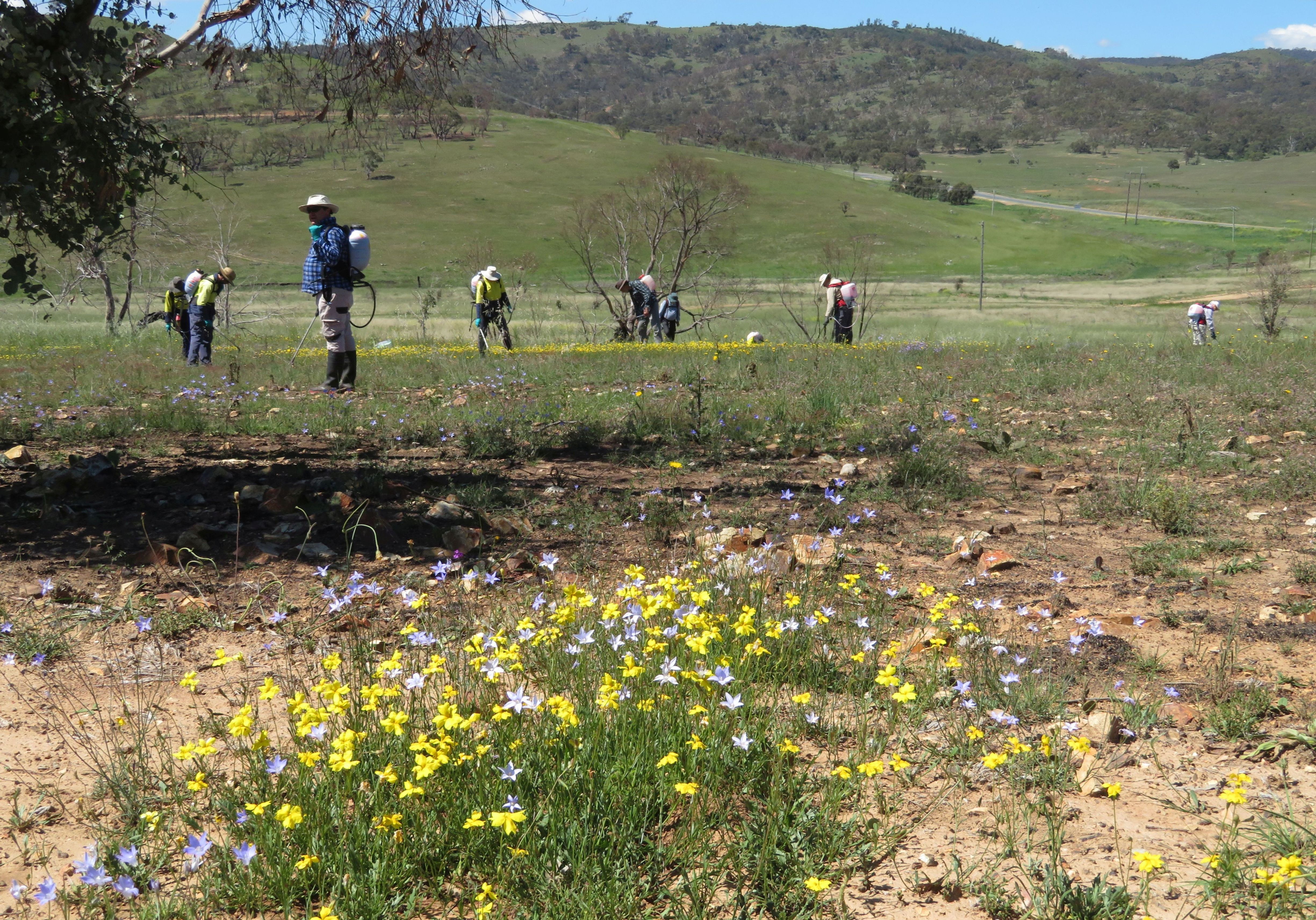
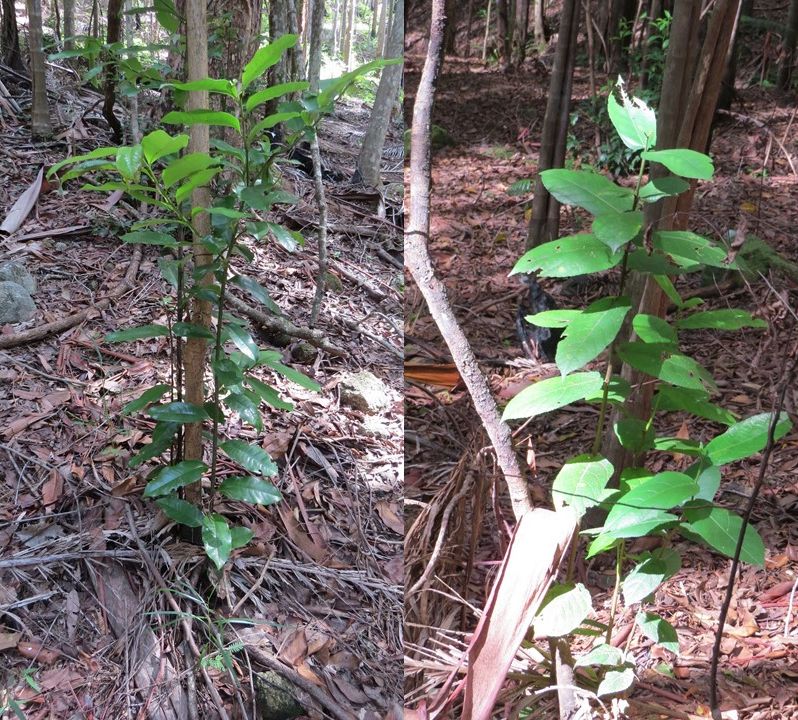
Revegetation works. Over 2000 River Red Gum trees and 1000  understorey plants, including Tangled Lignum (Duma florulenta) and Southern Cane-grass (Eragrostis infecunda), have been planted across the centre of the lake where no natural regeneration was likely to occur in the short to medium term. Members of the local Barapa Barapa and Wemba Wemba Traditional owner communities were employed to plant the trees and other plants (Fig. 2). The Barapa Barapa and Wemba Wemba Traditional Owners have a strong interest in the wetland because of its cultural values.


Figure 2. Uncle Trevor Kirby with a Red Gum he has just planted and guarded at Third Reedy Lake April 2022. . Virtually no native vegetation remained visible on the lake bed immediately after the long inundation. (Photo T. McDonald)

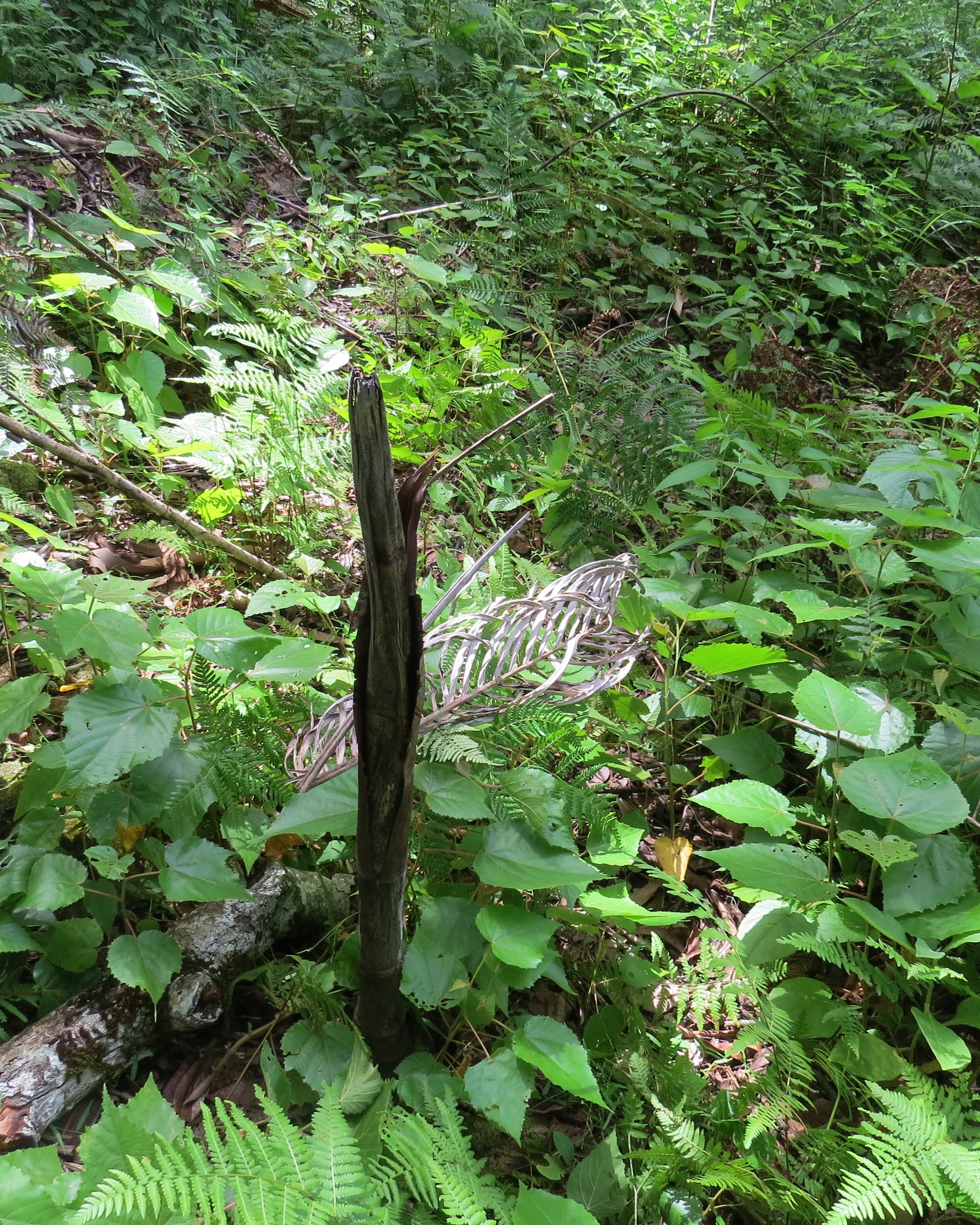
The River Red Gum seedlings have been planted next to dead River Red Gum stumps to replicate the original woodland structure of the wetland (Fig  3). Planting next to the stumps has other advantages; they provide shelter from the wind and sun and soil carbon and moisture levels are highest close to the rotting wood.

Figure 3. River Red Gum seedling planted next to an old red gum stump, Third Reedy Lake May 2022. (Photo D. Cook)

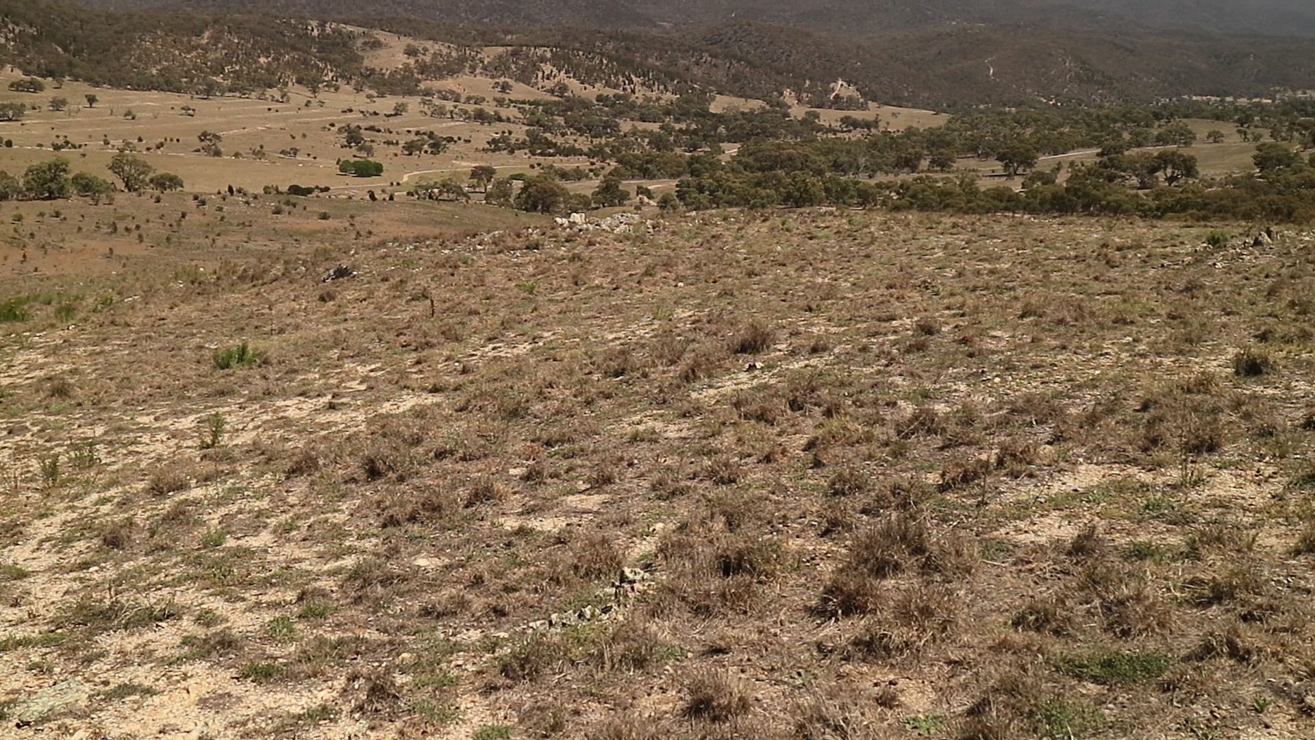
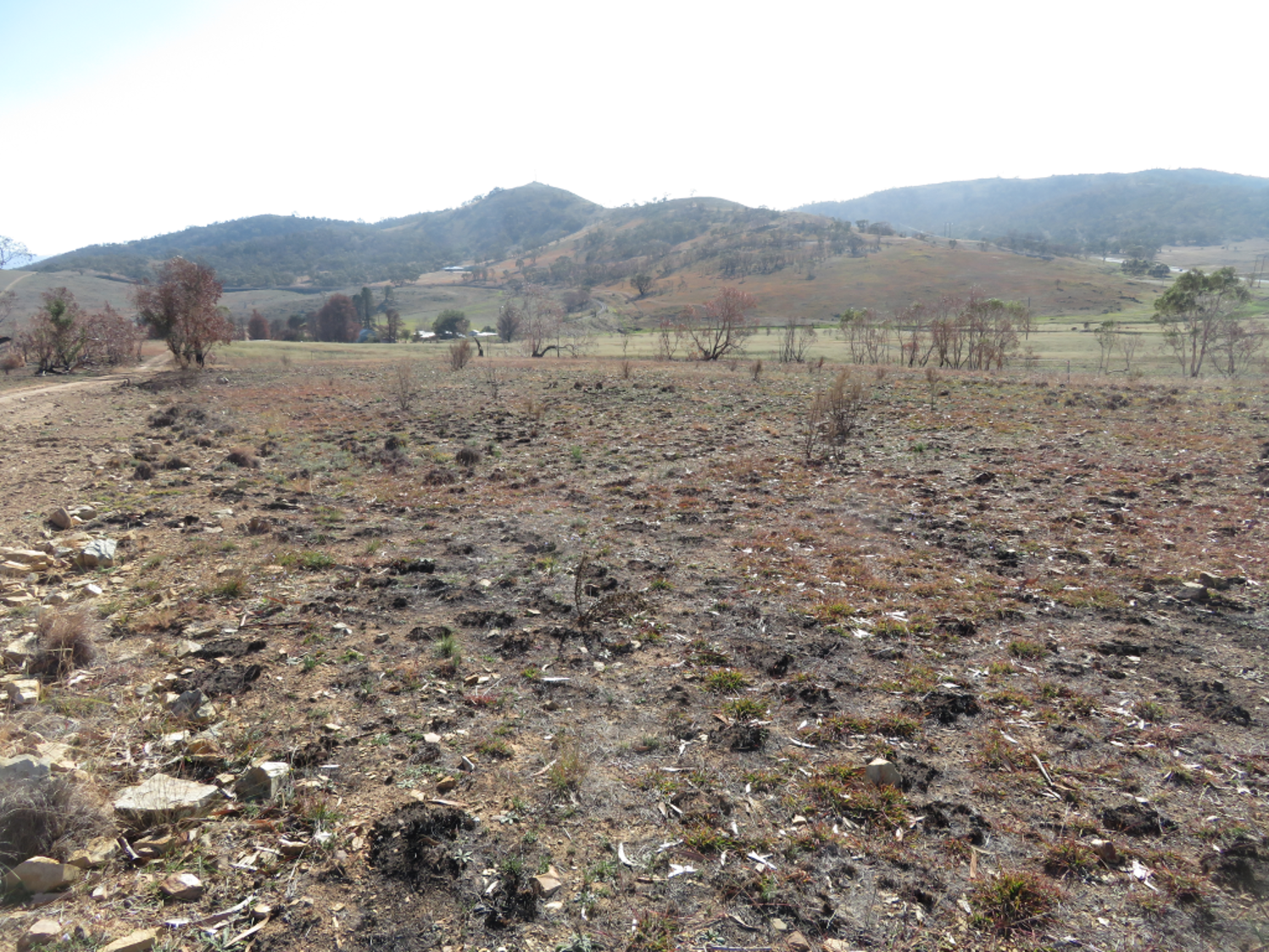
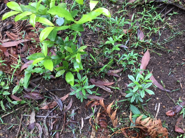
Results to date.  In the first 3 months without inundation the lakebed muds dried out, followed by deep cracking (Fig 2). Planted trees thrived as there was still ample moisture in the sub-soil.  Site inspections in May 2022 revealed that substantial natural regeneration of the wetland has begun (Fig. 4).

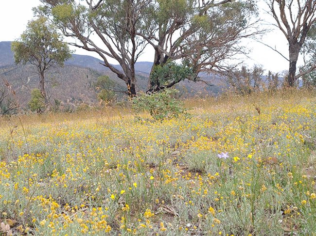
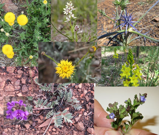
After 100 years without drying it was not known if any seed bank of the original lakebed vegetation would have survived. However, 46 native species have been recorded growing on the lakebed since the last of the water evaporated from the lake in April 2022. This includes two threatened species: Floodplain Groundsel (Senecio campylocarpus) and Applebush (Pterocaulon sphacelatum) (Fig. 5) . The germination of Applebush is particularly surprising given that this is only the fourth record of this plant in Victoria, the species being more common in the arid centre of Australia. Other indigenous species that have regenerated on the lakebed are shown in Figs 6 and 7.

Figure 4. Lake bed herbs regenerating after the drying phase, at Third Reedy Lake, May 2022 . A total of 46 native species have been recorded as having regenerated on the lakebed since the last of the water evaporated from the lake in April 2020 (Photo D. Cook)

Figure 5. Among the 46 native species regenerating is Applebush (Pterocaulon sphacelatum) which is particularly surprising as it is listed as endangered in Victoria and known to occur in only three other locations. (Photo Dylan Osler)

Figure 6. Spreading Nut-heads (Sphaeromorphaea littoralis), Third Reedy Lake May 2022. This species is uncommon in the Kerang region, the closest records to Third Reedy Lake being from the Avoca Marshes. (Photo D. Cook)

Figure 7. Golden Everlasting (Xerochrysum bracteatum) and Bluerod (Stemodia florulenta) make an attractive display of wildflowers. These species are uncommon at present but if weeds are controlled adequately, they should recolonise much of the wetland floor. (Photo D. Cook)

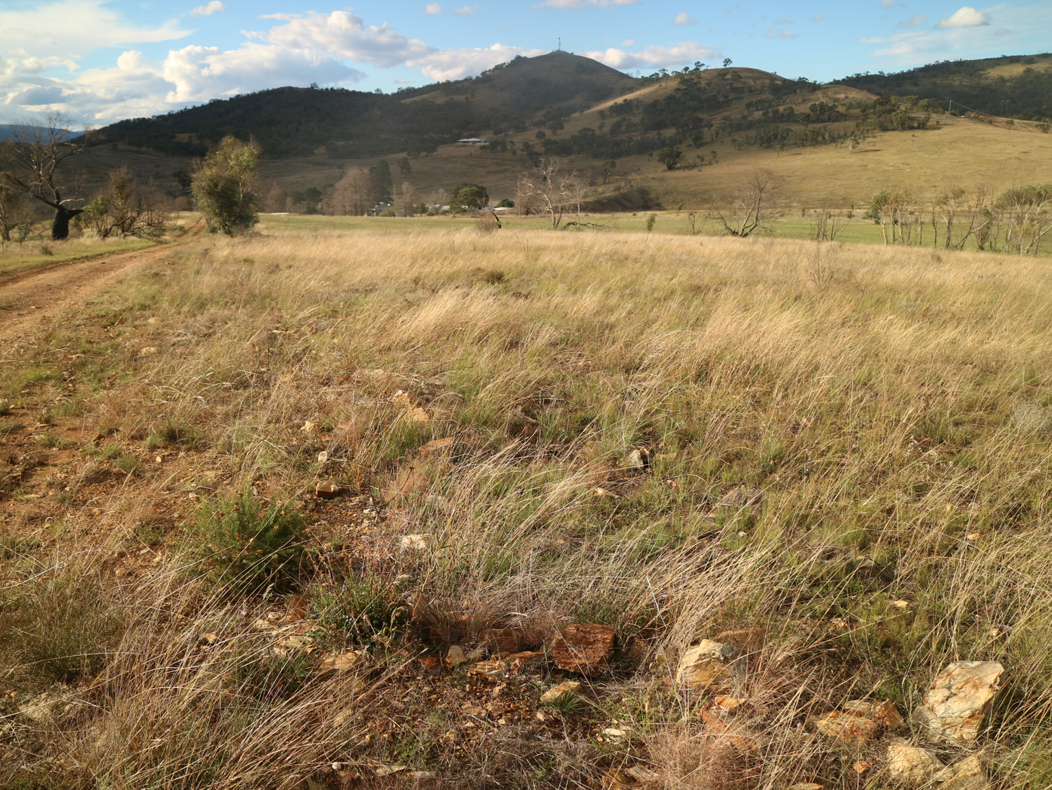
River Red Gum regeneration has been localised on the bed of the lake and has mainly occurred on the fringes close to where living Red Gum trees have shed seed. The densest Red Gum regeneration has occurred on a sandy rise close to the inlet of the lake, where the trees have grown rapidly (Figs 8 and 9). Many of the seedlings that have germinated on the edge of the lakebed are being heavily grazed by rabbits or wallabies.

Figure 8. Regenerating Red Gums and native grasses and sedges on a sandy rise near the inlet of Third Reedy Lake, May 2022.(Photo D. Cook)

Figure 9. River Red Gum seedling on cracking clay soil that has germinated near the lake edge. Many of these seedlings are being heavily grazed, probably by rabbits or wallabies. (Photo D. Cook)

The young trees will take many years to develop the hollows required by many species of wildlife, but hopefully the old stumps will persist for some time to provide this important habitat feature (Fig 10). When these trees grow large enough, they will provide shady nesting sites for colonial nesting wetland birds such as Australasian Darter (Anhinga novaehollandiae) (Fig. 10) and Great Cormorant  (Phalacrocorax carbo) and replace the dead standing trees as they rot and fall over.

Figure 10. Australasian Darter chicks on a nest in a live River Red Gum in the creek that joins Middle Lake to Third Reedy Lake. (Photo D. Cook)

Stakeholders: Barapa Barapa, Wemba Wemba, Goulburn-Murray Water, North Central Catchment Management Authority and Kerang Wetlands Ramsar Site Committee

Contact:  Damien Cook, restoration ecologist, Wetland Revival Trust, Email: damien@wetlandrevivaltrust.org

Post-fire assisted regeneration at Rutidosis Ridge, Scottsdale Reserve, Bredbo NSW


Figure 1. Undamaged grassy woodland reference site occurring at high elevation at Scottsdale (Photo: Brett Howland)

Introduction. Scottsdale Reserve is a 1,328-hectare private conservation reserve, near Bredbo NSW, owned and managed by Bush Heritage Australia. For over 100 years prior to purchase in 2006 the property was utilised for grazing and cropping. While most of the higher elevation areas of the property remained intact and offered the basis for improving landscape connectivity for wildlife, the agricultural land use had resulted in conversion of the flats and lower slopes of the property to largely exotic pasture species and accompanying weed.

This case study focuses on one approx 10 ha Apple Box (Eucalyptus bridgesiana) / Snow Gum, (Eucalyptus pauciflora) grassy woodland ridge within the property – named ‘Rutidosis Ridge’ because it is the location of a small population of the Endangered plant species Button Wrinklewort (Rutidosis leptorhynchoides). Set-grazing by sheep as well as some cropping had left the site nearly wholly dominated by the landscape-transforming exotic pasture grasses African Love Grass (Eragrostis curvula) and Serrated Tussock (Nasella tricotoma). Some scattered copses of eucalypts and some herbaceous natives remained, however, suggesting that the site might have some native regeneration potential, but the number and abundance of natives on the site appeared very low and the site was very dissimilar to a nearby healthy reference site (Fig. 1).

Works undertaken. Around a decade after land purchase and the discontinuation of grazing and cropping, Rutidosis Ridge was aerially sprayed during winter with flupropinate herbicide at a low dilution (1L / ha) known to be effective on some strains of African Love Grass and Serrated Tussock without killing native grasses and forbs. While the African Love Grass and Serrated Tussock had died by the following spring as a result of this soil-active herbicide, no substantial native regeneration was observed due to the persistence of the thick thatch of dead African Love Grass (Fig 2).

  • Figure 2.  Typical site showing sprayed African Love Grass thatch even many years after aerial spraying. (Photo T. McDonald )
  • Figure 3.  Intense wildfire that passed through Bredbo, NSW in early February. (Photo” New York Times)

An intense wildfire passed through the property on 2nd February 2020 (Fig. 3). This largely consumed the thatch, exposing stony topsoils and providing opportunities for regeneration of both natives and weeds that were stored in the soil seed bank.  Anticipating the need for post-fire spot-spray follow-up after the fire to avoid any native regeneration being overwhelmed by weed, Bush Heritage Australia (BHA) collaborated on a program of regular selective treatment of weed with the restoration organisation the Australian Association of Bush Regenerators (AABR). Personnel involved both contractors and volunteers skilled in recognising natives and weeds at seedling stage capable of spot-spraying with negligible off-target damage (Fig 4).  

Because the fire had removed African Love Grass thatch and cued germination of natives and weeds, the aim was to treat all weed prior to its seeding.  This allowed the managers to (a) take advantage of the fire’s flushing out the weed soil seed bank and avoid its further recharge and (b) retain maximum open spaces for further natives to emerge and colonise. 

During the year after the fire (March 2020-April 2021), the ~10ha site had been subjected to approx. 600 person hours of spot spraying, mainly undertaken by experienced bush regenerators. This commenced in March 2000 and continued at least fortnightly during the growing season.

Figure 4. Location of comprehensively spot-sprayed areas and target-weeded areas at Rutidosis Ridge. An opportunity exists to compare differences in richness and cover of natives and weed between the two treatments, ensuring comparisons are confined to within-comparable condition classes.

What we found by 1 year of treatments.  Post-fire observations in  March 2020 revealed Snow Gum resprouting from lignotubers and roots and Apple Box and Candlebark (Eucalyptus rubida) resprouting epicormically.  A wide suite of native grasses and forbs were starting to resprout or germinate alongside diverse herbaceous weeds. Within the first 12 months of regular spot-spraying, the cover and seed production of approx. 30 weed species was very substantially reduced.  Combined with fairly evenly distributed rainfall in the follow 12 months this reduction in weed allowed ongoing increases in native species cover and diversity per unit area, with seed production likely by most native species.  There was negligible off-target damage from the spray treatments. In December 2020 over 50 native herbaceous and sub-shrub species (including at least 11 Asteraceae, 9 Poaceae, 4 Fabaceae and 2 Liliaceae) were recorded within the work zones, with cover of natives very high in the higher condition zones, but plentiful bare ground remaining in the lower condition zones (Fig. 5).  

Figure 5.  Top:  Directly after wildfire showing black stubs of African Love Grass; Middle: Volunteers spot-spraying during the growing season, and Bottom: same site after 12 months but when native grasses were curing off after seeding. (Photos T. McDonald)

Predominant weed species included recovery African Love Grass, Viper’s Bugloss (Echium vulgare), St John’s Wort (Hypericum perforatum), Yellow Catsear (Hypochoeris radicata), Common Plantain (Plantago major), a range of thistles and around 20 other weed species.

Predominant natives included speargrasses (Austrostipa spp.), Redleg Grass (Bothriochloa macrantha), Kangaroo Grass (Themeda triandra), Native Panic (Panicum effusum), Common Raspwort (Gonocarpus teucrioides), Bindweed (Convolvulus erubescens), bluebells (Wahlenbergia spp.), Common Everlasting (Chrysocephalum apiculatum), fuzzweeds (Vitadennia spp.), Bear’s Ear (Cymbonotus lawsonianus), Creamy Candles (Stackhousia monogyna), Yellow Pimelea (Pimelea curviflora subsp. fusiformis) and Native St John’s Wort (Hypericum gramineum).  Species of higher conservation interest that regenerated included Blue Devil (Eryngium ovinum) and Threatened species that regenerated included Silky Swainson’s Pea (Swainsona sericea) and Button Wrinklewort. (Some of these species are pictured in Fig. 6).

Figure 6. Some of the forbs that flowered on Rutidosis Ridge during the growing season – including the Endangered Button Wrinklework (centre) and Vulnerable Silky Swainson’s Pea.(bottom left). (Photos various.)

Gradient of condition improving over time. As expected, the sites showed a gradient of condition (Fig. 7), with highest natural regeneration capacity retained in the tree clusters and stony crest, perhaps due to these less likely to be less favoured by sheep. (The tree clusters appear not to have been used as sheep camps). By March 2020, 1 year after work commenced, all sites were on a trajectory to move to the next higher condition class, assuming successful Winter 2021 aerial spray re-treatment of African Love Grass.  (Note that, while the pre-fire flupropinate treatment would normally have a residual effect for a few years and thus preventing germnation of this species, massive germination did occur of African Love Grass in many areas, which we speculate was either due to suitable post-fire germination conditions being delayed by the presence of dead grass thatch or to a possible denaturing of the chemical by the fire.)  

Figure 7. Condition classes in the Rutidosis Zones A-E revealed during the first few months of treatment. By the end of the growing season and after regular follow up spot-spraying it was clear that all zones comprehensively treated were improving in their native: weed cover ratio except for an increasing cover of African Love Grass, the treatment of which was deferred until a second aerial spray scheduled for winter 2021. (Map: T. McDonald)

Acknowledgements: This project would not have been possible without the help of BHA and AABR volunteers.

Contact: Tein McDonald and Phil Palmer, Scottsdale Tel: +61 (0) 447 860 613; Email: <teinm@ozemail.com.au and phil.palmer@bushheritage.org.au


Post-wildfire recovery at a wet sclerophyll/rainforest ecotone close to housing at Wanganui NSW

Joanne Green

Introduction. The Mt Nardi fire, on Wed 13th Nov 2019, provided an opportunity to observe the effects of a relatively low intensity burn at a wet sclerophyll/rainforest ecotone on an 18 acre rural residential property at Wanganui, NSW.

Prior to the fire the vegetation had not been burned for 50 years and was dominated by Brush Box (Lophostemon confertus), Red Bloodwood (Corymbia gummifera) and Forest Oak (Allocasuarina torulosa) –  with a mesic understory of rainforest species including Red Bopple Nut (Hicksbeachia pinnatifolia ), Jackwood (Cryptocarya glaucescens), Bangalow Palm (Archontophoenix cunninghamiana)  and  Tree Heath (Trochocarpa laurina).  The forest was on a trajectory from wet sclerophyll towards a palm-dominated forest.

Since the fire,  the recovery has reset the ecosystem to a wet sclerophyll community with a diversity of heathy species in the understorey, although there is also massive germination and resprouting of rainforest species that indicates that the rainforest understorey will return over time. Table 1 at the end of this summary shows the recovery of both sclerophyll and rainforest species, and their presence or absence above ground prior to the fire.

Figure 1. Dead Bangalow Palm amid a sea of Brown Kurraong seedlings post fire. (Photo: J. Green)


Figure 2. Resprouting saplings of (a) Bolwarra and (b) Creek Fig (Photo J. Green)

Mortality and recovery.

Resprouting:  The fire varied in intensity as it burned downslope. The highest intensity was at the edge of the National Park at the highest elevation above a rocky face. Turpentine (Syncarpa glomulifera), Lomandra (Lomandra longifolia), heath species and younger trees appeared to be killed by fire. While Turpentine has not yet resprouted, Lomandra has resprouted and heath species such as Acacia and Zieria have regrown from seedlings.  Bangalow Palms (Archontophoenix cunninghamiana) are completely dead wherever the fire burned to their tops (growing points) and perhaps many more are dying, indicated by the presence of a fungus on their trunks. One tall Brushbox (Lophostemon confertus) is completely dead.

A community with old growth Forest Oak (Allocasuarina torulosa) is further downslope closer to the rainforest lined creek. The roots system of these trees, burned under the ground and the fire could only be doused by digging out the peat-like root system. Some of the Forest Oaks died but most have recovered.  Taller canopy trees of rainforest and sclerophyll species died back but are resprouting. Midstorey trees, less than 8m, are largely dead, dying or resprouting from the base (coppicing).  The trunks are completely dead but there are many root suckers of species such as Jackwood (Cryptocaryia glaucescens), Bolwarra (Eupomatia laurina), Grey Possumwood (Quintinia verdonii) and the rare Red Bopple Nut (Hickbeachia pinnalifolia).

Treeferns such as Cyathea australis, C. cooperi and C. leichhardtiana were the first resprounters and ground ferns such as Soft Bracken (Hypolepis muelleri) are proliferating following the  rain since the fire event.

Figure 3. Proliferation of rainforest pioneers germinating after fire including Poison Peach (Trema aspera), Pencil Cedar (Polyscias murrayi) and Bleeding Heart (Homolanthus populifolius). (Photo J. Green)


Figure 4. Heath species such as Zieria (Zieria smithii) pictured at the right. germinated alongside rainforest species despite not being in the previous above-ground flora. (Photo: J. Green)

Seed germination: Rainforest species germinating included: Red Cedar (Toona ciliata) , Pencil Cedar (Polyscias murrayi), Brown Kurrajong (Commersonia bartramia), Red Ash (Alphitonia excelsa) and Corkwood (Duboisia myoporoides).  Heath species recruiting included: a large amount of Tree Pea (Daviesia arborea), Zieria (Zieria smithii), Prickly Acacia (Acacia ulicifolia), and Hibbertia spp. Herbaceous species included: Forest Lobelia (Lobelia trigonocaulis),  Kreysigia (Tripladenia cunninghamii), Hairy Tree Foil Desmodium rhytidophllum and other vines of the pea family are covering large areas of the ground.

Weed regeneration

Alongside the natives,  diverse weeds are proliferating after fire, representing all growth forms. Some weed species may be playing a facilitation role for rainforest recovery, while others should be  targeted to reduce their inhibiting effect on native regeneration. Given the level of regeneration across functional groups, this community is likely to benefit from assisted natural regeneration focusing on removal of weed that is competing with native regeneration.  Where possible it is desirable to use the opportunity of the wildfire to deplete populations of weed at the site to increase the community’s resilience to future fire. No reintroductions or seed input is needed at the site.

Future directions.  Consideration needs to be made as to which ecosystem will be the target for future management.  Retaining a sclerophyll overstorey is desirable for habitat values and hence allowing replacement of those individuals that died will be important for future forest dominants.  The use of fire as a control method to control the massive germination of rainforest seedlings and Bangalow Palm dominants is under consideration. For the healthy understorey elements to remain in the soil seed bank for future regeneration would at least require their retention until they have flowered, fruited and recharged the soil seed bank.  But consideration will be given to retaining more fire-resistant rainforest vegetation on the side of the forest closer to the house to act as a fire buffer to supplement the existing 50m fuel free zone.

Contact: Joanne Green, Email jogreen909@gmail.com

Table 1.

SPECIES HABITAT TYPE PRESENCE /ABSENCE BEFORE FIRE RECOVERY MODE
Botanical Name Subtropical Rainforest = STRF, Wet Sclerophyll = WS, Dry Sclerophyll = DS P /A Seed = S, Epicormic growth = EP, Coppice = COP, R = Resprout
TREES AND SHRUBS      
Acacia ulicifolia DS P S
Acacia melanoxylon STRF P S
Acmena smithii STRF P COP
Allocasuarina torulosa WS P EP
Alphitonia excelsa STRF P S/COP
Alphitonia petrei STRF P S
Archirhodomyrtus beckleri STRF P COP
Archontophoenix cunninghamiana STRF P S/Dead
Breynia oblongifolia STRF P S
Commersonia bartramia STRF P S
Cordyline rubra STRF P COP
Corymbia intermedia WS/DS P EP
Cryptocarya erythroxylon STRF P COP
Cryptocarya glaucescens STRF P COP
Daviesia arborea WS/DS A S
Diospyros pentamera STRF P COP
Diploglottis australis STRF P COP/Dead
Duboisia myoporoides STRF P S/COP
Elaeocarpus reticulatus STRF P COP
Eucalyptus microcorys DS P EP
Eucalyptus pilularis DS P EP
Eupomatia laurina STRF P COP
Flindersia bennettii STRF P COP
Ficus coronata STRF P S/COP
Glochidion ferdinandi STRF P COP
Hickbeachia pinnalifolia STRF P COP
Homalanthus populifolius STRF A S
Jagera pseudorhus STRF P COP
Leptospermum petersonii DS P COP/S
Lophostemon confertus WS P S/COP
Macaranga tanarius STRF A S
Melicope elleryana STRF P S
Myrsine variabilis STRF/WS P S
Nematolepis squamea DS A S
Neolitsia dealbata STRF P COP
Ozothamnus diosmifolius WS/DS P S
Persoonia media WS P S
Pilidiostigma glabrum STRF P COP
Polyscias  murrayii STRF A S
Polyscias sambucifolia STRF A S
Quintinia verdonii STRF P COP
Schizomeria ovata STRF P COP
Solanum mauritanium Non – Native A S
Syncarpia glomulifera WS P COP/Dead
Synoum glandulosum STRF P COP
Trema tomentosa STRF P S
Trochocarpa laurina WS P COP
Wilkea huegeliana STRF P S
Zieria smithii  WS A S
       
VINES AND CLIMBERS      
Billardiera scandens WS A S
Geitonoplesium cymosum STRF P S
Desmodium rhytidophllum WS/DS A S
Hibbertia dentata STRF P S
Hibbertia scandens STRF/WS P S
Kennedia rubicunda STRF A S
Morinda jasminoides STRF/WS P S
Rubus moluccanus STRF/WS P S
Smilax australis STRF/WS P S
Stephania japonica var. discolor STRF P S
       
FORBES AND GROUNDCOVERS      
Alpinia caerulea STRF/WS P R
Dianella caerulea STRF/WS P R
Entolasia stricta WS P S
Gahnia appressa WS P S
Lepidosperma laterale WS P R
Lobelia trigonocaulis STRF/WS P S/R
Lomandra longifolia WS P R
Oplismenus aemulus STRF/WS P S
Oplismenus imbecillis STRF/WS P S
Oplismenus undulatifolius STRF/WS P S
Pimelea ligustrina subsp. ligustrina STRF/WS A S
Tripladenia cunninghamii STRF/WS P S/R
Viola banksii STRF/WS A S
       
FERNS      
Adiantum hispidulum STRF/WS P R
Blechnum cartilagineum WS P R
Blechnum nudum STRF P R
Cyathea australis STRF/WS P R
Cyathea cooperi STRF P R
Cyathea leichhardtiana WS P R
Doodia aspera STRF/WS P R
Hypolepis muelleri STRF P R
Pteridium esculentum STRF/WS p R
Sticherus lobatus STRF p R


Beyond the 1990s, beyond Iluka – koalas and citizen science – UPDATE of EMR summary

Daniel Lunney, Lisa O’Neill, Alison Matthews, Dionne Coburn and Chris Moon

[Update of EMR summary – Lunney, Daniel, Lisa O’Neill, Alison Matthews and Dionne Coburn ( 2000) “Contribution of community knowledge of vertebrate fauna to management and planning. Ecological Management & Restoration, 1:3, . 175-184. https://onlinelibrary.wiley.com/doi/10.1046/j.1442-8903.2000.00036.x]

Key words: national parks, SEPP 44, adaptive management, social criteria, extinction, wildlife survey, coastal forests.

Figure 1. Interest in local wildlife among residents and visitors to the north coast village of Iluka was growing in the 1990s, providing an opportunity for community involvement in our wildlife survey designed not only to gain information but to raise awareness. (Photo Dan Lunney 1991.)

Introduction. Our EMR feature published in 2000 reported on research that commenced in 1997 when we set out to identify the species and locations of the vertebrate fauna of Iluka peninsula, at the mouth of the Clarence River NSW, Australia. Much of the peninsula had been damaged by post war sand mining and creeping urban growth. We had recognised that there was a growing interest by local communities in conserving biodiversity (Fig 1), as Iluka had residential areas not far from a magnificent Nature Reserve (Iluka NR) and a National Park (Bundjalung NP). We conducted a community-based survey, sent to every household, which used a large, coloured map of the peninsula and a questionnaire asking respondents to mark the locations of the fauna they had seen. As a result of the survey, we concluded that vertebrate fauna does live on private land, that local knowledge is valuable, and that there is both community concern over declining fauna and support for planning, management and long-term fauna research.

Figure 2. Two junior volunteers learning radio-tracking to locate koalas, Iluka Peninsula. (Photo Dan Lunney 1992)

The rise of citizen science. We were not the first to use a community-based survey for wildlife in NSW. A team (Philip Reed and Dan Lunney) in 1986-87 greatly expanded on some skilled, but tentative, efforts to survey Koala (Phascolarctos cinereus) in NSW by the small but effective Fauna Protection Panel. We produced a small questionnaire, which was distributed in 1986, and when we came to analysing the data in 1987, we joined up with CSIRO scientist Paul Walker who had a new tool, GIS, still in its infancy, but which showed great promise. By the time of the Iluka study, GIS was central to our methods.

Over the last 20 years there has been a revolution in the acquisition and application of community knowledge (Figs 2 and 3), a better appreciation of its extent, and limitations, and how to better integrate a greater diversity of disciplines for a more effective planning and management outcome. A Google Scholar search for ‘citizen science’ in July 2019 returned over 2 million results, establishing this phrase in the scientific literature to describe projects that enlist the community for collecting or analyzing scientific data. The rise and success of citizen science undoubtedly stems from the power of the internet and web-based tools that members of the public can use to record species’ locations, providing answers to such questions as: is a species increasing, decreasing or stable? – answers to which increase the capacity for managers and planners to be better targeted in their decisions. Such web-based technology also helps to overcome resource limitations where scale is an important factor. For example, for our 2006 state-wide koala and other wildlife survey we put a major effort into the distribution of the survey, a paper form with a large map. Now, the current 2019 survey is web-based, a procedure we explored in north-west NSW in 2014 where we selected the study area to be 200 by 300 km.

Figure 3. A skilled team climbing a tree to capture a koala for a health check and radio-tracking in a study of the koala population of the Iluka peninsula. (Photo Dan Lunney 1991.)

A further innovation comes from linking sociology to ecology and expanding the term from citizen science to ‘crowd-sourced information’. An example is a study in the four local government areas just north of Iluka, namely Lismore, Byron, Ballina and Tweed. The sociological side, led by Greg Brown, used the threatened koala as a case in point. The study demonstrated a novel, socio-ecological approach for identifying conservation opportunity that spatially connected landscapes with community preferences to prioritize koala recovery strategies at a regional scale. When multiple criteria (ecological, social, and economic) were included in the conservation assessment, we found the social acceptability criterion exerted the greatest influence on spatial conservation priorities. While this is a long way from our 1997 Iluka study, it is in the same lineage and represents two decades of development of what has become a widely accepted approach to regional planning.

Lessons learned and future directions. Looking back at the Iluka story, in one sense, it is a sorry one. When we first started our research on the Iluka peninsula in 1990, there was a visible population of koalas. It dwindled to extinction over the next decade so the locations of koalas in our EMR paper were of recent but fading memories. By defining our study area to a small location, it was possible to identify the cumulative impact of mining, housing, disease, roadkill, dog kill and fire. There have been reports of koalas being back on the peninsula as early as 2002 (Kay Jeffrey, local resident) and there have been subsequent sightings (John Turbill DPIE pers comm August 2019), we presume moving down from such locations as the northern part of Bundjalung National Park

Looking back on our EMR paper, we also see that the Emu (Dromaius novaehollandiae) was one of the most common species recorded by the community on the Iluka peninsula. It has now gone (John Turbill DPIE, pers. comm., August 2019). The coastal Emu population in northern New South Wales is now recognized as being under threat and a citizen science project called ‘Caring for our Coastal Emus’ has been established to collect recent emu sightings from the public using a web-based emu register to pin-point locations on a map. This register is administered by Clarence Valley Council and reflects the shift from the 1990s where the tools and expertise for collecting scientific data for management and planning were beyond the scope of local government. Today, local councils are considerably more engaged in conservation and community education projects.  Indeed, the Clarence Valley Council (2015) has prepared a Comprehensive Koala Plan of Management (CKPoM) for the lower Clarence, which includes Iluka, although it was not adopted beyond council level. The plan recognizes the importance of reducing further clearing and protecting and rehabilitating those areas that remain, and identifies that further studies and monitoring are required to establish the current status of the Iluka koala population.

In the early 1990s, we had prepared a possible plan of management for the koalas of Iluka peninsula but there was no legal incentive to adopt it. Thus, in late 1994, when one of us (DL) was asked by the then NSW Department of Planning and Urban Affairs to help write a SEPP (State Environmental Planning Policy) for koala habitat protection, the potential value of doing so was clear to us. SEPP 44 was written in three days, with a promise to revise it in 1995. SEPP 44 has proved to be valuable, although in recent years, the process of preparing and submitting CKoPMs from councils to the NSW state government seems to have stalled.

In conclusion, our EMR feature was written at the time of an upward inflection in the study of koalas, of fauna survey using crowd-sourced information.  We are now better equipped to use the new techniques from over three decades of what might be described as adaptive management of the ideas in our original EMR paper. We also press the point that research, exploring new ideas, incorporating new techniques and publishing our findings and thoughts make a crucial contribution to conserving not only koalas, but all our wildlife and natural areas, both in and out of reserves.  Such research is therefore vital to the survival of our wildlife.

Stakeholders and Funding bodies: In addition to the funding bodies in our EMR paper of 2000, support for the research supporting the above comments has been extensive, as reflected in the acknowledgements section of each report.

Contact. Daniel Lunney, Department of Planning, Industry and Environment NSW, (PO Box 1967, Hurstville NSW 2220 and the University of Sydney, NSW 2006. dan.lunney@environment.nsw.gov.au).

Koala conservation and the role of private land – UPDATE of EMR feature

Daniel Lunney, Alison Matthews, Chris Moon and John Turbill

[Update of EMR feature – Lunney, Daniel, Alison Matthews, Chris Moon and John Turbill (2002) Achieving fauna conservation on private land: Reflections on a 10-year project. Ecological Management & Restoration, 3:2, 90-96. https://onlinelibrary.wiley.com/doi/10.1046/j.1442-8903.2002.00100.x]

Key words: SEPP 44, Coffs Harbour, logging, urban development, New South Wales, ecological history, koala plan of management.

Introduction. Our 2002 paper in EMR focused on the local government area (LGA) of Coffs Harbour and reflected on our approach to meeting the challenge of finding a means of protecting populations of  Koala (Phascolarctos cinereus) on private land before habitat removal brought about their local extinction. This was prompted by our 1986–1987 state-wide koala survey that found that koala  populations had declined across New South Wales, largely as a result of habitat loss. The remaining koala stronghold, we identified at the time, was on the north coast, in areas such as in the rapidly expanding city of Coffs Harbour. Koalas in Coffs Harbour were found mostly on privately-owned land outside National Parks and Nature Reserves and State Forests.

It took 10 years (1990-2000) of struggle with politics, bureaucracy and vested interests to achieve a plan of management across one local government area (Coffs Harbour) to save koala habitat from the relentless clearing of private land. The reward for our efforts was a Comprehensive Koala Plan of Management (CKPoM), prepared under State Environmental Planning Policy 44 – koala habitat protection (SEPP 44), and adopted by Coffs Harbour City Council in 1999. SEPPs apply only to land over which local government has authority, not Crown Land, i.e. National Parks, Nature Reserves and State Forests. The Plan identified and ranked Koala habitat and set out criteria for minimizing local threats. It is a statutory instrument, gazetted in 2000 along with council’s Local Environmental Plan (LEP), which controls land-use planning. It was the first CKPoM in NSW and a demonstrated formula for undertaking such plans. Now in 2019, 20 years after the plan was formally adopted by Coffs Harbour City Council, and in the NSW parliament in 2000 as part of the Coffs Harbour LEP, the plan is still in place. We count that as a success. While revisions to both the SEPP and the Coffs Harbour CKPoM are in the wind, the 1999 plan still stands, as of October 2019.

Further, after five years of operation, Coffs Harbour council commissioned a strategic review of its CKPoM from the consultants, EcoLogical, which found that there was a 1.1% reduction in the area of primary koala habitat. In our view, such a small change over 5 years is an indication of the CKPoM’s impact in halting habitat loss on private land.

Figure 1. Historian, and co-worker, Antares Wells examining a document with items from the history of the Bellinger, the LGA immediately to the south of Coffs Harbour, as part of our study of the ecological history of the region. (Photo Dan Lunney 2013/)

Further studies. To add context to our work in Coffs Harbour, we undertook a range of further studies. These included an historical study, looking at the koala records from European settlement to 2000 through an ecological lens (Fig 1). The first wave of European settlers arrived in the early 1880s, and much of the initial development arose from logging. Collectively, the evidence identifies that the koala population of Coffs Harbour was widespread but never abundant, and that habitat loss has been relentless since European settlement. The transformation of a rural-forest mosaic to an urban landscape over the past four decades is the most recent stage in the incremental loss of habitat.

Also, in 2011, we undertook a repeat study of the koala population within Coffs Harbour LGA from our initial survey in 1990. Analyses showed that the koala population has endured between 1990 and 2011 and showed no evidence of a precipitous decline during this period. Rather, the population change was best characterised as stable to slowly declining.

The extensive koala datasets gathered since 1990 on the Coffs Harbour koala population are attractive for researchers and managers. They provide the basis for revisiting the LGA to look for change (Fig 2.) . Work in June 2019, for example, included the following: Department of Planning, Industry and Environment at Coffs Harbour is finalising a review of the Coffs Harbour LGA koala habitat study from funding by council; surveys completed in April 2019 revisited 68 of the original 119 sites we had selected in 1996, and 89 of those sites we had re-surveyed in 2011, and the total number of sites visited in the current survey was 176 in a report to Coffs Harbour council in September 2019.

Figure 2. Koala team standing in koala habitat near Bonville, Coffs Harbour LGA. From left to right, John Turbill, Martin Smith, Indrie Sonawane, Chris Moon and Martin Predavec. (Photo Dan Lunney 2013).

Mixed results. Rereading our original paper is unsettling. There is an enduring sense that the entire exercise, while locally worthwhile, has not translated into wider successes with respect to policy and implementation. Although our assessment of the success of the Coffs Harbour CKPoM is upbeat, the uptake of the concept by other councils has been modest. Some have opted for a koala plan of management, but not within the SEPP 44 framework, and others have contracted the preparation of the plans, but only using field survey data for koalas, not the citizen science component.

Among our reflections on our work is that the languages of planning, conservation and ecology need to be calibrated. Confusion has occurred because SEPP 44 refers to potential and core koala habitat when a Development Application (DA) is being assessed, but in the CKPoM in 1999 we used the terms primary, secondary and tertiary koala habitat. Adoption by local government of a CKPoM replaces the requirement to assess each individual DA for core habitat, because the CKPoM has mapped and ranked this habitat. In fact, the ease of seeing koala habitat on a map, ranked so that you know what development is possible, or not, within the particular ranking, expedites the DA process for all parties. This was a major selling point for Coffs Harbour council, along with our economic study which demonstrated that the value of having a koala population in the LGA exceeded the cost of implementing such a plan (Fig 3). While habitat ranking is appropriate for a CKPoM – a land-use planning and management instrument – one interpretation, a misguided one in our view, has been that primary habitat equals core habitat, and deems primary habitat in a CKPoM to be the only level of habitat to conserve. Such a view not only disregards the value of rankings for the purpose of planning, but also ignores the multiple ways that koalas need to use the landscape. We note that more recent plans have divided secondary habitat into secondary A and secondary B, but that does not change the principle of ranking. We also note that a recent choice is to use ‘core’ habitat in a CKPoM, although with a different approach to defining ‘core’, but this has yet to be consolidated in the proposed revised SEPP 44. On reflection, ‘core’ has become a problematic word because it implies that anything other than core can be ignored.

There have been considerable recent efforts to catch up on survey methods for koalas in State Forests. However, pressure remains on State Forests concerning their koala populations, such as the campaign by the National Parks Association of NSW for ‘The Great Koala National Park’ to add 175,000 ha of State Forests to existing protected areas to form a 315,000 ha reserve in the Coffs Harbour hinterland. National Parks and Nature Reserves are a central element in our efforts to conserve our fauna, but a transfer of State Forests to National Parks does not come to grips with the issue of the loss of habitat on private lands, including in situ habitat and linkages across the landscape.

SEPP 44 was promulgated in 1995, and while we recognise that it needs to be updated, our point remains that it has demonstrated potential to conserve koala habitat on private land, with an explicit role, indeed a key role, for local government. Strategies to conserve and restore koala habitat on private land—particularly on the more fertile lands, which are also the prime lands for farms and towns—will continue to be central to conserving the koala populations in NSW.

Figure 3. Economist Clive Hamilton explaining the economic advantages of conserving koalas in Coffs Harbour LGA. This presentation was given in Coffs Harbour at a national meeting for Ecological Economics. (Photo Dan Lunney 1996.)

Lessons learned and future directions. In 2019, our reflections on our 10-year study (1990-2000) allow us to conclude that identifying koala habitat on private land is possible, that plans to conserve it are acceptable, that the economic aspect is an important factor in the negotiations, and that local government has a role to play in this process. Since 2002 we have expanded our research horizon, crossing other disciplinary boundaries to encompass ecological history, using more sophisticated approaches to citizen science, stretching our geographical horizon to the north-west of NSW, incorporating the pervasive impact of climate change, and teasing out the contribution of koala care and rehabilitation and the value of detailed population studies such as by radio-tracking. We also conclude that local studies, especially repeated studies, e.g. at the LGA or Local Land Services (LLS) scale, are crucial, along with broad scale, periodic, state-wide surveys to keep track of the considerable individual differences across the geographic range of the koala.

Contact.  Daniel Lunney, Department of Planning, Industry and Environment NSW (PO Box 1967, Hurstville NSW 2220 and the University of Sydney, NSW 2006. dan.lunney@environment.nsw.gov.au

Rehabilitation of former Snowy Scheme Sites in Kosciuszko National Park – UPDATE of EMR feature 2019.

Gabriel Wilks

Update of EMR feature – MacPhee, Elizabeth and Gabriel Wilks (2013) Rehabilitation of former Snowy Scheme Sites in Kosciuszko National Park.  Ecological Management & Restoration, 14:3, 159-171. Doi https://onlinelibrary.wiley.com/doi/10.1111/emr.12067

Key words.  Habitat construction, steep slopes, rock spoil.

Figure 1. Shaped rock spoil ready for planting more than 50 years after being dumped.

Introduction. Our original EMR feature article described the origins of this large, long-term rehabilitation program and the challenges faced in the first 10 years. The program’s aim was to address a range of impacts upon montane and sub-alpine vegetation and river corridors in Kosciuszko National Park from the Snowy Hydro Scheme, constructed from 1949 to 1974. Impacts included dumping of large volumes of rock spoil, loss of topsoil and native vegetation, introduction and spread of weeds and asbestos fragments in the landscape.  The article outlined the development of methodologies for restoration, particularly planting trials on steep rock spoils, and how obstacles such as slope instability, plant material availability and lack of soil were being overcome. The process of program implementation was given, including environmental and cultural heritage assessments undertaken as part of site works.  In 2013 a number of positive outcomes were already evident at the 200 sites that had been subjected to at least some treatment, including 18 sites where major rehabilitation works were undertaken. Outcomes included reduction in waterway impacts and invasive weeds, expansion of the Kosciuszko fauna database, regional community benefits, and production of an Australian Alps Rehabilitation Field Guide.

Further work. The Former Snowy Scheme Rehabilitation Program continues to reduce the long term environmental and safety risks of old degraded construction sites to Kosciuszko National Park, as well as improve their visual and ecological function. Some sites treated by 2013 have blended in with the surrounding landscape and are difficult to identify. Many sites are continuing to improve in condition over time, with distinct vegetation layers, natural plant recruitment and evidence of native fauna habitat. Construction history, rock spoil and loss of soil and plant species remain evident at highly altered sites, despite a high standard of rehabilitation work.

An additional 12 Major rehabilitation works have been undertaken since 2013, with selected signature projects and rehabilitation techniques described below.  Note that the former Snowy Scheme rehabilitation program does not address the impact of current Snowy Hydro Limited or proposed infrastructure and support networks such as powerlines, easements, river regulation or roads.

1. Rehabilitation of the Tooma–Tumut Access Tunnel Adit Spoil Dump. This spoil dump (Fig. 1) is located on the highly incised upper reaches of the Tumut River.  The spoil originates from construction in 1958-1961 of the Eucumbene–Tumut Tunnel, which transfers the headwaters of the Tooma River to Tumut Pond. Following earthworks in 2017, the planting crew successfully planted, watered, fertilised and mulched approximately 12,000 plants on rock spoil, with monitoring being undertaken by Greening Australia Capital Region staff (Fig 2.)

Figure 2. Year 1 Revegetation monitoring at Tooma-Tumut SD by Greening Australia Capital Region staff, 2018

2. Construction of contained habitat for the Southern Corroboree Frog. A series of remote enclosures (Fig 3) have been constructed in both rehabilitation areas and former habitat locations to enable re-introduction of this Critically Endangered species (Fig 4), following the devastating impacts of chytrid disease. These enclosures are developing essential stepping stones for frogs from captive breeding programs to move back into the wild. Design of enclosures requires ensuring self-sustaining food and water, shallow ponds for breeding, ability for Threatened Species staff to monitor and control disease and exclusion of other frogs. These works have been done in partnership with NSW Threatened Species staff and zoo institutions.

Figure 3. Constructing Southern Corroboree Frog enclosures in remote locations

Figure 4. Southern Corroboree Frogs living successfully back in Kosciuszko

3. First live record of Smoky Mouse in Kosciuszko National Park. The Smoky Mouse (Pseudomys fumeus Fig. 5) was found alive and well for the first time in Kosciuszko National Park, at a Happy Jacks rehabilitation site. Up until the discovery, the only currently known population of the small, smoky grey coloured mouse still surviving in NSW was in the Nullica area, NSW South Coast.  Three individuals, 2 males and 1 female were a significant find for survival and database records of this Critically Endangered Species, and a technical short note was published in EMR in 2017 by fauna surveyor Martin Schulz who found the animals.

Figure 5. A Happy Jacks Smoky Mouse.

4. Making people and places safer with rehabilitation. Sites that housed construction depots and townships during Snowy scheme construction still contained fragments of asbestos which were rapidly degrading due to weather exposure. As total removal was not feasible, the rehabilitation team worked with asbestos experts to develop practical measures to reduce public safety risks. At the remote Junction Shaft Contractors Camp (at Happy Jacks, Figs 6 and 7) and a former township and current camping ground at Island Bend a range of techniques were developed, delineation of zones for suitable uses, creating natural vegetation buffers and capping with rock spoil and plants.

Figure 6. The Junction Shaft Camp in 1955.

Figure 7. The same site 62 years later (and one year after works) with a range of capping and planting zones, including a heli-pad, Mountain Pygmy Possum habitat, and new plantings to improve safety and environment.

5.  Applying techniques beyond Kosci. Project team members took some winter time out of Kosciuszko to ‘grow’ a protection zone for a known population of Endangered Green and Golden Bell Frog (Litoria aurea) and constructed a series of ponds for future breeding in an old sand quarry at Worrigee Nature Reserve, Nowra (Fig 8). Given former quarries are a feature of a large infrastructure project such as the Snowy Scheme, the team had the technical knowledge for how to restore ecological function despite a radical departure from usual flora and fauna species. A range of techniques including neighborhood consultation, barrier logs and blocks, berms and vegetation were used to reduce the impact of recreational and unauthorised motorbikes and rubbish dumping.

Figure 8. Creating Bell Frog habitat in degraded borrow pits.

6. Growing rehabilitation resources and protecting karst ecosystems. The use of treated waste at the Yarrangobilly Caves visitor precinct to grow snow grasses (Poa spp.) for use in rehabilitation projects across Kosciuszko and been continued and developed (Fig. 9). A renewed emphasis on site production has enabled Poa seed to be available for other projects within the Park. This provides an ecologically preferable option for soil stabilisation and ground cover establishment, reducing the risk of weed invasion and dependence on sterile rye corn as the only available option.

Figure 9. Inspecting plants for seed harvest, which yielded 52 kgs of Poa seed in 2017.

Lessons Learned. It is clear that this is a unique rehabilitation project due to the large number of sites, the natural and heritage values of Kosciuszko National Park and the longevity and continuity of the commitment (approx. 20 years).  Understandably, however, at this point in time challenges in rehabilitation remain. ‘Off the shelf’ rehabilitation products are limited due to remoteness of locations, plant species required, Park management policies and required hygiene protocols. It is important that additional threats are not accidentally introduced, such as foreign pathogens and flora and fauna. As much as possible, resources such as coarse woody debris, woodchip, plant material and compost are sourced from within the Park. A flexible and dynamic approach to the very definition of rehabilitation and techniques and materials is required.  Specific lessons include the following.

Adding organic material on degraded sites is always beneficial. Rehabilitation success has been most obvious where logs, litter, woodchip and straw have been added to the site, to provide mico-niche climate, habitat, and improve soil. While this may increase short term management requirements such as weed control, the commitment is worth it due to the improved results.

Creating compost from old sawmill sawdust has worked well for this rehabilitation project. The most recent development however is in the use of organics waste and treated effluent from visitation facilities as a compost, and there is opportunity for this on-Park recycling to develop.

Other resources such as rice straw have become limited during periods of sustained drought and less rice production. This will remain a challenge into the future. The value of minimising ground cover loss, retaining natural soil characteristics and organic matter in situ and ensuring rapid rehabilitation after disturbance in future developments will become increasingly important for rehabilitation success.

Be creative with team skills and capacity. Problems such asbestos contaminant presence must be addressed for safety, but doesn’t mean walking away from the challenge. A degraded site may be the perfect place to develop species targeted habitat.  Seek expertise advice and consider a range of current and new solutions.

ContactGabriel Wilks, Senior Project Officer, NPWS Southern Ranges Services. PO Box 472, Tumut NSW 2720.  Email: Gabriel.Wilks@environment.nsw.gov.au

Eastern Suburbs Banksia Scrub: is fire the key to restoration? – UPDATE to EMR FEATURE

Geoff Lambert, and Judy Lambert

[Update to EMR Feature – Geoff Lambert and Judy Lambert (2015) Progress with restoration and management of Eastern Suburbs Banksia Scrub on North Head, Sydney.  Ecological Management & Restoration, 16:2, 95-199. https://onlinelibrary.wiley.com/doi/10.1111/emr.12160]

Key Words. Banksia Scrub, North Head, Critically Endangered Ecological Community, Diversity.

Fig 1. Images of the same location over time, taken from “walk-through” photographic surveys (top to bottom) pre-fire, immediate post-fire and 5-years post-fire. (Photos Geoff Lambert)

Introduction. In the original feature, we reported on a number of projects related to the fire ecology of Eastern Suburbs Banksia Scrub (ESBS), also known as Coastal Sand Mantle Heath (S_HL03), located in conserved areas on North Head, Sydney Australia. Following a Hazard Reduction burn in September 2012, we examined changes in species numbers and diversity and compared these measures with control areas which had been thinned. We fenced one-third of the survey quadrats to test the effects of rabbit herbivory. There had been no fire in this area since 1951.

Twelve months after treatment, burned ESBS had more native plants, greater plant cover, more native species, greater species diversity and fewer weeds than did thinned ESBS (Fig 1). Areas that had been fenced after fire had “superior” attributes to unfenced areas. The results suggested that fire could be used to rejuvenate this heath and that this method produced superior results to thinning, but with a different species mix. Results of either method would be inferior were attempts not made to control predation by rabbits (See 2015 report).

Further works undertaken. In 2015 and 2017 we repeated the surveys, including photographic surveys on the same quadrats. Further Hazard Reduction burns were conducted, which provided an opportunity to repeat the studies reported in the 2015 feature. The study design of the burns was broadly similar to the earlier study, but rabbits were excluded by fencing four large “exclosures” over half the burn site. The pre-fire botanical survey was carried out in 2014, with logistical difficulties delaying the burn until late May 2018. Drought and other factors saw a post-fire survey delayed until October 2019. Photographic surveys of the quadrats have been completed.

Seven cm-resolution, six-weekly, aerial photography of North Head is regularly flown by Nearmap© (Fig 2). We use this photography to monitor the whole of the headland and, in particular, the various burn areas. In order to extrapolate from our quadrat-based sampling (usually 1% of a burn area), the University of Sydney flew 5mm-resolution UAV-based surveys on our behalf, on one of the 2012 burn areas and on the 2018 burn area in November 2017 (Fig 3) .

Apart from the fire studies, the general program of vegetation propagation and management has been continued by the Sydney Harbour Federation Trust and the North Head Sanctuary Foundation. The Australian Wildlife Conservancy has also undertaken a “whole of headland”, quadrat-based vegetation survey as the first stage of its “Ecological Health” rolling program for its sites.

Fig 2. Nearmap© site images (top to bottom) pre-fire, immediate post-fire and 7-years post-fire. (Photos Nearmap)

Further results. The original results suggested that fire could be used advantageously to rejuvenate ESBS and produced superior results to thinning. While subsequent photographic monitoring shows distinct vegetation change (Figs 1 and 2), on-ground monitoring showed that by five years after the fire we could no longer say this with any optimism. In summary:

  • In the immediate fire aftermath, there was vigorous growth of many species
  • Over the ensuing 5 years, plants began to compete for space, with many dropping out
  • Species diversity was high following the fire but then dropped below pre-fire levels
  • Some plants (e.g. Lepidosperma and Persoonia spp.) came to dominate via vegetative spread
  • The reed, Chordifex dimorphus has almost disappeared
  • Tea-trees (Leptospermum spp.) are gradually making a comeback
  • Between 2015 and 2017, ESBS species numbers were outpaced by non-ESBS species, but held their own in terms of ground cover.

The total disappearance of Chordifex (formerly an abundant species on North Head and prominent in the landscape) from fully-burned quadrats was not something that we could have predicted. This species is not in the Fire Response database, although some Restio spp. are known to be killed by fire. This contributes greatly to the visual changes in the landscape. The great proliferation of Lance Leaf Geebung (Persoonia lanceolata) has also changed the landscape amenity (Fig 1, bottom).

To summarise, the 2012 burn has not yet restored ESBS, but has produced a species mix which may or may not recover to a more typical ESBS assemblage with ongoing management over time. Given that the area had not been burned for 60 years, it may be decades before complete restoration.

Our further studies on the use of clearing and thinning on North Head as an alternative to fire (“Asset Protection Zone Programme”), indicates that thinning and planting can produce a vegetation community acceptable for asset protection fire management and potentially nearly as rich as unmanaged post-fire communities (Fig 4). It is necessary to actively manage these sites by removing fire-prone species every two years. In addition, a trial has been started to test whether total trimming of all except protected species to nearly ground level in an APZ, is an option for longer-term management.

Fig 3. “Thinning Experiment” fenced quadrat #3 in July 2019. The quadrat was created in 2013 by removing Coastal Teatree (Leptospermum laevigatum) and Tree Broom Heath (Monotoca elliptica). The experimental design is a test of raking and seeding, with each treatment in the longer rows. All non-endangered species plants were trimmed to 0.25 metres height in mid-2017. (Photo Geoff Lambert)

Lessons learned and future directions. It is too early to say whether we can maintain and/or restore North Head’s ESBS with a single fire. Further fires may be required. A similar conclusion has been drawn by the Centennial Parklands Trust, with its small-scale fire experiments on the York Road site. We need new and better spot- and broad-scale surveys and further burns in other areas on North Head over a longer period. The spring 2019 survey, just completed, offers an opportunity to better assess the notion that fire is beneficial and necessary.

It will be necessary to monitor the effects of future fires on ESBS diversity closely and for much longer than five years. More active management of the post-fire vegetation may be needed, as we have previously discussed in the feature, and as happens at Golf Club sites (also see video) .

The 2012 burn was relatively “cool”. There is some evidence that “hot” burns (such as have been carried out by NSW Fire and Rescue at some Eastern Suburbs golf courses) may produce improved restoration of ESBS. The 2018 burn on North Head was planned as a “hot” burn. This was not completely achieved, but we may be able to compare “hot” and “cool” burn patches within it.

Fig 4. A 2017 UAV image of quadrat 23 five years after the 2012 burn. The image has been rotated to show the quadrat aligned on the UTM grid. The red square shows the rabbit-proof fences; the black square shows the survey quadrat and the blue squares show the four 1×1 metre vegetation plots. The resolution is approximately 5 mm. (Photo University of Sydney Centre for Field Robotics)

Stakeholders. Sydney Harbour Federation Trust, North Head Sanctuary Foundation. Australian Wildlife Conservancy, NSW National Parks and Wildlife Service, Fire & Rescue NSW.

Funding Bodies. Foundation for National Parks & Wildlife [Grant No. 11.47], Sydney Harbour Federation Trust, Australian Wildlife Conservancy.

Contact Information. Dr G.A.Lambert, Secretary, North Head Sanctuary Foundation, (P.O.Box 896, BALGOWLAH 2093, Tel: +61 02 9949 3521, +61 0437 854 025, Email: G.Lambert@iinet.net.au. Web: https://www.northheadsanctuaryfoundation.org.au/

More than just a Long Paddock: Fostering native vegetation recovery in Riverina Travelling Stock Routes and Reserves – UPDATE of EMR feature

Ian Davidson

[Update of EMR feature – Davidson, Ian and Peter O’Shannassy (2017) More than just a Long Paddock: Fostering native vegetation recovery in Riverina Travelling Stock Routes and Reserves. Ecological Management & Restoration, 18:1, 4-14.  https://onlinelibrary.wiley.com/doi/10.1111/emr.12247]

Roger Harris with direct seeded shrubs –  Rand TSR. (Photo Ian Davidson)

Introduction.  As described in our 2017 EMR feature, the Enriching biodiversity in the NSW Riverina project was a five-year project funded by the Federal Government’s Carbon Farming initiative and managed by Murray Local Land Services (LLS). The project aimed to maintain the condition of the highest quality TSRs and improve the condition of 10% of all other TSRs, some of which had been receiving degrees of grazing management for many decades to optimize resilient native pastures (Refer to our earlier 2005, EMR feature). Given the NSW Riverina TSR network contains over 600 reserves, a sample was first selected for inspection to identify reserves with the potential for further active management. This led to the implementation of recommended land management and works on 109 reserves covering 13,558 ha and the subsequent monitoring of those reserves. Results indicated that, of these reserves, 70 had improved in vegetation condition by 2017. This project proved that large scale protection and improvement of TSR condition was possible using existing staff and provided valuable lessons that could be applied elsewhere across the state.

Table 1 Summary of key lessons learnt from the project and recommendations for effective TSR management

Human resources ·       Use existing knowledge where available

·       Maintain continuity of leadership

Assessment and

monitoring

·       Establish broadly applicable and consistent assessment and monitoring criteria

·       Use methods which are easily understood

·       Consider seasonal effects on the timing of surveys

·       Recommended actions should be appropriate for the site condition

Project Scale ·       Larger project areas and longer project timelines increase the rate of success

·       Regular monitoring avoids major problems

Revegetation ·       Seed banks are vital to achieving large scale revegetation

·       Multiple species should be used in direct seeding

·       Exotic grasses should be controlled prior to direct seeding

·       Native species can assist in spreading shrubs over time

Land Management ·       Controlling herbivores is critical during early growth stages

·       Grazing indicators/surrogates are useful

·       Stock type impacts grazing style

·       Cattle can graze areas with shrub seedling germination under certain conditions

·       Fencing and water points offer flexibility in managing stock for regeneration

·       Noisy Miners reduce small woodland bird numbers and they are difficult to control

Unplanned Impacts ·       Human intervention in unpredictable Natural events can lead to major changes in land management focus

Stuart Watson monitoring vegetation at Narrow Plains TSR. (Photo Ian Davidson)

Subsequent developments. Since the publication of our 2017 feature ‘More than just a Long Paddock: Fostering native vegetation recovery in Riverina Travelling Stock Routes and Reserves’ the following five key developments regarding nature conservation on TSRs in NSW have occurred.

  1. Developing and applying a simple field based consistent method for assessing and monitoring vegetation condition across the TSR network – A new rapid assessment and monitoring method was developed and trialed in this project for use by land managers with limited botanical and scientific skills and limited time. This field-based method known as Rapid Conservation Assessment Method (RAM) proved useful and has the potential for broader adoption across NSW. For detailed information refer to https://www.lls.nsw.gov.au/livestock/stock-routes/conservation-of-tsrs
  2. Categorizing the conservation status using an agreed method of TSRs across NSW – Using the RAM to complete assessments and collating all previously assessed TSR reports, LLS developed a consistent statewide map of the conservation status for the 534,000ha under their control (refer to https://www.lls.nsw.gov.au/livestock/stock-routes/conservation-of-tsr). This enabled LLS, the statewide land manager, to better understand the overall vegetation condition, extent and distribution of their TSR assets from a nature conservation perspective.
  3. Developing a Best environmental management practice (BeMP) Toolkit for TSRs to ensure good long-term conservation objectives – Key knowledge learnt from the Riverina project, LLS ranger’s knowledge and experience and existing literature influenced the development of the NSW Travelling Stock Reserves State Planning Framework 2016–21 (the Framework), which provides the framework for managing TSRs for conservation. A Best Environmental Management Practice (BeMP) toolkit was also prepared from this collation of knowledge to assist LLS deliver land management outcomes (including grazing, apiary, native seed collection, emergency response/refuge for livestock, threatened ecological communities and species, revegetation on TSRs, weed control, pest animal control, soil disturbance and drainage changes) consistent with the Framework. The BeMP is currently in draft form.
  4. Developing a statewide plan of management (PoM) for TSRs to ensure consistency across administrative boundaries – The NSW government is finalizing the details of a PoM which provides LLS staff, TSR stakeholders, investors, partners and customers with our shared vision and common mission. It sets out agreed strategies, approaches, principles and quality system to better manage the reserves. This PoM aims to improve social, economic, environmental and cultural outcomes while maintaining grazing as an important economic use and conservation tool. Importantly this plan establishes the need for shared responsibility and collaborative funding. For more information refer to https://www.lls.nsw.gov.au/__data/assets/pdf_file/0005/839930/NOV-TSR-PoM-MOedits-1.pdf
  5. Attracting significant investment to assist with protection and maintenance of TSR environmental values – LLS the managers of NSW TSRs receive no recurrent funding from government for the environmental management of the TSR estate and therefore have been dependent upon the proceeds from permits and leases e.g. grazing and annual grants e.g. weed and pest animal control to maintain the condition of TSRs. Now however, based on the PoM and guided by environmental management and works consistent with best environmental management practice, the LLS is negotiating with a government investor to fund agreed long term maintenance and enhancement of selected high and moderate conservation value TSRs.

Peter O’Shannassy with direct seeded shrubs on Snake Island TSR. (Photo Ian Davidson)

Lessons learned. Together, the five developments above show how the large-scale restoration project reported in 2017 has been further developed as a model for TSR protection and restoration across NSW, enabling buy-in by LLS to better manage these invaluable natural resource assets across NSW.

Acknowledgements. LLS staff Peter O’Shannassy steered most aspects of the project from its inception, whilst Stuart Watson and Roger Harris managed most of the on-ground management and works and lately Gary Rodda the Murray General Manager who has overseen the statewide development of the PoM. Lastly, I dedicate my TSR work to my great mate Rick Webster who was lost to us recently and with whom I shared a deep, long standing curiosity and love of these special areas.

Contact.  Ian Davidson (for technical matters) ian@regenerationsolutions.com.au  or  Peter O’Shannassy  (for land management and operational matters) peter.o’shannassy@lls.nsw.gov.au


Butterfly population persists 10 years after emergency habitat restoration and translocation – UPDATE to EMR feature

[Update to 2008 EMR feature  –  Raymond Mjadwesch and Simon Nally (2008) Emergency relocation of a Purple Copper Butterfly colony during roadworks: Successes and lessons learned. Ecological Management & Restoration,  9:2, 100-109.   https://doi.org/10.1111/j.1442-8903.2008.00400.x]

By Simon Nally and Raymond Mjadwesch

Fig 1.  The endangered Purple Copper Butterfly (Paralucia spinifera) (Photo Raymond Mjadwesch)

Key wordsParalucia spinifera, Purple Copper Butterfly, reintroduction, invertebrate, threatened species.

Introduction: As reported in the original EMR feature, the unintended destruction of the habitat of a population of the endangered Purple Copper Butterfly (Paralucia spinifera, Fig 1) north of Lithgow, Australia in 2004, precipitated a bold, innovative, and rapid emergency program of habitat restoration and butterfly larvae translocation.

A stand of the butterfly’s larval host plants, Blackthorn (Bursaria spinosa subsp. lasiophylla), had been largely destroyed to enable road construction (Fig 2a). The butterflies had commenced emerging from their nearly nine-month-long pupation in the attendant ant’s (Anonychomyrma itinerans) underground nests to find an absence of host plants.

Construction work ceased immediately, and supplementary Blackthorn plants were planted throughout the area of predicted butterfly emergence. The Blackthorn were planted in their pots, to allow for later removal and replanting in the area where the habitat was being restored.  The Blackthorn were sugar-baited to attract the attendant ant as the ant was assumed to affect the male butterfly’s selection of home ranges, and ultimately, egg-laying on these larval host plants. Concurrently with the provision of Blackthorn for egg-laying, an adjoining degraded area of potential habitat was treated for infestations of woody weeds and growth of emergent Eucalyptus trees that excluded Blackthorn or blocked sunlight, precluding its suitability for occupation by the species.  Once weeds were controlled, Blackthorn was established in this area using tube-stock planting.

Attendant ants were enticed to all the Blackthorn introduced to the site, male butterflies established territories and were successful at attracting females with whom to mate, and these females laid eggs on the Blackthorn. The project partners were relieved at these initial results! However, as much of the site was to be permanently destroyed due to road construction, this temporarily reprieved population had to be translocated.

Over 12 nights, 1,260 of the facultatively nocturnal larvae were collected (along with any associated attendant ants) as they emerged to feed on Blackthorn leaves and translocated to the newly created habitat established on an adjacent restoration area (Fig 2b). Each translocated larva was monitored until it was attended by ants (again attracted to the recipient habitat using a sugar bait). Further monitoring continued to confirm continued growth of larvae until pupation was assumed to occur.

The duration of the emergency habitat restoration and translocation activities from first discovery of the habitat destruction to the assumed pupation of the translocated larvae in the newly established habitat (Fig 3) was less than five months.

After the autumn and winter pupation period, the project partners were delighted to find butterflies emerging, mating, and laying eggs on the remaining restored habitat, one year after the initial habitat destruction was first detected. Monitoring of larval numbers during 2005-2008, which involved systematic nocturnal inspection of all Blackthorn plants at the site, indicated that the population was secure and had grown after an initial reduction in calculated numbers in the first year after translocation.

Figure 2a. 2004 – The site as found showing the extent of habitat destruction (when the butterfly and habitat loss was initially detected). (Photo Raymond Mjadwesch)

Figure 2b. 2005 – Larvae from yellow-delineated area were translocated (after temporary introduction) into the blue-delineated area and bushland further right. (Photo Raymond Mjadwesch)

Monitoring update: In 2013 and 2015 monitoring reverted to an area search method, counting flying butterflies – a technique routinely used to indicate butterfly distribution / areas of activity at each of the other known populations. In 2015, ten years after the emergency translocation and habitat restoration, 48 butterflies were observed in the restored habitat, the second highest number recorded for this site.

Note that the results of monitoring counts can vary with date of survey relative to the flying period, time of day, and weather conditions on the day, and represent an indicator of presence and activity rather than a measure of absolute abundance. During some years multiple monitoring events occurred; in 2013 and 2015 there was only a single monitoring count.

There have been no further nocturnal larvae counts since the culmination of the project.

A 2019 site assessment identified the need for further woody weed maintenance works (which has been ongoing in the interim, funded by the LLS) to avoid potential degradation of the habitat quality due to competition with and shading of the host plant, Blackthorn.  Longer term maintenance of this site may require active management to ensure persistence of Blackthorn either through burning or mechanical damage to Blackthorn to promote re-sprouting from the rootstock and juvenile leaf production. Juvenile leaves lack the hairy indumentum present on the lower surfaces of intermediate and adult Blackthorn leaves, and have been observed to be preferentially skeletonized by early-instar larvae.

The 2019 site inspection also revealed that powerline easement works had resulted in weedicide spraying of eucalypt (Eucalyptus ssp.) saplings throughout the restored habitat, with Blackthorn plants and other native plant species affected.

Figure 3a – the site in 2005, after restoration works were complete, showing the initial flush of pioneer species after soil disturbance and restoration. (Photo Raymond Mjadwesch)

Figure 3b – the site in 2019 showing the final shrubby understory of sedges and shrubs (including scattered Blackthorn) typical of the locally native open forest community. (Photo Raymond Mjadwesch)

Lessons learned and future directions: Several factors contributed to the success of the habitat restoration and translocation program, some of which were of notable serendipity. It was extremely fortunate that the species was detected within the affected area (after the initial survey of the site had failed to detect habitat for the species); that Blackthorn tube-stock (upon which the restoration relied) was available; that an area considered likely to support Purple Copper Butterfly suitable for rehabilitation lay adjacent to the affected area; and that the timing of the damage in the annual lifecycle of the species allowed the partners to work with the opportunity to establish larval food plants  when it was required.

However, we believe that it was human factors that fundamentally combined to create the environment for success:

  • the commitment of the NSW Roads and Maritime Services (then the RTA) to immediately and fully support restoration works to ameliorate the damage and maximize the chances of the population surviving in the long term, including changing the design of the works to reduce the extent of permanent damage, and the funding of the restoration, translocation, and monitoring activities.
  • the project partners, including the authors, the RTA, NSW National Parks and Wildlife Service, Australian Trust for Conservation Volunteers, and Lithgow LandCare unified in collaboration, ceasing other activities to direct all necessary effort to maximize chances of success.
  • the quick, resourceful and bold action to trial and implement innovative techniques that were risky and speculative, such as luring attendant ants to planted Blackthorn using sugar, trial translocating attendant ants, and translocating larvae.
  • that there had been sufficient field observations to  predict the likely behavior of butterflies and larvae and to predict the likely response of the species’ habitat to management intervention.

We encourage restoration practitioners to immerse themselves in the environments they intend to manipulate, and ponder on the behavior, function, and interactions between each element of the ecosystem before them. When choosing to act – to intervene – to manipulate, do so sensitively to what you both know and feel that you have learned in the field, and act decisively, quickly, and boldly. Most importantly, corral a team of partners who believe in the endeavor and who fully commit their support to each other for a common restoration objective.

Endnote: In September 2019, an unplanned fire burnt much of the site. Given the monitoring data available for this site, further monitoring to study the effect of fire on the species and its habitat is being considered.

 Stakeholders and Funding bodies:   NSW Roads and Traffic Authority (now NSW Roads and Maritime), NSW National Parks and Wildlife Service (now NSW Office of Environment and Heritage), Australian Trust for Conservation Volunteers, Lithgow LandCare, Australian Government Department of Environment and Energy

Contact information: Simon Nally, 8 Gurney Place PAGE ACT, Australia, Tel: +61 407870234, Email: suseandsimon@bigpond.com. Ray Mjadwesch, Mjadwesch Environmental Service and Support, 26 Keppel Street, Bathurst, NSW 2795 Australia, Tel: +61 423949789, Email:  ray@mjadweschenvironmental.com.au

Ku-ring-gai Flying-fox Reserve Habitat Restoration Project at Gordon, 2000 – 2019 UPDATE of EMR feature

Nancy Pallin

[Update to EMR feature –  Pallin, Nancy (2001) Ku-ring-gai Flying-fox Reserve Habitat restoration project, 15 years on.  Ecological Management & Restoration 1:1, 10-20. https://onlinelibrary.wiley.com/doi/10.1046/j.1442-8903.2000.00003.x]

Key words:         bush regeneration, community engagement, wallaby browsing, heat events, climate change

Figure 1. Habitat restoration areas at Ku-ring-gai Flying-fox Reserve within the urban area of Gordon, showing areas treated during the various phases of the project. Post-2000 works included follow up in all zones, the new acquisition area, the pile burn site, the ecological hot burn site and sites where vines have been targeted. (Map provided by Ku-ring-gai Council.)

Introduction. The aim of this habitat restoration project remains to provide self-perpetuating indigenous roosting habitat for Grey-headed Flying-fox (Pteropus poliocephalus) located at Ku-ring-gai Flying-fox Reserve in Gordon, NSW Australia (Fig 1).  The secondary aim was to retain the diversity of fauna and flora within the Flying-fox Reserve managed by Ku-ring-gai Council. Prior to works, weed vines and the activity of flying-foxes in the trees had damaged the canopy trees while dense weed beneath prevented germination and growth of replacement trees.  Without intervention the forest was unable to recover.  Natural regeneration was assisted by works carried out by Bushcare volunteers and Council’s contract bush regeneration team.  The work involved weed removal, pile burns and planting of additional canopy trees including Sydney Bluegum (Eucalyptus saligna), which was expected to cope better with the increased nutrients brought in by flying-foxes.

Figure 2. The changing extent of the Grey-headed Flying-fox camp from the start of the project, including updates since 2000. (Data provided by KBCS and Ku-ring-gai Council)

Significant changes have occurred for flying-foxes and in the Reserve in the last 20 years.

In 2001 Grey-headed Flying-fox was added to the threatened species lists, of both NSW and Commonwealth legislation, in the Vulnerable category.  Monthly monitoring of the number of flying-foxes occupying the Reserve  has continued monthly since 1994 and, along with mapping of the extent of the camp, is recorded on Ku-ring-gai Council’s Geographical Information System. Quarterly population estimates contribute to the National Monitoring Program to estimate the population of Grey-headed Flying-fox.  In terms of results of the monitoring, the trend in the fly-out counts at Gordon shows a slight decline.  Since the extreme weather event in 2010, more camps have formed in the Sydney basin in response to declining food resources.

In 2007, prompted by Ku-ring-gai Bat Conservation Society (KBCS), the size of the Reserve was increased by 4.3 ha by NSW Government acquisition and transfer to Council of privately owned bushland. The Voluntary Conservation Agreement that had previously established over the whole reserve in 1998 was then extended to cover the new area.   These conservation measures have avoided new development projecting into the valley.

From 2009 Grey-headed Flying-fox again shifted their camp northwards into a narrow gully between houses (Fig 2).  This led to human-wildlife conflict over noise and smell especially during the mating season. Council responded by updating the Reserve Management Plan to increase focus on the needs of adjoining residents.  Council removed and trimmed some trees which were very close to houses. In 2018 the NSW Government, through Local Governments, provided grants for home retrofitting such as double glazing, to help residents live more comfortably near flying-fox camps.

Heat stress has caused flying-fox deaths in the Reserve on five days since 2002. Deaths (358) recorded in 2013, almost all were juveniles of that year.  KBCS installed a weather station (Davis Instruments Vantage Pro Plus, connected through a Davis Vantage Connect 3G system) and data loggers to provide continuous recording of temperature and humidity within the camp and along Stoney Creek.  The station updates every 15 minutes and gives accurate information on conditions actually being experienced in the camp by the flying-foxes. The data is publicly available http://sydneybats.org.au/ku-ring-gai-flying-fox-reserve/weather-in-the-reserve/Following advice on the location and area of flying-fox roosting habitat and refuge areas on days of extremely high temperatures (Fig 3.) by specialist biologist Dr Peggy Eby, Council adopted the Ku-ring-gai Flying-fox Reserve 10 Year Management and Roosting Habitat Plan in 2018.  Restoration efforts are now focused on improving habitat along the lower valley slopes to encourage flying-foxes to move away from residential property and to increase their resilience to heat events which are predicted to increase with climate change.

Figure 3. Map showing the general distribution of flying-foxes during heat events, as well as the location of exclosures. (Map provided by Ku-ring-gai Council)

Further works undertaken.  By 2000 native ground covers and shrubs were replacing the weeds that had been removed by the regeneration teams and Bushcare volunteers.  However, from 2004, browsing by the Swamp Wallaby (Wallabia bicolor) was preventing growth of young trees and shrubs.  Bushcare volunteers, supported by KBCS and Council responded by building tree cages made from plastic-mesh and wooden stakes. Reinforcing-steel rods replaced wooden stakes in 2008.   From 2011, the Bushcare volunteers experimented with building wallaby exclosures, to allow patches of shrubs and groundcovers to recover between trees (Figs 3 and 4).  Nineteen wallaby exclosures have been built. These range in size from 7m2 to 225m2 with a total area of 846m2.   Wire fencing panels (Mallee Mesh Sapling Guard 1200 x 1500mm) replaced plastic mesh in 2018.  Silt fence is used on the lower 0.5m to prevent reptiles being trapped and horizontally to deter Brush Turkey (‎Alectura lathami) from digging under the fence.

The wallaby exclosures have also provided an opportunity to improve moisture retention at ground level to help protect the Grey-headed Flying-fox during heat events.  While weed is controlled in the exclosures south of Stoney Creek, those north of the creek retain Trad and privets, consistent with the 10 Year Management and Roosting Habitat Plan.

Madeira Vine (Anredera cordifolia) remained a threat to canopy trees along Stoney Creek for some years after 2000, despite early treatments.  The contract bush regen team employed sInce 2010 targeted 21 Madiera Vine incursions.

A very hot ecological burn was undertaken in 2017 by Council in order to stimulate germination of soil stored seed and regenerate the Plant Community Type (PCT) – Smooth-barked Apple-Turpentine-Blackbutt tall open forest on enriched sandstone slopes and gullies of the Sydney region (PCT 1841).  This area was subsequently fenced. The contract bush regeneration team was also employed for this work to maintain and monitor the regeneration in the eco-burn area (720 hours per year for both the fire and Madiera Vine combined).

Figure 4. Exclusion fence construction method. Pictured are Bushcare volunteers, Jill Green and Pierre Vignal. (Photo N Pallin).

Figure 5. Natural regeneration in 2018 in (unburnt) exclosure S-6 (including germination of Turpentines). (Photo N. Pallin)

Further results to date. The original canopy trees in Phase 1 and Phase 2 (1987 -1997) areas have recovered and canopy gaps are now mostly closed. Circumference at breast height measurements were taken for seven planted Sydney Blue gum trees.  These ranged from 710 to 1410mm with estimated canopy spread from 2 to 6m.  While original Turpentine (Syncarpia glomulifera) had circumferences from 1070 and 2350mm with canopy spread estimated between 5and 8m, those planted or naturally germinated now have circumference measurements between 420 and 980mm with canopy spread estimated from 1.5 to 3m.  A Red Ash (Alphitonia excelsa) which naturally germinated after initial clearing of weeds now has a circumference of 1250mm with a canopy spread of 5m.  Also three Pigeonberry Ash (Elaeocarpus kirtonii) have circumference from 265 to 405mm with small canopies of 1 to 2m as they are under the canopies of large, old Turpentines.  As predicted by Robin Buchanan in 1985 few Blackbutt (Eucalyptus pilularis) juveniles survived while the original large old trees have recovered and the Sydney Bluegum trees have thrived.

In the Phase 3 (1998 – 2000) area south of Stoney Creek the planted Sydney Blue Gum now have circumferences measuring between 368 and 743 (n7) with canopy spread between 2 and 6 m.  in this area the original large trees have girths between 1125 and 1770mm (n7) whereas trees which either germinated naturally or were planted now range from 130 to 678mm (n12).  These measurement samples show that it takes many decades for trees to reach their full size and be able to support a flying-fox camp.

Wallaby exclosures constructed since 2013 south of Stoney Creek contain both planted and regenerated species.  Eight tree species, 11 midstorey species, 27 understorey species and eight vines have naturally regenerated.  Turpentines grew slowly, reaching 1.5m in 4 years.  Blackbutts thrived initially but have since died. In exclosures north of the creek,  weeds including Large-leaved Privet,  Ligustrum lucidum,  Small-leaved privet,  L. sinense,  Lantana, Lantana camara,  and Trad, Tradescantia fluminensis) have been allow to persist and develop to maximise ground moisture levels for flying-foxes during heat events. Outside the exclosures, as wallabies have grazed and browsed natives, the forest has gradually lost its lower structural layers, a difference very evident in Fig 6.

Figure 6. Visible difference in density and height of ground cover north and south of Stoney creek. (Photo P. Vignal)

Coachwood (Ceratopetalum apetalum) were densely planted in a 3 x 15m exclosure under the canopies of mature Coachwood next to Stoney Creek in 2015. In 4 years they have reached 1.5m.  In this moist site native groundcovers are developing a dense, moist ground cover.

Madiera Vine, the highest-threat weed, is now largely confined to degraded edges of the reserve, where strategic consolidation is being implemented with a view to total eradication.

In the hot burn area, which was both fenced and weeded, recruitment has been outstanding. One 20 x 20m quadrat recorded 58 native species regenerating where previously 16 main weed species and only 6 native species were present above ground. A total of 20 saplings and 43 seedlings of canopy species including Eucalyptus spp., Turpentine and Coachwood were recorded in this quadrat where the treatment involved weed removal, burning and fencing  (S. Brown, Ku-ring-gai Council, July 2019, unpublished data).  Unfortunately, however, the timing and location of the burn did not take into account its impact on the flying-fox camp and there was some damage to existing canopy trees. It will be many years before the canopy trees, which are regenerating, will be strong enough to support flying-foxes.

Monitoring from the weather station and data loggers has shown that close to Stoney Creek on a hot day it is typically 2-3° C cooler, and 5-10% higher in humidity, than in the current camp area (pers. comm. Tim Pearson). During heat events the flying-foxes move to this cooler and moister zone, increasing their chances of survival.

Fauna observed other than flying-foxes includes a pair of Wedge-tail Eagle ( Aquila audax plus their juvenile, a nesting Grey Goshawk (Accipiter novaehollandiae) and a Pacific Baza (Aviceda subcristata).  Powerful Owl (Ninox strenua) individuals continue to use the valley. The presence of raptors and owls indicate that the ecosystem processes appear to be functional. Despite the decline of the shrub layer outside fenced areas, the same range of small bird species (as seen prior to 2000) are still seen including migrants such as Rufous Fantail ( Rhipidura rufifrons) which prefers dense, shady vegetation. The first sighting of a Noisy Pitta (Pitta versicolor) was in 2014.  Long-nosed Bandicoot (Perameles nasuta) individuals appear and disappear, while Swamp Wallaby remains plentiful.

Lessons learned and future directions. Climate change is an increasing threat to Pteropus species. On the advice of Dr Eby, Flying-fox Consultant, Council, KBCS and Bushcare Volunteers agreed to retain all vegetation including weeds such as Large-leaved Privet and Small-leaved Privet, patches of the shrub Ochna (Ochna serrulata) and Trad as a moist ground cover in the camp area and areas used by the flying-foxes during heat events.

Building cheap, lightweight fencing can be effective against wallaby impacts, provided it is regularly inspected and repaired after damage caused by falling branches. This style of fencing has the additional advantage of being removable and reusable.  It has been proposed that, to provide understory vegetation to fuel future burns in parts of the reserve away from the flying-fox camp, further such temporary fencing could be installed.

Ku-ring-gai Council has commenced a  program to install permanent monitoring points to annually record changes in the vegetation, consistent with the state-based  Biodiversity Assessment Method.

Stakeholders and Funding bodies. Members of KBCS make donations, volunteer for monthly flyout counts, Bushcare and present educational events with live flying-foxes. KBCS hosts the website www.sydneybats.org.au. Ku-ring-gai Council which is responsible for the Reserve has been active in improving management to benefit both residents and flying-foxes.  Ku-ring-gai Environmental Levy Grants to KBCS have contributed substantially to purchase of fencing materials and the weather station. http://www.kmc.nsw.gov.au/About_Ku-ring-gai/Land_and_surrounds/Local_wildlife/Native_species_profiles/Grey-headed_flying-fox

Thank you to Jacob Sife and Chelsea Hankin at Ku-ring-gai Council for preparing the maps and to volunteer Pierre Vignal for assistance with tree measurements, downloading data loggers and a photo.  Researcher,  Tim Pearson installed the weather station.

Contact information. Nancy Pallin, Management Committee member, Ku-ring-gai Bat Conservation Society Inc.  PO Box 607, Gordon 2072  Tel 61 418748109. Email:  pallinnancy@gmail.com