Category Archives: Victoria

Bridging the Gaps: Community Created Post-Storm Fauna Crossings

Key words. Wildlife bridge, habitat creation, storm recovery, forest management,  Fauna canopy bridge

Joanne Isaac

Figure 1. Bridge creation workshop at primary school. © ERA

Introduction. In June 2021, severe storms impacted large areas of the state of Victoria, Australia. A number of forested areas important for their biodiversity were damaged including the Yarra Ranges National Park, and Wombat State Forest – much of which is designated to become a national park in 2030.

The strong winds associated with the storms resulted in severe windthrow and wind-snap of trees, with many thousands of trees impacted and large areas of canopy lost across the forests.

The Wombat State Forest has a unique arboreal marsupial fauna, including the most south-westerly population of the endangered Southern Greater Glider (Petauroides volans) in Australia, and other threatened and declining arboreal species including the Brush-tailed Phascogale (Phascogale tapoatafa) and Eastern Pygmy-Possum (Cercartetus nanus). In addition, the area is home to more common species, such as Brush-tailed Possums (Trichosurus spp.) and Ring-tailed possums (Pseudocheirus peregrinus) which are important within the food chain for predators including Powerful Owl (Ninox strenua).

Areas of severe windthrow and canopy loss represent a substantial movement barrier to arboreal marsupials, most of whom prefer not to come to the ground where they are at risk of predation by cats and foxes, and potentially also car collision.

One possible temporary solution is fauna canopy rope bridges. Canopy bridges are often used in road projects when a road bisects habitat. Studies across Australia have demonstrated that a wide range of species will utilise these canopy bridges, including Ring-tailed Possums (Pseudocheirus spp.) and Leadbeater’s Possum (Gymnobelideus leadbeateri). Birds are also often recorded using bridges as perches.

However, pre-made canopy bridge can be extremely expensive, and cost prohibitive for many conservation projects which have limited funds available. In this project, we developed a simple technique to create temporary, biodegradable, fauna rope bridges for installation in storm-impacted habitat in the Wombat State Forest. We partnered with the Department of Energy, Environment and Climate Action (DEECA) and multiple local councils to involve the local community in workshops to create sections of bridge, which were then installed in strategic locations across the forest.

Preliminary works. Our team began by developing a simple method of rope bridge creation based on published accounts of pre-made fauna bridges. Unlike fauna bridges in road projects, these bridges were made to be temporary – to only last as long as it takes for the canopy to re-grow. As such, we chose natural sisal rope, which is biodegradable, but more resistant to ultraviolet light and wet than other natural rope such as manila.

In addition, we developed a method of attachment to standing trees which does not require additional infrastructure, and which also allows easy adjustment of attachment ropes to ensure host trees are not impacted into the future.

A prototype bridge was installed and monitored using a remote wildlife camera in order to test the design for suitability; within one week Krefft’s Glider (Petaurus notatus) were recorded using the bridge, and a number of birds used it as a perch.

Together with local councils, community events were organized in a variety of indoor and outdoor venues for rope bridge making workshops. These were advertised on social media and individual council websites.

Sections of bridge, approximately 10 meters long, were created by the community during workshops using a simple knotting technique (Fig. 1).

Bridges were installed in strategic locations in storm-damaged forest, determined through liaison on with the relevant local council and DEECA. Installations were completed by professional arborists (Fig. 2); sections of bridge were woven together and secured in order to create the required length for the installation site.

Figure 2. Bridge installation. © ERA

In the past year, more than 300m of rope bridge has been created as a result of these projects and four bridges have been installed in the Yarra Ranges area, and four in the Wombat State Forest area (Fig. 3). A number of bridges are being monitored using Reconyx cameras and three cameras on Hepburn Council bridges.

0Figure 3. Bridge following installation in the Wombat State Forest. © ERA.A variety of species have already been recorded using the rope bridges, including Feather-tailed gliders (Acrobates spp.) and Eastern Ring-tailed possums (Fig. 4), and birds including Crimson Rosella (Playcercus elegans) and Laughing Kookaburra (Dacelo novaeguineae) are using them as perches.

Figure 4. Ring-tailed Possum using a bridge in the Wombat State Forest. © ERA.

More bridges are planned for installation in the near future. We are currently also undertaking experiments to determine the lifespan of sisal rope in the environment, and decomposition rates.

Preliminary Results. Calculations estimate that the cost was around $20 per meter of completed rope bridge, as compared to upwards of $200 per meter for pre-made bridge. In terms of community engagement and involvement, a wide variety of individuals and groups attended workshops and made bridges. Local Scout groups and schools and the Youth Justice Centre were also involved. Preliminary results from a questionnaire indicate that participants welcomed the opportunity to contribute to helping the environment, and all participants would attend another workshop in the future.

Stakeholders and Funding bodies. The project has been funded by DEECA, Yarra Ranges and Hepburn Shire Councils. Its partners are Hepburn, Macedon Ranges and Moorabool Shire Councils, and Eco Warriors Australia. Ecology & Restoration Australia is supported by the Department of Energy, Environment and Climate Action, Yarra Ranges Council, Macedon Ranges Shire Council, Hepburn Shire Council, Moorabool Shire Council, and Eco Warriors Australia.

Contact information. Dr Jo Isaac, Principal Ecologist, Ecology & Restoration Australia, 10 View Street, Avonsleigh, Vic, 0459403286, jo.isaac@eraus.com.au

See also: video made by Yarra Ranges Council who recently promoted the project funded by themselves https://www.youtube.com/watch?v=t_Yc_nqLrdg

Lake Bolac Eel Festival and Environmental Forum – 25-26 March 2022

Figure 1. An Environmental Forum is a held at each Lake Bolac Eel Festival to bring to the festival-goers reliable information about the ecology of the region and its potential for improved management. (Photo Tein McDonald)

Introduction. Cultural events are increasingly recognised as critical to cultural change and community awareness building. One outstanding example is the Lake Bolac Eel Festival (Kuyang Lapakira – Plenty Eels), a biennial festival held at Lake Bolac in the western basalt plains of Victoria to celebrate environmental repair and Aboriginal cultural revival (Figs 1-5).

The timing of the festival reflects the season when Kuyang (Shortfinned Eel, Anguilla australis) begins its migration to the sea to spawn and when the First Nations Communities from surrounding areas gathered to harvest the species, trade and hold ceremonies. As such the festival is a significant gathering place for people who care for the environment and respect Aboriginal cultural heritage, promoting the restoration of Lake Bolac and surrounding waterways.

Figure 2. The 2022 Eel Festival’s Welcome to Country was conducted by Traditional Owner Brett Clarke with the assistance of local Indigenous community members. The Festival is a gathering of new generations of people affirming the traditions of past generations who cared for the lands and waters of the Lake Bolac area. (Photo Ayesha Burdett)

Figure 3. The festival is very small but is attended by many locals and those serious about ecological and cultural restoration. In 2022, workshops on topics including tanning Eel leather, Indigenous tools and song-making, and childrens’ craft activities were interspersed among music and dance events. (Photo Tein McDonald)

An Environmental Forum is a regular part of each festival program. At this year’s forum, chaired by freshwater wetland ecologist Michelle Casanova, six presenters including Traditional Owners, Glenelg Hopkins Catchment Management Authority representatives, the local Landcare group, local landholders and researchers provided rich information about the significance of the site, the eel and its habitat,  management strategies, and roles of stakeholders.

The Forum commenced with a moving Welcome dance and a smoking ceremony led by Traditional Owner Brett Clarke. The first speakers were Tim Hill and Jileena Cole, Chair and Facilitator respectively from the Beyond Bolac Catchment Action Group, who described the context of the efforts to protect and repair eel habitats in a production landscape. Brett Clarke then spoke movingly on the role of First Nations people caring for Country and culture. The third speaker was Greg Kerr, Senior Ecologist with Nature Glenelg Trust, who focused on exploring the idea of ‘home’ for animals in Lake Bolac, while the fourth speaker, John Sherwood from Deakin University, intrigued the audience with his presentation on recent evidence of the Moyjil archaeological site at Warrnambool Victoria that suggests far earlier habitation of Victoria by Aboriginal people than is conventionally understood.

Damein Bell – member of the Gundtijmara community, CEO of Gunditj Mirring Traditional Owners Aboriginal Corporation and currently a Board Member with the Glenelg Hopkins Catchment Management Authority – spoke engagingly on the long effort to have the Budj Bim Cultural Landscape recognised on the UNESCO World Heritage List in July 2019. This account reinforced the importance of patient and persistent action to effect social change.

Perhaps the most intriguing talk was the presentation by the sixth speaker, Wayne Koster from the Arthur Rylah Institute (DELWP) who regaled us with what is currently known about the migration of the Short-finned Eel. This species is native to the lakes, dams and coastal rivers of south-eastern Australia, New Zealand, and much of the South Pacific, but very little has been historically known about its reproduction or where this takes place. Preliminary results were presented of Waynes’s recent work satellite tracking oceanic migrations of the Short-finned Eel, with migration track to the Coral Sea between New Caledonia and Australia.

Figure 4. The large tent provides the setting for both the Environmental Forum and the later musical events. (Photo Tein McDonald)

Figure 5. The day’s activities culminated in a Twilight ceremony featuring Aboriginal dancers, followed by a concert headlined by local musician and one of the Festival founders, Neil Murray. ( Photo Una Allender).

Stakeholders: The event is managed by the Lake Bolac Eel Festival Committee. Funders include: Grampians Pyrenees Primary Care Partnership, Victorian Regional Arts Fund Community Grants Round 2 2019, Ararat Rural City Council; Regional Arts Victoria, Beyond Bolac Catchment Action Groups, Stronger Communities Programme Round 7 – Wannon, Visit Victoria – Regional Community Events Fund, Glenelg Hopkins CMA, Willaura Lake Bolac Community Bank and NBN Local.

Contacts: Una Allender <uallender@bigpond.com> or Ayesha Burdett <ayesha.burdett@gmail.com> Lake Bolac Eel Festival Committee.  Media contact: Sally Gibson <sgibsonaustralia@gmail.com>

Regeneration of indigenous vegetation at Third Reedy Lake as it has dried over summer and autumn 2022

Damien Cook

Introduction.  Third Reedy Lake is a freshwater wetland in the Kerang region in north central Victoria. It is part of the Kerang Wetlands Ramsar Site, which means that it is recognised as being of international significance for wetland conservation as it supports threatened plant and animal species and ecological communities and rookeries of colonial nesting wetland birds.

Prior to European occupation this wetland, along with Middle Lake and Reedy Lake, would have been inundated only when floodwaters came down the Loddon River and caused the intermittent Wandella and Sheep Wash Creeks to flow. At that time the wetland experienced a natural wetting and drying cycle, filling up from floodwaters and drying out completely between floods, which occurred on average once every 3 to 4 years.

In the 1920s, however, this natural wetting and drying cycle was discontinued. Third Reedy Lake became part of the Torrumbarry Irrigation Scheme. Water was diverted out of the Murray River at Torrumbarry Weir and made to flow through a series of natural wetlands including Kow Swamp, the Reedy Lakes, Little Lake Charm and Kangaroo Lake to deliver water to irrigate farms. The lakes and swamps became permanently inundated.  While this meant farmers had a reliable supply of water it also profoundly altered the ecology of the wetlands (Fi. 1).

Figure 1. Third Reedy Lake in February 2013 prior to being bypassed. Continuous inundation for around a century had drowned the native vegetation, leaving only skeletons of trees. (Photo D. Cook)

Trees such as River Red Gum (Eucalyptus camaldulensis) and Black Box (E. largiflorens) were drowned, lake bed plants that relied on a drying cycle could no longer grow and the ecological productivity of the wetlands was massively reduced. The density of wetland birds has been found to be positively correlated to wetland productivity and this metric has been used in a variety of ecological studies to compare the use of different habitats by wetland birds. During bird counts conducted in 2018 the highest density of birds on Third Reedy Lake was about 5 birds/hectare. In contrast the naturally intermittent Lake Bael Bael supported over 60 birds/hectare, a density 12 times higher. While Third Reedy Lake supported a maximum of 17 wetland bird species Lake Bael Bael supported a maximum 38 wetland bird species.

Works undertaken

Hydrological works.  Third Reedy Lake was deemed to be inefficient for moving water due to losses caused by evaporation and so it was intentionally bypassed by the irrigation scheme in 2020. The lake therefore dried for the first time in one hundred years over the summer of 2022. Environmental water will be periodically delivered to the wetland in the future to mimic its natural wetting and drying cycle and assist ecological recovery.

Revegetation works. Over 2000 River Red Gum trees and 1000  understorey plants, including Tangled Lignum (Duma florulenta) and Southern Cane-grass (Eragrostis infecunda), have been planted across the centre of the lake where no natural regeneration was likely to occur in the short to medium term. Members of the local Barapa Barapa and Wemba Wemba Traditional owner communities were employed to plant the trees and other plants (Fig. 2). The Barapa Barapa and Wemba Wemba Traditional Owners have a strong interest in the wetland because of its cultural values.


Figure 2. Uncle Trevor Kirby with a Red Gum he has just planted and guarded at Third Reedy Lake April 2022. . Virtually no native vegetation remained visible on the lake bed immediately after the long inundation. (Photo T. McDonald)

The River Red Gum seedlings have been planted next to dead River Red Gum stumps to replicate the original woodland structure of the wetland (Fig  3). Planting next to the stumps has other advantages; they provide shelter from the wind and sun and soil carbon and moisture levels are highest close to the rotting wood.

Figure 3. River Red Gum seedling planted next to an old red gum stump, Third Reedy Lake May 2022. (Photo D. Cook)

Results to date.  In the first 3 months without inundation the lakebed muds dried out, followed by deep cracking (Fig 2). Planted trees thrived as there was still ample moisture in the sub-soil.  Site inspections in May 2022 revealed that substantial natural regeneration of the wetland has begun (Fig. 4).

After 100 years without drying it was not known if any seed bank of the original lakebed vegetation would have survived. However, 46 native species have been recorded growing on the lakebed since the last of the water evaporated from the lake in April 2022. This includes two threatened species: Floodplain Groundsel (Senecio campylocarpus) and Applebush (Pterocaulon sphacelatum) (Fig. 5) . The germination of Applebush is particularly surprising given that this is only the fourth record of this plant in Victoria, the species being more common in the arid centre of Australia. Other indigenous species that have regenerated on the lakebed are shown in Figs 6 and 7.

Figure 4. Lake bed herbs regenerating after the drying phase, at Third Reedy Lake, May 2022 . A total of 46 native species have been recorded as having regenerated on the lakebed since the last of the water evaporated from the lake in April 2020 (Photo D. Cook)

Figure 5. Among the 46 native species regenerating is Applebush (Pterocaulon sphacelatum) which is particularly surprising as it is listed as endangered in Victoria and known to occur in only three other locations. (Photo Dylan Osler)

Figure 6. Spreading Nut-heads (Sphaeromorphaea littoralis), Third Reedy Lake May 2022. This species is uncommon in the Kerang region, the closest records to Third Reedy Lake being from the Avoca Marshes. (Photo D. Cook)

Figure 7. Golden Everlasting (Xerochrysum bracteatum) and Bluerod (Stemodia florulenta) make an attractive display of wildflowers. These species are uncommon at present but if weeds are controlled adequately, they should recolonise much of the wetland floor. (Photo D. Cook)

River Red Gum regeneration has been localised on the bed of the lake and has mainly occurred on the fringes close to where living Red Gum trees have shed seed. The densest Red Gum regeneration has occurred on a sandy rise close to the inlet of the lake, where the trees have grown rapidly (Figs 8 and 9). Many of the seedlings that have germinated on the edge of the lakebed are being heavily grazed by rabbits or wallabies.

Figure 8. Regenerating Red Gums and native grasses and sedges on a sandy rise near the inlet of Third Reedy Lake, May 2022.(Photo D. Cook)

Figure 9. River Red Gum seedling on cracking clay soil that has germinated near the lake edge. Many of these seedlings are being heavily grazed, probably by rabbits or wallabies. (Photo D. Cook)

The young trees will take many years to develop the hollows required by many species of wildlife, but hopefully the old stumps will persist for some time to provide this important habitat feature (Fig 10). When these trees grow large enough, they will provide shady nesting sites for colonial nesting wetland birds such as Australasian Darter (Anhinga novaehollandiae) (Fig. 10) and Great Cormorant  (Phalacrocorax carbo) and replace the dead standing trees as they rot and fall over.

Figure 10. Australasian Darter chicks on a nest in a live River Red Gum in the creek that joins Middle Lake to Third Reedy Lake. (Photo D. Cook)

Stakeholders: Barapa Barapa, Wemba Wemba, Goulburn-Murray Water, North Central Catchment Management Authority and Kerang Wetlands Ramsar Site Committee

Contact:  Damien Cook, restoration ecologist, Wetland Revival Trust, Email: damien@wetlandrevivaltrust.org

Biological and cultural restoration at McDonald’s Swamp in northern Victoria, Australia

Dixie Patten (Barapa Wemba Working for Country Committee) and Damien Cook (Wetland Revival Trust.

Introduction. McDonald’s Swamp is a 164-ha wetland of high ecological and cultural significance, and is one of the Mid Murray Wetlands in northern Victoria. The restoration this wetland is part of broader project, led by the Indigenous Barapa Wamba Water for Country Committee in collaboration with the Wetlands Revival Trust, to address the loss of thousands of wetland trees and associated understorey  plants that were killed by poor agricultural and water management that caused prolonged water logging and an elevated the saline water table.

Figure 1. Laura Kirby of the Barapa Wamba Water for Country restoration team beside plantings of two culturally important plants that are becoming well established; Common Nardoo (Marsilea drummondii) and Poong’ort (Carex tereticaulis). (Photo D. Cook.)

The project has a strong underpinning philosophy of reconciliation as it is a collaboration between the Wetland Revival Trust and Aboriginal Traditional Owners on Country – access to which was denied to our people for a long time, disallowing us to practice our own culture and have places to teach our younger generations.  One of the main aims of the project is  to employ Barapa and Wemba people on our own land (Fig 1), not only to restore the Country’s health but also to provide opportunities for a deeper healing for us people. Many of the species we are planting are significant cultural food plants or medicine plants. Indeed it’s actually about restoring people’s relationships with each other –Indigenous and non-Indigenous Australians – and maintaining our connection to  Country.

Over recent years the hydrology of many wetlands in the Kerang region has been vastly improved by a combination of drought, permanently improved irrigation practices in the catchment and the delivery of environmental water.  This has restored a more natural wetting and drying cycle that will enable regeneration of some prior species, largely through colonisation from the wetland edges and through reintroduction by waterbirds.

However, supplementary planting is needed to accelerate the recovery of keystone species at all strata and the ~50 ha of the wetland that has been assessed as highly degraded with little potential f or in-situ recovery from soil-stored seedbanks.

Figure 2. Aquatic species planted at McDonald’s Swamp, including Robust Water-milfoil (Myriophyllum papillosum), Common Water Ribbons (Cycnogeton procerum) and the endangered Wavy Marshwort (Nymphoides crenata). (Photo D. Cook)

Works undertaken: To date the project has employed 32 Traditional Owners, planting out and guarding canopy trees to replace those that have died, undertaking weed control, and replanting wetland understorey vegetation.

Over a period of 5 years,, around 60% of the presumed pre-existing species, including all functional groups, have been reintroduced to the site, involving 7000 plants over 80 ha of wetland. This includes scattered plantings of the canopy species River Red Gum (Eucalyptus camaldulensis), Black Box (Eucalyptus largiflorens) and Eumong (Acacia stenophylla).  Dense nodes have also been planted of a wide diversity of herbaceous wetland species including water ribbons (Cycnogeton spp.), Nardoo (Marsilea drummondii) and Old Man Weed (Centipeda cunninghamii). These nodes have been protected from waterbird grazing by netting structures for 3-6 months, after which time they have reproduced and spread their seeds and begun recruiting throughout the broader wetland..

Some areas of the swamp are dominated by overabundant native reeds due extended inundation in the past.  Such reeds – including Cumbungi (Typha orientalis) and Common Reed (Phragmites australis) – will be future targets for burning or cutting followed by flooding by environmental watering to reduce their abundance prior to reintroduction and recolonization by other indigenous species.

Figure 3. Prolific regeneration of the nationally endangered Stiff Grounsel (Senecio behrianus). The species is presumed extinct in South Australia and New South Wales and is now only known only from 5 wild and 6 re-introduced populations in Victoria. (Photo G Little)

Outcomes to date: Very high establishment and growth rates have been attained for the canopy tree species, many individuals of which have flowered and set seed within the 6 years since project commencement.  All the planted understorey species are now recruiting very well – particularly the Water Ribbons (Cycnogeton procerum and C. multifructum), Floating Pondweed (Potamogeton  cheesmannii), Common Nardoo (Marselia drummondii), Wavy Marshwort (Nymphoides crenata), Water Milfoils (Myriophyllum papillosum  and M. crispatum), Forde Poa (Poa fordeana), Swamp Wallaby-grass  (Amphibromus nervosus), River Swamp Wallaby-grass (Amphibromus fluitans) and the nationally endangered Stiff Groundsel (Senecio behrianus) (Fig.  3.).  The important Brolga (Antigone rubicunda) nesting plant Cane Grass (Eragrostis infecunda) has also spread vegetatively.  Where hundreds of individuals were planted, there are now many thousands recruiting from seed, building more and more potential to recruit and spread within the wetland.

After 7 years of a more natural wetting and drying regime, natural regeneration has also occurred of a range of native understorey species including populations of the important habitat plant Tangled Lignum (Duma florulenta), Lagoon Saltbush (Atriplex suberecta) and Common Spike-rush (Elaeocharis acuta) (Fig 4.).

Figure 4. Planted River Red Gum (Eucalyptus camaldulensis) and naturally regenerating Tangled Lignum (Duma florulenta) and a range of other native colonisers and some herbaceous weed at McDonald’s Swamp some6 years after hydrological amendment and supplementary planting. (Photo T McDonald)

Stakeholders:  Barapa Land and Water, Barapa Wamba Water for Country Committee, Parks Victoria, Department of Environment, Land, Water and Planning and the North Central Catchment Management Authority.

Contact: Damien Cook, Wetland Revival Trust, Email: damien@wetlandrevivaltrust.org

Is revegetation in the Sheep Pen Creek area, Victoria, improving Grey-crowned Babbler habitat? – UPDATE of EMR feature

Doug Robinson

[Update of EMR feature Robinson, Doug (2006) Is revegetation in the Sheep Pen Creek area, Victoria, improving Grey‐crowned Babbler habitat?  Ecological Management & Restoration, 7:2, 93-104.  https://doi.org/10.1111/j.1442-8903.2006.00263.x]

Key words: (<5 words): Monitoring, restoration, population ecology, woodland conservation

Figure 1. Location of babbler project works and other landcare works implemented since 1996 in the Sheep Pen Creek Land Management Group area and the two sub-districts used for the babbler study. (Source TFNVic)

Introduction: The Grey-crowned Babbler (Pomatostomus temporalis) (babbler) is a threatened woodland bird (classified as Endangered in the state of Victoria) that has declined substantially in overall distribution and abundance across much of its former range in southeastern Australia since European settlement.  Sheep Pen Creek Land Management Group area, in northern Victoria (Fig 1), was fortuitously the location of the largest known remaining babbler population in Victoria in the early 1990s (when this project began); and the focus of extensive land restoration programs from the 1980s onwards to help mitigate the impacts of erosion and dryland salinity, as well as biodiversity decline.  The original study, published in 2006, investigated the overall changes in tree cover across the district between 1971 and 1996 as a result of different land-management actions and responses of local babbler populations to those habitat changes.  The key finding was that in the Koonda sub-district which had a 5% overall increase in tree cover to 14% from 1971 to 2001, showed an increase in babbler numbers by about 30% (Table 1).   In the Tamleugh sub-district, tree cover increased by 1.3% to a total of 9%, with no change in babbler numbers.  The findings also showed that new babbler groups were preferentially colonizing new patches of vegetation established that suited their habitat needs.  Building on this research, the study concluded that future conservation programs needed to scale-up the extent of habitat restoration, target areas which were suitable for babbler colonization, and tailor incentive programs to assist with conservation of particular species.

Table 1. Changes in Grey-crowned Babbler numbers over time

Year Koonda Tamleugh
number of groups number of birds number of groups number of birds
1992 20 78 11 39
1993 20 89 10 34
1996 24 96 9 35
1997 24 102 8 30
1998 25 99 10 40
2000 26 97 10 43
2005 23 99 8 34

Further revegetation works undertaken. Since the initial study’s assessment of vegetation changes between 1971 and 1996, an additional 133 ha of vegetation has been restored or established as babbler habitat in Koonda district and 37 ha in the Tamleugh district (Figs 2 and 3, Table 2).  Extensive natural regeneration, supplemented by broadscale revegetation, has also occurred over more than 350 ha on five private conservation properties in the Koonda district,, contributing to substantial landscape change.  The wider landscape has also been identified as a statewide priority for nature conservation on private land, leading to increased conservation investment in permanent protection there by Victoria’s lead covenanting body – Trust for Nature.

Monitoring of outcomes: The monitoring that was carried out prior to the 2006 publication has not continued, leaving a knowledge gap as to how the population has fared in the context of the Millenium Drought and ongoing climate-change impacts. However, based on the original research’s initial findings, we conducted an experimental study with University of Melbourne to evaluate the effectiveness of habitat restoration in maintaining babbler survival. The study, published by Vesk and colleagues in 2015, compared the persistence and group size of babbler groups present in 1995 and subsequently in 2008 at a randomly selected set of stratified sites which had either had habitat works or none.  This study was conducted across a larger landscape of about 200,000 hectares which included Sheep Pen Creek Land Management Group area.  The study found that babbler group size decreased by about 15% over the 13 years at sites without restoration works.   At sites with restoration, average group size increased by about 22%, thereby effectively compensating for the overall reduction in numbers reported over that time.This increase also influenced subsequent demographic performance, with groups at restoration sites having higher breeding success and more fledglings than groups at control sites.

Another useful finding from this experimental study was the confirmation of the importance of particular habitat and landscape variables on babbler persistence.  In particular, abundance of large trees was a positive predictor of occupancy over time; and distance from the next nearest group was a negative predictor.

Figure 2. Changes in tree cover in the Koonda sub-district between 1971 (top),  and 2018 (bottom). (Source TFNVic).. (Source TFNVic)

Figure 3. Changes in tree cover in the Tamleugh sub-district between 1971 (top) and 2018 (bottom). (Source TFNVic)

Table 2.  Summary of additional habitat established or restored as part of the Sheep Pen Creek Grey-crowned Babbler project from 1996-2018, following the initial study period from 1971-1996.

District Number of sites Area (ha)
Koonda 62 133
Tamleugh 28   37
Other parts of landcare group and local babbler population area 29 103
Totals 119 273

Expansion of lessons to other districts: Building on the fundamental research conducted in Sheep Pen Creek Land Management Group area, similar habitat, landscape and babbler population assessments were subsequently undertaken in northwest Victoria near Kerang for the babbler populations found there.  Key results from these studies relevant to the initial Sheep Pen study were that the number of babbler groups in each sampled district was positively related to the proportion of woodland cover, especially the proportion of Black Box (Eucalyptus largiflorens) woodland habitat – the babblers’ preferred habitat in this region.  Conversely, the number of babbler groups was negatively associated with the proportion of land under intensive agriculture.  At the site scale, key positive predictors of babbler presence in Black Box habitat again included the abundance of large trees (> 60 cm dbh)

Lessons learned and future directions: The most valuable lesson learned since the initial paper was published was the power of the structured research project described above to evaluate the effectiveness of the babbler conservation program and inform future design and planning. The study further demonstrated the importance of taking a demographic approach to the species’ conservation needs, understanding what is happening across the whole population over time  and how habitat interventions can assist.  These lessons have since been applied usefully to other babbler projects  and more broadly to conservation of woodland birds.

The initial paper noted the importance of achieving landscape-scale change in vegetation extent, particularly in more fertile habitats. This has occurred to some extent within the Koonda district through a range of incentive programs, tender programs, covenanting programs and land purchase, but continues to achieve most gains on more infertile land. On fertile land, by contrast, there has been rapid land-use change to cropping over the past fifteen years, leading to reduced likelihood of those properties providing suitable habitat for babblers, as found in the study conducted in northwest Victoria.

The initial paper also suggested the benefit of developing tailored incentive programs for babblers and other threatened species with particular requirements to maximize potential conservation gains  and we suggest, based on Australian and overseas experiences,  that more specific incentive programs or more detailed criteria could assist.

Another important lesson learned was the difficulty in maintaining community-driven citizen-science monitoring, even with the best will in the world, without some over-arching organizational support and oversight.  We know that community monitoring for biodiversity conservation needs scientific input at the design and analysis stages; hence additional resources may also be required in terms of equipment or guidelines to help groups monitor effectively.  Modest government investments to conservation organisations with established biodiversity monitoring programs could usefully help address this issue.

Finally, the learnings from the Sheep Pen Creek Land Management babbler conservation project over nearly thirty years are that the landscape changes and that these changes are not always positive.  Land-use change is placing more pressure on  potential babbler habitat; and the eucalypt regrowth which was established and provided new nesting resources for a few years is now too tall to provide nesting habitat, but too dense and immature to provide suitable foraging habitat for another one hundred years.  Climate change is rapidly imposing constraints on the availability of food resources and breeding opportunities, exacerbated by increased competition for the same limited resources by exotic and native species.  For the Grey-crowned Babbler, the solution to all of these factors depends on ongoing commitment to the establishment or maintenance of their essential habitat needs and life-history requirements so that their life-cycle is provisioned for from generation to generation.

Stakeholders and Funding bodies:   Most of the targeted habitat works achieved for babblers in this landscape has occurred through funding support from the Australian government through its Natural Heritage Trust and Caring for our Country programs.  Broader habitat protection and restoration has occurred primarily with funding support to landholders from the Goulburn Broken Catchment Management Authority (GBCMA).  The Norman Wettenhall Foundation, along with GBCMA, was instrumental in enabling the research by University of Melbourne, which was also aided by the extensive voluntary support of Friends of the Grey-crowned Babbler.  Not least, local landholders continued to support the project and continue to protect or restore parts of their properties to assist with babbler conservation.

Contact information: [Doug Robinson, Trust for Nature, 5/379 Collins Street Melbourne, Victoria 3000, Australia.  dougr@tfn.org.au, (03) 86315800 or 0408512441; and  School of Life Sciences, La Trobe University, Bundoora, Victoria, Australia.


Recovering Murray-Darling Basin fishes by revitalizing a Native Fish Strategy – UPDATE of EMR feature

John Koehn, Mark Lintermans and Craig Copeland

[Update of EMR Feature: Koehn JD, Lintermans M, Copeland C (2014) Laying the foundations for fish recovery: The first 10 years of the Native Fish Strategy for the Murray‐Darling Basin, Australia. Ecological Management & Restoration, 15:S1, 3-12. https://onlinelibrary.wiley.com/doi/10.1111/emr.12090]

Key words restoration, native fish populations, threatened species, Australia, Murray-Darling Basin

Figure 1. The construction of fishways can help restore river connectivity by allowing fish movements past instream barriers. (Photo: ARI.)

 Introduction. Fish populations in the Murray-Darling Basin (MDB), Australia, have suffered substantial declines due to a wide range of threats and there is considerable concern for their future. Given these declines and the high ecological, economic, social and cultural values of fish to the Australian community, there is a need to recover these populations. In 2003, a Native Fish Strategy (NFS) was developed to address key threats; taking a coordinated, long-term, multi-jurisdictional approach, focussed on recovering all native fish (not just angling species) and managing alien species. The strategy objective was to improve populations from their estimated 10% of pre-European settlement levels, to 60% after 50 years of implementation.

To achieve this the NFS was intended to be managed as a series of 10-year plans to assist management actions in four key areas; the generation of new knowledge, demonstration that multiple actions could achieve improvements to native fish populations, building of a collaborative approach, and the communication of existing as well as newly-acquired science. The NFS successfully delivered more than 100 research projects across six ‘Driving Actions’ in its first 10 years, with highlights including the implementation of the ‘Sea to Hume’ fishway program (restoring fish passage to >2 200 km of the Murray River, Fig 1), improved knowledge of fish responses to environmental water allocations, development of new technologies for controlling alien fish, methods to distinguish hatchery from wild-bred fish, creating a community partnership approach to ‘ownership’ of the NFS, and rehabilitating fish habitats using multiple interventions at selected river (demonstrations) reaches.  The NFS partnership involving researchers, managers, policy makers and the community delivered an applied research program that was rapidly incorporated into on-the-ground management activities (e.g. design of fishways; alien fish control, environmental watering; emergency drought interventions). The NFS largely coincided with the Millennium Drought (1997-2010) followed by extensive flooding and blackwater events, and its activities contributed significantly to persistence of native fish populations during this time.

Funding for the NFS program ceased in 2012-13, after only the first decade of implementation but the relationships among fishers, indigenous people and government agencies have continued along with a legacy of knowledge, development of new projects and collaborative networks with key lessons for improved management of native fishes (see http://www.finterest.com.au/).

Figure 2. Recreational fishers are a key stakeholder in the Murray-Darling Basin, with a keen desire to have sustainable fishing for future generations. (Photo: Josh Waddell.)

Further works undertaken. Whilst the NFS is no longer funded as an official project, many activities have continued though a range of subsequent projects; some are highlighted below:

  • Environmental water: development of fish objectives and implementation of the Basin Plan, northern MDB complementary measures, further investigation of mitigation measures for fish extraction via pumps and water diversions.
  • Fishways: Completion of sea to Lake Hume fishway program and other fishways such as Brewarrina
  • Community engagement: Continuation of many Demonstration (recovery) reaches and intermittent NFS Forums (Fig 2).
  • Recreational fishery management: engagement of anglers through the creation of the Murray Cod (Maccullochella peelii) fishery management group and OzFish Unlimited.
  • Threatened species recovery: success with Trout Cod (Maccullochella macquariensis)  (Fig 3) and Macquarie Perch (Macquaria australasica) populations, development of population models for nine MDB native fish species.
  • Knowledge improvement: research has continued, as has the publication of previous NFS research-related work.
  • Indigenous and community connection to fishes: development of the concept of Cultural flows, involvement in Basin watering discussions.

Figure 3. Trout Cod are a success story in the recovery of Australian threatened species. (Photo: ARI.)

Further results to date. The continued poor state of native fishes means there is a clear need for the continuation of successful elements of the NFS. There is need, however, for revision to provide a contemporary context, as some major changes have occurred over the past decade. The most dramatic of these, at least publicly, has been the occurrence of repeated, large fish kills (Fig 4). This was most evident in the lower Darling River in early 2019 when millions of fish died. The media coverage and public outcry followed the South Australian Royal Commission and two ABC 4Corners investigations into water management, highlighted that all was not well in the Murray-Darling Basin. Indeed, following two inquiries, political recommendations were made to develop a Native Fish Recovery Management Strategy (NFMRS), and a business case is currently being developed. The drought, water extraction and insufficient management efforts to support native fish populations, especially within a broader sphere of a ‘new’ climate cycle of more droughts and climatic extremes, have contributed to these fish kill events. For example, one of the necessary restoration efforts intended from the Basin Plan was to provide more water for environmental purposes to improve river condition and fish populations. Recent research, however, appears to indicate that flow volumes down the Darling River have generally decreased. There is also a continuing decline of species with examples such as Yarra Pygmy Perch (Nannoperca obscura), now being extinct in MDB, and the closely related Southern Pygmy Perch (Nannoperca australis) which is still declining. Monitoring of fish populations has indicated that they remain in poor health and the need for recovery may be even greater than in 2003. We need to act now.

While some of the legacy of the NFS has continued, there has been a loss of integrated and coordinated recovery actions that were a key feature of the NFS. This loss of a Basin-wide approach has resulted in some areas (e.g. small streams and upland reaches) being neglected, with a concentration on lowland, regulated river reaches. There has also been a shift from a multi-threat, multi-solution approach to recovery, to a narrower, flow-focussed approach under the Basin Plan. In addition, there has been the installation of infrastructure (known as Sustainable Diversion Measures) to ‘save’ water which may have deleterious impacts on fish populations (e.g. the impoundment of water on floodplains by regulators or the changed operations of Menindee Lakes on the Darling River).

A clear success of the NFS was improvements in community understanding of native fishes and their engagement in restoration activities. These community voices- indigenous, conservation, anglers, etc. have been somewhat neglected in the delivery of the Basin Plan. There has been ongoing fish researcher and stakeholder engagement, but this has been largely driven by enormous goodwill and commitment from individuals involved in the collaborative networks established through the NFS. While these efforts have been supported by many funding bodies and partners such as the Murray-Darlin Basin Authority, state and Commonwealth water holders and agencies and catchment management authorities, without true cross-basin agreement and collaboration the effectiveness of these efforts will be significantly reduced.

Figure 4. Fish kills have created great public concern and are an indication of the need for improved management of native fish populations. (Photo:Graeme McRabb.)

Lessons learned and future directions.  Native fish populations in the MDB remain in a poor state and improvements will not be achieved without continued and concerted recovery efforts. Moreover, a 5-year review of the NFS indicated that while the actions undertaken to that time had been positive, they needed to be a scaling up considerably to achieve the established goals.  Recovery actions must be supported by knowledge and the lessons learnt from previous experience.  Some fish management and research activities have continued under the auspices of the Basin Plan, but these have largely focussed on the delivery of environmental water, either through water buy-backs or improved efficiency of water delivery. A key requirement is therefore transparent and accurate measurement and reporting of how much flow has been returned to the environment, and how this may have improved fish populations. This remains problematic as evidenced by the recent inquiries into fish kills in the lower Darling River (and elsewhere) and the lack of available water accounting. Fish kills are likely to continue to reoccur and the lingering dry conditions across much of the Northern Basin in 2018-19 and climate forecasts have highlighted the need for further, urgent actions through an updated NFS.

The NFS governance frameworks at the project level were excellent and while some relationships have endured informally, there is a need for an overarching strategy and coordination of efforts across jurisdictions to achieve the improved fish outcomes that are required. The absence of the formal NFS thematic taskforces (fish passage, alien fishes, community stakeholder, demonstration reaches etc) and the absence of any overarching NFS structures means that coordination and communication is lacking, with a focus only on water, limiting the previously holistic, cross jurisdiction, whole-of-Basin approach. The priority actions developed and agreed to for the NFS remain largely relevant, just need revitalized and given the dire status of native fish, scaled up significantly.

Stakeholders and funding. The continuation of quality research and increased understanding of fish ecology, however, not have kept pace with the needs of managers in the highly dynamic area of environmental watering. The transfer of knowledge to managers and the community needs to be reinvigorated. Efforts to engage recreational fishers and communities to become stakeholders in river health are improving (e.g. OzFish Unlimited: https://ozfish.org.au; Finterest website: http://www.finterest.com.au/) but with dedicated, increased support, a much greater level of engagement would be expected.  Previously, the community stakeholder taskforce and Native Fish coordinators in each state provided assistance and direction, including coordination of the annual Native Fish Awareness week. Some other key interventions such as the Basin Pest Fish Plan have not been completed and recovery of threatened fishes have received little attention (e.g. no priority fish identified in the national threatened species strategy).  Funding for fish recovery is now piecemeal, inadequate and uncoordinated, despite the growing need. The $13 B being spent on implementation of the Basin Plan should be complemented by an appropriate amount spent on other measures to ensure the recovery of MDB fishes.

Contact information. John Koehn is a Principal Research Scientist at the Arthur Rylah Institute for Environmental Research, Department of Environment, Land, Water and Planning, was an author the Murray-Darling Basin Native Fish Strategy and a member of various Native Fish Strategy panels and projects (Email:  John.Koehn@delwp.vic.gov.au). Mark Lintermans is an Associate Professor at Institute for Applied Ecology, University of Canberra, and was a member of various Native Fish Strategy panels and projects; (Email: Mark.Lintermans@canberra.edu.au). Craig Copeland is the CEO of OzFish Unlimited and a leading contributor to the development of the next stage of the Native Fish Strategy, the Northern Basin Complementary Measures Program and the 2017 MDB Native Fish Forum (Email: craigcopeland@ozfish.org.au).


Re-establishing cryptogamic crust at The Waterways, Mordialloc

By Damien Cook

Photo 1.  Crytogamic crust consisting of mosses, lichens and liverworts in inter-tussock space in restored grassland at Waterways. These spaces provide recruitment opportunities for herbaceous species such as Wahlenbergia multicaulis and Brachyscome parvula

Introduction:  The Waterways is a unique urban development on the Mordialloc Creek, in Melbourne’s south eastern suburbs, which combines a housing estate with 48 hectares of restored habitat set aside for indigenous fauna and flora in open space, lakes and other wetlands. (See EMR Project summary ‘The Waterways‘.)

The revegetation of 4 hectares of native grassland and 7 hectares of swamp scrub provided the opportunity to trial the re-establishment of non-vascular plant species, as well as the higher plants which are normally the focus of restoration efforts.

Method. A diversity of cryptogams including Thuidiopsis furfurosa, Hypnum cuppressiforme, Triquetrella papillata and some Rosulabryum and lichen species were collected in the field from nearby remnants of native vegetation threatened with imminent destruction by freeway construction and new housing estates. These were placed in a blender and made into a 2 litre, thick slurry and the slurry was then diluted into a 20 litre a firefighting backpack. The diluted slurry was then applied to bare soils in the revegetated areas at the Waterways in August 2002; some areas were left untreated as a control.

Results. It was not until the wet winter of 2016 that it became apparent how successful this technique had been. There are now quite large areas with a good cover of cryptogams, particularly in the restored grassland and swamp scrub areas. There are some cryptogams in the untreated areas, but the species richness and cover are much lower. Cryptogamic crust cover appears to suppress weed germination, reducing the need for herbicide application, yet provides recruitment opportunities for native forbs (see Photos 1-3).

Acknowledgements. Thanks are due to the Haines family who were the developers of “The Waterways”, and in particular Stephen Haines, for involving us in the revegetation of the site and allowing us scope to trial different ecological restoration techniques. 

Contact: Damien Cook (rakali2@outlook.com.au)

Photo 2. Swamp Scrub at Waterways. Note the dense layer of mosses in the understory, particularly Thuidiopsis furfurosa

Photo 3. Fruiting capsules of a species of Bryum in restored native grassland at Waterways

Recovery of indigenous plants and animals in revegetated areas at ‘The Waterways’, Victoria.

Photo 1.  Aerial view of Waterways from the west

By Damien Cook

 Introduction. Waterways is a 48-hectare restoration project located on Mordialloc Creek in Melbourne’s south- eastern suburbs which combines a housing estate with large areas of restored habitat set aside for indigenous fauna and flora in open space, lakes and other wetlands (see Photo 1).

Prior to restoration the land at Waterways was a property used for grazing horses and supported pasture dominated by exotic species such as Reed Fescue (*Festuca arundinacea) and Toowoomba Canary Grass (*Phalaris aquatica). (Note that an Asterix preceding a scientific name denotes that the species is not indigenous to the local area).

The habitats which are being restored at “The Waterways” reflect those that originally occurred in the Carrum Carrum Swamp, a vast wetland complex which, prior to being extensively drained in the 1870s, stretched from Mordialloc to Kananook and as far inland as Keysborough.

Local reference ecosystems were selected to act as a benchmark for what was to be achieved in each restored habitat in terms of species diversity and cover. Habitat Hectare assessments have been used to monitor the quality of restored vegetation (see Appendix 1).

A total of nine Ecological Vegetation Classes (EVCs, the standard unit of vegetation mapping in Victoria) are being re-established across the site across the following habitats

  • Open water, Submerged Aquatic Herbfields and Exposed Mudflats
  • Densely vegetated marshes
  • Swamp Paperbark Shrubland
  • Tussock Grassland
  • Plains Grassy Woodland

Photo 2. This sequence of photographs, taken over a nine-month period at the Waterways, shows vegetation establishment in a constructed wetland from newly constructed and bare of native species on the left to well vegetated with a high cover of indigenous plants and minimal weeds on the right.

Works undertaken. Restoration of the site commenced in October 2000. Extensive weed control and earthworks were carried out prior to the commencement of revegetation works, which involved planting, by 2003, over 2 million local provenance, indigenous plants.  Grassland species were planted out of hikos at a density of 5 to 6 per square meter into areas that had been treated with both knock-down and pre-emergent herbicide. Ongoing management of the site has included ecological burning and follow up weed control. When started the Waterways was the largest and most complex ecological restoration project ever undertaken in Victoria.

Results

Plants

Open water, Submerged Aquatic Herbfields and Exposed Mudflats.  Deep, open water areas cover an area of about 30 hectares of the site. Vegetation growing in this habitat includes submerged herb-fields of Pondweeds (Potamogeton species), Eel Grass (Vallisneria australis) and Stoneworts (Chara and Nitella species), which were planted over summer 2000/01.

Densely vegetated marshes. This habitat occupies about 10 hectares of the site, occurring where water is less than 1.5 meters deep around the fringes of the lakes and as broad bands across the wetlands. Swards of large sedges including Tall Spike-rush (Eleocharis sphacelata), Jointed Twig-sedge (Baumea articulata), Leafy Twig-sedge (Cladium procerum) and River Club-rush (Schoenoplectus tabernaemontani); aquatic herb-fields of Water Ribbons (Cycnogeton procerum), Upright Water-milfoil (Myriophyllum crispatum) and Running Marsh-flower (Ornduffia reniformis); as well as meadows supporting rushes, sedges and amphibious herbs. Localized areas with high salinity (4000 to 12 000 ppm) have been planted with a halophytic (salt tolerant) community including Sea Rush (Juncus krausii), Australian Salt-grass (Distichlis distichophylla), and Shiny Swamp-mat (Selliera radicans). Planting began in the marshes at the Waterways in October 2000 and vegetation established very rapidly in most areas (see Photo 2). This vegetation type provides habitat for the locally vulnerable Woolly Water-lily (Philydrum lanuginosum).

Swamp Paperbark Shrubland covers about 8 hectares, consisting of a 1ha remnant and additional areas that were planted in spring/summer 2001. As this shrubland habitat matures it is forming a dense canopy of species including Swamp Paperbark (Melaleuca ericifolia), Prickly Moses (Acacia verticillata subsp. verticillata), Manuka (Leptospermum scoparium), Woolly Tea-tree (Leptospermum lanigerum), Tree Everlasting (Ozothamnus ferrugineus) and Golden Spray (Viminerea juncea).

Photo 3. Rare plant species that have been established in restored native grasslands at “Waterways” include Grey Billy-buttons (Craspedia canens), Matted Flax-lily (Dianella amoena) and Pale Swamp Everlasting (Coronidium gunnianum).

Tussock Grassland covers about four hectares at the Waterways between two major wetland areas. About a third of this habitat was planted in spring 2001, with the remainder in spring 2002. The dominant plants of this habitat are tussock-forming grasses including wallaby grasses (Rytidosperma species), Kangaroo Grass (Themeda triandra) and Common Tussock Grass (Poa labillardierei var. labillardierei). A diverse array of native wildflowers occurs amongst these grasses. Rare plant species that have been established in this habitat zone include Grey Billy-buttons (Craspedia canens), Matted Flax-lily (Dianella amoena) and Pale Swamp Everlasting (Coronidium gunnianum, see Photo 3).

Plains Grassy Woodland This habitat type occurs in mosaic with Tussock grassland and differs in that it supportsscattered trees and clumps of shrubs. River Red Gum (Eucalyptus camaldulensis subsp. camaldulensis) and Swamp Gum (Eucalyptus ovata var. ovata) have been planted so that they will eventually form an open woodland structure. Other tree and tall shrub species planted in this habitat include Drooping Sheoak (Allocasuarina verticillata), Blackwood (Acacia melanoxylon) and the tree form of Silver Banksia (Banksia marginata), which is now very uncommon in the local area.

Seasonal Wetlands Small seasonal wetlands occur within Tussock Grassland (see Photo 4). Rare plant species that have been established in this habitat zone include Swamp Billy-buttons (Craspedia paludicola), Woolly Water-lily (Philydrum lanuginosum), Grey Spike-rush (Eleocharis macbarronii), Giant River Buttercup (Ranunculus amplus) and the nationally endangered Swamp Everlasting (Xerochrysum palustre).


Photo 4. Seasonal rain-filled wetland at Waterways

 Animals.

The Waterways is home to 19 rare and threatened fauna species including the nationally endangered Australasian Bittern (Botaurus poiciloptilus), Glossy Grass Skink (Pseudemoia rawlinsoni) and Magpie Goose (Anseranas semipalmata). The successful establishment of diverse vegetation has so far attracted 102 species of native birds, and the wetlands on the site are home to seven species of frogs.

Open water areas support large populations of Black Swans (Cygnus atratus), Ducks (Anas species), Eurasian Coots (Fulica atra), Cormorants (Phalacrocorax and Microcarbo species), Australian Pelicans (Pelecanus conspicillatus) and Australasian Darters (Anhinga novaehollandiae) that either feed on fish and invertebrates or the foliage and fruits of water plants.  As water levels recede over summer areas of mudflat are exposed. These flats provide ideal resting areas for water birds as well as feeding habitat for migratory wading birds including the Sharp-tailed Sandpiper (Calidris acuminata), Red-necked Stint (Calidris ruficollis) and Common Greenshank (Tringa nebularia) that fly from their breeding grounds as far away as Alaska and Siberia to spend the summer in Australia and are protected under special treaties between the Governments of countries through which they travel.

Photo 5. Magpie Geese (Anseranas semipalmata) at Waterways

In 2007 a small group of Magpie Geese (Anseranas semipalmata) became regular visitors to The Waterways (see Photo 5). This species was once extremely abundant in the Carrum Carrum Swamp. However, it was driven to extinction in southern Australia in the early 1900s by hunting and habitat destruction. The Magpie Goose seems to be making a recovery in Victoria, with numbers building up from birds captured in the Northern Territory and released in South Australia that are spreading across to areas where the species formerly occurred.

Seasonal wetlands are important breeding areas for frogs including the Banjo Frog (Limnodynastes dumerilii), Striped Marsh Frog (Limnodynastes peroni) and Spotted Grass Frog (Limnodynastes tasmaniensis) and a range of invertebrates that do not occur in the larger, more permanent storm water treatment wetlands such as Shield Shrimp (Lepidurus apus viridus). Birds which utilize these wetlands for feeding include the White-faced Heron (Egretta novaehollandiae) and Latham’s Snipe (Gallinago hardwickii).

Restored grassland provides an ideal hunting ground for several birds of prey, including the Brown Falcon (Falco berigora), Black-shouldered Kite (Elanus axillaris) and Australian Kestrel (Falco cenchroides). It also provides cover and feeding habitat for insect and seed-eating birds such as the Brown Quail (Coturnix ypsilophora). A flock of about 20 Blue-winged Parrots (Neophema chrysostoma) have been regularly seen in this habitat. These parrots are usually quite uncommon in the Melbourne area. Moist grasslands beside the wetland have been colonised by the vulnerable Glossy Grass Skink (Pseudemoia rawlinsoni) (see Photo 6).

Densely vegetated marshes provide habitat for a diversity of small, secretive birds such as Ballion’s Crake (Porzana pusilla), Little Grassbird (Megalurus gramineus) and Australian Reed Warbler (Acrocephalus australis), which find suitable refuges in the cover provided by dense vegetation. Dense thickets of Swamp Paperbark shrublands provide cover and feeding habitat for Ring-tail Possums (Pseudocheris peregrinus) and bushland birds such the Eastern Yellow Robin (Eopsaltria australis), thornbills (Acanthiza species), Superb Fairy-wren (Malurus cyaneus) and Grey Fantail (Rhipidura albiscapa). As the grassy woodlands mature they are providing structural habitat diversity and accommodating woodland birds such as cuckoos (Cacomantis and Chalcites species) and pardalotes (Pardalotus species).

It will take many years for the River Red Gums to reach a majestic size and stature, and to provide tree hollows which are essential for many species of native fauna. A limited number of tree hollows are provided in the dead trees (stags) that were placed in the Waterways wetlands.

Photo 6. The vulnerable Glossy Grass Skink (Pseudemoia rawlinsoni) at Waterways

The Future. The habitats that have been created at the Waterways are about 18 years old, yet they have already attracted a vast array of native fauna. Waterways is now home to 14 rare and threatened plant species and 19 threatened animal species. There is incredible potential for the area to provide vitally important habitat for an even greater diversity of rare plants and animals as these habitats mature.

If the area is to reach its full potential careful management of weeds and pest animals is required. Ongoing monitoring of flora and fauna is also necessary. These are both areas in which the local community is becoming involved.

Acknowledgements. The high standard of restoration achieved on the Waterways project was due to the project being appropriately funded and because it was managed by ecologists experienced in planning and implementing ecological restoration.  The project was partly funded by Melbourne Water, who are now the managers of the site, and partly by a developer, the Haines Family.  This unique relationship and the generosity and willingness to try something innovative by the developer were important factors in the success of the project.

Contact: Damien Cook (rakali2@outlook.com.au)

Appendix 1. Habitat Hectare results for four quadrats at Waterways, 2006

Long Swamp, Discovery Bay Coastal Park, Victoria

Mark Bachmann

Key words: wetland restoration, Ramsar, hydrology, Glenelg River, drainage

Long Swamp is a 15 km long coastal freshwater wetland complex situated in Discovery Bay Coastal Park, approximately 50 km north-west from Portland in south-western Victoria. The wetland system supports a diverse suite of nationally threatened species and is currently undergoing a Ramsar nomination process. Despite its size, reserved status and impressive biodiversity values, including recognition on the Directory of Important Wetlands in Australia, the local community in Nelson had expressed concern for over a decade about the impact that two artificial outlets to the ocean were having on wetland condition. The outlets were cut during an era when the swamp was grazed, many decades before being dedicated as a conservation reserve in the 1970s.

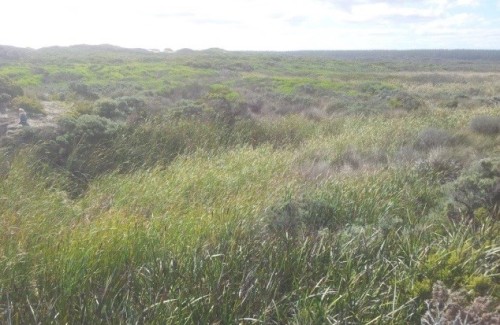
The wetland originally discharged into the ocean via Oxbow Lake and the Glenelg River mouth at Nelson. These changes to hydrology caused an interruption of flows, contributing to a long-term drying trend within the wetland complex.    This was not immediately obvious to many as the gradual drying of wetlands in a natural area is often less noticeable than in a cleared agricultural area, driven by a seamless and gradual shift towards more terrestrial species within the composition of native vegetation (Fig. 1).

Figure 1. Shrub (Leptospermum lanigerum) encroachment into sedgeland underway in Long Swamp.

In 2012, Nature Glenelg Trust (NGT) became actively involved in Long Swamp, working closely with Parks Victoria, the Nelson Coast Care Group, and the Glenelg Hopkins CMA. The initial involvement was to undertake a scientific review of the aquatic ecological values that might be impacted by the ecological shifts anecdotally observed to be underway. This early work identified that the more remote artificial outlet to the sea (White Sands) had in fact naturally closed, with a dune forming in front of the former channel several years earlier during the Millennium Drought (c. 2005). This formed an area of aquatic habitat immediately upstream of the former outlet that is now home to a diverse native freshwater fish community, including two nationally threatened fish species, the Yarra Pygmy Perch (Nannoperca obscura) and Dwarf Galaxias (Galaxiella pusilla). This observation and other investigations led to the planning of a restoration trial aimed at regulating or possibly blocking the second and final artificial outlet at Nobles Rocks to increase the availability, diversity and connectivity of aquatic habitats throughout Long Swamp, in order to benefit a wide range of wetland dependant species.

As well as undertaking basic monitoring across a broad range of taxonomic groups (birds, vegetation, frogs), the project has a particular emphasis on native freshwater fish populations as a primary indicator of project success.

Figure 2 – Aerial view of Nobles Rocks artificial outlet, detailing the location of the three trial sandbag structures.

Figure 2 . Aerial view of Nobles Rocks artificial outlet, detailing the location of the three trial sandbag structures.

Figure 3 - NGT staff members celebrate the completion of the third and final sandbag structure with some of the many dedicated volunteers from the local community.

Figure 3. Nature Glenelg Trust staff members celebrate the completion of the third and final sandbag structure with some of the many dedicated volunteers from the local community.

Reversal of artificial outlet impact over three phases.

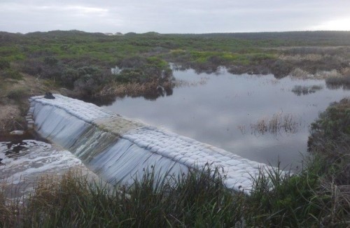
The first two stages of the restoration trial in May and July 2014 involved 56 volunteers from the community working together to construct low-level temporary sandbag structures, initially at the most accessible and technically feasible sections of drain under flowing conditions. Tackling the project in stages enabled us to learn sufficient information about the hydrological conditions at the site in 2014, before commencing the third and final stage of the trial in March 2015. On the 27th April 2015, the main structure was completed, following two days of preparation and nine days of sandbagging (using about 6,600 sandbags), which were put in place with the dedicated help of over 30 volunteers (see Figs 3 and 4). To achieve our target operating height, the structure was raised by a further 30 cm in August 2015.

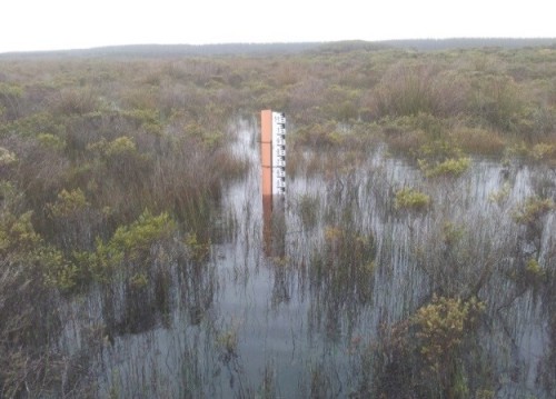
A series of gauge boards with water depth data loggers were also placed at key locations in the outlet channel and upstream into Long Swamp proper, to monitor the change in water levels throughout each stage of restoration and into the future.

Fig 4a. Long swamp

Figure 4a. View of the Phase 3 Restoration Trial Structure location prior to construction in March 2015.

Fig 4b. Long swamp

Figure 4b. Same location in June 2015, after construction of the Restoration Trial Structure.

Results to date.

Water levels in the swamp immediately upstream of the final structure increased, in the deepest portion of Long Swamp, from 34 cm (in April 2015) to 116 cm (in early September 2015). Further upstream, in a shallower area more representative of the impact on Long Swamp in the adjacent wider area, levels increased from being dry in April 2015, 14 cm deep in May, through to 43 cm deep in early September 2015, as shown in Figure 5. This is a zone where the shrub invasion is typical of the drying trend being observed in Long Swamp, and hence will be an important long-term monitoring location.

To evaluate the response of habitat to short and longer-term hydrological change, we also undertook longer-term landscape change analysis through GIS-based interpretation of aerial photography. This showed that we have currently recovered approximately 60 hectares of total surface water at Nobles Rocks, not including larger gains across downstream habitats as a result of groundwater mounding, sub-surface seepage and redirected surface flows that have also been observed.  These initial results and longer-term outcomes for targets species of native plants and animals will be detailed fully in future reports.

Fig 5a. Long swamp

Figure 5a. Further inland in the swamp after the Phase 3 structure was complete, shown here in May 2015. Depth – 14 cm.

Fig 5b. Long swamp

Figure 5b. Same photopoint 4 months later in September 2015. Depth – 43 cm.

Lessons learned and future directions.Meaningful community participation has been one of the most critical ingredients in the success of this project so far, leading to a strong sense of shared achievement for all involved. Monitoring will continue to guide the next steps of the project, with the ultimate aim of informing a consensus view (among those with shared interest in the park) for eventually converting the trial structure to a permanent solution.

Acknowledgements. Project partners include Parks Victoria, Nelson Coast Care Group, the Glenelg Hopkins CMA and the Friends of the Great South West Walk. Volunteers from several other groups have also assisted with the trials. Grant funding was generously provided by the Victorian Government.

Contact. Mark Bachmann, Nature Glenelg Trust, PO Box 2177, MT GAMBIER, SA 5290 Australia, Tel +61 8 8797 8181, Mob 0421 97 8181, Email: mark.bachmann@natureglenelg.org.au  Web: www.natureglenelg.org.au

See also:

Video conference presentation

NGH newsletter – including a link to a video on the project

Bradys Swamp EMR short summary

Picanninnie Ponds EMR short summary


Brady Swamp wetland complex, Grampians National Park, Victoria

Mark Bachmann

Key words: wetland restoration, Wannon River, hydrology, drainage, Gooseneck Swamp

A series of wetlands associated with the floodplain of the Wannon River (Walker, Gooseneck, and Brady Swamps), situated approximately 12 km north east of Dunkeld in western Victoria, were partially drained from the 1950s onwards for grazing purposes (Fig 1). A portion of these wetlands was later acquired and incorporated into the Grampians National Park (and other peripheral reserves) in the mid-1980s, managed by Parks Victoria. However, the balance of the wider wetland and floodplain area remained under private ownership, creating a degree of uncertainty surrounding reinstatement of water regime – an issue that was left unresolved for over two decades.

Many years of planning work, including modelling studies and biological investigations by a range of organisations, never quite managed to adequately resolve the best way to design and progress wetland restoration work in this area. To address the impasse, at the request of the Glenelg Hopkins CMA in early 2013, Nature Glenelg Trust proposed a staged restoration trial process which was subsequently agreed to by landowners, neighbours, government agencies, and local community groups.

Figure 1. Image from the present day: showing artificial drains (red lines/arrows) constructed to drain Walker, Gooseneck and Brady Swamps, as it operated from the 1950s–2013.

Figure 1. Image from the present day: showing artificial drains (red lines/arrows) constructed to drain Walker, Gooseneck and Brady Swamps, as it operated from the 1950s–2013.

Trials and permanent works undertaken.

Initial trials. The restoration process began in August 2013 with the installation of the first trial sandbag weir structure to regulate the artificial drain at Gooseneck Swamp. Its immediate success in reinstating wetland levels led to similar trials being initiated at Brady Swamp and Walker Swamp (Fig. 2) in 2014.

Figure 2. The volunteer sandbagging crew at the artificial drainage outlet from Walker Swamp - August 2014.

Figure 2. The volunteer sandbagging crew at the artificial drainage outlet from Walker Swamp – August 2014.

Permanent works were ultimately undertaken to reinstate the breached natural earthen banks at Brady and Gooseneck Swamps (Figure 3), implemented by Nature Glenelg Trust in early 2015.

Figure 3a. Trial Structure on the Brady Swamp outlet drain in 2014

Figure 3b. The same view shown in Figure 3a, after the completion of permanent works in 2015

Results. The works have permanently reinstated the alternative, original watercourse and floodplain of the Wannon River, which now activates when the water levels in these wetlands reach their natural sill level. This is predicted to have a positive impact on a wide range of flora and fauna species.

Monitoring is in place to measure changes to vegetation and the distribution and status of key fauna species, such as waterbirds, fish and frogs. Due to drought conditions experienced in 2015, to is too early to describe the full ecological impact of the works at this time.

4. Gooseneck Swamp in Sept 2014: the second season of the restoration trial, just prior to the implementation of permanent restoration works

Figure 4. Gooseneck Swamp in Sept 2014: the second season of the restoration trial, just prior to the implementation of permanent restoration works

Lessons learned. The success of these trials has been based on their tangible ability to demonstrate, to all parties involved, the potential wetland restoration outcome for the sites; made possible by using simple, low-cost, impermanent methods. To ensure the integrity of the trial structures, the sandbags used for this purpose are made of geotextile fabric, with a minimum field service life of approximately 5 years.

The trials were critical for building community confidence and collecting real operational data for informing the development of longer-term measures to increase the depth and duration of inundation.

A vital aspect of the trials has been the level of community participation, not only at the sandbagging “events”, but also the subsequent commitment to ecological monitoring, for helping evaluate the biological impacts of hydrological reinstatement. For example, the Hamilton Field Naturalists Club has been undertaking monthly bird monitoring counts that are helping Nature Glenelg Trust to develop a picture of the ecological value of these wetlands and their role in the wider landscape, including the detection of international migratory species.

Acknowledgements. Project partners include Parks Victoria, Hamilton Field Naturalists Club, the Glenelg Hopkins CMA, Macquarie Forestry and other private landholders. Volunteers from several other groups have also assisted with the trials. Grant funding was generously provided by the Victorian Government.

Contact. Mark Bachmann, Nature Glenelg Trust, PO Box 2177, MT GAMBIER, SA 5290 Australia. Tel +61 8 8797 8181, Mob 0421 97 8181; Email mark.bachmann@natureglenelg.org.au. Web| www.natureglenelg.org.au

See also:

Long Swamp EMR short summary

Picanninnie Ponds EMR short summary