Category Archives: reconstruction

Ecological restoration in urban environments in New Zealand – UPDATE of EMR feature

Bruce Clarkson, Catherine Kirby and Kiri Wallace

[Update of EMR feature  – Clarkson, B.D. & Kirby, C.L. (2016) Ecological restoration in urban environments in New Zealand. Ecological Management & Restoration, 17:3, 180-190.  https://onlinelibrary.wiley.com/doi/10.1111/emr.12229]

Key words: urban ecology; restoration; indigenous biodiversity; New Zealand

Figure 1. Kauri dieback disease is affecting individual trees (left). [Photo Nick Waipara]

Introduction. Our 2016 EMR feature reviewed the state of research and practice of ecological restoration in urban environments in New Zealand. We concluded that urban restoration can influence and support regional and national biodiversity goals. We also observed that research effort was light, lacking interdisciplinary breadth and may not be sufficiently connected to restoration practice to ensure long-term success of many projects.

While it is only three years since that review was published, urban ecological restoration continues to grow and evolve, and the policy setting and political context have changed significantly. New threats and opportunities have emerged. The spread of a dieback disease and the more recent arrival of myrtle rust, rapid uptake of Predator Free 2050, emergence of the One Billion Trees programme, a surge in housing and subdivision development, and a potentially more supportive policy framework are all major factors.

Threats and opportunities. Kauri dieback disease is severely affecting urban kauri forests and individual Kauri (Agathis australis) trees in Auckland and other northern North Island urban centres (Fig. 1). Large forest areas adjoining Auckland, including most notably the Waitākere Range and large parts of the Hunua Range, are now closed to the public, preventing access to popular recreational areas. The dieback is caused by a fungus-like pathogen Phytophtora agathicida that is spread through soil movement. The disease may have arrived from overseas although this is uncertain. There is no known cure but research efforts are underway to find a large-scale treatment option.

Myrtle rust (Austropuccinia psidii) was first found on mainland New Zealand in May of 2017, probably arriving by wind from Australia. Myrtle rust threatens many iconic New Zealand plant species in the family Myrtaceae including Pōhutukawa (Metrosideros excelsa), Mānuka (Leptospermum scoparium), Rātā (Metrosideros robusta), Kānuka (Kunzea spp.), Waiwaka (Syzygium maire) or Swamp maire, and Ramarama (Lophomyrtus bullata). These species are all used to a greater or lesser extent in restoration planting or as specimen trees or shrubs in urban centres, depending on amenity or ecological context. Mānuka is widely used as a pioneer or nurse crop for native forest restoration and is critical to the economically important mānuka honey industry. Waiwaka is a feature of many swamp forest gully restoration projects in Hamilton and this would be a significant setback if they were badly affected. The impact of myrtle rust is still not clear but experience from Australia suggests it may take several years before it reaches population levels sufficient to cause significant damage.

Figure 2. With rapid housing developments in New Zealand, it is important that urban restoration projects are well-planned and efficiently carried out to provide residents with greenspaces to benefit their cultural, health and wellbeing practices. [Photo Catherine Kirby]

In response to a range of housing issues characterised by many as a New Zealand housing crisis, the previous and current government has embarked on several major initiatives to increase the housing stock. A $1B Housing Infrastructure Fund (HIF) was established in October 2016 with provision for interest free loans to local government to enable opening up of new large areas of housing. Many urban centres including Auckland, Tauranga, Hamilton and Queenstown made early applications to the fund. Hamilton City Council was successful in obtaining $290.4 M support for a new greenfield subdivision in Peacocke on the southern edge of the city. This subdivision is intended to enable development of some 3700 houses over the next 10 years and 8100 in 30 years. Approximately 720 ha of peri-urban pastoral agricultural land would eventually be developed (See summary). Coupled with this, and already in progress, is the construction of the Southern Links state highway and local arterial road network. The first proposed subdivision Amberfield covers 105 ha and consent hearings are currently in progress. The environmental impacts of the proposal and how they might be mitigated are being contested. In brief, survival of a small population of the critically endangered Long-tailed Bat (Chalinolobos turberculatus) is the main environmental focus but other aspects including the extent of greenspace and ecological restoration required for ecological compensation are being considered (Figs. 2, 3). With strong political pressure to solve the housing crisis in Hamilton and in other urban centres, making adequate provision for greenspace, especially urban forest, and preventing environmental degradation and indigenous biodiversity decline will be a major challenge.

Figure 3. Aerial photo of Waiwhakareke Natural Heritage Park (65 ha), an award-winning and ongoing ecological restoration project situated on the edge of urban Hamilton. [Photo Dave Norris]

The Predator Free 2050 (PF2050) programme which gained government (National) approval in 2015, aims to eradicate Stoat (Mustela erminea), Ship Rat (Rattus rattus), Norway Rat (Rattus norvegicus) and Possum (Trichosurus vulpecula) from the whole of New Zealand by 2050 (Department of Conservation 2018). PF2050 is now gaining significant traction in urban environments (Figs. 4, 5) with many urban centres having good numbers of community-led projects underway (See PFNZ National Trust map). Crofton Downs in Wellington was New Zealand’s first predator-free community project. Led by Kelvin Hastie this project has effectively reduced predator numbers to the point that some sensitive native birds e.g. Kākā (Nestor meridionalis), have begun to nest in this suburb after an absence of more than 100 years (See RNZ report). Also in Wellington, the Miramar Peninsula (Te Motu Kairangi) has become a focus, because of its advantageous geography, with a goal to make the area predator free by 2019. Possums had already been exterminated in 2006 (www.temotukairangi.co.nz).

Figure 4. John Innes (Wildlife Ecologist, Manaaki Whenua Landcare Research) demonstrating trapping success. Removing pest mammals reduces predation, and also frees up the habitat and resources for our native fauna and flora to flourish. [Photo Neil Fitzgerald]

The One Billion Trees (1BT) programme was initiated by the new coalition government (Labour, NZ First, Greens) in 2017 with $238M released in 2018 for planting of both exotic and native trees across mixed land use types. It is not clear yet whether urban forest projects have received funding support but the guidelines suggest there is no reason why restoration of native forest in urban settings would not be eligible. While the emphasis is on exotic tree plantations, native species and long-term forest protection are increasingly being considered as viable options by the newly established government forestry agency Te Uru Rākau.

The policy setting for ecological restoration in urban environments is potentially becoming more favourable with the draft National Policy Statement on Indigenous Biodiversity (NPSIB) currently in review and the New Zealand Biodiversity Strategy under revision (See terms of reference). The draft NPSIB emphasises restoration of indigenous habitat in biodiversity depleted environments. Specifically, Policy 19: Restoring indigenous biodiversity depleted environments, recommends a target for indigenous land cover, which in urban areas and peri-urban areas must be at least 10 per cent. The revision of the New Zealand Biodiversity Strategy seems likely to give more emphasis to landscape scale restoration including urban environments.

Figure 5. New Zealand native lizards are extremely vulnerable to mammalian predation (e.g. mice, hedgehogs, ferrets, cats) as well as habitat destruction (e.g. new urban developments). [Photo Tony Wills]

Research update. Using the same targeted Google Scholar search method as reported in the EMR feature we have found 18 new peer reviewed papers published between 2015 and July 2019 (see updated bibliography) that are strongly focused on restoration in New Zealand urban environments. The single paper noted for 2015 was missed in our previous search. Again, we have not included books, book chapters or grey literature. This compares very favourably with the total 27 papers listed in our 2016 review of which more than half dated from 2009. An increasing publication rate confirms increasing interest and research efforts in aspects of urban ecological restoration. While most of the publications remain in the ecological science realm there are now some informed by other disciplines including engineering, psychology, landscape architecture and health sciences.

Most notably since our 2016 review, a new government-funded (Ministry of Business, Innovation and Employment) research programme, People, Cities and Nature, began in November of 2016. This four-year $823 k per annum research programme ends in October of 2020 unless a funding rebid to be submitted in March 2020 is successful. The programme undertakes multidisciplinary research in nine NZ cities via six inter-related projects: restoration plantings; urban lizards; mammalian predators; Māori restoration values; green-space benefits and cross-sector alliances. While the emphasis was on the ecological science of urban restoration at the outset, the programme has become increasingly involved in understanding the multiple benefits of urban ecological projects including social cohesion and health and recreation benefits. The need to connect restoration research and practice has been met by undertaking multi-agency and community workshops involving researchers and practitioners in five cities to date with a further four scheduled before the programme ends.

Acknowledgements. The People Cities and Nature research programme is funded by the Ministry of Business Innovation and Employment under grant number UOW1601.

Information. Bruce D. Clarkson, Environmental Research Institute, University of Waikato, Hamilton, New Zealand bruce.clarkson@waikato.ac.nz; Catherine L. Kirby, Environmental Research Institute, University of Waikato, Hamilton, New Zealand catherine.kirby@waikato.ac.nz; and Kiri J. Wallace, Environmental Research Institute, University of Waikato, Hamilton, New Zealand kiri.wallace@waikato.ac.nz.

Rehabilitation of former Snowy Scheme Sites in Kosciuszko National Park – UPDATE of EMR feature 2019.

Gabriel Wilks

Update of EMR feature – MacPhee, Elizabeth and Gabriel Wilks (2013) Rehabilitation of former Snowy Scheme Sites in Kosciuszko National Park.  Ecological Management & Restoration, 14:3, 159-171. Doi https://onlinelibrary.wiley.com/doi/10.1111/emr.12067

Key words.  Habitat construction, steep slopes, rock spoil.

Figure 1. Shaped rock spoil ready for planting more than 50 years after being dumped.

Introduction. Our original EMR feature article described the origins of this large, long-term rehabilitation program and the challenges faced in the first 10 years. The program’s aim was to address a range of impacts upon montane and sub-alpine vegetation and river corridors in Kosciuszko National Park from the Snowy Hydro Scheme, constructed from 1949 to 1974. Impacts included dumping of large volumes of rock spoil, loss of topsoil and native vegetation, introduction and spread of weeds and asbestos fragments in the landscape.  The article outlined the development of methodologies for restoration, particularly planting trials on steep rock spoils, and how obstacles such as slope instability, plant material availability and lack of soil were being overcome. The process of program implementation was given, including environmental and cultural heritage assessments undertaken as part of site works.  In 2013 a number of positive outcomes were already evident at the 200 sites that had been subjected to at least some treatment, including 18 sites where major rehabilitation works were undertaken. Outcomes included reduction in waterway impacts and invasive weeds, expansion of the Kosciuszko fauna database, regional community benefits, and production of an Australian Alps Rehabilitation Field Guide.

Further work. The Former Snowy Scheme Rehabilitation Program continues to reduce the long term environmental and safety risks of old degraded construction sites to Kosciuszko National Park, as well as improve their visual and ecological function. Some sites treated by 2013 have blended in with the surrounding landscape and are difficult to identify. Many sites are continuing to improve in condition over time, with distinct vegetation layers, natural plant recruitment and evidence of native fauna habitat. Construction history, rock spoil and loss of soil and plant species remain evident at highly altered sites, despite a high standard of rehabilitation work.

An additional 12 Major rehabilitation works have been undertaken since 2013, with selected signature projects and rehabilitation techniques described below.  Note that the former Snowy Scheme rehabilitation program does not address the impact of current Snowy Hydro Limited or proposed infrastructure and support networks such as powerlines, easements, river regulation or roads.

1. Rehabilitation of the Tooma–Tumut Access Tunnel Adit Spoil Dump. This spoil dump (Fig. 1) is located on the highly incised upper reaches of the Tumut River.  The spoil originates from construction in 1958-1961 of the Eucumbene–Tumut Tunnel, which transfers the headwaters of the Tooma River to Tumut Pond. Following earthworks in 2017, the planting crew successfully planted, watered, fertilised and mulched approximately 12,000 plants on rock spoil, with monitoring being undertaken by Greening Australia Capital Region staff (Fig 2.)

Figure 2. Year 1 Revegetation monitoring at Tooma-Tumut SD by Greening Australia Capital Region staff, 2018

2. Construction of contained habitat for the Southern Corroboree Frog. A series of remote enclosures (Fig 3) have been constructed in both rehabilitation areas and former habitat locations to enable re-introduction of this Critically Endangered species (Fig 4), following the devastating impacts of chytrid disease. These enclosures are developing essential stepping stones for frogs from captive breeding programs to move back into the wild. Design of enclosures requires ensuring self-sustaining food and water, shallow ponds for breeding, ability for Threatened Species staff to monitor and control disease and exclusion of other frogs. These works have been done in partnership with NSW Threatened Species staff and zoo institutions.

Figure 3. Constructing Southern Corroboree Frog enclosures in remote locations

Figure 4. Southern Corroboree Frogs living successfully back in Kosciuszko

3. First live record of Smoky Mouse in Kosciuszko National Park. The Smoky Mouse (Pseudomys fumeus Fig. 5) was found alive and well for the first time in Kosciuszko National Park, at a Happy Jacks rehabilitation site. Up until the discovery, the only currently known population of the small, smoky grey coloured mouse still surviving in NSW was in the Nullica area, NSW South Coast.  Three individuals, 2 males and 1 female were a significant find for survival and database records of this Critically Endangered Species, and a technical short note was published in EMR in 2017 by fauna surveyor Martin Schulz who found the animals.

Figure 5. A Happy Jacks Smoky Mouse.

4. Making people and places safer with rehabilitation. Sites that housed construction depots and townships during Snowy scheme construction still contained fragments of asbestos which were rapidly degrading due to weather exposure. As total removal was not feasible, the rehabilitation team worked with asbestos experts to develop practical measures to reduce public safety risks. At the remote Junction Shaft Contractors Camp (at Happy Jacks, Figs 6 and 7) and a former township and current camping ground at Island Bend a range of techniques were developed, delineation of zones for suitable uses, creating natural vegetation buffers and capping with rock spoil and plants.

Figure 6. The Junction Shaft Camp in 1955.

Figure 7. The same site 62 years later (and one year after works) with a range of capping and planting zones, including a heli-pad, Mountain Pygmy Possum habitat, and new plantings to improve safety and environment.

5.  Applying techniques beyond Kosci. Project team members took some winter time out of Kosciuszko to ‘grow’ a protection zone for a known population of Endangered Green and Golden Bell Frog (Litoria aurea) and constructed a series of ponds for future breeding in an old sand quarry at Worrigee Nature Reserve, Nowra (Fig 8). Given former quarries are a feature of a large infrastructure project such as the Snowy Scheme, the team had the technical knowledge for how to restore ecological function despite a radical departure from usual flora and fauna species. A range of techniques including neighborhood consultation, barrier logs and blocks, berms and vegetation were used to reduce the impact of recreational and unauthorised motorbikes and rubbish dumping.

Figure 8. Creating Bell Frog habitat in degraded borrow pits.

6. Growing rehabilitation resources and protecting karst ecosystems. The use of treated waste at the Yarrangobilly Caves visitor precinct to grow snow grasses (Poa spp.) for use in rehabilitation projects across Kosciuszko and been continued and developed (Fig. 9). A renewed emphasis on site production has enabled Poa seed to be available for other projects within the Park. This provides an ecologically preferable option for soil stabilisation and ground cover establishment, reducing the risk of weed invasion and dependence on sterile rye corn as the only available option.

Figure 9. Inspecting plants for seed harvest, which yielded 52 kgs of Poa seed in 2017.

Lessons Learned. It is clear that this is a unique rehabilitation project due to the large number of sites, the natural and heritage values of Kosciuszko National Park and the longevity and continuity of the commitment (approx. 20 years).  Understandably, however, at this point in time challenges in rehabilitation remain. ‘Off the shelf’ rehabilitation products are limited due to remoteness of locations, plant species required, Park management policies and required hygiene protocols. It is important that additional threats are not accidentally introduced, such as foreign pathogens and flora and fauna. As much as possible, resources such as coarse woody debris, woodchip, plant material and compost are sourced from within the Park. A flexible and dynamic approach to the very definition of rehabilitation and techniques and materials is required.  Specific lessons include the following.

Adding organic material on degraded sites is always beneficial. Rehabilitation success has been most obvious where logs, litter, woodchip and straw have been added to the site, to provide mico-niche climate, habitat, and improve soil. While this may increase short term management requirements such as weed control, the commitment is worth it due to the improved results.

Creating compost from old sawmill sawdust has worked well for this rehabilitation project. The most recent development however is in the use of organics waste and treated effluent from visitation facilities as a compost, and there is opportunity for this on-Park recycling to develop.

Other resources such as rice straw have become limited during periods of sustained drought and less rice production. This will remain a challenge into the future. The value of minimising ground cover loss, retaining natural soil characteristics and organic matter in situ and ensuring rapid rehabilitation after disturbance in future developments will become increasingly important for rehabilitation success.

Be creative with team skills and capacity. Problems such asbestos contaminant presence must be addressed for safety, but doesn’t mean walking away from the challenge. A degraded site may be the perfect place to develop species targeted habitat.  Seek expertise advice and consider a range of current and new solutions.

ContactGabriel Wilks, Senior Project Officer, NPWS Southern Ranges Services. PO Box 472, Tumut NSW 2720.  Email: Gabriel.Wilks@environment.nsw.gov.au

Is revegetation in the Sheep Pen Creek area, Victoria, improving Grey-crowned Babbler habitat? – UPDATE of EMR feature

Doug Robinson

[Update of EMR feature Robinson, Doug (2006) Is revegetation in the Sheep Pen Creek area, Victoria, improving Grey‐crowned Babbler habitat?  Ecological Management & Restoration, 7:2, 93-104.  https://doi.org/10.1111/j.1442-8903.2006.00263.x]

Key words: (<5 words): Monitoring, restoration, population ecology, woodland conservation

Figure 1. Location of babbler project works and other landcare works implemented since 1996 in the Sheep Pen Creek Land Management Group area and the two sub-districts used for the babbler study. (Source TFNVic)

Introduction: The Grey-crowned Babbler (Pomatostomus temporalis) (babbler) is a threatened woodland bird (classified as Endangered in the state of Victoria) that has declined substantially in overall distribution and abundance across much of its former range in southeastern Australia since European settlement.  Sheep Pen Creek Land Management Group area, in northern Victoria (Fig 1), was fortuitously the location of the largest known remaining babbler population in Victoria in the early 1990s (when this project began); and the focus of extensive land restoration programs from the 1980s onwards to help mitigate the impacts of erosion and dryland salinity, as well as biodiversity decline.  The original study, published in 2006, investigated the overall changes in tree cover across the district between 1971 and 1996 as a result of different land-management actions and responses of local babbler populations to those habitat changes.  The key finding was that in the Koonda sub-district which had a 5% overall increase in tree cover to 14% from 1971 to 2001, showed an increase in babbler numbers by about 30% (Table 1).   In the Tamleugh sub-district, tree cover increased by 1.3% to a total of 9%, with no change in babbler numbers.  The findings also showed that new babbler groups were preferentially colonizing new patches of vegetation established that suited their habitat needs.  Building on this research, the study concluded that future conservation programs needed to scale-up the extent of habitat restoration, target areas which were suitable for babbler colonization, and tailor incentive programs to assist with conservation of particular species.

Table 1. Changes in Grey-crowned Babbler numbers over time

Year Koonda Tamleugh
number of groups number of birds number of groups number of birds
1992 20 78 11 39
1993 20 89 10 34
1996 24 96 9 35
1997 24 102 8 30
1998 25 99 10 40
2000 26 97 10 43
2005 23 99 8 34

Further revegetation works undertaken. Since the initial study’s assessment of vegetation changes between 1971 and 1996, an additional 133 ha of vegetation has been restored or established as babbler habitat in Koonda district and 37 ha in the Tamleugh district (Figs 2 and 3, Table 2).  Extensive natural regeneration, supplemented by broadscale revegetation, has also occurred over more than 350 ha on five private conservation properties in the Koonda district,, contributing to substantial landscape change.  The wider landscape has also been identified as a statewide priority for nature conservation on private land, leading to increased conservation investment in permanent protection there by Victoria’s lead covenanting body – Trust for Nature.

Monitoring of outcomes: The monitoring that was carried out prior to the 2006 publication has not continued, leaving a knowledge gap as to how the population has fared in the context of the Millenium Drought and ongoing climate-change impacts. However, based on the original research’s initial findings, we conducted an experimental study with University of Melbourne to evaluate the effectiveness of habitat restoration in maintaining babbler survival. The study, published by Vesk and colleagues in 2015, compared the persistence and group size of babbler groups present in 1995 and subsequently in 2008 at a randomly selected set of stratified sites which had either had habitat works or none.  This study was conducted across a larger landscape of about 200,000 hectares which included Sheep Pen Creek Land Management Group area.  The study found that babbler group size decreased by about 15% over the 13 years at sites without restoration works.   At sites with restoration, average group size increased by about 22%, thereby effectively compensating for the overall reduction in numbers reported over that time.This increase also influenced subsequent demographic performance, with groups at restoration sites having higher breeding success and more fledglings than groups at control sites.

Another useful finding from this experimental study was the confirmation of the importance of particular habitat and landscape variables on babbler persistence.  In particular, abundance of large trees was a positive predictor of occupancy over time; and distance from the next nearest group was a negative predictor.

Figure 2. Changes in tree cover in the Koonda sub-district between 1971 (top),  and 2018 (bottom). (Source TFNVic).. (Source TFNVic)

Figure 3. Changes in tree cover in the Tamleugh sub-district between 1971 (top) and 2018 (bottom). (Source TFNVic)

Table 2.  Summary of additional habitat established or restored as part of the Sheep Pen Creek Grey-crowned Babbler project from 1996-2018, following the initial study period from 1971-1996.

District Number of sites Area (ha)
Koonda 62 133
Tamleugh 28   37
Other parts of landcare group and local babbler population area 29 103
Totals 119 273

Expansion of lessons to other districts: Building on the fundamental research conducted in Sheep Pen Creek Land Management Group area, similar habitat, landscape and babbler population assessments were subsequently undertaken in northwest Victoria near Kerang for the babbler populations found there.  Key results from these studies relevant to the initial Sheep Pen study were that the number of babbler groups in each sampled district was positively related to the proportion of woodland cover, especially the proportion of Black Box (Eucalyptus largiflorens) woodland habitat – the babblers’ preferred habitat in this region.  Conversely, the number of babbler groups was negatively associated with the proportion of land under intensive agriculture.  At the site scale, key positive predictors of babbler presence in Black Box habitat again included the abundance of large trees (> 60 cm dbh)

Lessons learned and future directions: The most valuable lesson learned since the initial paper was published was the power of the structured research project described above to evaluate the effectiveness of the babbler conservation program and inform future design and planning. The study further demonstrated the importance of taking a demographic approach to the species’ conservation needs, understanding what is happening across the whole population over time  and how habitat interventions can assist.  These lessons have since been applied usefully to other babbler projects  and more broadly to conservation of woodland birds.

The initial paper noted the importance of achieving landscape-scale change in vegetation extent, particularly in more fertile habitats. This has occurred to some extent within the Koonda district through a range of incentive programs, tender programs, covenanting programs and land purchase, but continues to achieve most gains on more infertile land. On fertile land, by contrast, there has been rapid land-use change to cropping over the past fifteen years, leading to reduced likelihood of those properties providing suitable habitat for babblers, as found in the study conducted in northwest Victoria.

The initial paper also suggested the benefit of developing tailored incentive programs for babblers and other threatened species with particular requirements to maximize potential conservation gains  and we suggest, based on Australian and overseas experiences,  that more specific incentive programs or more detailed criteria could assist.

Another important lesson learned was the difficulty in maintaining community-driven citizen-science monitoring, even with the best will in the world, without some over-arching organizational support and oversight.  We know that community monitoring for biodiversity conservation needs scientific input at the design and analysis stages; hence additional resources may also be required in terms of equipment or guidelines to help groups monitor effectively.  Modest government investments to conservation organisations with established biodiversity monitoring programs could usefully help address this issue.

Finally, the learnings from the Sheep Pen Creek Land Management babbler conservation project over nearly thirty years are that the landscape changes and that these changes are not always positive.  Land-use change is placing more pressure on  potential babbler habitat; and the eucalypt regrowth which was established and provided new nesting resources for a few years is now too tall to provide nesting habitat, but too dense and immature to provide suitable foraging habitat for another one hundred years.  Climate change is rapidly imposing constraints on the availability of food resources and breeding opportunities, exacerbated by increased competition for the same limited resources by exotic and native species.  For the Grey-crowned Babbler, the solution to all of these factors depends on ongoing commitment to the establishment or maintenance of their essential habitat needs and life-history requirements so that their life-cycle is provisioned for from generation to generation.

Stakeholders and Funding bodies:   Most of the targeted habitat works achieved for babblers in this landscape has occurred through funding support from the Australian government through its Natural Heritage Trust and Caring for our Country programs.  Broader habitat protection and restoration has occurred primarily with funding support to landholders from the Goulburn Broken Catchment Management Authority (GBCMA).  The Norman Wettenhall Foundation, along with GBCMA, was instrumental in enabling the research by University of Melbourne, which was also aided by the extensive voluntary support of Friends of the Grey-crowned Babbler.  Not least, local landholders continued to support the project and continue to protect or restore parts of their properties to assist with babbler conservation.

Contact information: [Doug Robinson, Trust for Nature, 5/379 Collins Street Melbourne, Victoria 3000, Australia.  dougr@tfn.org.au, (03) 86315800 or 0408512441; and  School of Life Sciences, La Trobe University, Bundoora, Victoria, Australia.


The biodiversity benefits of Greening Australia’s Saltshaker Project, Boorowa, NSW – UPDATE of EMR feature

David Freudenberger, Graham Fifield, Nicki Taws, Angela Calliess and Lori Gould

[Update of EMR feature – Freudenberger, David, Judith Harvey and Alex Drew (2004) Predicting the biodiversity benefits of the Saltshaker Project, Boorowa, NSW. Ecological Management & Restoration, 5:1, 5-14. https://doi.org/10.1111/j.1442-8903.2004.00176.x]

Key words: woodland restoration, monitoring, farmland rehabilitation, community engagement

Figure 1. Boorowa River Recovery project sites, south eastern NSW.

Introduction

The Boorowa catchment in central NSW, like most of the wheat-sheep belt of eastern Australia, has been extensively cleared for agriculture.  Remnant woodland cover is less than 10% and highly fragmented into small patches, often less than 20 ha. As described in the 2004 article, there has been a documented decline in biodiversity across this region linked to declines in landscape function including dryland salinity and eucalypt dieback. In response to these declines, farmers in this catchment have been involved in land rehabilitation projects for over 25 years.  Many of these projects have been facilitated by Greening Australia, a national non-governmental organisation focused on protecting and restoring native vegetation.  Pioneering projects in the 1990s were often small in scale and lacked landscape scale targets.  To address this, Greening Australia collaborated with CSIRO to develop guidelines for catchment scale “enhancement activities” for the $1.8 Million “Saltshaker Project” that carried out ground works as described in Box 1 of the 2004 article (reproduced below). The project was based on a $845,000 grant from the Australian Government’s Natural Heritage Trust program and $1 Million in in-kind support from farmers, the Boorowa Shire, Boorowa Landcare and Greening Australia. This project ran for just two years (2000-2002), but it was hoped that the project would provide strategic guidance for decades to come.  This appears to be the case.

 Box 1. Priority ‘enhancement activities
1. Protect existing remnant vegetation by fencing out domestic livestock with a priority to protect 10 ha or larger remnants in the best condition (complex understorey).
2. Establish native understorey plants in those protected remnants requiring enhancement of habitat complexity.
3. Enlarge existing remnants to at least 10 ha.
4. Create linkages between fenced remnants and other protected remnants. Linkages should be at least 25 m wide, or 10 ha stepping-stones, particularly in those areas more than 1.5 km from other patches 10 ha in size.
5. Fencing and revegetation of at least 50 m wide along creeks and flow lines.
6. In recharge areas, revegetate in 2-ha blocks, or greater than eight row strips to intercept deep soil water moving down-slope.
7. Revegetate areas mapped as having a high risk of dryland salinity.
8. Block plantings in discharge areas with links to other saline reclamation works.

(Box reproduced with permission from the original feature]

During the Saltshaker project, bird surveys were conducted within 54 discrete patches of remnant woodland.  Bird species were identified that were particularly sensitive to loss of habitat area, simplification of habitat structure, and increase in habitat isolation. The Eastern Yellow Robin was the focal species for this catchment. It generally occurred in woodland patches larger than 10 ha that were no more than 1.5 km from other patches at least 10 ha in size, and had at least a moderate structural complexity made up of a healthy overstorey of eucalypts with an understorey of regenerating trees, shrubs, tussock grasses and fallen timber. The Saltshaker project predicted that many other woodland birds would co-occur if the habitat requirements of the Eastern Yellow Robin were met by patch and landscape scale enhancement activities.

Further works. The Saltshaker project was followed by many others since 2002. The largest project was “Boorowa River Recovery” that began in 2005 as a partnership managed by Greening Australia with the Lachlan Catchment Management Authority and the Boorowa Landcare Group.  Through a total investment of almost $2.2 million (in-kind included), this project rehabilitated or protected 640 ha of riparian area along 80 km of river including a continuous 29 km stretch of the Boorowa River above the town water supply dam (Figs 1 and 2). It involved more than 60 land managers who implemented on-ground works described in individual ten year management contracts. On-farm project size averaged 11.6 ha.

Other projects funded by a diversity of sources, particularly the Australian Government, have protected an additional 88 ha of woodland remnant, enhanced 353 ha of remnants, and revegetated 425 ha of native vegetation within the catchment.  Projects included Whole of Paddock Rehabilitation (WOPR).  All project activities linked to funding have been recorded in a detailed project management database held by Greening Australia. These additional projects were consistent with the enhancement activities recommended by the Saltshaker Project and described in the EMR feature.

Figure 2 (a) Before and (b) after willow removal in the Boorowa River Catchment. After willow removal, all sites were planted to a diversity of trees and shrubs.

Outcomes. There has been no comprehensive follow-up to the 2001 bird surveys across the Boorowa Catchment.  However since then, there is now a large and comprehensive scientific literature demonstrating dramatic increases in woodland birds in the revegetation areas in this region of southeastern NSW (reviewed in 2018). Most all the conservation and restoration activities in this catchment have likely led to an increase in woodland birds over the past 20 years.

Of all the Boorowa projects, the Boorowa River Recovery projects had sufficient funding for monitoring outcomes six years after project activities commenced. A sub-sample of 20 sites out of a pool of 47 were monitored for improvements in vegetation cover and density, macroinvertebrate abundance and stream bank stability. Planted shrub cover generally doubled at all sites as expected. Macroinvertebrate scores did not differ between treated and control sites, though activities did appear to improve stream bank stability (an indirect measure of reduced erosion).  Subsequent monitoring 12 years on showed further improvements in ecosystem function.

Since the Saltshaker Project finished, there has been no systematic monitoring of the hundreds of woodland remnants protected and enhanced by this project and subsequent ones.  However, landholders and staff anecdotally report indicative improvements in vegetation cover and wildlife habitat on the sites, and we can infer from a 2008 study that included woodland sites in the Boorowa Catchment, that significant ecological improvements are likely from fencing out livestock from woodland patches. This study found improvements included greater native floristic richness, native groundcover and overstorey regeneration within fenced sites compared to unfenced sites. Similarly, a 2009 study found that woodland sites in south eastern Australia, with livestock grazing removed, had a greater abundance of beetles and the opportunist ant functional group, a faster rate of litter decomposition, greater native plant richness, greater length of logs, and a better vegetation condition score.

Lessons learned. Long-term action with short-term funding. Natural resource management projects have been ongoing in the Boorowa catchment for over 25 years. But no single project has been funded for more than five years. This is the reality of natural resource management (NRM) in much of Australia.  Government NRM programs come and go with election cycles, but fortunately the commitment of landholders and local organisations persists.

Partnership model. All the projects before and after the Saltshaker Project have involved landholders working collaboratively with local agencies administering the diversity of funding. Most projects had a steering committee that proved a good way for stakeholders to have input through all stages of project, which was particularly important during project planning. Idealism needed to be balanced with practicality so bureaucracy was minimised while maintaining accountability. Good communication that recognised that no single view was more valuable than another was important, although full consensus was not always possible. Trust was enabled when processes were developed collectively. Skilled coordinators needed a clear understanding of their roles and care taken to not get involved in local politics.

Assessing outcomes. Developing a highly predictive understanding of ecological outcomes from NRM activities in catchments like Boorowa is a scientifically complex, expensive and long-term process. The confidence we can now claim for an increase in abundance and diversity of woodland birds in the Boorowa catchment stems from two types of monitoring. First is project monitoring of outputs like the 425 ha of revegetation known to have been established in the catchment. We know this from Greening Australia’s project management database (unfortunately there is no national database for this kind of outputs),  although satellite imagery should be able to pick up this output once plantings have a dense enough canopy. It is essential to know when and where project outputs like revegetation have occurred in order to then design scientifically rigorous studies to research ecological outcomes like increases in flora and fauna diversity and abundance. We have confidence that wildlife is colonising revegetation because research groups have conducted sophisticated statistical analyses of wildlife data from woodland revegetation in nearly 200 sites across south eastern Australia for over 15 years (summarised in a 2018 study).

Gaps in understanding. We know a lot about the ecological and social outcomes of NRM activities, but much less about improving the cost effectiveness of outputs such as revegetation and understory enhancements(see 2016 review). There are no recent published benchmarks on how much revegetation should cost in the face of variable climatic conditions, soil types and terrain.  More revegetation case studies need to be documented, but they need to include an accounting of costs.  The Australian restoration challenge is vast, funding always limited, so practical research and transparent accounting is sorely needed to reduce the cost of ecologically effective restoration.

Continuous re-learning. The many and diverse projects in the Boorowa Catchment are typical of NRM activities in Australian woodlands over the past 25 years. Each project has involved different agencies, many no longer exist or have changed their names (e.g. Catchment Management Authorities have morphed into Local Land Services in NSW). Each agency, including NGOs like Greening Australia, have a natural turn-over of staff. For example, only one staff member of Greening Australia involved in Saltshaker remains with the organisation.  Landholders tend to remain longer, but they too retire, sell out, and move on. Like education, every new staff member and every new landholder needs to learn the complex processes of successful catchment repair. This learning needs to be hands-on, hence funding for NRM activities and extension is needed in perpetuity (just like education). But experiential learning needs to be complemented with a diversity of learning resources such as the EMR journal, easily assessable reports (too many have disappeared from Government websites) and new media such as YouTube videos. Most importantly, communities of practice need to be perennially nurtured by a diversity of practitioners, experienced and less so.  There is much still to be learned and shared.

Stakeholders and Funding bodies:   The primary funding bodies for projects in the Boorowa catchment were the Australian Government, TransGrid, Alcoa Australia, the NSW Environmental Trust, and the former Lachlan Catchment Management Authority. These external funds were complemented by a diversity of in-kind support provided by farmers, Boorowa Shire Council, and other community members of the catchment.

Contact details. David Freudenberger, Fenner School of Environment and Society (Australian National University, Canberra, 0200, Australia, Email: david.freudenberger@anu.edu.au). GF, NT and AC can be contacted at Greening Australia, Kubura Pl, Aranda ACT 2614, Australia; and LG at GrassRoots Environmental, Canberra (http://www.grassrootsenviro.com/)


Ecological Restoration of Donaghys Corridor, Gadgarra, north Queensland – UPDATE of EMR feature

Nigel Tucker

[Update of EMR feature – Tucker, Nigel I. J. and Tania Simmons (209) Restoring a rainforest habitat linkage in north Queensland: Donaghy’s Corridor, Ecological Management & Restoration, 10:2, 98-112, https://onlinelibrary.wiley.com/doi/10.1111/j.1442-8903.2009.00471.x]

Keywords: Rainforest, corridor, regeneration, disturbance effects

Introduction. Complex notophyll vine forests of the Atherton Tablelands, particularly from basalt derived soils, have been significantly fragmented and degraded by human settlement over a 100yr period. Fragment isolation results in edge effects, exotic species colonisation, loss of genetic variability and species decline. During high rainfall events, eroding streambanks on farms mobilise sediments to the receiving environment of the Great Barrier Reef. Re-connecting isolated fragments to larger forest blocks through restored riparian corridors aims to reverse these effects through adaptive management. The restoration of Donaghys Corridor is an example of adaptive management, and its establishment was a key factor in the adoption of other local corridor projects.

As reported in the 2009 features, around 20,000 plants of selected local species were established in four yearly plantings (1995/96/97/98) along Toohey Creek, creating a continuous habitat corridor between the isolated Lake Barrine fragment (500ha) and the adjacent Gadgarra section of Wooroonooran N.P (80,000ha), both being part of the Wet Tropics World Heritage Area. The corridor is 1,200m in length and 100m wide, with three rows of Hoop Pine (Araucaria cunninghamiana) planted either side of the fenced corridor, which was established on lands largely owned by the Donaghy family. On completion, the corridor was secured through the Queensland Government’s declaration of Donaghys Corridor Nature Refuge, the State’s first Nature Refuge proclaimed over an ecologically restored site.

Ongoing recovery. In 2000, a vegetation survey of 3m x 5m plots in 12 permanent transects throughout the corridor showed regeneration had occurred upon canopy closure (Tucker and Simmons 2009).  Between 1995 and 1998, 119 native species had regenerated within the transects, mainly through vertebrate-mediated dispersal. The most recent (ongoing) survey, ca.20yrs after planting, indicates that regeneration has continued, and the majority of regenerating species are again vertebrate dispersed. There has also been a measurable increase in vegetation structural complexity, and a variety of life forms are present including ferns, orchids, vines, scramblers and canopy trees.

Restored vegetation in 2000 was characterised by vegetation of even age and size classes and only a developing canopy was present (no sub-canopy). Recruitment was limited to the ground storey. Over 20yrs, total numbers of recruiting species have increased, along with canopy height, and the sub-canopy is now a distinguishable and measurable feature. To illustrate this change, species diversity and structure in two typical transects from the oldest (1995) and youngest (1998) plantings are shown in the table below. Figures are from the most recent survey (2019) and the bracketed numbers indicate comparative values in 2000.

Canopy

height

Sub-canopy

Height

Number of species Average number of species/plot Average number of species/plot – sub-canopy Average number of species/plot – ground storey
1995 19.9 (5) 7.5 (0) 84 (53) 22.6 (12.5) 8.3 13.8
1998 14.4 (2.5) 7.3 (0) 63 (15) 14.2 (1.6) 2.2 15.8

There has also been a significant difference in the distribution of regenerating vegetation. In 2000, regeneration was negatively correlated with edge, being concentrated in the central portion of each transect. Greater structural complexity and increased shading have significantly reduced the edge effect and regeneration is now distributed equally across the entire width of the corridor. This edge-effect reduction may partially result from the three Hoop Pine rows, now ca.15m tall, planted on each side of the corridor.

Figure 1.  Part of the 18m x 250m fence crossing Donaghys Corridor

Natural and man-made disturbance. Since establishment there has been both natural and anthropogenic disturbance. Occasional incursions by cattle have occurred, entering via fences sometimes damaged by branches falling from maturing corridor vegetation. In small areas incursions have visibly damaged regeneration but surveys show this has not significantly affected regeneration. Feral pig disturbance has also occurred but does not appear to have affected regeneration.

In 2006, corridor vegetation was damaged by severe tropical Cyclone Larry. Most stems lost crowns and some waters’ edge stems were permanently bent by floodwaters, but vegetation recovery was rapid and no weed invasion occurred. This infers a measure of resilience by restored vegetation to disturbance, and the distribution of regeneration described above supports this inference.

Anthropogenic disturbance has been more interventionist and not aligned to the original concept adopted by government, landholders, scientists and the community when the project commenced in 1995.  In 2017, the corridor’s upstream neighbour, with support from the DES but without consultation with the Donaghy family or other affected landholders, erected a chain mesh fence 250m long and 1.8m high across the western end of the corridor (see Figure 1). This is part of a larger fence which completely encloses mature forest at the western end of the corridor, including corrugated iron placed across the bed of Toohey Creek. Enquiries revealed the fence is part of an enclosure for a Cassowary (Casuarius casuarius johnsonii) rehabilitation facility, operated by Rainforest Reserves Australia (RRA) under a commercial arrangement with the Queensland Government.

Enhancing landscape permeability was the key reason for undertaking the Donaghys Corridor project, and the endangered Cassowary was a key target species; 53 Cassowary food plants were included in the original planting matrix of 100 species to encourage corridor utilisation. The Queensland Government notes that corridors are a key strategy in Cassowary conservation. In addition to blocking the movement of terrestrial vertebrates such as Cassowaries, Pademelon (Thylogale stigmatica) and Musky Rat Kangaroo (Hypsiprymnodon moschatus), construction of the enclosure has inadvertently fenced in a number of animals whose territories included part of the enclosure.

DES has advised that the fence is temporary and will be removed when restoration plantings on RRA lands are ‘sufficiently well-developed’ to support Cassowaries being rehabilitated.  It is unknown, however, when or through what processes this removal will occur. Resolution of the issue is anticipated.  However, such actions highlight the pitfalls associated with single-species conservation, and potential conflicts that might arise when responsibility for management of endangered species moves from the State to the non-scientific, commercially-focused private sector. Whilst iconic wildlife e.g., the Cassowary, can be effective in harnessing community and landholder participation in restoration, here it is clear that decision making and communication has been far from optimal, which may well lead to landholder and community disillusionment. In this case, the fence has also disrupted ongoing monitoring and evaluation. Planned re-survey of terrestrial vertebrate colonisation and movement has now been cancelled, given the unknown effect of the fence on wildlife passage and the behaviour of animals inadvertently trapped within the enclosure.

Lessons learned.  The project shows that sustained regeneration of native species can be achieved in restored tropical vegetation, along with increased structural complexity and functional resilience to natural disturbance.  However, the fencing incident shows that dysfunction in a restoration project can arise from totally unanticipated causes, potentially undoing well-established partnerships between government, community, scientists and landholders.

Contact.  Nigel Tucker, Director & Principal Environmental Scientist, Biotropica.  PO Box 866 Malanda QLD 4885 ; Email: nigeltucker@biotropica.com.au; Tel: +61 7 4095 1116.


Developments in Big Scrub Rainforest Restoration: UPDATE of EMR feature

Tony Parkes, Mark Dunphy, Georgina Jones and Shannon Greenfields

[Update of EMR feature article: Parkes, Tony, Mike Delaney, Mark Dunphy, Ralph Woodford, Hank Bower, Sue Bower, Darren Bailey, Rosemary Joseph, John Nagle, Tim Roberts, Stephanie Lymburner, Jen Ford and Tein McDonald (2012) Big Scrub: A cleared landscape in transition back to forest? Ecological Management & Restoration 12:3, 212-223. https://doi.org/10.1111/emr.12008]

Key words: Lowland Subtropical Rainforest, ecological restoration, seed production, landholder action, corridors

Figure 1a. Rainforest regenerators undertake camphor injection, leaving bare trees standing creating light and an opportunity for seed in the soil to naturally regenerate. (Photo © Envite Environment)

Figure 1b Aerial photo showing camphor conversion by injection
(Photo © Big Scrub Regeneration Pty. Ltd.)

Introduction. The Big Scrub, on the NSW north coast, was once the largest tract of Lowland Subtropical Rainforest (LSR) in Australia. It was reduced to less than 1% of its original extent by he end of hte 19th century after clearing for agriculture. Big Scrub Landcare (BSL) is a non-profit organisation dedicated to improving the long-term ecological functionality of what remains of this critically endangered ecosystem –  lowland subtropical rainforest.  Our 2012 EMR feature reported on remnant restoration and revegetation works overseen by BSL to 2012. At that time, 68 remnants were identified as significantly affected from the impacts of environmental degradation including weed invasion and cattle access. These remnants had been undergoing treatments, with 20 substantially recovered and on a ‘maintenance’ regime.  Approximately 900,000 trees had been planted to establish 250 ha of young diverse well-structured rainforest.  A comparatively small area of forest dominated by the highly invasive exotic, Camphor Laurel (Cinnamomum camphora) (Camphor), which  has colonised much of the Big Scrub landscape had been converted to early phase LSR by skilled removal of a range of weeds and facilitating natural regeneration. 

Progress since 2012. Substantial progress in restoring critically endangered lowland subtropical rainforest in the Big Scrub has been achieved over the past seven years in the following areas.

  • Assisted regeneration of remnants has continued and become more focused
  • Re-establishment of LSR through plantings has expanded
  • Camphor conversion has developed in scale and techniques
  • Greater security of funding has been achieved
  • Community engagement has greatly improved and expanded
  • Genome science is being applied to produce seed with optimal genetic diversity for rainforest restoration.

Assisted regeneration of remnants. This work continues to be the major focus of on-ground restoration work. About 2000 regenerator days (9 years Full Time Equivalent) of work has been undertaken in 45 remnants. BSL’s remnant restoration program has become more strategic, with more focus on Very High Conservation Value (VHCV) remnants, particularly those in the NSW National Parks Estate, including the VHCV sites in Nightcap National Park (NP) including Big Scrub Flora Reserve, Minyon Falls and Boomerang Falls; Andrew Johnston’s Scrub NR; Snow’s Gully Nature Reserve (NR); Boatharbour NR; Victoria Park NR and Davis Scrub NR, plus the Booyong Flora Reserve. Rehabilitation work at these sites is prioritised in the major new four-year Conservation Co-funding project funded jointly by BSL and the NSW government’s Saving our Species program. Big Scrub Foundation (BSF) funding has enabled BSL to continue maintenance work in remnants that have reached or are approaching the maintenance stage.

Monitoring outcomes has become more rigorous and has demonstrated ongoing improvements in vegetation structure, with decreasing levels of weed invasion and improvements in native species cover.

BSL’s partner Envite Environment, with some assistance from BSL, is creating an important linkage between Nightcap NP and Goonengerry NP by the restoration of rainforest through the progressive removal of weeds that had dominated the 80 ha Wompoo/Wanganui corridor between these two NPs.

 Re-establishment of rainforest by planting. The area of LSR is being re-established by planting on cleared land has also continued to expand.   In the last 7 years  more than 0.5 million rainforest trees have been planted in the Big Scrub region, contributing to the restoration of another 175 ha of LSR, expanding total area of re-established rainforest by another 13%. While landscape-scale landholder driven work is inevitably opportunistic rather than strategic, the establishment of new patches of LSR enhance valuable stepping-stone corridors across the Big Scrub. Since 2012 the number of regenerators working fulltime in the Big Scrub region has increased by approximately 50%.  Another trend that has strengthened in the last 7 years is that larger plantings are now being carried out by well-resourced landowners. This is accounting for about 40% of the annual plantings. Offsets for residential development account for another 40% of trees planted. The remaining 20% is made up by small landowners, cabinet timber plantations, large-scale landscaping, and other planting of Big Scrub species. This is a significant change from the more dominant grant-based small landowner/Landcare group plantings prior to 2012.

 Camphor conversion. Larger areas of Camphor forest are being converted to rainforest, with project areas increasing substantially from less than a hectare to ten and twenty hectares. BSL estimates that more than 150 ha of Camphor forest are currently under conversion. Some landowners underake camphor injection which leaves bare trees standing, creating light and an opportunity for existing native seedlings and seed in the soil (or seed dropped by perching birds) to naturally regenerate (Fig 1). Others are choosing the more expensive option of physically removing the Camphor trees and carefully leaving the rainforest regrowth (Fig 2).  Improved techniques and landholder capacity building continue to progress and camphor conversion is now a significant component of rainforest restoration.

BSL alone is facilitating the conversion of almost 40 ha of Camphor forest to LSR funded by two 3-year grants from the NSW Environmental Trust, together with contributions from the 19 landholders involved in these projects. The ecological outcomes being achieved are significant and less costly than revegetation via plantings.

Figure 2a. Camphor forest under conversion using heavy machinery leaving rainforest regrowth intact (Photo © Big Scrub Landcare)

Figure 2b. Aerial photo showing camphor conversion by removal
(Photo © Big Scrub Landcare)

Greater security of funding. Australian Government funding for biodiversity conservation is at a very low level. Competition for existing NSW state government funding is increasing. BSL therefore has continued to  develop new strategies for fund raising to ensure continuity of its long-term program for the ecological restoration of critically endangered LSR in the Big Scrub and elsewhere. Ongoing funding of at least $150,000 annually is needed to ensure the great progress made  over the past 20 years in rehabilitating remnants is  maintained and expanded to new areas of large remnants. These funds finance weed control and monitoring; weeds will always be a part of the landscape and an ongoing threat to our rainforest remnants.

Establishment of the Big Scrub Foundation in 2016 was a major development in BSL’s fund raising strategy. The Foundation received a donation of AUD $1M to establish a permanent endowment fund that is professionally invested to generate annual income that helps finance BSL’s remnant care program and its other activities. Generous donors are also enabling the Foundation to help finance the Science Saving Rainforest Program.

Figure 3a. Australian gardening celebrity Costa Gregoriou at a Big Scrub community tree planting (part of the 17th annual Big Scrub Rainforest Day) in 2015 (Photo © Big Scrub Landcare)

Figure 3b. Founder of the Australian Greens political party Bob Brown and Dr. Tony Parkes at the 18th annual Big Scrub Rainforest Day in 2016. (Photo © Big Scrub Landcare)

Community engagement. The  Big Scrub Rainforest Day continues to be BSL’s  major annual community engagement event, with the total number of attendees estimated to have exceeded 12,000 over the past 7 years; the 2016 day alone attracted more than 4000 people (Fig 3). Every second year the event is held at Rocky Creek Dam.  A new multi-event format involving many other organisations has been introduced on alternate years.

BSL’s Rainforest Restoration Manual has been updated in the recently published third edition and continues to inform and educate landowners, planners and practitioners.

BSL in partnership with Rous County Council produced a highly-commended book on the social and ecological values of the Big Scrub that has sold over 1000 copies. BSL’s website has had a major upgrade: its Facebook page is updated weekly; its e-newsletter is published every two months. BSL’s greatly improved use of social media is helping to raise its profile and contribute to generating donations from the community, local businesses and philanthropic organisations to fund its growing community education and engagement work and other activities.

Science saving rainforests program. BSL, the Royal Botanic Gardens Sydney, the BSF and their partners have commenced an internationally innovative program to apply the latest DNA sequencing and genome science to establish plantations to produce seed of key species with optimal genetic diversity for the ecological restoration of critically endangered lowland subtropical rainforest. This program will for the first time address the threat posed by fragmentation and isolation resulting from the extreme clearing of Australia’s LSR, which is estimated to have resulted in the destruction of 94% of this richly biodiverse Gondwana-descended rainforest.

Many  key  LSR species are trapped in small populations in  isolated remnants  that  lack the genetic diversity needed to adapt and survive in the long term, particularly faced with climate change Necessary  genetic diversity is also lacking in many key species in the 500 ha of planted and regrowth rainforest. The first stage of the program, already underway, involves collecting leaf samples from approximately 200 individual old growth trees in 35 remnant populations across the ranges of 19 key structural species of the ‘original’ forest. DNA will be extracted from the leaf samples of each species and sequenced. The  latest genome science will be applied to select the 20 individual trees of each species that will be cloned to provide planting stock with optimal genetic diversity for the establishment of a living seed bank in the form of a plantation that will produce seed  for use in restoration plantings. As the individual trees in the restoration plantings reproduce, seed with appropriate genetic diversity and fitness will be distributed across the landscape. The project focuses on key structural species and thus helping the survival of Australia’s critically endangered Lowland Subtropical Rainforest in the long term.

Lessons learned and current and future directions. A key lesson learned some five years ago was that BSL had grown to the point where volunteers could no longer manage the organisation effectively. BSL took a major step forward in 2015 by engaging a part-time Manager, contributing to BSL’s continuing success by expanding the scope, scale and effectiveness of its community engagement activities and improving its day to day management.

The principal lesson learned from BSL’s on-ground restoration program is to focus on rehabilitation of remnants and not to take on large planting projects, but rather support numerous partnered community tree planting events. Large grant-funded multi-site tree planting projects are too difficult to manage and to ensure landholders carry out the necessary maintenance in the medium to long term.

Acknowledgements.  BSL acknowledges our institutional Partners and receipt of funding from the NSW government’s Saving our Species program, NSW Environmental Trust and Big Scrub Foundation.

Contact:  Shannon Greenfields, Manager, Big Scrub Landcare (PO Box 106,  Bangalow NSW 2479 Australia; . Tel: +61 422 204 294; Email: info@bigscrubrainforest.org.au Web: www.bigscrubrainforest.org.au)

Seagrass restoration off the Adelaide coast using seeds and seedlings – UPDATE of EMR feature

Jason Tanner

[Update of EMR feature article :  Tanner JE, Andrew D. Irving, Milena Fernandes, Doug Fotheringham, Alicia McArdle and  Sue Murray-Jones (2014) Seagrass rehabilitation off metropolitan Adelaide: a case study of loss, action, failure and success.Ecological Restoration & Management 15: 3, 168-179.  https://onlinelibrary.wiley.com/doi/10.1111/emr.12133]

Key words:  Amphibolis, Posidonia, Recruitment facilitation, Seagrass loss

Figure 1: Bag layout for small-scale experiments on Amphibolis recruitment facilitation (top left), Amphibolis seedlings (top right), close-up of basal ‘grappling hook’ that allows seedlings to attach (bottom left), and examples of older style double-layered bags with and without seedlings attached (bottom right).

Introduction: Over the last half century or so, over 6,000 hectares of seagrass has been lost off the Adelaide coast due to anthropogenic nutrient and sediment inputs.  This loss has led to coastal erosion, decreased habitat, loss of carbon storage, and decreased fish abundance.  Recent improvements to wastewater treatment and stormwater runoff have led to some natural recovery, but changes in sand movement resulting from the loss now prevent recolonization of many areas.  Our September 2014 feature article in EMR described how SARDI have been working with other state government agencies and universities to develop a cost-effective technique to restore these areas.  Typical seagrass restoration costs on the order of AUD$1 million per hectare, but by facilitating natural recruitment of Amphibolis, yet over the last 17 years we have developed a technique that only costs a few tens of thousands of dollars.  As described in the feature, this technique uses hessian sand bags (Fig. 1) to provide a stable recruitment substrate while seedlings become established, and has resulted in the re-establishment of small trial patches of seagrass restoration (10-100 m2) which are now over 10 years old (Fig. 2) Importantly, these sites have been colonized by Posidonia and Zostera seagrasses, and provide habitat for faunal assemblages that are similar to those of nearby natural meadows, suggesting potential for small plots to act as ‘starters’ for ecosystem recovery.

Figure 2: Examples of Amphibolis restoration showing progression of establishment from 12 months (top left), 41 months (top right), 58 months (bottom left) and 8 years (bottom right).

Further work undertaken: Since our original article in EMR, we have continued monitoring the 1 hectare trial patches and expanded our focus to include additional species in the restoration, especially Posidonia.  We have also started assessing how bags degrade over time under different storage conditions, as operationalizing this technique will require bags to be stored potentially for a month or more between filling and deployment.  Importantly, the SA Government has now allocated funds for a proof of application, which will involve the deployment of hessian bags over approx. 10 hectares in late autumn 2020.

Further results to date: Two 1 hectare trials were deployed in June 2014, with 1,000 bags in each (Fig. 3).  After 9 months, these bags had an average 6.2 Amphibolis seedlings each, which was typical for bags deployed outside the winter recruitment season in previous years.  After a further 12 months, this increased to 9.2 seedlings per bag, within the range of densities previously seen for small-scale winter deployments (7-23 seedlings per bag).  A further 12 months later, densities had decreased to 3.1 seedlings per bag.  In 2017, a third 1 hectare trial was established with 2,500 bags, although these bags only had 1.2 seedlings each after 9 months. Unfortunately loss of nearly all marker stakes on all three plots due to suspected disturbance by fishing gear meant that further monitoring was not possible.  It should be noted that for the successful small-scale deployments, stem densities between 2 and 5 years were very low, and it was only after 5-7 years that success was evident.

Planting Posidonia seedlings into the bags showed good success over the first 3-4 years, with seedlings becoming established and developing into what appeared to be adult plants with multiple shoots, which did not allow individual seedlings to be identified (Fig. 4).  However, leaf densities declined substantially in the 12 months following the February 2016 survey, and recovery has been slow in the 2 years since.  Trials with different fill types (different sand/clay mixes, different amounts of organic matter added) indicated that this did not influence establishment success or growth, and neither did planting density.  Small and large seeds, however, tended to fare poorly compared to those of intermediate size (10-13 mm).  These results have been supported by short-term tank experiments, which also showed that there is only a short window for collecting fruits (those collected on 28 Dec formed an average 3.3 120 mm long leaves each after 2 ½ months, while those collected 6 days earlier or 3 days later formed < 2 leaves which were no more than 80 mm long).  After collection, fruits that did not release their seedling within 2-3 days performed poorly, and seedlings were best planted within 10 days of release. Whilst earlier Posidonia field experiments were undertaken by divers planting seedlings, which is time consuming and expensive, in 2017 seedlings were planted either onshore or on the boat, and then glued into the bags prior deployment.  This was as successful as planting underwater after 1 and 2 years, with an average 20% seedling survival, and leaf lengths of 20-25 cm, across all treatments.

Bags filled with moist sand rapidly dried out in storage, and did not deteriorate any quicker than those filled with dry sand, although it should be noted that in this experiment all bags had good air circulation around them, which would not be the case if they were stored in bulk.  Bags left outdoors exposed to the elements deteriorated quicker than those stored indoors, and pallet wrapping led to them rapidly becoming mouldy.

Figure 3: Pallets of sand bags ready for deployment (top left), and typical images of deployment

Lessons learned and future directions:  While the hessian bag method has resulted in the successful establishment of small patches of seagrasses that have persisted for around a decade, and which are now functioning like natural patches due to colonization by other marine plants and animals, the development of the technique has not been straightforward.  Refining the technique has required the development of a good understanding of the timing of recruitment, and the willingness to put conventional wisdom to the test.  This work has also required funders to take a long-term view, and to be willing to accept the fact that success cannot be established within a conventional 3-year funding cycle.  In this case, it was only 5-7 years and 2 funding cycles after deployment that we saw our small-scale trials being successful.  Now that we have established the technique at a small-scale, we are experiencing a new set of challenges with scaling up.  The 1 hectare plots have not been as successful as we had hoped.  In part, this may be due to low bag density – our small-scale plots were equivalent of approx. 10,000 bags per hectare, not the 1,000-2,500 that we have used.  Consequently, our next trial with involve a range of bag densities, from 1,000 to 10,000 bags per hectare.  In our previous article, we had indicated that we were looking at developing novel coatings to improve the life of the hessian bags, however, this proved cost prohibitive and reduced the ability of seedlings to attach to the bags.  Instead, we have now commenced a new collaboration with textile scientists to look at alternative natural fibres that might last longer than hessian but still be cheap, effective and biodegradable.

Stakeholders and Funding bodies:   SA Department for Environment & Water, SA Water, Adelaide & Mount Lofty Ranges Natural Resource Management Board, Australian Research Council, South Australian Research & Development Institute, Flinders University

Contact information: A/Prof Jason Tanner, Principal Scientist – Environmental Assessment & Rehabilitation, SARDI Aquatic Sciences, PO Box 120, Henley Beach, SA. 5022. Tel: +61 8 8429 0119. Email: jason.tanner@sa.gov.au

Figure 4: Example of Posidonia rehabilitation at time of planting (left – January 2012), after 2 years (middle – February 2014) and 4 years (right – February 2016).


Recovery of indigenous plants and animals in revegetated areas at ‘The Waterways’, Victoria.

Photo 1.  Aerial view of Waterways from the west

By Damien Cook

 Introduction. Waterways is a 48-hectare restoration project located on Mordialloc Creek in Melbourne’s south- eastern suburbs which combines a housing estate with large areas of restored habitat set aside for indigenous fauna and flora in open space, lakes and other wetlands (see Photo 1).

Prior to restoration the land at Waterways was a property used for grazing horses and supported pasture dominated by exotic species such as Reed Fescue (*Festuca arundinacea) and Toowoomba Canary Grass (*Phalaris aquatica). (Note that an Asterix preceding a scientific name denotes that the species is not indigenous to the local area).

The habitats which are being restored at “The Waterways” reflect those that originally occurred in the Carrum Carrum Swamp, a vast wetland complex which, prior to being extensively drained in the 1870s, stretched from Mordialloc to Kananook and as far inland as Keysborough.

Local reference ecosystems were selected to act as a benchmark for what was to be achieved in each restored habitat in terms of species diversity and cover. Habitat Hectare assessments have been used to monitor the quality of restored vegetation (see Appendix 1).

A total of nine Ecological Vegetation Classes (EVCs, the standard unit of vegetation mapping in Victoria) are being re-established across the site across the following habitats

  • Open water, Submerged Aquatic Herbfields and Exposed Mudflats
  • Densely vegetated marshes
  • Swamp Paperbark Shrubland
  • Tussock Grassland
  • Plains Grassy Woodland

Photo 2. This sequence of photographs, taken over a nine-month period at the Waterways, shows vegetation establishment in a constructed wetland from newly constructed and bare of native species on the left to well vegetated with a high cover of indigenous plants and minimal weeds on the right.

Works undertaken. Restoration of the site commenced in October 2000. Extensive weed control and earthworks were carried out prior to the commencement of revegetation works, which involved planting, by 2003, over 2 million local provenance, indigenous plants.  Grassland species were planted out of hikos at a density of 5 to 6 per square meter into areas that had been treated with both knock-down and pre-emergent herbicide. Ongoing management of the site has included ecological burning and follow up weed control. When started the Waterways was the largest and most complex ecological restoration project ever undertaken in Victoria.

Results

Plants

Open water, Submerged Aquatic Herbfields and Exposed Mudflats.  Deep, open water areas cover an area of about 30 hectares of the site. Vegetation growing in this habitat includes submerged herb-fields of Pondweeds (Potamogeton species), Eel Grass (Vallisneria australis) and Stoneworts (Chara and Nitella species), which were planted over summer 2000/01.

Densely vegetated marshes. This habitat occupies about 10 hectares of the site, occurring where water is less than 1.5 meters deep around the fringes of the lakes and as broad bands across the wetlands. Swards of large sedges including Tall Spike-rush (Eleocharis sphacelata), Jointed Twig-sedge (Baumea articulata), Leafy Twig-sedge (Cladium procerum) and River Club-rush (Schoenoplectus tabernaemontani); aquatic herb-fields of Water Ribbons (Cycnogeton procerum), Upright Water-milfoil (Myriophyllum crispatum) and Running Marsh-flower (Ornduffia reniformis); as well as meadows supporting rushes, sedges and amphibious herbs. Localized areas with high salinity (4000 to 12 000 ppm) have been planted with a halophytic (salt tolerant) community including Sea Rush (Juncus krausii), Australian Salt-grass (Distichlis distichophylla), and Shiny Swamp-mat (Selliera radicans). Planting began in the marshes at the Waterways in October 2000 and vegetation established very rapidly in most areas (see Photo 2). This vegetation type provides habitat for the locally vulnerable Woolly Water-lily (Philydrum lanuginosum).

Swamp Paperbark Shrubland covers about 8 hectares, consisting of a 1ha remnant and additional areas that were planted in spring/summer 2001. As this shrubland habitat matures it is forming a dense canopy of species including Swamp Paperbark (Melaleuca ericifolia), Prickly Moses (Acacia verticillata subsp. verticillata), Manuka (Leptospermum scoparium), Woolly Tea-tree (Leptospermum lanigerum), Tree Everlasting (Ozothamnus ferrugineus) and Golden Spray (Viminerea juncea).

Photo 3. Rare plant species that have been established in restored native grasslands at “Waterways” include Grey Billy-buttons (Craspedia canens), Matted Flax-lily (Dianella amoena) and Pale Swamp Everlasting (Coronidium gunnianum).

Tussock Grassland covers about four hectares at the Waterways between two major wetland areas. About a third of this habitat was planted in spring 2001, with the remainder in spring 2002. The dominant plants of this habitat are tussock-forming grasses including wallaby grasses (Rytidosperma species), Kangaroo Grass (Themeda triandra) and Common Tussock Grass (Poa labillardierei var. labillardierei). A diverse array of native wildflowers occurs amongst these grasses. Rare plant species that have been established in this habitat zone include Grey Billy-buttons (Craspedia canens), Matted Flax-lily (Dianella amoena) and Pale Swamp Everlasting (Coronidium gunnianum, see Photo 3).

Plains Grassy Woodland This habitat type occurs in mosaic with Tussock grassland and differs in that it supportsscattered trees and clumps of shrubs. River Red Gum (Eucalyptus camaldulensis subsp. camaldulensis) and Swamp Gum (Eucalyptus ovata var. ovata) have been planted so that they will eventually form an open woodland structure. Other tree and tall shrub species planted in this habitat include Drooping Sheoak (Allocasuarina verticillata), Blackwood (Acacia melanoxylon) and the tree form of Silver Banksia (Banksia marginata), which is now very uncommon in the local area.

Seasonal Wetlands Small seasonal wetlands occur within Tussock Grassland (see Photo 4). Rare plant species that have been established in this habitat zone include Swamp Billy-buttons (Craspedia paludicola), Woolly Water-lily (Philydrum lanuginosum), Grey Spike-rush (Eleocharis macbarronii), Giant River Buttercup (Ranunculus amplus) and the nationally endangered Swamp Everlasting (Xerochrysum palustre).


Photo 4. Seasonal rain-filled wetland at Waterways

 Animals.

The Waterways is home to 19 rare and threatened fauna species including the nationally endangered Australasian Bittern (Botaurus poiciloptilus), Glossy Grass Skink (Pseudemoia rawlinsoni) and Magpie Goose (Anseranas semipalmata). The successful establishment of diverse vegetation has so far attracted 102 species of native birds, and the wetlands on the site are home to seven species of frogs.

Open water areas support large populations of Black Swans (Cygnus atratus), Ducks (Anas species), Eurasian Coots (Fulica atra), Cormorants (Phalacrocorax and Microcarbo species), Australian Pelicans (Pelecanus conspicillatus) and Australasian Darters (Anhinga novaehollandiae) that either feed on fish and invertebrates or the foliage and fruits of water plants.  As water levels recede over summer areas of mudflat are exposed. These flats provide ideal resting areas for water birds as well as feeding habitat for migratory wading birds including the Sharp-tailed Sandpiper (Calidris acuminata), Red-necked Stint (Calidris ruficollis) and Common Greenshank (Tringa nebularia) that fly from their breeding grounds as far away as Alaska and Siberia to spend the summer in Australia and are protected under special treaties between the Governments of countries through which they travel.

Photo 5. Magpie Geese (Anseranas semipalmata) at Waterways

In 2007 a small group of Magpie Geese (Anseranas semipalmata) became regular visitors to The Waterways (see Photo 5). This species was once extremely abundant in the Carrum Carrum Swamp. However, it was driven to extinction in southern Australia in the early 1900s by hunting and habitat destruction. The Magpie Goose seems to be making a recovery in Victoria, with numbers building up from birds captured in the Northern Territory and released in South Australia that are spreading across to areas where the species formerly occurred.

Seasonal wetlands are important breeding areas for frogs including the Banjo Frog (Limnodynastes dumerilii), Striped Marsh Frog (Limnodynastes peroni) and Spotted Grass Frog (Limnodynastes tasmaniensis) and a range of invertebrates that do not occur in the larger, more permanent storm water treatment wetlands such as Shield Shrimp (Lepidurus apus viridus). Birds which utilize these wetlands for feeding include the White-faced Heron (Egretta novaehollandiae) and Latham’s Snipe (Gallinago hardwickii).

Restored grassland provides an ideal hunting ground for several birds of prey, including the Brown Falcon (Falco berigora), Black-shouldered Kite (Elanus axillaris) and Australian Kestrel (Falco cenchroides). It also provides cover and feeding habitat for insect and seed-eating birds such as the Brown Quail (Coturnix ypsilophora). A flock of about 20 Blue-winged Parrots (Neophema chrysostoma) have been regularly seen in this habitat. These parrots are usually quite uncommon in the Melbourne area. Moist grasslands beside the wetland have been colonised by the vulnerable Glossy Grass Skink (Pseudemoia rawlinsoni) (see Photo 6).

Densely vegetated marshes provide habitat for a diversity of small, secretive birds such as Ballion’s Crake (Porzana pusilla), Little Grassbird (Megalurus gramineus) and Australian Reed Warbler (Acrocephalus australis), which find suitable refuges in the cover provided by dense vegetation. Dense thickets of Swamp Paperbark shrublands provide cover and feeding habitat for Ring-tail Possums (Pseudocheris peregrinus) and bushland birds such the Eastern Yellow Robin (Eopsaltria australis), thornbills (Acanthiza species), Superb Fairy-wren (Malurus cyaneus) and Grey Fantail (Rhipidura albiscapa). As the grassy woodlands mature they are providing structural habitat diversity and accommodating woodland birds such as cuckoos (Cacomantis and Chalcites species) and pardalotes (Pardalotus species).

It will take many years for the River Red Gums to reach a majestic size and stature, and to provide tree hollows which are essential for many species of native fauna. A limited number of tree hollows are provided in the dead trees (stags) that were placed in the Waterways wetlands.

Photo 6. The vulnerable Glossy Grass Skink (Pseudemoia rawlinsoni) at Waterways

The Future. The habitats that have been created at the Waterways are about 18 years old, yet they have already attracted a vast array of native fauna. Waterways is now home to 14 rare and threatened plant species and 19 threatened animal species. There is incredible potential for the area to provide vitally important habitat for an even greater diversity of rare plants and animals as these habitats mature.

If the area is to reach its full potential careful management of weeds and pest animals is required. Ongoing monitoring of flora and fauna is also necessary. These are both areas in which the local community is becoming involved.

Acknowledgements. The high standard of restoration achieved on the Waterways project was due to the project being appropriately funded and because it was managed by ecologists experienced in planning and implementing ecological restoration.  The project was partly funded by Melbourne Water, who are now the managers of the site, and partly by a developer, the Haines Family.  This unique relationship and the generosity and willingness to try something innovative by the developer were important factors in the success of the project.

Contact: Damien Cook (rakali2@outlook.com.au)

Appendix 1. Habitat Hectare results for four quadrats at Waterways, 2006

The ecological restoration of Te Motu Tapu a Taikehu, Hauraki Gulf, New Zealand

The Motutapu Restoration Trust 

Introduction. Te Motu Tapu a Taikehu (Motutapu Island, 1509 ha) is located in the Hauraki Gulf Marine Park, situated on the east coast of the north of New  Zealand’s North Island. It lies immediately adjacent to Rangitoto Island which is a volcano that last erupted approximately 500-550 years ago. This, and previous eruptions would have regularly devastated the forest and wetland ecosystems on Motutapu.

After a history of Maori settlement, European clearing and farming and use for military purposes during WWII, the Island was transferred to what is now the Department of Conservation (DOC) in 1970. The island is now designated a recreation reserve, open to the public.

Pollen records suggest that after the Rangitoto eruptions ceased around AD 1500, Motutapu recovered to be covered by a patchwork of lowland podocarp/broadleaf forest typical of that found in the Auckland region, and presumably was habitat to birds, reptiles, bats, fish and invertebrates similar to those on other Northland islands and the mainland.

Habitat loss through anthropogenic disturbances including fire, clearing for farming, and the introduction of mammalian predators saw many species of native bird, reptile and plants extirpated. Prior to restoration started in 1994, Motutapu was almost entirely covered by pastoral grassland dominated by exotic species, except for a few, very small forest remnants, and a depauperate native faunal communities.

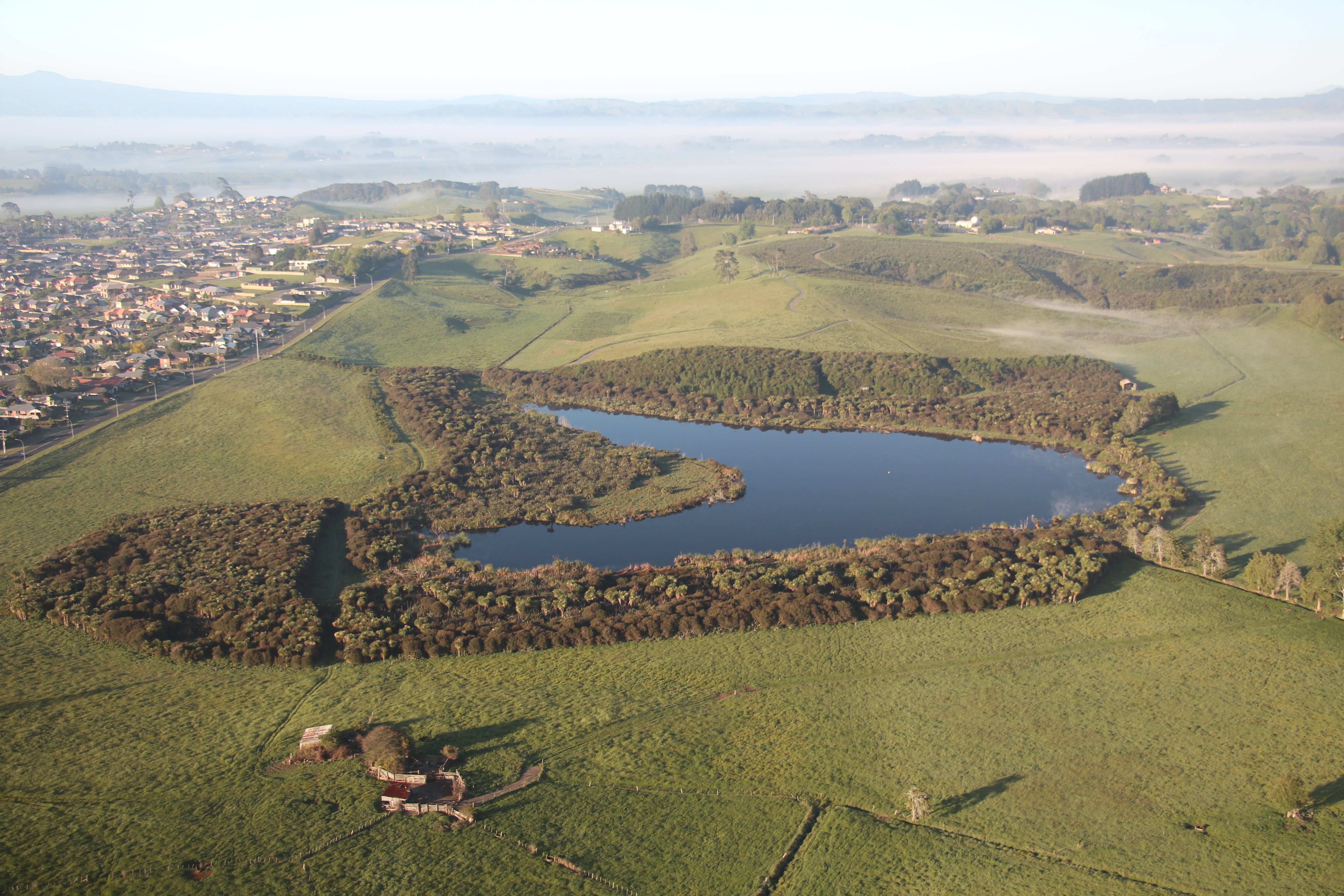
Motutapu Island is a 40-minute ferry journey from Auckland City. Map: Department of Conservation

Restoration project

Planning of the ecological restoration program is undertaken by the Natural Heritage Committee of the Trust, a group of some 15 volunteers who meet monthly to plan, and discuss implementation. Members are highly qualified, skilled and enthusiastic practitioners. Together the committee  brings sound ecological theory and practice to the  restoration of flora and fauna. Published plans they work from include the 1994 Motutapu Restoration Working Plan and subsequent 2010 audit.

The objective is to return the island forest and wetland ecosystems to a post-eruption state, with a goal of reaching 500 ha of restored forest and wetland over coming decades. Although this area is far less than the full area of the island, it allows the conservation of cultural and archaeological sites, such as pā, WWII infrastructure, and farming landscapes. The post-eruption state can be described as lowland mixed broadleaf/podocarp forest, with a suite of seabirds, waders, forest birds, reptiles, bats and invertebrates interacting with each other so that natural evolutionary processes can once more resume for these taxa on the island.

Implementation of the ecological restoration of Motutapu has been underway for 23 years, since the formation of the Motutapu Restoration Trust (MRT) in 1994. To date,  in excess of 100 ha of pasture has been converted  to pioneer forest representing an estimated 450,000+ trees  planted. Volunteer hours total 21,462 between  2005 and 2015, and is currently in excess of 3,200 hours annually.

The major activities of the ecological restoration are:

  • Seed collecting from the island and wider Auckland region
  • Plant propagation in the island nursery – year round
  • Planting in the winter months
  • Weeding year round
  • Fauna translocation and monitoring (birds, reptiles, fish and crustacea) in conjunction with DOC

Planters in action: Photo: MRT

15,136 plants went into Hospital B paddock; one of the most difficult planting sites on the island.
Photo: MRT

Home Bay forest, with Motuihe Island and the Auckland mainland in the background. Photo: MRT

Revegetation. The original strategy (1994 – 2009) was to initiate successional processes by planting pioneer phase species, which would later give way to mature phase species dispersed naturally by birds. However, it was realized that mature phase species would be slow to arrive, as the island is isolated from native forests on nearby islands and seed dispersal from them is unlikely. If seed is dispersed from its own remnant forests, any new forest will continue to reflect the depauperate nature of these remnants.

In 2010, the planting strategy was updated to include enrichment planting of mature phase forest species into the forests planted up to 15 years earlier. Seeds for this were eco-sourced from the wider Auckland region, within boundaries agreed with DOC, and brought to the island nursery for propagation. This was an opportunity to return species to the island that are currently absent, including Swamp Maire (Syzygium maire), Tree  Fuchsia (Fuchsia excorticata),  Pigeonwood (Hedycarya  arborea), White Maire (Nestegis lanceolata), Black Maire (N. cunninghamii), Turepo (Streblus  banksii) and a number  of podocarps including Matai (Prumnopitys taxifolia), Miro (P. ferruginea) and Rimu (Dacrydium cupressinum).

The project has a large nursery, operated by one full time volunteer and supported by other volunteers during the week and weekends. The nursery provides all the plants for the planting programme. Seed is collected by a small team of collectors who travel Auckland’s and the Island’s forest remnants for seeds all year round. Growing media is supplied pro bono by Daltons and Living Earth and delivered by DOC boat. The risk of importing the introduced pests Rainbow Skink (Lampropholis delicata) as eggs and Argentine Ant (Linepithema humile) precludes bringing potted plants onto the island.

Weeds such as Woolly Nightshade (Solanum mauritianum),  Moth  Vine (Araujia  sericifera), Evergreen  Buckthorn (Rhamnus alaternus), Apple of Sodom (Solanum linnaeanum), pampas (Cortaderia  spp.), and Boneseed (Chrysanthemoides monilifera) have been  present on the  island for many years, and in pasture had been kept in check by grazing. However, when pasture is retired, populations of these weeds  explode and threaten the plantings on not only Motutapu  Island, but also by dispersal to neighbouring Hauraki Gulf Islands. In particular, Rangitoto Island is threatened by invasion of weeds from Motutapu.

Weeding of the planted forests takes place in a strategic and planned way year round. Volunteers routinely grid search the plantations and control the infestations (using the hip chain method). Sources of reinfestation on other parts of the island are addressed by contractors who have the training to get at inaccessible weeds (e.g., cliff faces). New drone technology is in the process of being recruited to  identify infestations of weeds  from the  air, where they cannot be seen from the ground, or where access is particularly hazardous (e.g., cliff faces).

Pest species management. The suite of mammalian predators and herbivores on the Island prior to 2009 were detrimental to both flora and fauna, and their continued presence would have meant that neither locally extinct bird and plant species could be reintroduced, nor palatable plant species thrive.  These pests included: rats (Rattus rattus,  R. norvegicus, R. exulans); House Mouse (Mus musculus); Stoat (Mustela erminea); feral Cat (Felis catus); Hedgehog  (Erinaceus  europaeus occidentalis) and the European Rabbit (Oryctolagus cuniculus).

The successful eradication of pests from Motutapu and Rangitoto Islands was undertaken by DOC in 2009 using helicopters to disperse broadifacoum. DOC employs a biosecurity ranger on the island who responds to any new rat, stoat or other incursions.

Recent arrivals of North Island brown kiwi bring the total to 26, closer to the target of 40 required for a founder population. Photo: MRT

Further releases of takahē will bring the breeding
pairs to a total of 20, the largest total outside Fiordland. Photo: MRT

Faunal translocations. A major milestone was the declaration in 2011 of pest-free status for the Island, and the subsequent re-introductions of birds and aquatic taxa that this allowed.

The island’s pest-free status gives safe refuge to some of New Zealand’s rarest bird species. Since it became pest-free, the following rare, endangered and non-threatened species have been translocated:

  • Coromandel Brown Kiwi (Apteryx mantelli)
  • Takahē (Porphyrio hochstetteri)
  • Tīeke (Philesturnus rufusater)
  • Shore Plover (Thinornis  novaeseelandiae)
  • Whitehead (Mohoua albicilla)
  • Pāteke (Anas chlorotis)
  • Redfin bully (Gobiomorphus huttoni)
  • Koura (Paranephrops planifrons)

Survey and Monitoring.  Annual surveys of terrestrial birds and shorebirds by the Ornithological Society of New Zealand have been undertaken since 2007. As well,  a survey of seabirds nesting on the island is underway, and monitoring of translocated birds by MRT volunteers in association with DOC is ongoing. Stream fauna and reptiles are surveyed and reported on annually by DOC.

The Island’s native and exotic plants are also being surveyed to ascertain progress of the recovery over time, and plant survival rates have been monitored informally via regular tours of the plantings to assess what is working and what is not.

Evidence that recovery processes are securely occurring on the island

It is clear that the 100ha of restored vegetation has resulted in natural processes of vegetation recovery occurring, with natural regeneration evident for many species. Once the fruiting forest is fully established on Motutapu Island we envisage that it will be fully self-sustaining via seed dispersal by frugivorous birds.

Populations of fauna, with four exceptions, appear to be self-sustainable on Island. Many of the reintroduced bird species are clearly reproducing on the island and populations are growing without human intervention as evidenced by our bird surveys. The exceptions are Shore plover and Pāteke which naturally disperse away from the Island, necessitating several translocations to ensure the populations build to create a resident population, and are viable. Kiwi and Takahē populations are still being built up to founder population size.

 Bird species (terrestrial diurnal including waders):

  • an increase from 50 species in 2010 to 60 in 2015
  • Re-introduced populations expanding: Takahē, Whitehead,  Tīeke
  • Self-introduced or now detectable: Kākāriki (Cyanoramphus novaezelandiae), Bellbird (Anthornis melanura), Spotless Crake (Porzana tabuensis), Little Blue Penguin (Eudyptula minor), Banded Rail (Gallirallus phillipensis), Grey-faced Storm Petrel (Pterodroma macroptera  gouldi).

Reptiles: Population and range expansions of the four native and one introduced species. The following are the natives:

  • Common Gecko (Woodworthia maculatus): up to ten-fold at some sites since 2008
  • Suter’s Skink (Oligosoma suteri): up to a hundred-fold at some sites since 2008 baseline
  • Copper Skink (Cyclodina aeneum): up to ten-fold at some sites since 2008 baseline
  • Moko Skink (Oligosoma moco): up to ten-fold at some sites since 2008

Fish:

  • Giant kokopu (Galaxius argenteus) now

Secure engagement with local  stakeholders.

There are a number of stakeholders that are fully engaged in the project through the MRT,  including:

  • Department of Conservation – MRT’s partner since the inception of the Trust in 1994, which has been responsible for some of our biggest milestones, such as the eradication of mammalian predators 2009-2011.
  • Motutapu Farms Ltd – leases the pasture from DOC to farm beef and sheep, becoming Auckland’s largest Another long-standing partner, helping the ecology of the island and wider Hauraki Gulf by farming organically.
  • Ngāi Tai ki Tamaki – the iwi who have mana whenua on the island and give their blessing to reintroduced fauna
  • Ngāti Paoa & Ngāti Tamaterā – Coromandel iwi who are kaitiaki of the North Island Brown Kiwi (Coromandel  subspecies) on
  • Motutapu Outdoor Education Centre (MOEC)  – use the island for accommodation of school groups gaining outdoor
  • Pāteke recovery
  • Takahē recovery group
  • Auckland Zoo – monitoring the populations of Redfin Bully ( Gobiomorphus huttoni) and Koura (Paranephrops planifrons).

Contact : Liz Brooks, Manager, Motutapu Restoration Trust, Newmarket, Auckland 1149, New Zealand.  Tel: +64 9 455 9634; PO Box 99 827; Email:  liz@motutapu.org.nz

Landscape-scale terrestrial revegetation around the Coorong, Lower Lakes and Murray Mouth, South Australia

Hafiz Stewart, Ross Meffin, Sacha Jellinek

Key words. Restoration, prioritisation, woodland, ecosystems

Introduction. Located in South Australia at the terminus of the Murray-Darling River, the Coorong, Lower Lakes and Murray Mouth (CLLMM) region has immense ecological, economic and cultural importance. The landscape varies from the low hills of Mount Lofty Ranges in the northwest, through the low valleys and plains surrounding Lake Alexandrina and Lake Albert, to the plains and dunes of the Coorong in the southeast (Fig 1). These landforms had a large influence on the composition of pre-European vegetation communities in the region, with the Mount Lofty Ranges dominated by eucalypt forests and woodlands, the lakes surrounded by a mixture of mallee, temperate shrublands and wetland vegetation, and the Coorong supporting coastal and wetland vegetation communities.

The region has been extensively cleared since European settlement and the introduction of intensive agriculture (cropping and grazing), so that now only a fraction of the original native vegetation remains. This has resulted in a substantial decline in biodiversity and recognition of the area as a critically endangered eco-region. These impacts have been compounded by water extraction upstream and anthropogenic changes to hydrological regimes. The recent drought further exacerbated these environmental problems and severely affected the region’s people and economy.

Fig. 1. The Coorong, Lower Lakes and Murray Mouth region showing terrestrial and aquatic plantings.

Figure 1. The Coorong, Lower Lakes and Murray Mouth region showing terrestrial and aquatic plantings.

Broad aim and any specific objectives. In response to drought and other issues affecting the region the Australian and South Australian governments funded the landscape-scale CLLMM Recovery Project (2011 – 2016). This project aims to help restore the ecological character of the site and build resilience in the region’s ecosystems and communities. As a part of this, the CLLMM Vegetation Program aimed to strategically restore native vegetation to buffer and increase the connectivity of existing remnants.

Works undertaken. Three key tools were utilised to achieve these goals. First, an integrated Landscape Assessment was used to identify priority plant communities for restoration in the region. To do this, we classified vegetation types occurring in the CLLMM landscape, then identified suites of bird species associated with each vegetation type. The status and trends of each of these bird species were then used as indicators to determine the conservation priority of each vegetation type. Second, a framework was developed to identify the most appropriate vegetation types to reconstruct at a given site, depending on characteristics such as soil type and landform. This was based on the composition and structure of remnant communities and their associated environmental settings. Finally, a Marxan analysis was conducted across the region to prioritise sites for restoration works based on the aims of the program, with an aspirational target of restoring 30% of each priority vegetation type. Following an expression of interest process that made use of existing networks in the local community and the traditional owners of the CLLMM and surrounding area, the Ngarrindjeri, prioritised sites were then selected from those made available by landholders.

For each site, we developed a plan specifying the site preparation required, and species and densities to be planted. Native plants were sourced from local nurseries, ensuring that provenance and appropriate collection guidelines were followed. Tubestock was used to provide an opportunity for social benefits, including the development of community run nurseries, and due to their higher survival rates. Planting was carried out by regional contractors engaged by the CLLMM Recovery Project Vegetation Program, along with the Goolwa to Wellington Local Action Planning association and the Ngarrindjeri Regional Authority. During this program wetland restoration was also undertaken through the planting of a native sedge species, the River Club Rush (Schoenoplectus tabernaemontani), which assisted in stabilising shorelines and creating habitat for aquatic plant communities.

Results to date. By the end of the program around 5 million native plants will have been planted at 148 sites on private and public land covering more than 1,700 hectares (Fig. 1). In total 202 species of plants have currently been planted, comprising 11% overstorey, 38% midstorey and 51% understorey species. Initial results indicate that around 66% of plants survive the first summer, at which point they are well established. Woodland and mallee bird species are starting to use these revegetated areas. When compared to remnant areas of the same vegetation type, both native plant species richness and bird diversity are lower in restored habitats. However, while the bird communities in restored habitats are dominated by generalist species, specialist species such as endangered Mount Lofty Ranges Southern Emu-Wrens have been recorded in revegetated areas, providing early signs that planted areas are benefiting rarer species. The restored communities are still very young, and over time we expect these areas will start to structurally resemble remnant habitats.

Lessons learned and future directions. Resourcing of research alongside program delivery allowed us to implement a sound prioritisation process and a systematic, strategic, and effective approach to the restoration of the landscape. The capacity to collect good vegetation, soil and bird occurrence data was crucial to this. Successful delivery also required funding for site preparation and follow-up, a well-developed network of native plant nurseries, engaged community and indigenous groups, and good relationships with local landholders.

Stakeholders and Funding bodies. The CLLMM Vegetation Program is a landscape scale habitat restoration project, jointly funded by the Australian and South Australian governments under the Coorong, Lower Lakes and Murray Mouth Recovery Project. We would like to thank the Goolwa to Wellington Local Action Planning Association, the Milang and Districts Community Association and the Ngarrindjeri Regional Authority for their assistance in undertaking this revegetation. DEWNR’s Science, Monitoring and Knowledge branch undertook the initial ecosystem analysis.

Contact information.  Hafiz Stewart, Department of Environment, Water and Natural Resources, South Australia. Hafiz.stewart@sa.gov.au