Category Archives: Rainforest

Crowdy Bay National Park, NSW – Assisted regeneration of a littoral rainforest patch post 2019-20 summer wildfire

Figure 1. Volunteers at the initial working bee in the burnt littoral rainforest.

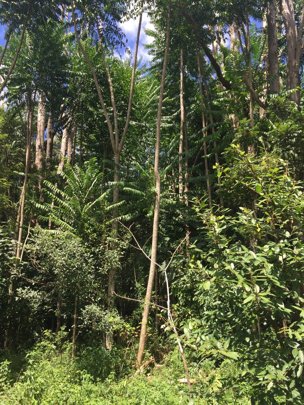
Introduction. Crowdy Bay National Park is located on the NSW Mid-north coast and comprises coastal landscapes, some of which have were sand mined prior to the area’s acquisition for conservation in the 1970s. Littoral rainforest remnant and regrowth patches occur within the Park and are listed at State level and as Endangered Ecological Community and at national level as a Threatened Ecological Community. The rainforest community type forms in the dune swales, protected by Coast Banksia (Banksia integrifolia) and is dominated over time by Tuckeroo ( Cupaniopsis anacardioides) and Beach Alectryon (Alectryon coriaceus), with other rainforest co-dominants and associated shrubs, vines and groundcovers.

For over four decades,  a regeneration program has been carried out in the park by volunteers working through the National Parks Association (NPA), Mid North Coast Branch. This short summary refers to the condition of one floristically diverse littoral rainforest patch at Kylie’s Beach, half of which was burnt in a spot-wildfire in late 2019 and in which weed managment works commenced 2 years prior to the wildfire due to pre-existing weed issues (Fig 1).

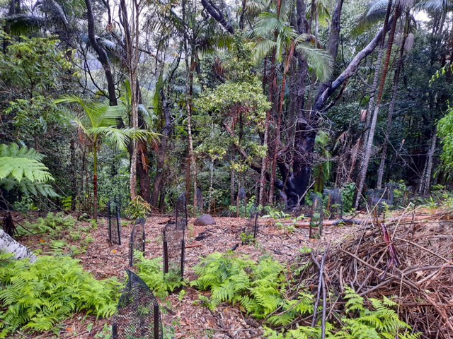
The wildfire and early recovery. The wildfire burnt all the banksias on the foredune crest that were providing wind protection for the littoral rainforest, as well as 1ha of the littoral rainforest. It left the ground layer beneath both areas largely bare. In the areas burnt, all trees appeared dead. With rainfall occurring soon after the fire, post-fire coppicing of rainforest trees and Banksia commenced; with germination of native seedlings occurring with the arrival of heavy rains in December 2020 -January 2021. By mid-autumn 2020 the northern foredune section was thickly covered with colonising Blady Grass (Imperata cylindrica) that provided cover for other successional natives (Fig 2) .

Weed recovery, however, was very rapid. As early as May 2020, the site was a sea of annuals, with abundant Lantana (Lantana camara), Coastal Morning Glory (Ipomoea cairica), Cape Gooseberry (Physalis peruviana), Crofton Weed (Ageratina adenophora) and scatterings of Cape Ivy (Senecio mikanioides) and Tobacco Bush (Solanum mauritianum). Volunteers were at a loss to see how the site could be helped to regenerate. Not having previously worked in a burnt rainforest, the first though was to take out all the weeds. Under the guidance of retired regenerator Tom Clarke from the Australian Association of Bush Regenerators (AABR) however, a different approach was taken.

Figure 2. Blady Grass has covered much of the floor.

Works undertaken. Commencing in May 2020 Sue Baker from NPA and Tom Clarke from AABR conducted monthly working bees to strategically remove weeds. The approach was to  regard the weeds as the new canopy cover and primary colonisers, providing invaluable shade and moisture retention for the regenerating rainforest species. It was agreed that the main initial objective was to see the re-establishment of a canopy, however low, to protect the ground moisture levels and any recovering herb layer. At this point any woody weeds were considered allies in that they were resprouting along with many native pioneer species. Treatment of woody weeds was selective and dependent upon direct competition with native plants. Instead, treatment of weed vines and creepers was targeted, with removal of Morning Glory and Cape Ivy a priority, at least to the edge of the burnt zone.

Subsequently, apart from preventing the spread of Cape Ivy and removing dense infestations of fruiting Cape Gooseberry, the method was to remove weeds only where they were competing with native seedlings with as much removal of their fruits and seeds as possible, followed by thinning out later where helpful. By January 2021, native ground cover had recovered sufficiently to remove the annuals, some of which were 2m high. Over time, the selective treatment of woody weeds has continued as more and more native regen appeared. By taking this approach we have left nature largely to do its own thing with minimal detrimental impact from weeding.

In addition, we have taken the view that the wildfire was not soley a negative; it has also provided an opportunity to address some of the long-standing weed issues in the broader area of Kylie’s Beach including that of Glory Lily (Gloriosa superba) and Golden Wreath Wattle (Acacia saligna) which the fire stimulated to germinate from the soil seed bank in their thousands.

As well as the weed management work, over a kilogram of native seed was broadcast in mid-summer 2020 in the hope it might improve recovery of the ecosystem.

Volunteer visits. After a site inspection tour on 14th May 2020 there have been at least 17 visits to Crowdy Bay National Park where regeneration works has been carried out, not only in the littoral rainforest, but also in the broader Kylie’s beach area. These occurred in May (1 visit), July (3 visits), August (4 visits involving 12 volunteers), September (2 visits), October (4 visits), November (1 visit) and lately in January 2021 (2 visits).

Figure 3. Tuckeroo coppicing from the burnt stump.

Figure 4. Lillypilly coppicing.

Results to date.  The site has demonstrated itself to have high levels of native resilience, having been in relatively healthy condition apart from per-existing weed infestations. High levels of rain in the 2020-21 summer has promoted extensive and vigorous growth. At February 2021, the forest floor was a carpet of native vegetation and some areas knee-high in dense native grasses. Less care in selecting woody weeds for treatment is now required.

Much of the regeneration is from germinating seeds but some has been from re-sprouting rootstocks, resprouting stems or coppicing from the bases of trees, including rainforest trees (Figs 3 and 4) although some large trees are dead  (See Table 1). With the assisted regeneration work (i.e. strategic weed removal post-fire) the site is quickly shifting from a predominantly weed-dominated post-fire succession to one dominated by native plants.

There is no evidence that the sown seed has yet contributed to the regeneration at this stage.  Native regeneration was occurring across the area prior to the date when germination of sown seed would be expected and it is now clear that additional seed was not required.

Plans for ongoing management.  The continued wet and humid conditions in summer 2021 have provided highly favorable conditions for regeneration. During 2021 the volunteers will try to keep up with the work at Kylie’s Beach through regular bush regeneration camp outs (as organised for many years, except 2020 which was cancelled due to COVID-19 restrictions). Work plans for the next camp-out have been scheduled to include the Kylie’s Beach littoral rainforest site and will include follow-up treatment of vines and Crofton Weed. Full recovery is likely to take years as the recovery process moves at its own pace.

Two major issues remain – dense ground and canopy cover of coastal morning glory in the area will need meticulous treatment. Also an entire drainage line on the steep, rocky cliff face behind the dune is densely infested with Crofton Weed that must be left in place to stabilize the slope until sufficient native cover takes hold. Volunteers were able to remove flowers from the Crofton Weed for a certain distance up the slope. Contractors will be needed in 2021 to deal with the upper slope.

Acknowledgements: We thank the organisation and leadership of NPA group.  The fact that this was already in place prior to the fire, was a key to the success of the work to date. This group has an outstanding history and connection with many sites in the Park over many years. The linking of AABR to the project provided additional support in project design and facilitating additional volunteer from the ABBR network for the post-fire restoration side of the program.

Contacts:  Tom Clarke AABR 0418411785 and Sue Baker (NPA MNC branch)

Table 1. Kylie’s Beach Littoral Rainforest Post Fire Restoration  – responses of native and exotic species (Exotics marked with an asterisk)

Scientific name Common name Response of the species at this site Notes
Grasses
Imperata cylindrica Blady Grass Resprouted Dominating burnt floor devoid of canopy
Oplismenus aemulus Basket Grass Resprouted and germinated Near edge of existing canopy
Ehrharta erecta* Panic Veldtgrass Germinated Hillside on open ground near crofton weed
Eriochloa procera Spring Grass Germinated Near edge of existing canopy
Scramblers and Climbers
Marsdenia flavescens Hairy Milk Vine Resprouted and germinated At edge of existing canopy
Senecio mikanioides* Cape Ivy Resprouted Remnants creeping through grasses, has been heavily targeted.
Ipomoea cairica* Mile-a-minute Resprouted and germinated Existing condition taking advantage, targeted for weeding
Desmodium sp. (varians?) Desmodium Germinated Carpeting over slope to dune swale
Glycine sp. (tabacina?) Love Creeper Germinated Carpeting over slope to dune swale
Sarcopetalum harveyanum Pearl Vine Resprouted and germinated Near edge of existing canopy.
Stephania japonica Snake Vine Resprouted and germinated Near edge of existing canopy or large remnant structures
Dioscorea transversa Native Yam Resprouted Near edge of existing canopy or large remnant structures
Passiflora edulis* Blue Passion Flower Resprouted and germinated Single isolated plant. Previously overlooked?
Rubus parvifolius Native Raspberry Resprouted and germinated Creeping through rank grasses
Cayratia clematidea Slender Grape Resprouted and germinated Creeping through rank grasses
Cissus antarctica Kangaroo Grape Resprouted Mostly at edge of existing canopy.
Tetrastigma nitens Three-leaved Water Vine Resprouted Near edge of existing canopy
Flagellaria indica Whip Vine Resprouted Isolated individuals searching for structure
Geitonoplesium cymosum Scrambling Lily Resprouted Creeping through rank grasses
Smilax australis Austral Sarspariila Resprouted Moving into grass floor plus climbing burnt structures.
Ground Covers and Herbs
Hydrocotle bonariensis* Pennywort Resprouted Associated with commelina in low swale
Commelina cyanea Scurvy Weed Resprouted Feature of low swale within open floor area; also underneath grasses.
Melanthera biflora Melanthera Resprouted Carpeting top of rise from dune swale
Tufted Plants
Crinum pedunculatum Swamp Lily Resprouted Seaward edge to dune swale
Dianella congesta Coastal Flax Lily
Lomandra longifolia Mat Rush Resprouted and germinated Isolated individuals, seedlings and survivors
Ficinia nodosa Knobby Club-sedge Resprouted Seaward side pushing up from dune swale below
Cyperus sp. (sanguinolentus?) Sedge Resprouted Associated with commelina etc in swale near False Bracken
Alocasia brisbanensis Cunjevoi Resprouted Scattered near edge of existing canopy or structures.
Ferns
Doodia aspera Rasp Fern Resprouted Mostly near edges of existing canopy
Pellaea falcata Sickle Fern Resprouted Mostly with grass at edge of existing canopy
Calochlaena dubia False Bracken Fern Resprouted Dense patches on floor adjacent to Blady Grass
Dicksonia antarctica Treefern Resprouted Unaffected individuals near edges
Shrubs
Acacia longifolia (var. sophorae?) Golden Wattle Germinated Seedling growth mostly seaward edge of floor.
Breynia oblongifolia Coffee Bush Germinated Isolated individuals from seedlings
Banksia integrifolia Coastal Banksia Resprouted and germinated Coppicing from burnt stumps plus seedlings
Physalis peruviana* Cape Gooseberry Rampant pioneer exotic targeted for weeding
Solanum nigrum* Blackberry Nightshade Germinated Rampant pioneer exotic targeted for weeding
Lantana camara* Lantana Resprouted Rampant pioneer exotic targeted for weeding
Poyscias elegans Celerywood Germinated Scattered seedlings
Trema tomentosa var. viridis Native Peach Germinated Pioneer from seedlings; competing well
Conyza sumatrensis* Tall Fleabane Germinated Rampant pioneer exotic targeted for weeding
Notelea venosa? Mock Olive Resprouted Coppicing from burnt stump.
Bidens Pilosa* Cobbler’s Pegs Germinated Rampant pioneer exotic targeted for weeding
Phytolacca octandra* Inkweed Germinated Isolated patches
Ageratina Adenophora* Crofton Weed Resprouted and germinated?? Isolated patches on floor plus large, dense infestation covering hillside soak
Chrysanthemoides monilifera* Bitou Bush Resprouted and germinated Isolated individual plants
Trees
Cupaniopsis anacardioides Tuckeroo Resprouted and germinated Coppicing from burnt stumps plus seedlings
Wilkiea huegeliana Wilkiea Resprouted Coppicing from burnt stumps
Homalanthus populifolius Bleeding Heart Germinated Pioneer from seedlings; competing well
Alectryon coriaceus Beach Tamarind Resprouted Coppicing from burnt stumps.
Solanum mauritianum* Tree Tobacco Germinated Pioneer exotic targeted for weeding
Ficus rubiginosa Port Jackson Fig Resprouted Coppicing from burnt stumps
Laurel type Coppicing from burnt stumps
Synoum glandulosum Scentless Rosewood Resprouted Coppicing from burnt stumps

Post-wildfire recovery at a wet sclerophyll/rainforest ecotone close to housing at Wanganui NSW

Joanne Green

Introduction. The Mt Nardi fire, on Wed 13th Nov 2019, provided an opportunity to observe the effects of a relatively low intensity burn at a wet sclerophyll/rainforest ecotone on an 18 acre rural residential property at Wanganui, NSW.

Prior to the fire the vegetation had not been burned for 50 years and was dominated by Brush Box (Lophostemon confertus), Red Bloodwood (Corymbia gummifera) and Forest Oak (Allocasuarina torulosa) –  with a mesic understory of rainforest species including Red Bopple Nut (Hicksbeachia pinnatifolia ), Jackwood (Cryptocarya glaucescens), Bangalow Palm (Archontophoenix cunninghamiana)  and  Tree Heath (Trochocarpa laurina).  The forest was on a trajectory from wet sclerophyll towards a palm-dominated forest.

Since the fire,  the recovery has reset the ecosystem to a wet sclerophyll community with a diversity of heathy species in the understorey, although there is also massive germination and resprouting of rainforest species that indicates that the rainforest understorey will return over time. Table 1 at the end of this summary shows the recovery of both sclerophyll and rainforest species, and their presence or absence above ground prior to the fire.

Figure 1. Dead Bangalow Palm amid a sea of Brown Kurraong seedlings post fire. (Photo: J. Green)


Figure 2. Resprouting saplings of (a) Bolwarra and (b) Creek Fig (Photo J. Green)

Mortality and recovery.

Resprouting:  The fire varied in intensity as it burned downslope. The highest intensity was at the edge of the National Park at the highest elevation above a rocky face. Turpentine (Syncarpa glomulifera), Lomandra (Lomandra longifolia), heath species and younger trees appeared to be killed by fire. While Turpentine has not yet resprouted, Lomandra has resprouted and heath species such as Acacia and Zieria have regrown from seedlings.  Bangalow Palms (Archontophoenix cunninghamiana) are completely dead wherever the fire burned to their tops (growing points) and perhaps many more are dying, indicated by the presence of a fungus on their trunks. One tall Brushbox (Lophostemon confertus) is completely dead.

A community with old growth Forest Oak (Allocasuarina torulosa) is further downslope closer to the rainforest lined creek. The roots system of these trees, burned under the ground and the fire could only be doused by digging out the peat-like root system. Some of the Forest Oaks died but most have recovered.  Taller canopy trees of rainforest and sclerophyll species died back but are resprouting. Midstorey trees, less than 8m, are largely dead, dying or resprouting from the base (coppicing).  The trunks are completely dead but there are many root suckers of species such as Jackwood (Cryptocaryia glaucescens), Bolwarra (Eupomatia laurina), Grey Possumwood (Quintinia verdonii) and the rare Red Bopple Nut (Hickbeachia pinnalifolia).

Treeferns such as Cyathea australis, C. cooperi and C. leichhardtiana were the first resprounters and ground ferns such as Soft Bracken (Hypolepis muelleri) are proliferating following the  rain since the fire event.

Figure 3. Proliferation of rainforest pioneers germinating after fire including Poison Peach (Trema aspera), Pencil Cedar (Polyscias murrayi) and Bleeding Heart (Homolanthus populifolius). (Photo J. Green)


Figure 4. Heath species such as Zieria (Zieria smithii) pictured at the right. germinated alongside rainforest species despite not being in the previous above-ground flora. (Photo: J. Green)

Seed germination: Rainforest species germinating included: Red Cedar (Toona ciliata) , Pencil Cedar (Polyscias murrayi), Brown Kurrajong (Commersonia bartramia), Red Ash (Alphitonia excelsa) and Corkwood (Duboisia myoporoides).  Heath species recruiting included: a large amount of Tree Pea (Daviesia arborea), Zieria (Zieria smithii), Prickly Acacia (Acacia ulicifolia), and Hibbertia spp. Herbaceous species included: Forest Lobelia (Lobelia trigonocaulis),  Kreysigia (Tripladenia cunninghamii), Hairy Tree Foil Desmodium rhytidophllum and other vines of the pea family are covering large areas of the ground.

Weed regeneration

Alongside the natives,  diverse weeds are proliferating after fire, representing all growth forms. Some weed species may be playing a facilitation role for rainforest recovery, while others should be  targeted to reduce their inhibiting effect on native regeneration. Given the level of regeneration across functional groups, this community is likely to benefit from assisted natural regeneration focusing on removal of weed that is competing with native regeneration.  Where possible it is desirable to use the opportunity of the wildfire to deplete populations of weed at the site to increase the community’s resilience to future fire. No reintroductions or seed input is needed at the site.

Future directions.  Consideration needs to be made as to which ecosystem will be the target for future management.  Retaining a sclerophyll overstorey is desirable for habitat values and hence allowing replacement of those individuals that died will be important for future forest dominants.  The use of fire as a control method to control the massive germination of rainforest seedlings and Bangalow Palm dominants is under consideration. For the healthy understorey elements to remain in the soil seed bank for future regeneration would at least require their retention until they have flowered, fruited and recharged the soil seed bank.  But consideration will be given to retaining more fire-resistant rainforest vegetation on the side of the forest closer to the house to act as a fire buffer to supplement the existing 50m fuel free zone.

Contact: Joanne Green, Email jogreen909@gmail.com

Table 1.

SPECIES HABITAT TYPE PRESENCE /ABSENCE BEFORE FIRE RECOVERY MODE
Botanical Name Subtropical Rainforest = STRF, Wet Sclerophyll = WS, Dry Sclerophyll = DS P /A Seed = S, Epicormic growth = EP, Coppice = COP, R = Resprout
TREES AND SHRUBS      
Acacia ulicifolia DS P S
Acacia melanoxylon STRF P S
Acmena smithii STRF P COP
Allocasuarina torulosa WS P EP
Alphitonia excelsa STRF P S/COP
Alphitonia petrei STRF P S
Archirhodomyrtus beckleri STRF P COP
Archontophoenix cunninghamiana STRF P S/Dead
Breynia oblongifolia STRF P S
Commersonia bartramia STRF P S
Cordyline rubra STRF P COP
Corymbia intermedia WS/DS P EP
Cryptocarya erythroxylon STRF P COP
Cryptocarya glaucescens STRF P COP
Daviesia arborea WS/DS A S
Diospyros pentamera STRF P COP
Diploglottis australis STRF P COP/Dead
Duboisia myoporoides STRF P S/COP
Elaeocarpus reticulatus STRF P COP
Eucalyptus microcorys DS P EP
Eucalyptus pilularis DS P EP
Eupomatia laurina STRF P COP
Flindersia bennettii STRF P COP
Ficus coronata STRF P S/COP
Glochidion ferdinandi STRF P COP
Hickbeachia pinnalifolia STRF P COP
Homalanthus populifolius STRF A S
Jagera pseudorhus STRF P COP
Leptospermum petersonii DS P COP/S
Lophostemon confertus WS P S/COP
Macaranga tanarius STRF A S
Melicope elleryana STRF P S
Myrsine variabilis STRF/WS P S
Nematolepis squamea DS A S
Neolitsia dealbata STRF P COP
Ozothamnus diosmifolius WS/DS P S
Persoonia media WS P S
Pilidiostigma glabrum STRF P COP
Polyscias  murrayii STRF A S
Polyscias sambucifolia STRF A S
Quintinia verdonii STRF P COP
Schizomeria ovata STRF P COP
Solanum mauritanium Non – Native A S
Syncarpia glomulifera WS P COP/Dead
Synoum glandulosum STRF P COP
Trema tomentosa STRF P S
Trochocarpa laurina WS P COP
Wilkea huegeliana STRF P S
Zieria smithii  WS A S
       
VINES AND CLIMBERS      
Billardiera scandens WS A S
Geitonoplesium cymosum STRF P S
Desmodium rhytidophllum WS/DS A S
Hibbertia dentata STRF P S
Hibbertia scandens STRF/WS P S
Kennedia rubicunda STRF A S
Morinda jasminoides STRF/WS P S
Rubus moluccanus STRF/WS P S
Smilax australis STRF/WS P S
Stephania japonica var. discolor STRF P S
       
FORBES AND GROUNDCOVERS      
Alpinia caerulea STRF/WS P R
Dianella caerulea STRF/WS P R
Entolasia stricta WS P S
Gahnia appressa WS P S
Lepidosperma laterale WS P R
Lobelia trigonocaulis STRF/WS P S/R
Lomandra longifolia WS P R
Oplismenus aemulus STRF/WS P S
Oplismenus imbecillis STRF/WS P S
Oplismenus undulatifolius STRF/WS P S
Pimelea ligustrina subsp. ligustrina STRF/WS A S
Tripladenia cunninghamii STRF/WS P S/R
Viola banksii STRF/WS A S
       
FERNS      
Adiantum hispidulum STRF/WS P R
Blechnum cartilagineum WS P R
Blechnum nudum STRF P R
Cyathea australis STRF/WS P R
Cyathea cooperi STRF P R
Cyathea leichhardtiana WS P R
Doodia aspera STRF/WS P R
Hypolepis muelleri STRF P R
Pteridium esculentum STRF/WS p R
Sticherus lobatus STRF p R


Regenerating and planting of rainforest buffers to protect homes and rainforest from future fires

Joanne Green, Rainer Hartlieb and Zia Flook

Introduction. The wildfires of November and December, 2019, burnt over 5,500 hectares of Nightcap National Park and the surrounding areas, including the rural communities of Huonbrook and Wanganui inland from Byron Bay in NSW, Australia. The fires occurred during a period of extreme fire risk after 2 years with below average rainfall. They mainly burnt the sclerophyll forest along the ridgetops, but the extreme conditions also saw fire burn the edge of the rainforest where it was eventually extinguished.

This summary reports on actions on one multiple occupancy property in Huonbrook, NSW after an ember attack from the Mt Nardi fire entered the property in the early hours of the 9th November 2019. During the fire, residents evacuated.  Their homes were saved but they returned to find that the fire burnt an area of eucalypts  – mainly Flooded Gum (Eucalyptus grandis) and several bamboo species that had been planted during the late 20th century to reforest an area where subtropical rainforest had been-long cleared for dairy farming. The plantings had also become infested with weed including Camphor Laurel (Cinnamomum camphora) and Lantana (Lantana camara), the latter increasing their combustibility under dry conditions. After the fires, the landholders sought solutions that could provide a more fire-resistant barrier to reduce potential fire threat to homes and the nearby remnant rainforest. As a result they opted to restore the buffer zone with the more fire-retardant subtropical rainforest that had been the original native vegetation of the area.

Figure 1. Multiple native and weed species germinated after fire. (Photo Rainforest 4)

Figure 2. Prolific germination of the wind-dispersed Red Cedar (Toona ciliaris), among many rainforest species germinating and resprouting on site. (Photo Joanne Green)

Works undertaken. Starting in March 2020, with support from Madhima Gulgan’s Indigenous bush regeneration team, Huonbrook residents and landowners commenced work on the site. The first task in any zone to be treated was to clear the debris sufficiently to allow access for weeding and planting. The second task was to identify any subtropical rainforest species (germinating after the fire) that were to be retained and to note areas that were bare and would be suited to plantings. (No planting was done where there was any natural regeneration.)  The third task was to remove prolific exotic weeds, while protecting the natives, with the final task involving planting, staking and tree guarding.

The main weed species on site were Lantana, Running Bamboo (Phyllostachys spp.), Kahill Ginger (Hedychium gardnerianum), Winter Senna (Senna x pendula), and Inkweed (Phytolacca octandra). A total of 12 rainforest tree species germinating included the secondary species Red Cedar (Toona ciliaris) and Celerywood (Polyscias elegana) and the pioneers Red Ash (Alphitonia excelsa), Macaranga (Maccaranga tanarius) and Bleeding Heart (Homolanthus populifolius). A total of seven native rainforest understorey species  resprouted including Dianella (Dianella caerulea), Native Ginger (Alpinia caerulea.) and Cordyline (Cordyline petiolaris).

Figure 3. Madhima Gulgan’s Indigenous bush regeneration team assisting  landholders with post-fire weeding.  This work revealed where understorey natives were regenerating and where gaps required planting. (Photo Rainforest 4)

Some  300 rainforest trees (around 30 species) and another 300 understorey plants have been planted at the site to date from May-Sept 2020, with a total of 3600 plants proposed to be planted on additional fire affected sites as part of this project. Locally occurring tree species planted to date include Lillipilly (Acmena smithii), Native Tamarind (Diploglottis australis), Firewheel Tree (Stenocarpus snuatus), and Long-leaved Tuckeroo (Cupaniopsis newmanii) Understorey species planted included Dianella, Lomandra, Native Ginger and Cordyline.  All required tree guards to protect them from browsing by the native Red-necked Pademelon (Thyogale thetis).

After the planting, more natural regeneration of weed and natives occurred, particularly of the ground ferns; Harsh Ground Fern (Hypolepis muelleri), Binung Fern (Christella dentata), and Soft Treefern (Cyathea cooperi). Since the rain in autumn 2020 and the above average rainfall year that has followed, the landholders are managing weed in the regeneration and plantings together and work is now extending into the unburnt buffer zone.

Figure 4. A total of 300 containerised plants were installed to reinstate lowland subtropical rainforest on the site and provide a less fire prone vegetation buffer to protect residential dwellings. (Photo Joanne Green)

Figure 5. Diagram of location of the buffer plantation in relation to dwellings. (Diagram. Joanne Green)

Results to date: Nearly 12 months after planting has seen a nearly 100% survival rate and many of the planted trees have grown to an average height 1-2m. The number of native rainforest species on site now is approximately 25 tree and 23 understorey species and vines.  Ferns cover 40% of the site. The difference between the number planted and the number on site (18 species) can be attributed to natural regeneration.

Further colonisation of rainforest species is expected over time. Whilst, in hindsight, we see that much of the site could have been captured by natives as a result of  weed management alone, the planting has added a broader diversity of species, and will accelerate the process of succession to a more mature rainforest stand.

Acknowledgements: The Madhima Gulgan Indigenous bush regeneration team was funded by the inGrained Foundation and the Rainforest 4 Foundation. See https://www.rainforest4.org/. Technical advice was provided by Joanne Green.

Contact: Rainer Hartlieb, Huonbrook landholder, rainerhart@aapt.net.au and Zia Flook, Rainforest 4 Foundation Conservation Program Manager, zia@rainforestrangers.org

Second trial of watering device design to facilitate seed dispersal into revegetation sites

Amanda Freeman

Figure 1. Watering device on stand with camera above.

Introduction. This summary reports on methods and results of a trial to improve the design of a watering device. (See preliminary trial in EMR summary). This trial drew upon lessons learned In the “Kickstart” pasture conversion project,  (see https://authors.elsevier.com/a/1bhz81L%7EGwOHhQ) where perches and water basins were installed on two private properties in the upper Barron, Queensland, with the aim of catalysing rainforest regeneration.  The seeds of 31 species of bird-dispersed forest trees and shrubs were deposited in water basins, largely due to Pied Currawong (Strepera graculina) using the water to regurgitate seeds. The Kickstart Project demonstrated that there is potential for supplementary water to enhance seed dispersal into revegetation sites; however, the seeds regurgitated into basins in that study were not deposited in sites suitable for germination, limiting the basins’ usefulness as restoration tools.

Our 2016 EMR Project Summary described a watering device designed to overcome this problem of seed being deposited in water receptacles.  The trial was conducted at the School for Field Studies property near Yungaburra, Queensland and this summary reports the results of our trial which aimed to identify whether frugivorous birds would use our watering device. We also assessed the amount of maintenance the watering device required to function effectively.

Figure 2. A Lewin’s Honeyeater (Meliphaga lewinii) at a watering device, May 2017.

Watering Device Trial. In July 2016, three 3 x 3m plots were established in an approximately 120 x 30m area of disused pasture at the School for Field Studies property. The site was located 15m from the edge of primary rainforest on one side and adjacent to a mosaic of scattered trees, restoration plantings and secondary forest on the other three sides. Each plot had a perch, 3-4m high, cut to standard form from Sarsaparilla (Alphitonia petriei) trees. Each plot also had a watering device placed close to the base of the perch. These were commercially available automatic water dispensers used for poultry set on a 1.5m high base with a perch that allowed birds of different sizes to access water from several angles and for expelled seed to fall to the ground (Figs. 1-3).

Motion-activated cameras (Ranger Compact 2 MP) were installed above each watering device to monitor visits to the water. Apart from a total of 37 days when the cameras were removed for maintenance, the three watering devices were monitored from 22 July 2016 to 13 December 2018 when the trial ended. In the analysis, continuous series of images of one or two birds at a watering device were treated as one visit by that species.

The three plots with a perch and watering device were interspersed with plots that only had a perch or had no structures at all. Apart from within the plots and a narrow access track between them, grass and woody vegetation were not controlled in the surrounding disused pasture.

Figure 3. A Victoria’s Riflebird (Ptiloris victoriae) at a watering device, October 2016.

What we found. Eighty-six visits by three frugivorous bird species were recorded across the three watering devices over the course of the trial. Ninety percent of visits were during the late dry seasons (September-November). One watering device was visited much more often than the others, receiving 70% of all visits. The other two watering devices received 20% and 10% of visits respectively (Table 1).

One bird species, the generalist Lewin’s Honeyeater (Meliphaga lewinii), was by far the most frequent visitor to the watering devices, making up 80% of frugivore visits (Fig. 2). Victoria’s Riflebird (Ptiloris victoriae) was the next most frequent visitor (14% of visits, Fig. 3) and Little Shrikethrush (Colluricincla megarhyncha) was the least frequent visitor (6% of frugivore visits). The only other species that used the watering devices was the Olive-backed Sunbird (Nectarinia jugularis) for which five visits were recorded. All species were recorded drinking from the watering devices. Only the Olive-backed Sunbird could bathe in the small water outlets and were recorded doing so on three occasions.

The watering devices required little maintenance over the 2.5yrs they were deployed. Water was replenished when needed at roughly six-monthly intervals and the water outlets, which collected debris and algae, were cleaned monthly. The devices had no noticeable deterioration at the end of the study.

Table 1. Number of frugivorous bird visits to three watering devices in disused pasture, 22 July 2016 to 13 December 2018.

  1 2 3 Total
Lewin’s Honeyeater Meliphaga lewinii 51 8 10 69
Victoria’s Riflebird Ptiloris victoriae 6 0 6 12
Little Shrikethrush Colluricincla megarhyncha 3 1 1 5
Frugivorous bird visits 60 9 17 86

Conclusions. Our watering devices were only used by three frugivorous bird species, most frequently by the Lewin’s Honeyeater a dietary generalist. Generalist avian frugivores tend to move mainly in more open habitats enhancing the dispersal of pioneer or non-forest trees across the landscape rather than carrying seeds from remnant forest into pasture.

Bird use of the watering devices was highly variable and largely confined to the late dry season when rainfall is low, and temperatures are warm to hot. These are poor conditions for germination and plant growth and likely limit recruitment of dispersed seeds.

Despite these limitations, watering devices are a low-cost intervention that may augment perches and attract frugivorous birds, thereby accelerating forest regeneration. The watering devices deployed in this trial did not collect seed, preserving the potential for seed to be dispersed. They required little maintenance and proved suitable for prolonged outdoor use. Watering devices warrant further investigation. 

Acknowledgements. Thanks to William (Bill) Johnson and John Hall for designing the watering device stand and camera attachment and preparing and maintaining the plots. The School for Field Studies funded the trial.

Contact. Amanda N. D. Freeman. Nature North, PO Box 1536, Atherton, Qld, 4883 Australia. The School for Field Studies, Centre for Rainforest Studies (PO Box 141, Yungaburra, Qld 4884 Australia; Tel: +61 (0) 438 966 773; Email: amandafreeman@naturenorth.com.au).

See also EMR project summary on the preliminary trial of this project: https://site.emrprojectsummaries.org/2016/11/02/a-water-point-design-to-facilitate-seed-dispersal-into-revegetation-or-pasture-sites/

Ecological Restoration of Donaghys Corridor, Gadgarra, north Queensland – UPDATE of EMR feature

Nigel Tucker

[Update of EMR feature – Tucker, Nigel I. J. and Tania Simmons (209) Restoring a rainforest habitat linkage in north Queensland: Donaghy’s Corridor, Ecological Management & Restoration, 10:2, 98-112, https://onlinelibrary.wiley.com/doi/10.1111/j.1442-8903.2009.00471.x]

Keywords: Rainforest, corridor, regeneration, disturbance effects

Introduction. Complex notophyll vine forests of the Atherton Tablelands, particularly from basalt derived soils, have been significantly fragmented and degraded by human settlement over a 100yr period. Fragment isolation results in edge effects, exotic species colonisation, loss of genetic variability and species decline. During high rainfall events, eroding streambanks on farms mobilise sediments to the receiving environment of the Great Barrier Reef. Re-connecting isolated fragments to larger forest blocks through restored riparian corridors aims to reverse these effects through adaptive management. The restoration of Donaghys Corridor is an example of adaptive management, and its establishment was a key factor in the adoption of other local corridor projects.

As reported in the 2009 features, around 20,000 plants of selected local species were established in four yearly plantings (1995/96/97/98) along Toohey Creek, creating a continuous habitat corridor between the isolated Lake Barrine fragment (500ha) and the adjacent Gadgarra section of Wooroonooran N.P (80,000ha), both being part of the Wet Tropics World Heritage Area. The corridor is 1,200m in length and 100m wide, with three rows of Hoop Pine (Araucaria cunninghamiana) planted either side of the fenced corridor, which was established on lands largely owned by the Donaghy family. On completion, the corridor was secured through the Queensland Government’s declaration of Donaghys Corridor Nature Refuge, the State’s first Nature Refuge proclaimed over an ecologically restored site.

Ongoing recovery. In 2000, a vegetation survey of 3m x 5m plots in 12 permanent transects throughout the corridor showed regeneration had occurred upon canopy closure (Tucker and Simmons 2009).  Between 1995 and 1998, 119 native species had regenerated within the transects, mainly through vertebrate-mediated dispersal. The most recent (ongoing) survey, ca.20yrs after planting, indicates that regeneration has continued, and the majority of regenerating species are again vertebrate dispersed. There has also been a measurable increase in vegetation structural complexity, and a variety of life forms are present including ferns, orchids, vines, scramblers and canopy trees.

Restored vegetation in 2000 was characterised by vegetation of even age and size classes and only a developing canopy was present (no sub-canopy). Recruitment was limited to the ground storey. Over 20yrs, total numbers of recruiting species have increased, along with canopy height, and the sub-canopy is now a distinguishable and measurable feature. To illustrate this change, species diversity and structure in two typical transects from the oldest (1995) and youngest (1998) plantings are shown in the table below. Figures are from the most recent survey (2019) and the bracketed numbers indicate comparative values in 2000.

Canopy

height

Sub-canopy

Height

Number of species Average number of species/plot Average number of species/plot – sub-canopy Average number of species/plot – ground storey
1995 19.9 (5) 7.5 (0) 84 (53) 22.6 (12.5) 8.3 13.8
1998 14.4 (2.5) 7.3 (0) 63 (15) 14.2 (1.6) 2.2 15.8

There has also been a significant difference in the distribution of regenerating vegetation. In 2000, regeneration was negatively correlated with edge, being concentrated in the central portion of each transect. Greater structural complexity and increased shading have significantly reduced the edge effect and regeneration is now distributed equally across the entire width of the corridor. This edge-effect reduction may partially result from the three Hoop Pine rows, now ca.15m tall, planted on each side of the corridor.

Figure 1.  Part of the 18m x 250m fence crossing Donaghys Corridor

Natural and man-made disturbance. Since establishment there has been both natural and anthropogenic disturbance. Occasional incursions by cattle have occurred, entering via fences sometimes damaged by branches falling from maturing corridor vegetation. In small areas incursions have visibly damaged regeneration but surveys show this has not significantly affected regeneration. Feral pig disturbance has also occurred but does not appear to have affected regeneration.

In 2006, corridor vegetation was damaged by severe tropical Cyclone Larry. Most stems lost crowns and some waters’ edge stems were permanently bent by floodwaters, but vegetation recovery was rapid and no weed invasion occurred. This infers a measure of resilience by restored vegetation to disturbance, and the distribution of regeneration described above supports this inference.

Anthropogenic disturbance has been more interventionist and not aligned to the original concept adopted by government, landholders, scientists and the community when the project commenced in 1995.  In 2017, the corridor’s upstream neighbour, with support from the DES but without consultation with the Donaghy family or other affected landholders, erected a chain mesh fence 250m long and 1.8m high across the western end of the corridor (see Figure 1). This is part of a larger fence which completely encloses mature forest at the western end of the corridor, including corrugated iron placed across the bed of Toohey Creek. Enquiries revealed the fence is part of an enclosure for a Cassowary (Casuarius casuarius johnsonii) rehabilitation facility, operated by Rainforest Reserves Australia (RRA) under a commercial arrangement with the Queensland Government.

Enhancing landscape permeability was the key reason for undertaking the Donaghys Corridor project, and the endangered Cassowary was a key target species; 53 Cassowary food plants were included in the original planting matrix of 100 species to encourage corridor utilisation. The Queensland Government notes that corridors are a key strategy in Cassowary conservation. In addition to blocking the movement of terrestrial vertebrates such as Cassowaries, Pademelon (Thylogale stigmatica) and Musky Rat Kangaroo (Hypsiprymnodon moschatus), construction of the enclosure has inadvertently fenced in a number of animals whose territories included part of the enclosure.

DES has advised that the fence is temporary and will be removed when restoration plantings on RRA lands are ‘sufficiently well-developed’ to support Cassowaries being rehabilitated.  It is unknown, however, when or through what processes this removal will occur. Resolution of the issue is anticipated.  However, such actions highlight the pitfalls associated with single-species conservation, and potential conflicts that might arise when responsibility for management of endangered species moves from the State to the non-scientific, commercially-focused private sector. Whilst iconic wildlife e.g., the Cassowary, can be effective in harnessing community and landholder participation in restoration, here it is clear that decision making and communication has been far from optimal, which may well lead to landholder and community disillusionment. In this case, the fence has also disrupted ongoing monitoring and evaluation. Planned re-survey of terrestrial vertebrate colonisation and movement has now been cancelled, given the unknown effect of the fence on wildlife passage and the behaviour of animals inadvertently trapped within the enclosure.

Lessons learned.  The project shows that sustained regeneration of native species can be achieved in restored tropical vegetation, along with increased structural complexity and functional resilience to natural disturbance.  However, the fencing incident shows that dysfunction in a restoration project can arise from totally unanticipated causes, potentially undoing well-established partnerships between government, community, scientists and landholders.

Contact.  Nigel Tucker, Director & Principal Environmental Scientist, Biotropica.  PO Box 866 Malanda QLD 4885 ; Email: nigeltucker@biotropica.com.au; Tel: +61 7 4095 1116.


Developments in Big Scrub Rainforest Restoration: UPDATE of EMR feature

Tony Parkes, Mark Dunphy, Georgina Jones and Shannon Greenfields

[Update of EMR feature article: Parkes, Tony, Mike Delaney, Mark Dunphy, Ralph Woodford, Hank Bower, Sue Bower, Darren Bailey, Rosemary Joseph, John Nagle, Tim Roberts, Stephanie Lymburner, Jen Ford and Tein McDonald (2012) Big Scrub: A cleared landscape in transition back to forest? Ecological Management & Restoration 12:3, 212-223. https://doi.org/10.1111/emr.12008]

Key words: Lowland Subtropical Rainforest, ecological restoration, seed production, landholder action, corridors

Figure 1a. Rainforest regenerators undertake camphor injection, leaving bare trees standing creating light and an opportunity for seed in the soil to naturally regenerate. (Photo © Envite Environment)

Figure 1b Aerial photo showing camphor conversion by injection
(Photo © Big Scrub Regeneration Pty. Ltd.)

Introduction. The Big Scrub, on the NSW north coast, was once the largest tract of Lowland Subtropical Rainforest (LSR) in Australia. It was reduced to less than 1% of its original extent by he end of hte 19th century after clearing for agriculture. Big Scrub Landcare (BSL) is a non-profit organisation dedicated to improving the long-term ecological functionality of what remains of this critically endangered ecosystem –  lowland subtropical rainforest.  Our 2012 EMR feature reported on remnant restoration and revegetation works overseen by BSL to 2012. At that time, 68 remnants were identified as significantly affected from the impacts of environmental degradation including weed invasion and cattle access. These remnants had been undergoing treatments, with 20 substantially recovered and on a ‘maintenance’ regime.  Approximately 900,000 trees had been planted to establish 250 ha of young diverse well-structured rainforest.  A comparatively small area of forest dominated by the highly invasive exotic, Camphor Laurel (Cinnamomum camphora) (Camphor), which  has colonised much of the Big Scrub landscape had been converted to early phase LSR by skilled removal of a range of weeds and facilitating natural regeneration. 

Progress since 2012. Substantial progress in restoring critically endangered lowland subtropical rainforest in the Big Scrub has been achieved over the past seven years in the following areas.

  • Assisted regeneration of remnants has continued and become more focused
  • Re-establishment of LSR through plantings has expanded
  • Camphor conversion has developed in scale and techniques
  • Greater security of funding has been achieved
  • Community engagement has greatly improved and expanded
  • Genome science is being applied to produce seed with optimal genetic diversity for rainforest restoration.

Assisted regeneration of remnants. This work continues to be the major focus of on-ground restoration work. About 2000 regenerator days (9 years Full Time Equivalent) of work has been undertaken in 45 remnants. BSL’s remnant restoration program has become more strategic, with more focus on Very High Conservation Value (VHCV) remnants, particularly those in the NSW National Parks Estate, including the VHCV sites in Nightcap National Park (NP) including Big Scrub Flora Reserve, Minyon Falls and Boomerang Falls; Andrew Johnston’s Scrub NR; Snow’s Gully Nature Reserve (NR); Boatharbour NR; Victoria Park NR and Davis Scrub NR, plus the Booyong Flora Reserve. Rehabilitation work at these sites is prioritised in the major new four-year Conservation Co-funding project funded jointly by BSL and the NSW government’s Saving our Species program. Big Scrub Foundation (BSF) funding has enabled BSL to continue maintenance work in remnants that have reached or are approaching the maintenance stage.

Monitoring outcomes has become more rigorous and has demonstrated ongoing improvements in vegetation structure, with decreasing levels of weed invasion and improvements in native species cover.

BSL’s partner Envite Environment, with some assistance from BSL, is creating an important linkage between Nightcap NP and Goonengerry NP by the restoration of rainforest through the progressive removal of weeds that had dominated the 80 ha Wompoo/Wanganui corridor between these two NPs.

 Re-establishment of rainforest by planting. The area of LSR is being re-established by planting on cleared land has also continued to expand.   In the last 7 years  more than 0.5 million rainforest trees have been planted in the Big Scrub region, contributing to the restoration of another 175 ha of LSR, expanding total area of re-established rainforest by another 13%. While landscape-scale landholder driven work is inevitably opportunistic rather than strategic, the establishment of new patches of LSR enhance valuable stepping-stone corridors across the Big Scrub. Since 2012 the number of regenerators working fulltime in the Big Scrub region has increased by approximately 50%.  Another trend that has strengthened in the last 7 years is that larger plantings are now being carried out by well-resourced landowners. This is accounting for about 40% of the annual plantings. Offsets for residential development account for another 40% of trees planted. The remaining 20% is made up by small landowners, cabinet timber plantations, large-scale landscaping, and other planting of Big Scrub species. This is a significant change from the more dominant grant-based small landowner/Landcare group plantings prior to 2012.

 Camphor conversion. Larger areas of Camphor forest are being converted to rainforest, with project areas increasing substantially from less than a hectare to ten and twenty hectares. BSL estimates that more than 150 ha of Camphor forest are currently under conversion. Some landowners underake camphor injection which leaves bare trees standing, creating light and an opportunity for existing native seedlings and seed in the soil (or seed dropped by perching birds) to naturally regenerate (Fig 1). Others are choosing the more expensive option of physically removing the Camphor trees and carefully leaving the rainforest regrowth (Fig 2).  Improved techniques and landholder capacity building continue to progress and camphor conversion is now a significant component of rainforest restoration.

BSL alone is facilitating the conversion of almost 40 ha of Camphor forest to LSR funded by two 3-year grants from the NSW Environmental Trust, together with contributions from the 19 landholders involved in these projects. The ecological outcomes being achieved are significant and less costly than revegetation via plantings.

Figure 2a. Camphor forest under conversion using heavy machinery leaving rainforest regrowth intact (Photo © Big Scrub Landcare)

Figure 2b. Aerial photo showing camphor conversion by removal
(Photo © Big Scrub Landcare)

Greater security of funding. Australian Government funding for biodiversity conservation is at a very low level. Competition for existing NSW state government funding is increasing. BSL therefore has continued to  develop new strategies for fund raising to ensure continuity of its long-term program for the ecological restoration of critically endangered LSR in the Big Scrub and elsewhere. Ongoing funding of at least $150,000 annually is needed to ensure the great progress made  over the past 20 years in rehabilitating remnants is  maintained and expanded to new areas of large remnants. These funds finance weed control and monitoring; weeds will always be a part of the landscape and an ongoing threat to our rainforest remnants.

Establishment of the Big Scrub Foundation in 2016 was a major development in BSL’s fund raising strategy. The Foundation received a donation of AUD $1M to establish a permanent endowment fund that is professionally invested to generate annual income that helps finance BSL’s remnant care program and its other activities. Generous donors are also enabling the Foundation to help finance the Science Saving Rainforest Program.

Figure 3a. Australian gardening celebrity Costa Gregoriou at a Big Scrub community tree planting (part of the 17th annual Big Scrub Rainforest Day) in 2015 (Photo © Big Scrub Landcare)

Figure 3b. Founder of the Australian Greens political party Bob Brown and Dr. Tony Parkes at the 18th annual Big Scrub Rainforest Day in 2016. (Photo © Big Scrub Landcare)

Community engagement. The  Big Scrub Rainforest Day continues to be BSL’s  major annual community engagement event, with the total number of attendees estimated to have exceeded 12,000 over the past 7 years; the 2016 day alone attracted more than 4000 people (Fig 3). Every second year the event is held at Rocky Creek Dam.  A new multi-event format involving many other organisations has been introduced on alternate years.

BSL’s Rainforest Restoration Manual has been updated in the recently published third edition and continues to inform and educate landowners, planners and practitioners.

BSL in partnership with Rous County Council produced a highly-commended book on the social and ecological values of the Big Scrub that has sold over 1000 copies. BSL’s website has had a major upgrade: its Facebook page is updated weekly; its e-newsletter is published every two months. BSL’s greatly improved use of social media is helping to raise its profile and contribute to generating donations from the community, local businesses and philanthropic organisations to fund its growing community education and engagement work and other activities.

Science saving rainforests program. BSL, the Royal Botanic Gardens Sydney, the BSF and their partners have commenced an internationally innovative program to apply the latest DNA sequencing and genome science to establish plantations to produce seed of key species with optimal genetic diversity for the ecological restoration of critically endangered lowland subtropical rainforest. This program will for the first time address the threat posed by fragmentation and isolation resulting from the extreme clearing of Australia’s LSR, which is estimated to have resulted in the destruction of 94% of this richly biodiverse Gondwana-descended rainforest.

Many  key  LSR species are trapped in small populations in  isolated remnants  that  lack the genetic diversity needed to adapt and survive in the long term, particularly faced with climate change Necessary  genetic diversity is also lacking in many key species in the 500 ha of planted and regrowth rainforest. The first stage of the program, already underway, involves collecting leaf samples from approximately 200 individual old growth trees in 35 remnant populations across the ranges of 19 key structural species of the ‘original’ forest. DNA will be extracted from the leaf samples of each species and sequenced. The  latest genome science will be applied to select the 20 individual trees of each species that will be cloned to provide planting stock with optimal genetic diversity for the establishment of a living seed bank in the form of a plantation that will produce seed  for use in restoration plantings. As the individual trees in the restoration plantings reproduce, seed with appropriate genetic diversity and fitness will be distributed across the landscape. The project focuses on key structural species and thus helping the survival of Australia’s critically endangered Lowland Subtropical Rainforest in the long term.

Lessons learned and current and future directions. A key lesson learned some five years ago was that BSL had grown to the point where volunteers could no longer manage the organisation effectively. BSL took a major step forward in 2015 by engaging a part-time Manager, contributing to BSL’s continuing success by expanding the scope, scale and effectiveness of its community engagement activities and improving its day to day management.

The principal lesson learned from BSL’s on-ground restoration program is to focus on rehabilitation of remnants and not to take on large planting projects, but rather support numerous partnered community tree planting events. Large grant-funded multi-site tree planting projects are too difficult to manage and to ensure landholders carry out the necessary maintenance in the medium to long term.

Acknowledgements.  BSL acknowledges our institutional Partners and receipt of funding from the NSW government’s Saving our Species program, NSW Environmental Trust and Big Scrub Foundation.

Contact:  Shannon Greenfields, Manager, Big Scrub Landcare (PO Box 106,  Bangalow NSW 2479 Australia; . Tel: +61 422 204 294; Email: info@bigscrubrainforest.org.au Web: www.bigscrubrainforest.org.au)

Restoration and conservation in an iconic National Park – UPDATE of EMR feature

David Lindenmayer, Chris MacGregor, Natasha Robinson, Claire Foster, and Nick Dexter

[Update of EMR feature – David B. Lindenmayer, Christopher MacGregor, Nick Dexter, Martin Fortescue and Peter Cochrane (2013)  Booderee National Park Management: Connecting science and management.  Ecological Management & Restoration, 14:1, 2-10. https://onlinelibrary.wiley.com/doi/10.1111/emr.12027]

Keywords: Invasive animal and plant control, reintroduction, monitoring

Introduction. Booderee National Park is an iconic, species-rich, coastal reserve that supports a range of threatened and endangered native animals and plants. Several key management actions have been implemented to promote the conservation of biodiversity in Booderee National Park. These include the control of an exotic predator (the Red Fox Vulpes vulpes), the control of highly invasive Bitou Bush (Chrysanthemoides monilifera subsp. rotundata), the management of fire, and the reintroduction of previously extinct native mammals. A key part of work at Booderee National Park has been a long-term monitoring program that commenced in late 2002 and which has aimed to quantify the effectiveness of major management interventions, including the four listed above. The monitoring program has documented the long-term trajectories of populations of birds, arboreal marsupials, terrestrial mammals, reptiles, frogs and native plants in a range of major vegetation types (from heathland and sedgeland to woodland, forest and rainforest) and in response to fire, and weed and feral predator control. Importantly, the monitoring program has provided a foundational platform from which a suite of post-graduate studies and other research programs have been completed.

Further works undertaken. A key part of the researcher-manager partnership has been to analyse the long-term trajectories of populations of mammals, birds and reptiles in Booderee National Park. The monitoring data indicate that many species of mammals are declining, with some having become recently locally extinct (e.g. Greater Glider Petauroides volans) or close to extinction in the reserve (e.g. Common Ringtail Possum Pseudocheirus peregrinus) . This is despite populations of these species persisting in nearby reserves.  Robust interrogation of the multi-taxa monitoring data has been unable to identify reasons for these declines. Interestingly, the declines observed for mammals have not been observed to date in other vertebrate groups, including birds, reptiles and amphibians. An experimentally-based reintroduction program for the Greater Glider aims to not only re-establish populations of the species in Booderee National Park, but also to identify the reasons for the original decline. That program will be in addition to reintroduction programs already underway for other mammal species, the Long-nosed Potoroo (Potorous tridactylus), the Southern Brown Bandicoot (Isoodon obesulus) and Eastern Quoll (Dasyurus vivverinus) that used to inhabit Booderee National Park but which went extinct many decades earlier.

Additional research being undertaken in Booderee National Park has included: (1) studies of the effectiveness of control efforts for Bitou Bush and associated recovery of native vegetation and native fauna, (2) the interactive effects of fire and browsing on native plants and an array of animal groups, and (3) studies of leaf litter and other fuel dynamics in relation to previous fire history and macropod browsing.

Figure 1. Key area of Booderee National Park showing an area of coastal forest before and after Bitou Bush treatment.

Further results to date. Research and monitoring in the past six years have resulted in many new insights including some of considerable value for informing restoration programs. A small subset of these findings is outlined below.

  • Conventional approaches to the control of invasive Bitou Bush entail spraying ultra-low volume herbicide (Fig. 1), followed by burning of the “cured” dead material, and then respraying of the seedlings that germinate after fire. This spray-burn-spray protocol is both the most ecologically effective and the most cost-effective way of controlling Bitou Bush and, at the same time, facilitates the recovery of native vegetation. More recent analysis has revealed spray frequency as the most important determinant of long-term control. There are mixed effects of control methods on native species; plant species abundance was positively related to Bitou Bush control, while native bird abundance (except for Eastern Bristlebird Dasyornis brachypterus, Fig 2.) and mammal abundance were weakly negatively associated with Bitou control.
  • There can be strong interactions between the occurrence of fire and browsing by macropods on native plants as well as particular groups of animals such as spiders.
  • Reintroduction programs for the Southern Brown Bandicoot and Eastern Quoll have been relatively successful, although the latter species suffers high rates of mortality, particularly as a result of fox predation and collisions with motor vehicles. Nevertheless, populations of both species have survived over multiple years and reproduced successfully.

Figure 2. The Eastern Bristlebird, a species for which Booderee National Park is a stronghold. Notably, the species responds positively to management interventions to control Bitou Bush. (Photo Graeme Chapman)

Lessons learned and future directions. The work at Booderee National Park is a truly collaborative partnership between reserve managers, a university and the local Indigenous community.  A key part of the enduring, long-term success of the project has been that a full-time employee of The Australian National University has been stationed permanently in the Parks Australia office in the Jervis Bay Territory. That person (CM) works on an almost daily basis within Booderee National Park and this provides an ideal way to facilitate communication of new research and monitoring results to managers. It also enables emerging management concerns to be included as part of adaptive monitoring practices.

One of the key lessons learned from the long-term work has been the extent of ecological “surprises” – that is, highly unexpected results, including those which continue to remain unexplained. An example is the rapid loss of the Greater Glider and the major decline in populations of the Common Ringtail Possum. One of the clear benefits of this integrated monitoring-management team has been the rapid response to emerging threats. For example in response to high rates of mortality of reintroduced Eastern Quolls, control of the Red Fox was intensified within the park and greater cross-tenure control efforts with neighbouring private and public land managers have commenced. Regular evaluation of monitoring data and management actions has also enabled careful examination of the kinds of risks that can compromise reintroduction programs. These and other learnings will inform other, future reintroduction and translocation programs that are planned for Booderee National Park such as that for the Greater Glider.

Stakeholders and funding bodies. Ongoing work has been supported by many funding bodies and partners. These include the Wreck Bay Aboriginal Community who are the Traditional Owners of Booderee National Park as well as Parks Australia who co-manage the park with the Wreck Bay Aboriginal Community. Other key funders include the Department of Defence, the Thomas Foundation, The National Environmental Science Program (Threatened Species Recovery Hub), the Australian Research Council, the Margaret Middleton Foundation, and the Norman Wettenhall Foundation. Partnerships with Rewilding Australia, Taronga Conservation Society, WWF Australia, NSW Forestry Corporation and various wildlife sanctuaries have been instrumental to reintroduction programs.

Contact information. David Lindenmayer, Chris MacGregor, Natasha Robinson and Claire Foster are with the National Environmental Science Program (Threatened Species Recovery Hub), Fenner School of Environment and Society, The Australian National University (Canberra, ACT, 2601, david.lindenmayer@anu.edu.au). Nick Dexter is with Parks Australia, Jervis Bay Territory, Australia, 2540.

Motuora Restoration Project, New Zealand

Key Words: Ecological restoration, reintroductions, island restoration, community engagement, Motuora Restoration Society

Motuora Restoration Society (http://motuora.org.nz) is recognised by the New Zealand Department of Conservation as the lead community agency for the restoration of Motuora, an 80 ha island in the Hauraki Gulf, New Zealand.  Since 2003 the Society has taken responsibility for the Island’s day-to-day management as well as developing and implementing the Island’s long term restoration strategy. Our aspiration is summed up in our  statement “It is our dream that future generations will enjoy a forest alive with native birds, reptiles and insects”.

Figure 1 – Aerial view of the Island before planting began. Area to bottom left has been sprayed in preparation for planting (Photo from cover of 2007 Motuora Native Species Restoration Plan).

Figure 1 – Aerial view of the Island before planting began. Area to bottom left has been sprayed in preparation for planting (Photo from cover of 2007 Motuora Native Species Restoration Plan).

 Figure 2 – Aerial view of the Island after completion of the pioneer planting. (Photo by Toby Shanley)


Figure 2 – Aerial view of the Island after completion of the pioneer planting. (Photo by Toby Shanley)

Background. Motuora is located on the east coast of New Zealand’s North Island near Auckland City. Motuora would once have been tree-covered and have hosted a wide range of native plants, invertebrates, reptiles and birds, particularly burrow-nesting seabirds. It was visited by early Polynesian settlers, later Māori, who would have initially camped, but later lived more permanently on the Island raising crops and harvesting fish, shellfish and presumably seabird eggs, chicks and adults. European settlers later occupied the Island, burning off most of the bush to encourage growth of grasses for their grazing livestock.

Towards the end of the farming period in the 1980s most of the Island’s native flora and fauna were gone. Interestingly however, there were never breeding populations of introduced mammalian pests on the Island so the remnant ecosystem had not been impacted by mice, rats, mustelids, hedgehogs, possums, goats, pigs or deer.

From about 1987 onwards both Government and members of the public began to take an interest in the Island and to promote the idea of adopting it as a predator-free bird habitat. Discussions continued over the next few years and by 1992 a sub-committee of the mid-North Royal Forest and Bird Protection Society had been formed and, in partnership with the Department of Conservation, drew up the first ‘strategy plan’ for the Island. Work parties began seed collecting, trial tree planting, weeding and fencing upgrades. By 1995 it had become apparent that the project could best proceed by way of an independent group dedicated to the task and the Motuora Restoration Society was formed.

The work on Motuora was designed to be a true restoration project combining firm ideas about the model ecosystem desired and a ‘bottom-up’ approach (vegetation-invertebrates-reptiles-birds) timing planting and introductions in a logical sequence. The historical presence of species on Motuora was inferred from comparisons with other less modified islands off the north east of the North Island, and particularly those from within the Rodney and Inner Gulf Ecological Districts, and using paleological information collected from the adjacent mainland.  Motuora Restoration Society has resisted the temptation to add iconic attractive species not originally present on the Island which might have raised the profile of the project.

Works carried out. The Society and its volunteers have contributed many thousands of hours to the restoration of the Island since 1995, raising and planting more than 300,000 native seedlings. This was particularly challenging with the logistics of working on an island without a regular ferry service or wharf. The project also included seabird and other species translocations, monitoring, weeding and track maintenance as well as fundraising.

The framework adopted began with reforestation so that appropriate habitat could be reinstated. A nursery was set up and seeds were collected from the Island, from nearby islands and, when necessary, from the mainland. With the exception of some areas of higher ground providing panoramic views from the Island, the land area was prepared (by weed-killing rampant kikuyu grass) and planted with hardy, wind and salt tolerant tree species. Once the trees were established, the canopy closed and sufficient shelter available, less hardy species and those requiring lower light levels were planted among the pioneers.  Today the planting of 400,000 trees of pioneer species is all but complete; and the raising and planting of ‘canopy’ and less hardy species continues.

In terms of fauna, invertebrate populations were surveyed and have been monitored as the forest has matured. One species, Wētāpunga (Deinacrida heteracantha) has been introduced.   Four reptiles have been introduced: Shore Skink (Oligosoma smithi), Duvaucel’s Gecko (Hoplodactylus duvaucelii),  Raukawa Gecko (Woodworthia maculata) and Pacific Gecko (Dactylocnemis pacificus).  One small land bird – Whitehead (Mohoua albicilla) has been translocated with 40 individuals moved to the Island.  Four seabird species have been attracted or translocated to the Island including the Common Diving Petrel (Pelecanoides urinatrix), and Pycroft’s Petrel (Pterodroma pycrofti).

Results. The project has restored Motuora from a pastoral farm (dominated by introduced grasses, weeds and only a small remnant fringe of naturally regenerating native forest) to a functioning native ecosystem, predominantly covered in early succession native forest with an intact canopy.

Initially the population of invertebrates was dominated by grassland species but the range and population size of forest dwellers has now much improved and the invertebrate fauna is now rich and plentiful (although rarer and endangered species are still to be added).  An initial suite of populations of flightless invertebrates remain depauperate.  Whitehead, an insectivorous bird species, has flourished with a current population of several hundred. At this early stage in the introduction of native fauna it is possible to report successful breeding and, for the most part, sufficient survival of initial colonisers of the species introduced to suggest that new populations will be established.  Sound attraction systems have led to initial breeding of Fluttering Shearwater (Puffinus gavia) and Australasian Gannet (Morus serrator).

Partnerships. Management of the Island is shared with the Department of Conservation (DOC) who administer the site on behalf of the Crown. DOC has legal commitments to engage with and act on behalf of the general public and particularly with iwi (Māori) who have generally expressed strong support for the restoration project and are expected to have co-management rights over the Island in the future.

Over the years the combined efforts of DOC staff, University researchers, the committee, thousands of volunteers and a host of donors and sponsors have worked hard to bring the Island to its present state.

Future directions. A sustained effort will continue to be required each year on biosecurity and weeding programmes. It will be many more decades before the forest matures and seabird and reptile populations reach capacity levels and a substantial workload is anticipated in managing and monitoring the emerging ecosystem for many years to come.

Acknowledgements: The success of the project is reinforced by the fact that the Society has maintained a close collaboration with a range of scientists and have inspired the active support and engagement of so many volunteers.  We thank all our inspiring volunteers and the following participating academics and researchers who have contributed to the project over the past ten years: Plants: Shelley Heiss Dunlop, Helen Lindsay (contractor). Reptiles: Marleen Baling (Massey University), Dylan van Winkel (consultant), Su Sinclair (Auckland Council), Manuela Barry (Massey University). Invertebrates: Chris Green (DOC), Robin Gardner-Gee (Auckland University), Jacqueline Beggs (Auckland University), Stephen Wallace (Auckland University). Birds: Robin Gardner-Gee (Auckland University), Jacqueline Beggs (Auckland University), Kevin Parker (Massey University), Richard Griffiths (DOC), Graeme Taylor (DOC), Helen Gummer (DOC contractor). The restoration project has been supported financially though grant aid received from a wide range of funders.

Contact: Secretary, Motuora Restoration Society, Email: secretary@motuora.org.nz; www: http://motuora.org.nz/

A water point design to facilitate seed dispersal into revegetation or pasture sites

Amanda N. D. Freeman

Introduction. Although perches have been shown to enhance seed dispersal into revegetation sites, the efficacy of providing a water source to attract seed dispersers is largely untested.  In a Griffith University-led study aimed at “kick-starting” conversion of pasture to forest www.wettropics.gov.au/cfoc , bird-attracting structures that included a perch and water trough at the base were shown to enhance frugivore-assisted seed dispersal.  A complementary study in the same sites has identified the seeds of over 40 bird dispersed species deposited in the water troughs (Amanda Freeman; The School for Field Studies, Centre for Rainforest Studies (SFS-CRS) and Griffith University; 2012-2014, unpublished data).  Although the water troughs demonstrably attracted frugivorous birds, most notably Pied Currawongs (Strepera graculina ) using the water to regurgitate, any seeds regurgitated into troughs would be unavailable to germinate (Fig 1.).

Figure 1. A Pied Currawong at a water trough in a “Kickstart” pasture conversion plot. [See Elgar, A.T., Freebody, K., Pohlman, C.P., Shoo, L.P. & Catterall, C.P. (2014) Overcoming barriers to seedling regeneration during forest restoration on tropical pasture land and the potential value of woody weeds. Frontiers in Plant Science 5: 200. http://dx.doi.org/10.3389/fpls.2014.00200]

Figure 1. A Pied Currawong at a water trough in a “Kickstart” pasture conversion plot. [See Elgar, A.T., Freebody, K., Pohlman, C.P., Shoo, L.P. & Catterall, C.P. (2014) Overcoming barriers to seedling regeneration during forest restoration on tropical pasture land and the potential value of woody weeds. Frontiers in Plant Science 5: 200. http://dx.doi.org/10.3389/fpls.2014.00200%5D

Preliminary trial. Using a commercially available automatic waterer used for poultry, we designed a water point with a water dispenser that is too small for birds to regurgitate or defecate into, allowing expelled seed to fall to the ground.  The device is also simple and relatively cheap to build (<$100 Australian).  Once installed, the device requires little attention because the water remains cool and evaporation is minimal so the water may last several months without replenishing. The waterer, a plastic container which distributes water to a small dish by the action of a float, sits on a sturdy metal base 1.5m high.  The base has a perch allowing birds of different sizes to access the water from several angles and an attachment for a camera to enable bird visits to be monitored.  We envisage that the water point may facilitate seed dispersal by attracting frugivorous birds that will regurgitate and/or defecate at or near the water point.

We conducted an initial trial at a revegetation site at SFS-CRS in February 2016.  For this trial we baited the water point with Kiwi Fruit (Actinidia sp.) but this was soon consumed by insects. During the trial we recorded two species of fruit-dispersing bird, Pied Currawong and Lewin’s Honeyeater (Meliphaga lewinii) using our prototype water point within one month of its installation in (Fig 2.).

figure-2

Figure 2. A Pied Currawong drinking from a water point (kiwi fruit bait in foreground).

Design of second trial. In July 2016 we established a small trial at SFS-CRS to test the relative efficacy of perches alone versus perches coupled with our water point device in facilitating seed dispersal into cleared sites that lack remnant or planted trees.  We have nine fenced 3m2 plots in ungrazed former pasture, 15m from the edge of primary rainforest (Fig 3.).  Six plots have a perch, 3-4m high, cut to standard form from Sarsaparilla (Alphitonia petriei) trees.  Three of these plots also have a water point placed close to the base of the perch and a camera monitoring visits to the water.  Three plots have no structures.

Grass in all plots will be suppressed by herbicide spray (on an ‘as needed’ basis) and seedling recruitment in the plots will be monitored. In the first three months, no birds have been recorded using the water points in the trial plots.

Figure 3. Perch and water device trial plots, September 2016.

Figure 3. Perch and water device trial plots, September 2016.

Contact: Amanda Freeman, Centre Director, The School for Field Studies, Centre for Rainforest Studies, PO Box 141, Yungaburra, QLD 4884, Tel: +61 (7) 40953656; Email:  afreeman@fieldstudies.org


Subtropical rainforest restoration at the Rous Water Rainforest Reserve, Rocky Creek Dam, 1983 – 2016

Key words: Lowland subtropical rainforest, ecosystem reconstruction, drinking water catchment, continual improvement process.

Introduction. Rous Water is actively engaged in ecosystem reconstruction within the drinking water catchment areas it manages on behalf of the community. The aim of these activities is to improve the functioning of essential natural processes that sustain water quality. The methodology used for rainforest restoration by Rous Water has evolved over time through an ‘adaptive management’ process at Rocky Creek Dam. This adaptive management approach has demonstrated that effective large scale sub-tropical regeneration at Rocky Creek Dam is achieved through complete removal of competing plants. The technique has become known as the Woodford Method and is now being applied at other Rous Water restoration sites.

The Rous Water Rainforest Reserve at Rocky Creek Dam is set in the northern headwaters of the Richmond River catchment, on the southern rim of the Tweed shield volcano. Basalt flows from the volcano have produced nutrient rich Red Ferrosol that supported diverse sub-tropical rainforest ecosystems across the region, until the rainforest was largely cleared for agriculture in the late 19th century. The Rocky Creek Dam site is adjacent to the Big Scrub Flora Reserve, the largest remaining remnant subtropical rainforest in the region. This reserve acts as a reference site for the restoration project (Fig 1).

Figure 1. Detail of the regeneration areas at Rocky Creek Dam, showing the areas treated and the year of the initial works

Figure 1. Detail of the regeneration areas at Rocky Creek Dam, showing the areas treated and the year of the initial works

Clearing of land in the vicinity of Rocky Creek Dam by early settlers commenced in the 1890s, with the cleared lands used for the establishment of dairy farms and a sawmill. In 1949, following acquisition of the site by Rous County Council (now Rous Water) for the construction of a water supply dam, this former farmland had reverted to weedy regrowth characterised by a mosaic of native/exotic grass, Lantana (Lantana camara) and Camphor Laurel (Cinnamomum camphora) which supressed any expansion or recovery of scattered rainforest remnants. Transformation of the site commenced in 1983 when Rous Water became actively engaged in ecosystem recovery by systematically removing weeds that suppressed rainforest regeneration, a practice that continues today.

Rainforest restoration methods. The practices and management tools used in rainforest restoration at the site have been previously described by Woodford (2000) and Sanger et al. (2008). The work method typically involves the systematic poisoning and slashing of weeds to promote recruitment of rainforest plants from the soil seed bank and then to facilitate the growth of suppressed rainforest plants, providing a structural framework for further seed dispersal by wind and, particularly, flying frugivores and thus further colonisation by later phase rainforest trees.

Since 1983, an area of approximately 70 ha has been progressively treated in 1-2 ha blocks using this methodology (refer Fig 1), with progressively diminishing amounts of follow-up treatment needing to be conducted in the treated areas over subsequent years to secure successional progression of the rainforest species.

Use of this method means that, due to recruitment from the seed bank and the use of stags (from dead camphor laurel) as perches for seed dispersing birds, very limited planting has been required on the site. This has preserved the genetic integrity of the Big Scrub in this location.

Results. A total of approximately 70 hectares of weed dominated regrowth has been treated at the Rous Water Rainforest Reserve since commencement in 1983 (Figure 1). This is approximately 35 ha since the report previously published in 2000 and represents approximately 30 % of the Rous Water property at Rocky Creek Dam.

This progressive treatment of compartments of weedy regrowth at Rocky Creek Dam has continued to lead to rapid canopy closure by shorter lived pioneer and early secondary tree species, with a gradual progression to higher proportions of later secondary and primary species with increasing time since treatment. All tree species that are listed as occurring in the reference site are not only now present in the restoration area, but informal observations suggest that most, if not all, are increasing in abundance over time (Figs 2-6)

Figure 2. Treated regrowth at the Rous Water Rainforest Reserve, Rocky Creek Dam After 1 year (foreground)

Figure 2. Typical regeneration of rainforest species 1 year after Lantana removal at the Rous Water Rainforest Reserve, Rocky Creek Dam (foreground).

Figure 3. Same photopoint after 6 years

Figure 3. Typical recovery after 6 years

Figure 4. Same photopoint after 12 years

Figure 4. Typical recovery after 12 years

Figure 5. Same scenario after 20 years

Figure 5. typical recovery after 20 years

Figure 6. After 30 years

Figure 6. Typical recovery after 30 years

The structure of the older treated regrowth areas sites appears to be converging on rainforest conditions, as noted by Kanowski & Catterall (2007). Thackway & Specht (2015) depict how 25 ha of systematically treated compartments that were covered almost entirely with lantana are progressing back towards the original Lowland Subtropical Rainforest’s composition, structure and ecological function (Fig 7). Overall the vegetation status in this area was assessed at between 85% and 90% of its pre-clearing status.

This process is, at its oldest 33 years old and in some locations much younger. So it is clear that the development of the subtropical vegetation still has many decades, possibly centuries, to go, before it approaches the composition, structural and habitat characteristics of a primary forest. Notwithstanding the large areas of natural regrowth that are yet to be worked, it is evident that a large proportion of the assisted regeneration areas progressively worked by Rous over the past 33 years now requires only a low level of ongoing maintenance. This shows that these sites are maturing over time and have largely reached a self-organising state, and in the fullness of time will achieve a high degree of similarity to the reference state.  (A recovery wheel for one subsite is shown in Fig 8)

Fig 7, Thackway fig rocky creek dam1

Figure 7. Assessment of change in indicators of vegetation condition in a 25 ha area. This depicts the degree of recoveery of Lowland Subtropical Rainforest found at Rocky Creek Dam, Big Scrub, NSW against a pre-clearing reference. (Graph reproduced with permission. The method used to generate the graph is described in Thackway, R. and Specht, A., (2015). Synthesising the effects of land use on natural and managed landscapes. Science of the Total Environment. 526:136–152 doi:10.1016/j.scitotenv.2015.04.070. ) Condition indices for transition Phase 4 were derived from prior reports including Sanger et al. 2008 and Woodford 2000. Metadata can be viewed at http://portal.tern.org.au/big-scrub-rocky-queensland-brisbane/16908 .

Lessons learned. Using this method of harnessing the natural resilience processes of the rainforest, we have been able to progress the recovery of an important water catchment area, restoring very high biodiversity conservation values in a landscape where rainforest was, and remains, in serious decline., The ability of the high resilience sites at Rocky Creek Dam to respond to the Woodford Method is clearly demonstrated, but there is ample evidence that application of this and similar resilience-based rainforest restoration methods can harnessed resilience at other sites in the Big Scrub that are at greater distances from remnants.

Figure 8. Distribution of management intensity classes across the Rous Water Rainforest Reserve at Rocky Creek Dam.

Figure 8. Distribution of management intensity classes across the Rous Water Rainforest Reserve at Rocky Creek Dam. (Legend for this map is in Appendix 1)

Current work and future directions. Work continues at the site and management is supportive of-site evaluation to assess the extent to which the treated areas are undergoing successional development using a range of available assessment tools.

To assist future planning, and in order to address the issue of how to best estimate and plan for restoration works and associated costs, Rous Water has adapted the methodology developed on the Tweed-Byron Bush Futures Project, where each restoration site/area was assigned a Management Intensity Class (MIC) based on a generalised assessment of site condition, weed composition and cover and other management requirements. (Fig 8) The MIC describes the frequency of restoration work required to restore the site to a minimal maintenance level and how many years this would take to achieve. The MIC aims to describe the extent of management intervention necessary to restore the site to a minimal maintenance level. For this analysis this equates to the establishment of a self sustaining sub-tropical rainforest buffer zone. Each management intensity class is associated with a particular restoration trajectory/cost per hectare, based on visitation frequency by a standard 3 person team and expressed in terms of number of visits required to control / manage weeds. Appendix 1 below shows details of the MIC classification, showing for each class, relevant site criteria, and the estimated level of bush regeneration resources required to bring each class to a low maintenance level.

Contact: Anthony Acret, Catchment Assets Manager,  Rous Water. Tel: +61 (0) 2 6623 3800, Email: anthony.acret@rouswater.nsw.gov.au

Rocky Creek Dam recovery wheel adjacent to Forest Edge

Appendix 1. Legend for Management intensity classes used in Fig 8. (From Tweed-Byron Bush Futures)

Appendix 1. Legend for Management intensity classes used in Fig 8.