Category Archives: Bush regeneration

Facilitated natural regeneration in the ‘Middle clearing (Setaria plots)’ of Minyumai Indigenous Protected Area, The Gap NSW

Minyumai Rangers

Figure 1. Aerial view of the Setaria-dominated clearing at Minyuma IPA prior to restoration work . The trial area arrowed is the location of the preliminary trial of herbiciding plus fire followed by regular spot spraying of weed regrowth. The project was then expanded to much of clearing to the left of the artificial drain running through the centre of the site (Photo Minyuma IPA)

Introduction. ‘Minyumai’ is an approx. 2000ha property owned by Minyumai Landholding Aboriginal Corporation (MLHAC) and managed by the MLAC board and the Minyumai Rangers. The property is located on the far north coast of NSW, adjacent to Bundjalung National Park and Tabbimoble Nature Reserve and was dedicated as an Indigenous Protected Area (IPA) in 2011. 

The property is largely comprised of native ecosystems, including five Endangered Ecological Communities (EECs), however it has a history of grazing in largely three sizeable clearings.  The largest and most degraded of these clearings (the ‘middle clearing’) (Figs. 1 and 2) became known to the Rangers as the ‘Setaria plots’ as it was almost completely devoid of trees, was dominated by the introduced pasture grass Setaria (Setaria sphacelata) and was subsequently divided into multiple plots for treatment and monitoring.

Figure 2. Closer view of the density and cover of Setaria at the site prior to treatment. (Photo Minyuma IPA)

The purpose of the work in the Setaria plots is to convert the vegetation from weed dominance to dominance by native species of the site’s prior ‘Swamp sclerophyll forest on coastal floodplains’ EEC. The project started in 2014 and is an ongoing part of the Ranger’s regular works program. 

Works undertaken. After a successful trial sponsored by Firesticks in an adjacent area, a facilitated natural regeneration approach was adopted in the Setaria plots, supplemented by some tree planting. While there were little or no above-ground natives evident among the mature Setaria at the start of the project (Fig 2), the Firesticks trial showed that the use of fire followed by precision weed spraying would result in at least some regeneration of native ground covers from the soil seed bank.

Figure 3. Firebreaks were installed at the site prior to spraying and burning and remain maintained to allow for ongoing use of fire during over time should it prove beneficial. (Photo Minyuma IPA)
Figure 4. Minyumai Rangers and visitors from a neighbouring IPA running a burn on the site. (Photo Minyuma IPA)

The plot-by-plot approach subsequently adopted involved creating firebreaks, overspraying the mature setaria with 1% glyphosate and subsequent burning of the dried weed biomass (Figs 3 and 4).  Subsequent follow-up spot-spraying was then systematically and regularly carried out.

Monitoring.  The project offered an opportunity to separate and compare burn and spray treatments with spray-only treatments – i.e.  all plots (except untreated controls) were subjected to systematic weed management but some were additionally burnt.  Species counts and cover was measured at 2 years of age and again at 4 years of age – with the ground stratum monitored using 15 quadrats (7 burn+spray, 6 spray only and 3 controls) and woody cover monitored using 18  (20m) transects (line intercepts).

Figure 5. Photopoint monitoring showing changes at the site over a 3 year period showing treatments and gradual regeneration of natives. (Photos Minyuma IPA)

Results to date.  While the initial follow up treatments revealed extensive weed, this rapidly transitioned to native dominance over time (Fig 5) and with fairly rigorous herbicide treatment of all weed by the Rangers.  The site developed high levels of cover within 18 months. A total of  37 native species were recorded over the four years (including 5 trees, 2 shrubs,  1 vine, 18 forbs, 7 sedges and 4 grasses) .  A total of 26 weed species (1 shrub, 14 forbs, 2 sedges and 9 grasses) occurred and while weed cover reduced over time ) most species of weed remained present in the system.  

The quadrat data showed that the fire plus spot-spraying treatment resulted in improved native cover in the ground stratum (scoring an average of 3.38 on a 5 level cover scale)  compared to spot-spraying alone (scoring an average of 2.17 on the 5-level cover scale) with the controls remaining in the lowest cover level.

Transect monitoring of woody species cover over time showed a significant increase in tree cover after both fire plus spray (n=5)  and spray alone (n=9) treatments compared to the untreated controls (n=4) but there was no significant difference between the burn plus spray and spray only  treatments, which is understandable as none of the tree species form soil seed banks.

Figure 6.  Drone photo of the same quadrats from the air in August 2023, nine years after the work commenced. The dense green tree growth in the middle of the photo is all regrowth on the treated plots. Between this area and the intact Paperbark forest in the further distance there is a band of untreated land still dominated by Setaria and without native colonisation. (Note the Eucalypt circled is the same Eucalypt in the right hand background of the photos in Figure 5.)   (Photo G. Little)

Changes over time. The sedges, which were initially abundant in the understorey,  became less abundant over the two readings. Native grasses were initially far less common but increased over time, and 10 years on are still far less prevalent than sedges, which makes sense considering the wetland nature of the site.

Some  forbs, such as Buttercups (Ranunculus spp.), Gotu Kola (Centella asiatica), Pennyworts (Hydryocotyle spp.), Kidney Weed (Dichondra repens) and Native St Johns Wort (Hypericum perforatum) became frequent or abundant and remained so over the monitoring period. while other forbs such as Grass Lily (Murdannia graminea), Ludwigia (Ludwigia and Native Bluebell (Wahlenbergia sp.) remained uncommon or even rare.

Over the 10 years since the project began, the tree species Swamp Box (Lophosptemon suaveolens), Swamp Oak (Casuarina glauca) and Broad-leaved Paperbark (Melaleuca quinquinervia) have all become markedly more abundant over time through colonisation from the surrounding forest (Fig. 6) – with natural regeneration far outweighing any tree planting efforts made at the start of the project.  Forest Red Gum (Eucalyptus tereticornis) did not however increase from the remnant tree on site nor did planted seedlings of this species survive.   

Lessons learned and future directions.  When comparing the treated areas with untreated areas it is clear that the native tree colonisaton is confined to the treated areas. Although the treated areas developed high native herbaceous cover it is likely that the open niches created by the weed control and fire allowed colonisation by trees, while the dense Setaria cover prevented regrowth. 

A major challenge has been the presence of wild cattle on the property that have proved resistant to capture. This required electric fencing of the site for some years to avoid damage to plantings, although natural regeneration has now overtaken the plantings.

Critical to success was rigorous follow up prior to the weed reseeding.  Complete avoidance of reseeding was not always possible due to funding limitations or personnel changes. This has resulted in some reinvasion of Setaria in some of the plots, although the Rangers continue to manage the site well. 

As the mown firebreaks are still in place, there is potential for cool fire to be reintroduced into the site (followed by further weed control) should this be considered ecologically beneficial.  The site may also benefit from a project (being conducted in collaboration with Nature Glenelg Trust) to fill in the artificial drain visible in Fig 1.

Stakeholders and Funding bodies.  We acknowledge the valuable contributions of all the Minyumai IPA Rangers, particularly the early leadership of Minyumai Rangers, Daniel Gomes, Justin Gomes and Belinda Gomes. The Commonwealth Government’s IPA program funded the delivery of biodiversity management services by MLHAC, and funding and advice for the fire trials was provided by the NSW Nature Conservation Council’s  Firesticks initiative, with advice from Oliver Costello and Richard Brittingham. Tein McDonald advised on techniques and monitoring and Andrew Johnston provided training for the Minyumai Rangers in the first years of the project.

Contact: Mary Wilson, Minyumai Land Holding Aboriginal Corporation. Email: <admin@minyumai.org.au>

Rewilding lake edges at Sherwood Arboretum, Queensland

Carole Bristow

Figure 1. The site in 2014, 5 years prior to works, showing the lack of wetland fringing vegetation due to it being regularly brushcut. (Photo Friends of Sherwood Arboretum)

Sherwood Arboretum, 15 hectares in size, contains a collection of planted (specimen) Queensland native trees under the supervision of Brisbane Botanic Gardens. Located in the suburb of Sherwood in Brisbane, the Arboretum has the Brisbane River as its western boundary and there are three small watercourses running both into and out of two lakes, providing habitat for wildlife. Before the development of the Arboretum in 1925, the lakes were a single paperbark swamp with small patches of open water. An early city water main ran across the swamp roughly dividing it in two. In 1975 the water main was covered by rocks and soil to form a causeway/walking path, and the swamp was reshaped to form two open lakes containing three islands. Many species of birds use the lakes, the watercourses, and the Arboretum as a whole, gathering and dispersing according to season or changes in management.

Prior to the commencement of regeneration treatments the edges of the lake were relatively barren (Fig 1), kept in this condition by regular mowing and brushcutting which led to occasional collapses of the edges into the lake.  Close inspection found around 14 natives among the weeds being mowed and brushcut; so the idea came that perhaps the natives could be allowed to grow and protect the edge.  This would also form a natural plant community and potential faunal habitat. Twenty weed species were observed, including Signal Grass (Brachiaria decumbens), Green Panic (Megathyrsus maximus var. pubiglumis), Bahia Grass (Paspalum notatum), Slender Pigeon Grass (Setaria parviflora), Blue Couch (Digitaria didactyla), Blue Billy Goat Weed (Ageratum houstonianium), Creeping Indigo (Indigofera spicata).

Works undertaken. In 2019, agreement was reached to discontinue mowing to the edge and brushcutting, and to trial bush regeneration-style weed management along a manageable portion of the lake edge; that is, both sides of the causeway.  The work was carried out by two members of the Friends of Sherwood Arboretum bushcare group, a Habitat Brisbane bushcare group which is supported by Brisbane City Council.   The two volunteers worked on a weekly basis over 4 years, gradually removing weeds to release native plants.  The technique involved weed removal prior to weed seed shed while allowing natives to seed.  The objective was to reduce weed soil seed banks and recharge native soil seed banks over time.

Figure 2. The north-west corner of the causeway in 2021 showing high density natives, particularly Willow Primrose. (Photo Gordon King)

Results to date. As weed cover declined markedly, natives increasingly reappeared, dominating the site within two years.  At the peak of the site’s recovery, 34 native wetland herbaceous species had returned – many of these in high abundance in particular locations Figs 2-7).  These particularly included Tassle Sedge (Carex facsicularis), Emu Foot (Cullen tenax), Narrrow-leaved Indigo (Indigofera linifolia), Common Rush (Juncus usitatus), Willow Primrose (Ludwigia octovalvis), Slender Knotweed (Persicaria decipiens), Spotted Knotweed (Persicaria strigosa) and Poison Pratia (Lobelia concolor).

Water birds that also graze on land have been observed by the regeneration team to be increasingly using the lake edges – including Purple Swamphen (Porphyrio melanotus), Wood Duck (Chenonetta jubata) (Fig 6), Dusky Moorhen (Gallinula tenebrosa) and Intermediate Egret (Ardea intermedia).  The wetland plant insect life has also increased in the recovered areas.  As a result, the Chequered Swallowtail Butterfly (Papilio demoleus) (Fig. 7) is now seen among the Emu Foot, one of its host plants.

Figure 3. General view with White Eclipta (Eclipta prostrata), Slender Knotweed, Willow Primrose, Commelina (Commelina sp.) and Azolla (Azolla sp.) (Photo Gordon King)

Figure 4. Emu Foot. One of the natives tenaciously surviving even when there was a heavy weed presence. (Insets are of the characteristic five leaflets and the inflorescence.) (Photos Gordon King.)

Figure 5. Diversity of native species is high in some places – such as pictured here where Willow Primrose, Common Reed, White Eclipta, Binung (Christella dentata), Sprawling Bluebell (Wahlenbergia gracilis) and Emu Foot occur in close proximity. The waterlily is the introduced Mexican Waterlily (Nymphaea mexicana) and is controlled from time to time. (Photo Gordon King)

Figure 6. Wood Ducks foraging along the regenerating lake edges. (Photo Gordon King)

Figure 7. Insect life has increased including the Chequered Swallowtail butterfly for which Emu Foot is a host plant. (Photo Gordon King)

Changes over time. Composition has proven to be seasonally variable. At one point when the water had reduced to a very low level in the lake, muddy edges appeared, and Bacopa (Bacopa monniera.) emerged and flowered. A few days later there was rain and the water rose and covered the flowering plants – which are unlikely to return until muddy edges reappear. More recently, with heavy rains in February 2022, floodwaters covered all the banks to a depth of over 1m for several days.  Many species were severely affected, particularly Willow Primrose.  However a good recovery of all species is occurring.

A notable result of the work has been that the lake edges are no longer eroding and it is clear that valuable new habitat has been created.  These results provide more positive options for future management of the more extended lake edge should habitat restoration be undertaken in the future. It is an inspiring project to be involved in.

Acknowledgements: Brisbane Botanic Gardens and Brisbane City Council Habitat Brisbane program for agreeing to try this process. The Habitat Brisbane program also helped with occasional contractor support. Also thanks are extended to Gordon King, for his unflagging effort as fellow worker and for the use of his photographs.

Contact: Carole Bristow, bushcare leader, Friends of Sherwood Arboretum bristowc@bigpond.net.au

Highly resilient response at a Cooma restoration site points to native plant adaptation to drought and short growing seasons

Tein McDonald

Figure 1. One of the many ‘before and after’ photo pairs showing how, (a) at the start of the project in 2019, a near-monoculture of African Love Grass was persisting even during the drought – but (b) native regeneration boomed after two seasons of good rain and regular spot-spraying of the prolific and diverse weed that regenerated along with the natives.

Introduction. Assisted regeneration works have been undertaken over three seasons at a small (4ha) but uncleared privately owned bush block on the urban boundary of Cooma in the southern tablelands of NSW. Degradation at the start of the project in 2019 reflected past land uses. Flatter areas disturbed by historic light sheep grazing and vehicular tracks appeared in poor condition, with infestations of serious weed, particularly bird spread shrubs and pasture weeds. Drought-induced dieback occurred across the site, along with evidence of overgrazing by macropods and rabbits. Most of the site’s extensive (lichen and moss-covered) granite rocky knolls, however, remained undisturbed and in good condition.

Results of the works were expected to be gradual, given that the area’s annual average rainfall was around 538 mm and growing seasons short due to the southern tablelands’ relatively cold climate. While these lower expectations were reasonable, they did not factor in the above average rainfall of the 2021-21 season and, particularly, the very high and evenly distributed rainfall of the 2021-22 growing season.

Vegetation community. The main vegetation association on the site (and the Reserve) is Ribbon Gum (Eucalyptus viminalis)-E Black Cypress Pine (Callitris endlicheri) grassy woodland, with co-dominant trees including Candlebark (E. rubida), Apple Box (E. bridgesiana), Broad-leaved Peppermint (E. dives) and Mountain Gum (E. dalympleana). Sweet Bursaria (Bursaria spinosa), Red-stemmed Wattle (Acacia rubida) and Woolly Grevillea (Grevillea lanigera) are common in the mid-storey, along with six Fabaceae shrubs. Out of the 88 native vascular plant species, 63 are herbaceous (15 grass species and 48 forb species including 13 Asteraceae) species.

Weeds. At least 40 weed species occur on site, falling into two groupings – shrubs and groundcovers. The most prevalent shrubs were Orange Firethorn (Pyrocantha spp.) and Cotoneaster (Cotoneaster spp.) The most prevalent groundcovers were African Love Grass (Eragrostis curvula), Yellow Catsear (Hypochaeris radicata), Smooth Catsear (Hypochaeris glabra), St Johns Wort (Hypericum perforatum), Hare’s Foot Clover (Trifolium arvense), Proliferous pink (Petrorhagia nanteuilii) and Fleabane (Conyza sp.).

Works undertaken. Works have focused on the systematic and careful spot-spraying of individual weeds, rigorously following up to avoid the weed recharging soil seed banks. Cut brush was also laid down in a brickwork pattern along the contours to retain waterflow (where erosion was an issue) or deter macropods (where overgrazing was an issue, see https://youtu.be/4hmLFSL_kHQ ).

At the commencement of the works, ‘before’ photos were taken from eight pegged photopoints and at least 10 other informal ‘before’ shots across a wider range of subsites. Condition class mapping was undertaken using a 5-scale system adapted from the system used by the NSW National Trust since the 1980s.

Figure 3. (a) Before and (b) after treatment at the ‘Rabbit flat’ subsite. This area was highly drought affected and overgrazed by kangaroos and rabbits in 2019. Weed trimmings were laid on the site to reduce sheet erosion and grazing. Weeds were regularly controlled, particularly African Love Grass and Hare’s Foot Clover. Drought breaking rains triggered germination of mainly Golden Everlasting (Chrysocephalum apiculatum), New Holland Daisy (Vittadinea cuneata) and range of other natives. Very little African Love Grass and other weeds now persist at this site.

Weed treatments (totalling approx. 250 hours) were carried out over three growing seasons (Spring- Autumn) starting in December 2019 and extending till May 2022 (Table 1). By far the most hours (237) were directed to precision knapsack spot-spraying of groundcover weeds, with relatively few hours treating shrub weeds. The highest input was required in the third season, due to its exceptionally favourable rainfall (Fig. 2) when we needed to increase our inputs to treat all herbaceous weed across the whole site prior to their setting seed and recharging seed banks.

Table 1.  Hours involved in spot-spraying of groundcover weed for each of the three seasons.

Season 1  (2019-20) Season 2(2020-21) Season 3(2019-20)
77 56

Figure 2. Rainfall records at the site over three growing seasons from December 2019 to May 2022 (Blue bars is rainfall recorded at East St, Cooma; the red line the mean rainfall recorded at the Cooma Visitor’s Centre).

Results to date. While the site is far from fully recovered and works will be ongoing, results to date are encouraging. Figures 1 and 3 are three of many before and after photo pairs that compare the condition of all subsites prior to work with native plant recovery by January 2022 –24 months after the first drought-breaking rains. (Also see multiple photos at https://youtu.be/wjNviPl-MqY .) The condition classifications prior to works and at 3 seasons after works are shown in Figure 4.

In general most sites appear to have moved up in condition by at least one class; there is now substantially more area of medium to high condition after treatment compared to prior to treatment. However this result is still somewhat uncertain as the degree to which some of the Hare’s-foot Clover may have matured prior to spraying is unclear. The test of condition will be in Spring during the next above-average rainfall year.

Figure 4. Condition mapping (a) before and (b) after 3 seasons using a five-level condition classification system. The two maps show an increase in area of the green end of the spectrum (higher condition) and a reduction in area at the red end of the spectrum (lower condition). [The colour-coding and criteria are based on a four-level system used traditionally in the bush regeneration industry developed by the National Trust in the 1970s then modified during the 1990s by T. McDonald and subsequently resequenced to align with the 1-5 sequencing used in the 5-star system of the National Restoration Standards.]

Lessons learned and future directions.  The resilience level of this cold-climate, drought-affected plant community proved to be surprisingly high and growth relatively rapid after highly favourable rainfall. This may indeed be due to the species’ adaptation to periodic drought and short growing seasons.  Importantly (as elsewhere) such resilience also lends a capacity for natives to recover after periods of weed domination if that weed is removed.

It is logical to view the pattern of drought followed by highly favourable rainfall as somewhat similar to wildfire followed by highly favourable rainfall.  In such circumstances there is benefit in systematically treating as large an area as possible to (i) take advantage of the opportunities for rapid recovery of natives and (ii)  avoid massive and unusual recharge of weed seedbanks that could set a site’s condition back by many decades. While the landholders in this case did the work themselves and could increase or decrease work as required per season, cases relying on public funding would benefit from contingency funding being set aside for supporting additional restoration inputs in high rainfall seasons post-fire or post-drought.

Stakeholders.  The works were carried out by the block’s landholders Tein McDonald and Graeme Little.   Friends of Grassland helped with plant identification and encouragement and provided a small grant  to offset the costs of herbicide and equipment.

Contact:  Tein McDonald teinm@ozemail.com.au

Post-fire assisted regeneration at Rutidosis Ridge, Scottsdale Reserve, Bredbo NSW


Figure 1. Undamaged grassy woodland reference site occurring at high elevation at Scottsdale (Photo: Brett Howland)

Introduction. Scottsdale Reserve is a 1,328-hectare private conservation reserve, near Bredbo NSW, owned and managed by Bush Heritage Australia. For over 100 years prior to purchase in 2006 the property was utilised for grazing and cropping. While most of the higher elevation areas of the property remained intact and offered the basis for improving landscape connectivity for wildlife, the agricultural land use had resulted in conversion of the flats and lower slopes of the property to largely exotic pasture species and accompanying weed.

This case study focuses on one approx 10 ha Apple Box (Eucalyptus bridgesiana) / Snow Gum, (Eucalyptus pauciflora) grassy woodland ridge within the property – named ‘Rutidosis Ridge’ because it is the location of a small population of the Endangered plant species Button Wrinklewort (Rutidosis leptorhynchoides). Set-grazing by sheep as well as some cropping had left the site nearly wholly dominated by the landscape-transforming exotic pasture grasses African Love Grass (Eragrostis curvula) and Serrated Tussock (Nasella tricotoma). Some scattered copses of eucalypts and some herbaceous natives remained, however, suggesting that the site might have some native regeneration potential, but the number and abundance of natives on the site appeared very low and the site was very dissimilar to a nearby healthy reference site (Fig. 1).

Works undertaken. Around a decade after land purchase and the discontinuation of grazing and cropping, Rutidosis Ridge was aerially sprayed during winter with flupropinate herbicide at a low dilution (1L / ha) known to be effective on some strains of African Love Grass and Serrated Tussock without killing native grasses and forbs. While the African Love Grass and Serrated Tussock had died by the following spring as a result of this soil-active herbicide, no substantial native regeneration was observed due to the persistence of the thick thatch of dead African Love Grass (Fig 2).

  • Figure 2.  Typical site showing sprayed African Love Grass thatch even many years after aerial spraying. (Photo T. McDonald )
  • Figure 3.  Intense wildfire that passed through Bredbo, NSW in early February. (Photo” New York Times)

An intense wildfire passed through the property on 2nd February 2020 (Fig. 3). This largely consumed the thatch, exposing stony topsoils and providing opportunities for regeneration of both natives and weeds that were stored in the soil seed bank.  Anticipating the need for post-fire spot-spray follow-up after the fire to avoid any native regeneration being overwhelmed by weed, Bush Heritage Australia (BHA) collaborated on a program of regular selective treatment of weed with the restoration organisation the Australian Association of Bush Regenerators (AABR). Personnel involved both contractors and volunteers skilled in recognising natives and weeds at seedling stage capable of spot-spraying with negligible off-target damage (Fig 4).  

Because the fire had removed African Love Grass thatch and cued germination of natives and weeds, the aim was to treat all weed prior to its seeding.  This allowed the managers to (a) take advantage of the fire’s flushing out the weed soil seed bank and avoid its further recharge and (b) retain maximum open spaces for further natives to emerge and colonise. 

During the year after the fire (March 2020-April 2021), the ~10ha site had been subjected to approx. 600 person hours of spot spraying, mainly undertaken by experienced bush regenerators. This commenced in March 2000 and continued at least fortnightly during the growing season.

Figure 4. Location of comprehensively spot-sprayed areas and target-weeded areas at Rutidosis Ridge. An opportunity exists to compare differences in richness and cover of natives and weed between the two treatments, ensuring comparisons are confined to within-comparable condition classes.

What we found by 1 year of treatments.  Post-fire observations in  March 2020 revealed Snow Gum resprouting from lignotubers and roots and Apple Box and Candlebark (Eucalyptus rubida) resprouting epicormically.  A wide suite of native grasses and forbs were starting to resprout or germinate alongside diverse herbaceous weeds. Within the first 12 months of regular spot-spraying, the cover and seed production of approx. 30 weed species was very substantially reduced.  Combined with fairly evenly distributed rainfall in the follow 12 months this reduction in weed allowed ongoing increases in native species cover and diversity per unit area, with seed production likely by most native species.  There was negligible off-target damage from the spray treatments. In December 2020 over 50 native herbaceous and sub-shrub species (including at least 11 Asteraceae, 9 Poaceae, 4 Fabaceae and 2 Liliaceae) were recorded within the work zones, with cover of natives very high in the higher condition zones, but plentiful bare ground remaining in the lower condition zones (Fig. 5).  

Figure 5.  Top:  Directly after wildfire showing black stubs of African Love Grass; Middle: Volunteers spot-spraying during the growing season, and Bottom: same site after 12 months but when native grasses were curing off after seeding. (Photos T. McDonald)

Predominant weed species included recovery African Love Grass, Viper’s Bugloss (Echium vulgare), St John’s Wort (Hypericum perforatum), Yellow Catsear (Hypochoeris radicata), Common Plantain (Plantago major), a range of thistles and around 20 other weed species.

Predominant natives included speargrasses (Austrostipa spp.), Redleg Grass (Bothriochloa macrantha), Kangaroo Grass (Themeda triandra), Native Panic (Panicum effusum), Common Raspwort (Gonocarpus teucrioides), Bindweed (Convolvulus erubescens), bluebells (Wahlenbergia spp.), Common Everlasting (Chrysocephalum apiculatum), fuzzweeds (Vitadennia spp.), Bear’s Ear (Cymbonotus lawsonianus), Creamy Candles (Stackhousia monogyna), Yellow Pimelea (Pimelea curviflora subsp. fusiformis) and Native St John’s Wort (Hypericum gramineum).  Species of higher conservation interest that regenerated included Blue Devil (Eryngium ovinum) and Threatened species that regenerated included Silky Swainson’s Pea (Swainsona sericea) and Button Wrinklewort. (Some of these species are pictured in Fig. 6).

Figure 6. Some of the forbs that flowered on Rutidosis Ridge during the growing season – including the Endangered Button Wrinklework (centre) and Vulnerable Silky Swainson’s Pea.(bottom left). (Photos various.)

Gradient of condition improving over time. As expected, the sites showed a gradient of condition (Fig. 7), with highest natural regeneration capacity retained in the tree clusters and stony crest, perhaps due to these less likely to be less favoured by sheep. (The tree clusters appear not to have been used as sheep camps). By March 2020, 1 year after work commenced, all sites were on a trajectory to move to the next higher condition class, assuming successful Winter 2021 aerial spray re-treatment of African Love Grass.  (Note that, while the pre-fire flupropinate treatment would normally have a residual effect for a few years and thus preventing germnation of this species, massive germination did occur of African Love Grass in many areas, which we speculate was either due to suitable post-fire germination conditions being delayed by the presence of dead grass thatch or to a possible denaturing of the chemical by the fire.)  

Figure 7. Condition classes in the Rutidosis Zones A-E revealed during the first few months of treatment. By the end of the growing season and after regular follow up spot-spraying it was clear that all zones comprehensively treated were improving in their native: weed cover ratio except for an increasing cover of African Love Grass, the treatment of which was deferred until a second aerial spray scheduled for winter 2021. (Map: T. McDonald)

Acknowledgements: This project would not have been possible without the help of BHA and AABR volunteers.

Contact: Tein McDonald and Phil Palmer, Scottsdale Tel: +61 (0) 447 860 613; Email: <teinm@ozemail.com.au and phil.palmer@bushheritage.org.au


Crowdy Bay National Park, NSW – Assisted regeneration of a littoral rainforest patch post 2019-20 summer wildfire

Figure 1. Volunteers at the initial working bee in the burnt littoral rainforest.

Introduction. Crowdy Bay National Park is located on the NSW Mid-north coast and comprises coastal landscapes, some of which have were sand mined prior to the area’s acquisition for conservation in the 1970s. Littoral rainforest remnant and regrowth patches occur within the Park and are listed at State level and as Endangered Ecological Community and at national level as a Threatened Ecological Community. The rainforest community type forms in the dune swales, protected by Coast Banksia (Banksia integrifolia) and is dominated over time by Tuckeroo ( Cupaniopsis anacardioides) and Beach Alectryon (Alectryon coriaceus), with other rainforest co-dominants and associated shrubs, vines and groundcovers.

For over four decades,  a regeneration program has been carried out in the park by volunteers working through the National Parks Association (NPA), Mid North Coast Branch. This short summary refers to the condition of one floristically diverse littoral rainforest patch at Kylie’s Beach, half of which was burnt in a spot-wildfire in late 2019 and in which weed managment works commenced 2 years prior to the wildfire due to pre-existing weed issues (Fig 1).

The wildfire and early recovery. The wildfire burnt all the banksias on the foredune crest that were providing wind protection for the littoral rainforest, as well as 1ha of the littoral rainforest. It left the ground layer beneath both areas largely bare. In the areas burnt, all trees appeared dead. With rainfall occurring soon after the fire, post-fire coppicing of rainforest trees and Banksia commenced; with germination of native seedlings occurring with the arrival of heavy rains in December 2020 -January 2021. By mid-autumn 2020 the northern foredune section was thickly covered with colonising Blady Grass (Imperata cylindrica) that provided cover for other successional natives (Fig 2) .

Weed recovery, however, was very rapid. As early as May 2020, the site was a sea of annuals, with abundant Lantana (Lantana camara), Coastal Morning Glory (Ipomoea cairica), Cape Gooseberry (Physalis peruviana), Crofton Weed (Ageratina adenophora) and scatterings of Cape Ivy (Senecio mikanioides) and Tobacco Bush (Solanum mauritianum). Volunteers were at a loss to see how the site could be helped to regenerate. Not having previously worked in a burnt rainforest, the first though was to take out all the weeds. Under the guidance of retired regenerator Tom Clarke from the Australian Association of Bush Regenerators (AABR) however, a different approach was taken.

Figure 2. Blady Grass has covered much of the floor.

Works undertaken. Commencing in May 2020 Sue Baker from NPA and Tom Clarke from AABR conducted monthly working bees to strategically remove weeds. The approach was to  regard the weeds as the new canopy cover and primary colonisers, providing invaluable shade and moisture retention for the regenerating rainforest species. It was agreed that the main initial objective was to see the re-establishment of a canopy, however low, to protect the ground moisture levels and any recovering herb layer. At this point any woody weeds were considered allies in that they were resprouting along with many native pioneer species. Treatment of woody weeds was selective and dependent upon direct competition with native plants. Instead, treatment of weed vines and creepers was targeted, with removal of Morning Glory and Cape Ivy a priority, at least to the edge of the burnt zone.

Subsequently, apart from preventing the spread of Cape Ivy and removing dense infestations of fruiting Cape Gooseberry, the method was to remove weeds only where they were competing with native seedlings with as much removal of their fruits and seeds as possible, followed by thinning out later where helpful. By January 2021, native ground cover had recovered sufficiently to remove the annuals, some of which were 2m high. Over time, the selective treatment of woody weeds has continued as more and more native regen appeared. By taking this approach we have left nature largely to do its own thing with minimal detrimental impact from weeding.

In addition, we have taken the view that the wildfire was not soley a negative; it has also provided an opportunity to address some of the long-standing weed issues in the broader area of Kylie’s Beach including that of Glory Lily (Gloriosa superba) and Golden Wreath Wattle (Acacia saligna) which the fire stimulated to germinate from the soil seed bank in their thousands.

As well as the weed management work, over a kilogram of native seed was broadcast in mid-summer 2020 in the hope it might improve recovery of the ecosystem.

Volunteer visits. After a site inspection tour on 14th May 2020 there have been at least 17 visits to Crowdy Bay National Park where regeneration works has been carried out, not only in the littoral rainforest, but also in the broader Kylie’s beach area. These occurred in May (1 visit), July (3 visits), August (4 visits involving 12 volunteers), September (2 visits), October (4 visits), November (1 visit) and lately in January 2021 (2 visits).

Figure 3. Tuckeroo coppicing from the burnt stump.

Figure 4. Lillypilly coppicing.

Results to date.  The site has demonstrated itself to have high levels of native resilience, having been in relatively healthy condition apart from per-existing weed infestations. High levels of rain in the 2020-21 summer has promoted extensive and vigorous growth. At February 2021, the forest floor was a carpet of native vegetation and some areas knee-high in dense native grasses. Less care in selecting woody weeds for treatment is now required.

Much of the regeneration is from germinating seeds but some has been from re-sprouting rootstocks, resprouting stems or coppicing from the bases of trees, including rainforest trees (Figs 3 and 4) although some large trees are dead  (See Table 1). With the assisted regeneration work (i.e. strategic weed removal post-fire) the site is quickly shifting from a predominantly weed-dominated post-fire succession to one dominated by native plants.

There is no evidence that the sown seed has yet contributed to the regeneration at this stage.  Native regeneration was occurring across the area prior to the date when germination of sown seed would be expected and it is now clear that additional seed was not required.

Plans for ongoing management.  The continued wet and humid conditions in summer 2021 have provided highly favorable conditions for regeneration. During 2021 the volunteers will try to keep up with the work at Kylie’s Beach through regular bush regeneration camp outs (as organised for many years, except 2020 which was cancelled due to COVID-19 restrictions). Work plans for the next camp-out have been scheduled to include the Kylie’s Beach littoral rainforest site and will include follow-up treatment of vines and Crofton Weed. Full recovery is likely to take years as the recovery process moves at its own pace.

Two major issues remain – dense ground and canopy cover of coastal morning glory in the area will need meticulous treatment. Also an entire drainage line on the steep, rocky cliff face behind the dune is densely infested with Crofton Weed that must be left in place to stabilize the slope until sufficient native cover takes hold. Volunteers were able to remove flowers from the Crofton Weed for a certain distance up the slope. Contractors will be needed in 2021 to deal with the upper slope.

Acknowledgements: We thank the organisation and leadership of NPA group.  The fact that this was already in place prior to the fire, was a key to the success of the work to date. This group has an outstanding history and connection with many sites in the Park over many years. The linking of AABR to the project provided additional support in project design and facilitating additional volunteer from the ABBR network for the post-fire restoration side of the program.

Contacts:  Tom Clarke AABR 0418411785 and Sue Baker (NPA MNC branch)

Table 1. Kylie’s Beach Littoral Rainforest Post Fire Restoration  – responses of native and exotic species (Exotics marked with an asterisk)

Scientific name Common name Response of the species at this site Notes
Grasses
Imperata cylindrica Blady Grass Resprouted Dominating burnt floor devoid of canopy
Oplismenus aemulus Basket Grass Resprouted and germinated Near edge of existing canopy
Ehrharta erecta* Panic Veldtgrass Germinated Hillside on open ground near crofton weed
Eriochloa procera Spring Grass Germinated Near edge of existing canopy
Scramblers and Climbers
Marsdenia flavescens Hairy Milk Vine Resprouted and germinated At edge of existing canopy
Senecio mikanioides* Cape Ivy Resprouted Remnants creeping through grasses, has been heavily targeted.
Ipomoea cairica* Mile-a-minute Resprouted and germinated Existing condition taking advantage, targeted for weeding
Desmodium sp. (varians?) Desmodium Germinated Carpeting over slope to dune swale
Glycine sp. (tabacina?) Love Creeper Germinated Carpeting over slope to dune swale
Sarcopetalum harveyanum Pearl Vine Resprouted and germinated Near edge of existing canopy.
Stephania japonica Snake Vine Resprouted and germinated Near edge of existing canopy or large remnant structures
Dioscorea transversa Native Yam Resprouted Near edge of existing canopy or large remnant structures
Passiflora edulis* Blue Passion Flower Resprouted and germinated Single isolated plant. Previously overlooked?
Rubus parvifolius Native Raspberry Resprouted and germinated Creeping through rank grasses
Cayratia clematidea Slender Grape Resprouted and germinated Creeping through rank grasses
Cissus antarctica Kangaroo Grape Resprouted Mostly at edge of existing canopy.
Tetrastigma nitens Three-leaved Water Vine Resprouted Near edge of existing canopy
Flagellaria indica Whip Vine Resprouted Isolated individuals searching for structure
Geitonoplesium cymosum Scrambling Lily Resprouted Creeping through rank grasses
Smilax australis Austral Sarspariila Resprouted Moving into grass floor plus climbing burnt structures.
Ground Covers and Herbs
Hydrocotle bonariensis* Pennywort Resprouted Associated with commelina in low swale
Commelina cyanea Scurvy Weed Resprouted Feature of low swale within open floor area; also underneath grasses.
Melanthera biflora Melanthera Resprouted Carpeting top of rise from dune swale
Tufted Plants
Crinum pedunculatum Swamp Lily Resprouted Seaward edge to dune swale
Dianella congesta Coastal Flax Lily
Lomandra longifolia Mat Rush Resprouted and germinated Isolated individuals, seedlings and survivors
Ficinia nodosa Knobby Club-sedge Resprouted Seaward side pushing up from dune swale below
Cyperus sp. (sanguinolentus?) Sedge Resprouted Associated with commelina etc in swale near False Bracken
Alocasia brisbanensis Cunjevoi Resprouted Scattered near edge of existing canopy or structures.
Ferns
Doodia aspera Rasp Fern Resprouted Mostly near edges of existing canopy
Pellaea falcata Sickle Fern Resprouted Mostly with grass at edge of existing canopy
Calochlaena dubia False Bracken Fern Resprouted Dense patches on floor adjacent to Blady Grass
Dicksonia antarctica Treefern Resprouted Unaffected individuals near edges
Shrubs
Acacia longifolia (var. sophorae?) Golden Wattle Germinated Seedling growth mostly seaward edge of floor.
Breynia oblongifolia Coffee Bush Germinated Isolated individuals from seedlings
Banksia integrifolia Coastal Banksia Resprouted and germinated Coppicing from burnt stumps plus seedlings
Physalis peruviana* Cape Gooseberry Rampant pioneer exotic targeted for weeding
Solanum nigrum* Blackberry Nightshade Germinated Rampant pioneer exotic targeted for weeding
Lantana camara* Lantana Resprouted Rampant pioneer exotic targeted for weeding
Poyscias elegans Celerywood Germinated Scattered seedlings
Trema tomentosa var. viridis Native Peach Germinated Pioneer from seedlings; competing well
Conyza sumatrensis* Tall Fleabane Germinated Rampant pioneer exotic targeted for weeding
Notelea venosa? Mock Olive Resprouted Coppicing from burnt stump.
Bidens Pilosa* Cobbler’s Pegs Germinated Rampant pioneer exotic targeted for weeding
Phytolacca octandra* Inkweed Germinated Isolated patches
Ageratina Adenophora* Crofton Weed Resprouted and germinated?? Isolated patches on floor plus large, dense infestation covering hillside soak
Chrysanthemoides monilifera* Bitou Bush Resprouted and germinated Isolated individual plants
Trees
Cupaniopsis anacardioides Tuckeroo Resprouted and germinated Coppicing from burnt stumps plus seedlings
Wilkiea huegeliana Wilkiea Resprouted Coppicing from burnt stumps
Homalanthus populifolius Bleeding Heart Germinated Pioneer from seedlings; competing well
Alectryon coriaceus Beach Tamarind Resprouted Coppicing from burnt stumps.
Solanum mauritianum* Tree Tobacco Germinated Pioneer exotic targeted for weeding
Ficus rubiginosa Port Jackson Fig Resprouted Coppicing from burnt stumps
Laurel type Coppicing from burnt stumps
Synoum glandulosum Scentless Rosewood Resprouted Coppicing from burnt stumps

Post-wildfire recovery at a wet sclerophyll/rainforest ecotone close to housing at Wanganui NSW

Joanne Green

Introduction. The Mt Nardi fire, on Wed 13th Nov 2019, provided an opportunity to observe the effects of a relatively low intensity burn at a wet sclerophyll/rainforest ecotone on an 18 acre rural residential property at Wanganui, NSW.

Prior to the fire the vegetation had not been burned for 50 years and was dominated by Brush Box (Lophostemon confertus), Red Bloodwood (Corymbia gummifera) and Forest Oak (Allocasuarina torulosa) –  with a mesic understory of rainforest species including Red Bopple Nut (Hicksbeachia pinnatifolia ), Jackwood (Cryptocarya glaucescens), Bangalow Palm (Archontophoenix cunninghamiana)  and  Tree Heath (Trochocarpa laurina).  The forest was on a trajectory from wet sclerophyll towards a palm-dominated forest.

Since the fire,  the recovery has reset the ecosystem to a wet sclerophyll community with a diversity of heathy species in the understorey, although there is also massive germination and resprouting of rainforest species that indicates that the rainforest understorey will return over time. Table 1 at the end of this summary shows the recovery of both sclerophyll and rainforest species, and their presence or absence above ground prior to the fire.

Figure 1. Dead Bangalow Palm amid a sea of Brown Kurraong seedlings post fire. (Photo: J. Green)


Figure 2. Resprouting saplings of (a) Bolwarra and (b) Creek Fig (Photo J. Green)

Mortality and recovery.

Resprouting:  The fire varied in intensity as it burned downslope. The highest intensity was at the edge of the National Park at the highest elevation above a rocky face. Turpentine (Syncarpa glomulifera), Lomandra (Lomandra longifolia), heath species and younger trees appeared to be killed by fire. While Turpentine has not yet resprouted, Lomandra has resprouted and heath species such as Acacia and Zieria have regrown from seedlings.  Bangalow Palms (Archontophoenix cunninghamiana) are completely dead wherever the fire burned to their tops (growing points) and perhaps many more are dying, indicated by the presence of a fungus on their trunks. One tall Brushbox (Lophostemon confertus) is completely dead.

A community with old growth Forest Oak (Allocasuarina torulosa) is further downslope closer to the rainforest lined creek. The roots system of these trees, burned under the ground and the fire could only be doused by digging out the peat-like root system. Some of the Forest Oaks died but most have recovered.  Taller canopy trees of rainforest and sclerophyll species died back but are resprouting. Midstorey trees, less than 8m, are largely dead, dying or resprouting from the base (coppicing).  The trunks are completely dead but there are many root suckers of species such as Jackwood (Cryptocaryia glaucescens), Bolwarra (Eupomatia laurina), Grey Possumwood (Quintinia verdonii) and the rare Red Bopple Nut (Hickbeachia pinnalifolia).

Treeferns such as Cyathea australis, C. cooperi and C. leichhardtiana were the first resprounters and ground ferns such as Soft Bracken (Hypolepis muelleri) are proliferating following the  rain since the fire event.

Figure 3. Proliferation of rainforest pioneers germinating after fire including Poison Peach (Trema aspera), Pencil Cedar (Polyscias murrayi) and Bleeding Heart (Homolanthus populifolius). (Photo J. Green)


Figure 4. Heath species such as Zieria (Zieria smithii) pictured at the right. germinated alongside rainforest species despite not being in the previous above-ground flora. (Photo: J. Green)

Seed germination: Rainforest species germinating included: Red Cedar (Toona ciliata) , Pencil Cedar (Polyscias murrayi), Brown Kurrajong (Commersonia bartramia), Red Ash (Alphitonia excelsa) and Corkwood (Duboisia myoporoides).  Heath species recruiting included: a large amount of Tree Pea (Daviesia arborea), Zieria (Zieria smithii), Prickly Acacia (Acacia ulicifolia), and Hibbertia spp. Herbaceous species included: Forest Lobelia (Lobelia trigonocaulis),  Kreysigia (Tripladenia cunninghamii), Hairy Tree Foil Desmodium rhytidophllum and other vines of the pea family are covering large areas of the ground.

Weed regeneration

Alongside the natives,  diverse weeds are proliferating after fire, representing all growth forms. Some weed species may be playing a facilitation role for rainforest recovery, while others should be  targeted to reduce their inhibiting effect on native regeneration. Given the level of regeneration across functional groups, this community is likely to benefit from assisted natural regeneration focusing on removal of weed that is competing with native regeneration.  Where possible it is desirable to use the opportunity of the wildfire to deplete populations of weed at the site to increase the community’s resilience to future fire. No reintroductions or seed input is needed at the site.

Future directions.  Consideration needs to be made as to which ecosystem will be the target for future management.  Retaining a sclerophyll overstorey is desirable for habitat values and hence allowing replacement of those individuals that died will be important for future forest dominants.  The use of fire as a control method to control the massive germination of rainforest seedlings and Bangalow Palm dominants is under consideration. For the healthy understorey elements to remain in the soil seed bank for future regeneration would at least require their retention until they have flowered, fruited and recharged the soil seed bank.  But consideration will be given to retaining more fire-resistant rainforest vegetation on the side of the forest closer to the house to act as a fire buffer to supplement the existing 50m fuel free zone.

Contact: Joanne Green, Email jogreen909@gmail.com

Table 1.

SPECIES HABITAT TYPE PRESENCE /ABSENCE BEFORE FIRE RECOVERY MODE
Botanical Name Subtropical Rainforest = STRF, Wet Sclerophyll = WS, Dry Sclerophyll = DS P /A Seed = S, Epicormic growth = EP, Coppice = COP, R = Resprout
TREES AND SHRUBS      
Acacia ulicifolia DS P S
Acacia melanoxylon STRF P S
Acmena smithii STRF P COP
Allocasuarina torulosa WS P EP
Alphitonia excelsa STRF P S/COP
Alphitonia petrei STRF P S
Archirhodomyrtus beckleri STRF P COP
Archontophoenix cunninghamiana STRF P S/Dead
Breynia oblongifolia STRF P S
Commersonia bartramia STRF P S
Cordyline rubra STRF P COP
Corymbia intermedia WS/DS P EP
Cryptocarya erythroxylon STRF P COP
Cryptocarya glaucescens STRF P COP
Daviesia arborea WS/DS A S
Diospyros pentamera STRF P COP
Diploglottis australis STRF P COP/Dead
Duboisia myoporoides STRF P S/COP
Elaeocarpus reticulatus STRF P COP
Eucalyptus microcorys DS P EP
Eucalyptus pilularis DS P EP
Eupomatia laurina STRF P COP
Flindersia bennettii STRF P COP
Ficus coronata STRF P S/COP
Glochidion ferdinandi STRF P COP
Hickbeachia pinnalifolia STRF P COP
Homalanthus populifolius STRF A S
Jagera pseudorhus STRF P COP
Leptospermum petersonii DS P COP/S
Lophostemon confertus WS P S/COP
Macaranga tanarius STRF A S
Melicope elleryana STRF P S
Myrsine variabilis STRF/WS P S
Nematolepis squamea DS A S
Neolitsia dealbata STRF P COP
Ozothamnus diosmifolius WS/DS P S
Persoonia media WS P S
Pilidiostigma glabrum STRF P COP
Polyscias  murrayii STRF A S
Polyscias sambucifolia STRF A S
Quintinia verdonii STRF P COP
Schizomeria ovata STRF P COP
Solanum mauritanium Non – Native A S
Syncarpia glomulifera WS P COP/Dead
Synoum glandulosum STRF P COP
Trema tomentosa STRF P S
Trochocarpa laurina WS P COP
Wilkea huegeliana STRF P S
Zieria smithii  WS A S
       
VINES AND CLIMBERS      
Billardiera scandens WS A S
Geitonoplesium cymosum STRF P S
Desmodium rhytidophllum WS/DS A S
Hibbertia dentata STRF P S
Hibbertia scandens STRF/WS P S
Kennedia rubicunda STRF A S
Morinda jasminoides STRF/WS P S
Rubus moluccanus STRF/WS P S
Smilax australis STRF/WS P S
Stephania japonica var. discolor STRF P S
       
FORBES AND GROUNDCOVERS      
Alpinia caerulea STRF/WS P R
Dianella caerulea STRF/WS P R
Entolasia stricta WS P S
Gahnia appressa WS P S
Lepidosperma laterale WS P R
Lobelia trigonocaulis STRF/WS P S/R
Lomandra longifolia WS P R
Oplismenus aemulus STRF/WS P S
Oplismenus imbecillis STRF/WS P S
Oplismenus undulatifolius STRF/WS P S
Pimelea ligustrina subsp. ligustrina STRF/WS A S
Tripladenia cunninghamii STRF/WS P S/R
Viola banksii STRF/WS A S
       
FERNS      
Adiantum hispidulum STRF/WS P R
Blechnum cartilagineum WS P R
Blechnum nudum STRF P R
Cyathea australis STRF/WS P R
Cyathea cooperi STRF P R
Cyathea leichhardtiana WS P R
Doodia aspera STRF/WS P R
Hypolepis muelleri STRF P R
Pteridium esculentum STRF/WS p R
Sticherus lobatus STRF p R


Regenerating and planting of rainforest buffers to protect homes and rainforest from future fires

Joanne Green, Rainer Hartlieb and Zia Flook

Introduction. The wildfires of November and December, 2019, burnt over 5,500 hectares of Nightcap National Park and the surrounding areas, including the rural communities of Huonbrook and Wanganui inland from Byron Bay in NSW, Australia. The fires occurred during a period of extreme fire risk after 2 years with below average rainfall. They mainly burnt the sclerophyll forest along the ridgetops, but the extreme conditions also saw fire burn the edge of the rainforest where it was eventually extinguished.

This summary reports on actions on one multiple occupancy property in Huonbrook, NSW after an ember attack from the Mt Nardi fire entered the property in the early hours of the 9th November 2019. During the fire, residents evacuated.  Their homes were saved but they returned to find that the fire burnt an area of eucalypts  – mainly Flooded Gum (Eucalyptus grandis) and several bamboo species that had been planted during the late 20th century to reforest an area where subtropical rainforest had been-long cleared for dairy farming. The plantings had also become infested with weed including Camphor Laurel (Cinnamomum camphora) and Lantana (Lantana camara), the latter increasing their combustibility under dry conditions. After the fires, the landholders sought solutions that could provide a more fire-resistant barrier to reduce potential fire threat to homes and the nearby remnant rainforest. As a result they opted to restore the buffer zone with the more fire-retardant subtropical rainforest that had been the original native vegetation of the area.

Figure 1. Multiple native and weed species germinated after fire. (Photo Rainforest 4)

Figure 2. Prolific germination of the wind-dispersed Red Cedar (Toona ciliaris), among many rainforest species germinating and resprouting on site. (Photo Joanne Green)

Works undertaken. Starting in March 2020, with support from Madhima Gulgan’s Indigenous bush regeneration team, Huonbrook residents and landowners commenced work on the site. The first task in any zone to be treated was to clear the debris sufficiently to allow access for weeding and planting. The second task was to identify any subtropical rainforest species (germinating after the fire) that were to be retained and to note areas that were bare and would be suited to plantings. (No planting was done where there was any natural regeneration.)  The third task was to remove prolific exotic weeds, while protecting the natives, with the final task involving planting, staking and tree guarding.

The main weed species on site were Lantana, Running Bamboo (Phyllostachys spp.), Kahill Ginger (Hedychium gardnerianum), Winter Senna (Senna x pendula), and Inkweed (Phytolacca octandra). A total of 12 rainforest tree species germinating included the secondary species Red Cedar (Toona ciliaris) and Celerywood (Polyscias elegana) and the pioneers Red Ash (Alphitonia excelsa), Macaranga (Maccaranga tanarius) and Bleeding Heart (Homolanthus populifolius). A total of seven native rainforest understorey species  resprouted including Dianella (Dianella caerulea), Native Ginger (Alpinia caerulea.) and Cordyline (Cordyline petiolaris).

Figure 3. Madhima Gulgan’s Indigenous bush regeneration team assisting  landholders with post-fire weeding.  This work revealed where understorey natives were regenerating and where gaps required planting. (Photo Rainforest 4)

Some  300 rainforest trees (around 30 species) and another 300 understorey plants have been planted at the site to date from May-Sept 2020, with a total of 3600 plants proposed to be planted on additional fire affected sites as part of this project. Locally occurring tree species planted to date include Lillipilly (Acmena smithii), Native Tamarind (Diploglottis australis), Firewheel Tree (Stenocarpus snuatus), and Long-leaved Tuckeroo (Cupaniopsis newmanii) Understorey species planted included Dianella, Lomandra, Native Ginger and Cordyline.  All required tree guards to protect them from browsing by the native Red-necked Pademelon (Thyogale thetis).

After the planting, more natural regeneration of weed and natives occurred, particularly of the ground ferns; Harsh Ground Fern (Hypolepis muelleri), Binung Fern (Christella dentata), and Soft Treefern (Cyathea cooperi). Since the rain in autumn 2020 and the above average rainfall year that has followed, the landholders are managing weed in the regeneration and plantings together and work is now extending into the unburnt buffer zone.

Figure 4. A total of 300 containerised plants were installed to reinstate lowland subtropical rainforest on the site and provide a less fire prone vegetation buffer to protect residential dwellings. (Photo Joanne Green)

Figure 5. Diagram of location of the buffer plantation in relation to dwellings. (Diagram. Joanne Green)

Results to date: Nearly 12 months after planting has seen a nearly 100% survival rate and many of the planted trees have grown to an average height 1-2m. The number of native rainforest species on site now is approximately 25 tree and 23 understorey species and vines.  Ferns cover 40% of the site. The difference between the number planted and the number on site (18 species) can be attributed to natural regeneration.

Further colonisation of rainforest species is expected over time. Whilst, in hindsight, we see that much of the site could have been captured by natives as a result of  weed management alone, the planting has added a broader diversity of species, and will accelerate the process of succession to a more mature rainforest stand.

Acknowledgements: The Madhima Gulgan Indigenous bush regeneration team was funded by the inGrained Foundation and the Rainforest 4 Foundation. See https://www.rainforest4.org/. Technical advice was provided by Joanne Green.

Contact: Rainer Hartlieb, Huonbrook landholder, rainerhart@aapt.net.au and Zia Flook, Rainforest 4 Foundation Conservation Program Manager, zia@rainforestrangers.org

The Role of Swamps in Drought: Popes Glen Creek, Blackheath

Alan Lane

Introduction

The important role of swamps in water storage and as regulators of stream flow has been well documented (10.1016/j.geomorph.2018.03.004). Previous EMR project summary reports on Popes Glen Creek, Blackheath, have described the establishment of a swamp on the former highly degraded and weed-infested silt plug at the headwaters of the creek.  (See links at end of this summary.)  That 18-year long project has been documented in “The Full Story”, https://dl.bookfunnel.com/ebgais2pxn and an 8-minute summary video can be viewed at https://www.youtube.com/watch?v=610sas330EQ

The recent severe drought in New South Wales provided the opportunity to monitor the water table in this swamp in the absence of rain and compare the impact on the swamp vegetation with that on more elevated and drier slopes nearby.

How we measured the water table. Six piezometers were installed at the start of this rehabilitation project, located about 50 m apart and midway between the edges of the long, rectangular silt plug. These went down to the bedrock, at depths of between 113 and 152 cm and were used to monitor water table depth and also for sampling water quality and stygofauna.

What we found. During periods of normal or above average rainfall (e.g. September 2019), the water table at each of these bore holes was typically at the depth below soil surface shown in Table 1.

Levels fell almost to bedrock during the drought (Oct 2019 – Dec 2019), before recovering after rains in January and February 2020 (Tables 1, 2). 

Table 1. Water table depths during normal and below-average rainfall periods.

Bore hole number
Depth below surface (cm) 1 2 3 4 5 6
Normal rainfall period (Sept 2019) 31 2 7 11 23 9
After drought period (Dec 2019) 103 106 121 103 123
After recovering rainfall (Feb 2020) 29 0 12 21 13

Table 2.  Rainfall, October 2019 – February 2020.

Month Rainfall (mm)1 5-year average (mm)2 % of average
September 2019 81.4 53.6 151.6
October 2019 23.8 76.7 31.0
November 2019 26.4 82.2 32.1
December 2019 0.4 69.5 0.6
January 2020 99.2 127.9 77.6
February 2020 560.4 183.6 305
  1. From Bureau of Meteorology, Mount Boyce, NSW
  2. From willyweather.com.au, Mount Boyce, NSW

During this period of extreme drought, the vegetation on the slopes above the Popes Glen swamp manifested extreme water stress in a way never before seen (Figs. 1, 2). Many of these extensive expanses of Coral Fern (Glycaenia dicarpa), stands of Fishbone Water Fern (Blechnum nudum) and individual Black Tree Fern (Cyathea australis) plants have not recovered and now appear unlikely to do so.

Figure 1. Expanses of severely water-stressed Glycaenia dicarpa on slopes above the Popes Glen swamp.

Figure 2. Many of the Blechnum nudum and Cyathea australis on slopes above the swamp have failed to recover.

In marked contrast, the vegetation in the swamp area (Fen Sedge (Carex gaudichaudiana), Tassel Sedge (Carex fascicularis), Tall Spikerush (Eleocharis sphacelata) and Juncus sp.) remained lush and vigorous (Fig. 3), suggesting it was sustained by the supply of water retained in the substrate.

This supply was progressively depleted during the drought and the water table had fallen almost to bedrock before the rains in January (Tables 1, 2).

Figure 3. Vegetation in the Popes Glen swamp remained lush throughout the drought.

Implications. It seems inevitable that this water supply would have been completely exhausted had the 2019-2020 drought lasted longer. Temperate Highland Peat Swamps on Sandstone (THPSS), including the Popes Glen swamp, appear threatened by the even more prolonged droughts anticipated as climate disruptions due to global heating become more marked.

Acknowledgements. This work was supported by Blue Mountains City Council and funding from the Environmental Trust of NSW.

Contact. Alan Lane alanlane388@gmail.com

See also EMR Project Summaries:


Eastern Suburbs Banksia Scrub: is fire the key to restoration? – UPDATE to EMR FEATURE

Geoff Lambert, and Judy Lambert

[Update to EMR Feature – Geoff Lambert and Judy Lambert (2015) Progress with restoration and management of Eastern Suburbs Banksia Scrub on North Head, Sydney.  Ecological Management & Restoration, 16:2, 95-199. https://onlinelibrary.wiley.com/doi/10.1111/emr.12160]

Key Words. Banksia Scrub, North Head, Critically Endangered Ecological Community, Diversity.

Fig 1. Images of the same location over time, taken from “walk-through” photographic surveys (top to bottom) pre-fire, immediate post-fire and 5-years post-fire. (Photos Geoff Lambert)

Introduction. In the original feature, we reported on a number of projects related to the fire ecology of Eastern Suburbs Banksia Scrub (ESBS), also known as Coastal Sand Mantle Heath (S_HL03), located in conserved areas on North Head, Sydney Australia. Following a Hazard Reduction burn in September 2012, we examined changes in species numbers and diversity and compared these measures with control areas which had been thinned. We fenced one-third of the survey quadrats to test the effects of rabbit herbivory. There had been no fire in this area since 1951.

Twelve months after treatment, burned ESBS had more native plants, greater plant cover, more native species, greater species diversity and fewer weeds than did thinned ESBS (Fig 1). Areas that had been fenced after fire had “superior” attributes to unfenced areas. The results suggested that fire could be used to rejuvenate this heath and that this method produced superior results to thinning, but with a different species mix. Results of either method would be inferior were attempts not made to control predation by rabbits (See 2015 report).

Further works undertaken. In 2015 and 2017 we repeated the surveys, including photographic surveys on the same quadrats. Further Hazard Reduction burns were conducted, which provided an opportunity to repeat the studies reported in the 2015 feature. The study design of the burns was broadly similar to the earlier study, but rabbits were excluded by fencing four large “exclosures” over half the burn site. The pre-fire botanical survey was carried out in 2014, with logistical difficulties delaying the burn until late May 2018. Drought and other factors saw a post-fire survey delayed until October 2019. Photographic surveys of the quadrats have been completed.

Seven cm-resolution, six-weekly, aerial photography of North Head is regularly flown by Nearmap© (Fig 2). We use this photography to monitor the whole of the headland and, in particular, the various burn areas. In order to extrapolate from our quadrat-based sampling (usually 1% of a burn area), the University of Sydney flew 5mm-resolution UAV-based surveys on our behalf, on one of the 2012 burn areas and on the 2018 burn area in November 2017 (Fig 3) .

Apart from the fire studies, the general program of vegetation propagation and management has been continued by the Sydney Harbour Federation Trust and the North Head Sanctuary Foundation. The Australian Wildlife Conservancy has also undertaken a “whole of headland”, quadrat-based vegetation survey as the first stage of its “Ecological Health” rolling program for its sites.

Fig 2. Nearmap© site images (top to bottom) pre-fire, immediate post-fire and 7-years post-fire. (Photos Nearmap)

Further results. The original results suggested that fire could be used advantageously to rejuvenate ESBS and produced superior results to thinning. While subsequent photographic monitoring shows distinct vegetation change (Figs 1 and 2), on-ground monitoring showed that by five years after the fire we could no longer say this with any optimism. In summary:

  • In the immediate fire aftermath, there was vigorous growth of many species
  • Over the ensuing 5 years, plants began to compete for space, with many dropping out
  • Species diversity was high following the fire but then dropped below pre-fire levels
  • Some plants (e.g. Lepidosperma and Persoonia spp.) came to dominate via vegetative spread
  • The reed, Chordifex dimorphus has almost disappeared
  • Tea-trees (Leptospermum spp.) are gradually making a comeback
  • Between 2015 and 2017, ESBS species numbers were outpaced by non-ESBS species, but held their own in terms of ground cover.

The total disappearance of Chordifex (formerly an abundant species on North Head and prominent in the landscape) from fully-burned quadrats was not something that we could have predicted. This species is not in the Fire Response database, although some Restio spp. are known to be killed by fire. This contributes greatly to the visual changes in the landscape. The great proliferation of Lance Leaf Geebung (Persoonia lanceolata) has also changed the landscape amenity (Fig 1, bottom).

To summarise, the 2012 burn has not yet restored ESBS, but has produced a species mix which may or may not recover to a more typical ESBS assemblage with ongoing management over time. Given that the area had not been burned for 60 years, it may be decades before complete restoration.

Our further studies on the use of clearing and thinning on North Head as an alternative to fire (“Asset Protection Zone Programme”), indicates that thinning and planting can produce a vegetation community acceptable for asset protection fire management and potentially nearly as rich as unmanaged post-fire communities (Fig 4). It is necessary to actively manage these sites by removing fire-prone species every two years. In addition, a trial has been started to test whether total trimming of all except protected species to nearly ground level in an APZ, is an option for longer-term management.

Fig 3. “Thinning Experiment” fenced quadrat #3 in July 2019. The quadrat was created in 2013 by removing Coastal Teatree (Leptospermum laevigatum) and Tree Broom Heath (Monotoca elliptica). The experimental design is a test of raking and seeding, with each treatment in the longer rows. All non-endangered species plants were trimmed to 0.25 metres height in mid-2017. (Photo Geoff Lambert)

Lessons learned and future directions. It is too early to say whether we can maintain and/or restore North Head’s ESBS with a single fire. Further fires may be required. A similar conclusion has been drawn by the Centennial Parklands Trust, with its small-scale fire experiments on the York Road site. We need new and better spot- and broad-scale surveys and further burns in other areas on North Head over a longer period. The spring 2019 survey, just completed, offers an opportunity to better assess the notion that fire is beneficial and necessary.

It will be necessary to monitor the effects of future fires on ESBS diversity closely and for much longer than five years. More active management of the post-fire vegetation may be needed, as we have previously discussed in the feature, and as happens at Golf Club sites (also see video) .

The 2012 burn was relatively “cool”. There is some evidence that “hot” burns (such as have been carried out by NSW Fire and Rescue at some Eastern Suburbs golf courses) may produce improved restoration of ESBS. The 2018 burn on North Head was planned as a “hot” burn. This was not completely achieved, but we may be able to compare “hot” and “cool” burn patches within it.

Fig 4. A 2017 UAV image of quadrat 23 five years after the 2012 burn. The image has been rotated to show the quadrat aligned on the UTM grid. The red square shows the rabbit-proof fences; the black square shows the survey quadrat and the blue squares show the four 1×1 metre vegetation plots. The resolution is approximately 5 mm. (Photo University of Sydney Centre for Field Robotics)

Stakeholders. Sydney Harbour Federation Trust, North Head Sanctuary Foundation. Australian Wildlife Conservancy, NSW National Parks and Wildlife Service, Fire & Rescue NSW.

Funding Bodies. Foundation for National Parks & Wildlife [Grant No. 11.47], Sydney Harbour Federation Trust, Australian Wildlife Conservancy.

Contact Information. Dr G.A.Lambert, Secretary, North Head Sanctuary Foundation, (P.O.Box 896, BALGOWLAH 2093, Tel: +61 02 9949 3521, +61 0437 854 025, Email: G.Lambert@iinet.net.au. Web: https://www.northheadsanctuaryfoundation.org.au/

Ku-ring-gai Flying-fox Reserve Habitat Restoration Project at Gordon, 2000 – 2019 UPDATE of EMR feature

Nancy Pallin

[Update to EMR feature –  Pallin, Nancy (2001) Ku-ring-gai Flying-fox Reserve Habitat restoration project, 15 years on.  Ecological Management & Restoration 1:1, 10-20. https://onlinelibrary.wiley.com/doi/10.1046/j.1442-8903.2000.00003.x]

Key words:         bush regeneration, community engagement, wallaby browsing, heat events, climate change

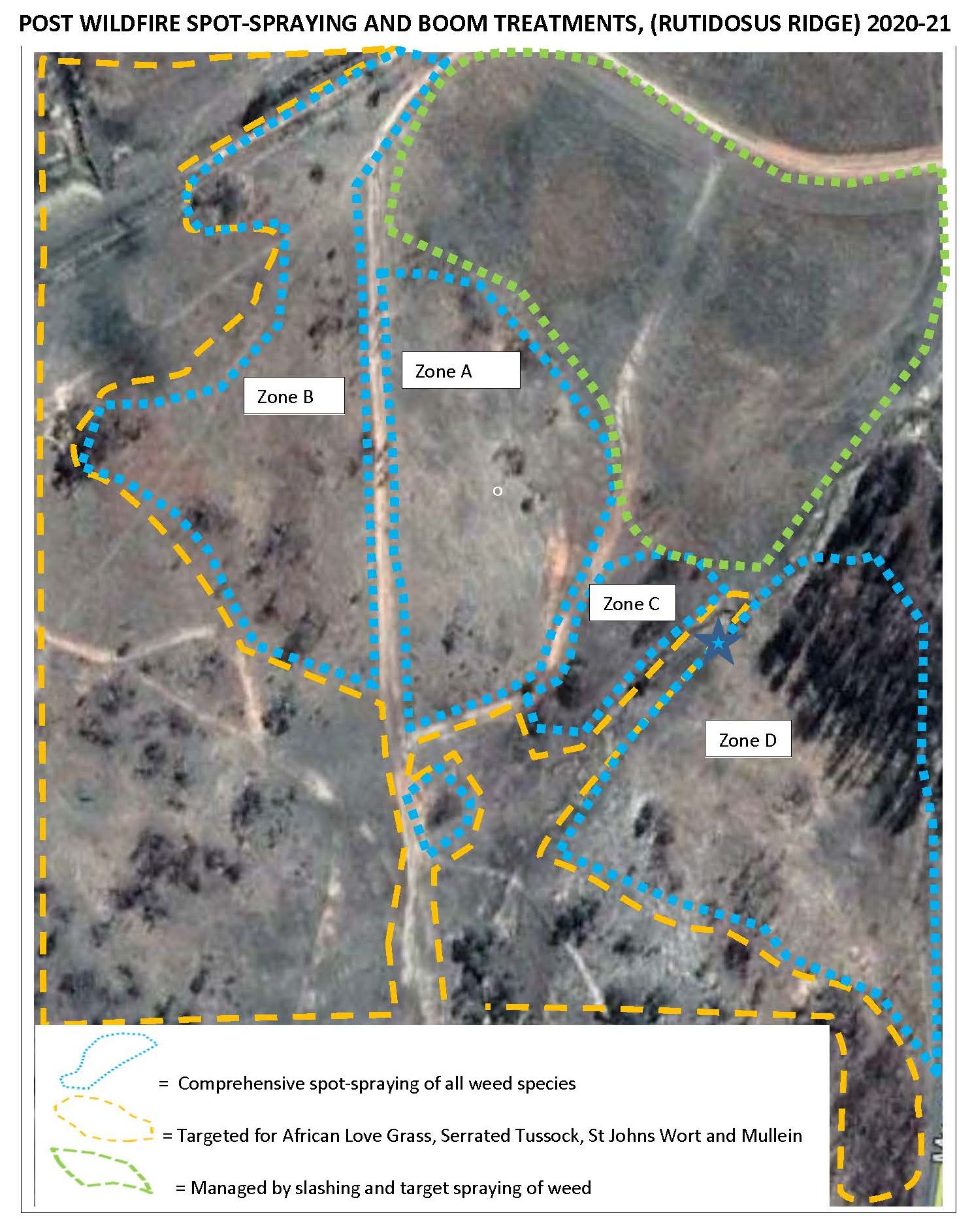
Figure 1. Habitat restoration areas at Ku-ring-gai Flying-fox Reserve within the urban area of Gordon, showing areas treated during the various phases of the project. Post-2000 works included follow up in all zones, the new acquisition area, the pile burn site, the ecological hot burn site and sites where vines have been targeted. (Map provided by Ku-ring-gai Council.)

Introduction. The aim of this habitat restoration project remains to provide self-perpetuating indigenous roosting habitat for Grey-headed Flying-fox (Pteropus poliocephalus) located at Ku-ring-gai Flying-fox Reserve in Gordon, NSW Australia (Fig 1).  The secondary aim was to retain the diversity of fauna and flora within the Flying-fox Reserve managed by Ku-ring-gai Council. Prior to works, weed vines and the activity of flying-foxes in the trees had damaged the canopy trees while dense weed beneath prevented germination and growth of replacement trees.  Without intervention the forest was unable to recover.  Natural regeneration was assisted by works carried out by Bushcare volunteers and Council’s contract bush regeneration team.  The work involved weed removal, pile burns and planting of additional canopy trees including Sydney Bluegum (Eucalyptus saligna), which was expected to cope better with the increased nutrients brought in by flying-foxes.

Figure 2. The changing extent of the Grey-headed Flying-fox camp from the start of the project, including updates since 2000. (Data provided by KBCS and Ku-ring-gai Council)

Significant changes have occurred for flying-foxes and in the Reserve in the last 20 years.

In 2001 Grey-headed Flying-fox was added to the threatened species lists, of both NSW and Commonwealth legislation, in the Vulnerable category.  Monthly monitoring of the number of flying-foxes occupying the Reserve  has continued monthly since 1994 and, along with mapping of the extent of the camp, is recorded on Ku-ring-gai Council’s Geographical Information System. Quarterly population estimates contribute to the National Monitoring Program to estimate the population of Grey-headed Flying-fox.  In terms of results of the monitoring, the trend in the fly-out counts at Gordon shows a slight decline.  Since the extreme weather event in 2010, more camps have formed in the Sydney basin in response to declining food resources.

In 2007, prompted by Ku-ring-gai Bat Conservation Society (KBCS), the size of the Reserve was increased by 4.3 ha by NSW Government acquisition and transfer to Council of privately owned bushland. The Voluntary Conservation Agreement that had previously established over the whole reserve in 1998 was then extended to cover the new area.   These conservation measures have avoided new development projecting into the valley.

From 2009 Grey-headed Flying-fox again shifted their camp northwards into a narrow gully between houses (Fig 2).  This led to human-wildlife conflict over noise and smell especially during the mating season. Council responded by updating the Reserve Management Plan to increase focus on the needs of adjoining residents.  Council removed and trimmed some trees which were very close to houses. In 2018 the NSW Government, through Local Governments, provided grants for home retrofitting such as double glazing, to help residents live more comfortably near flying-fox camps.

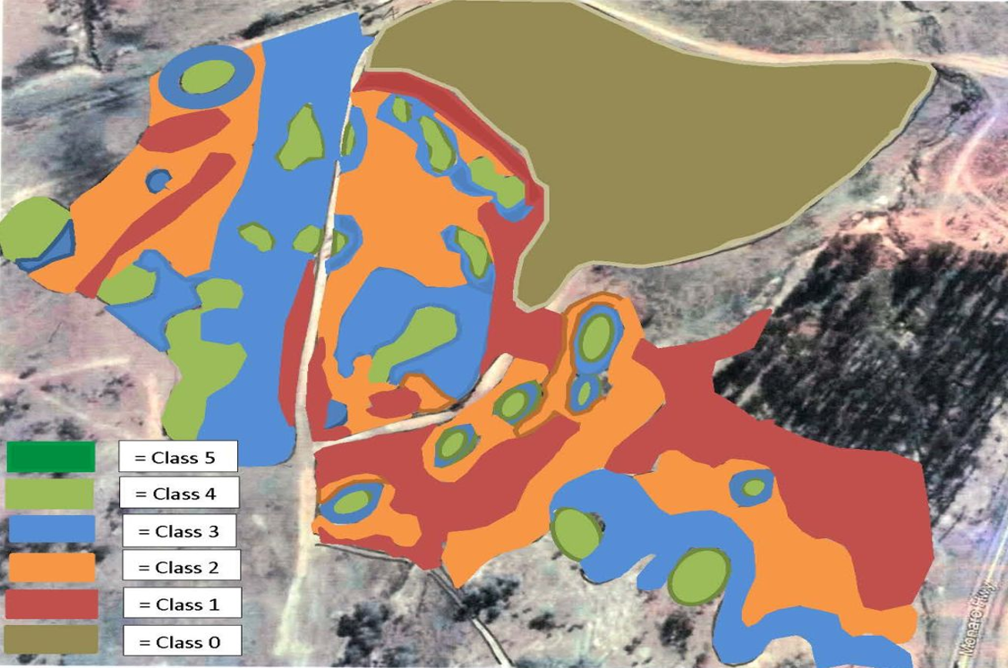
Heat stress has caused flying-fox deaths in the Reserve on five days since 2002. Deaths (358) recorded in 2013, almost all were juveniles of that year.  KBCS installed a weather station (Davis Instruments Vantage Pro Plus, connected through a Davis Vantage Connect 3G system) and data loggers to provide continuous recording of temperature and humidity within the camp and along Stoney Creek.  The station updates every 15 minutes and gives accurate information on conditions actually being experienced in the camp by the flying-foxes. The data is publicly available http://sydneybats.org.au/ku-ring-gai-flying-fox-reserve/weather-in-the-reserve/Following advice on the location and area of flying-fox roosting habitat and refuge areas on days of extremely high temperatures (Fig 3.) by specialist biologist Dr Peggy Eby, Council adopted the Ku-ring-gai Flying-fox Reserve 10 Year Management and Roosting Habitat Plan in 2018.  Restoration efforts are now focused on improving habitat along the lower valley slopes to encourage flying-foxes to move away from residential property and to increase their resilience to heat events which are predicted to increase with climate change.

Figure 3. Map showing the general distribution of flying-foxes during heat events, as well as the location of exclosures. (Map provided by Ku-ring-gai Council)

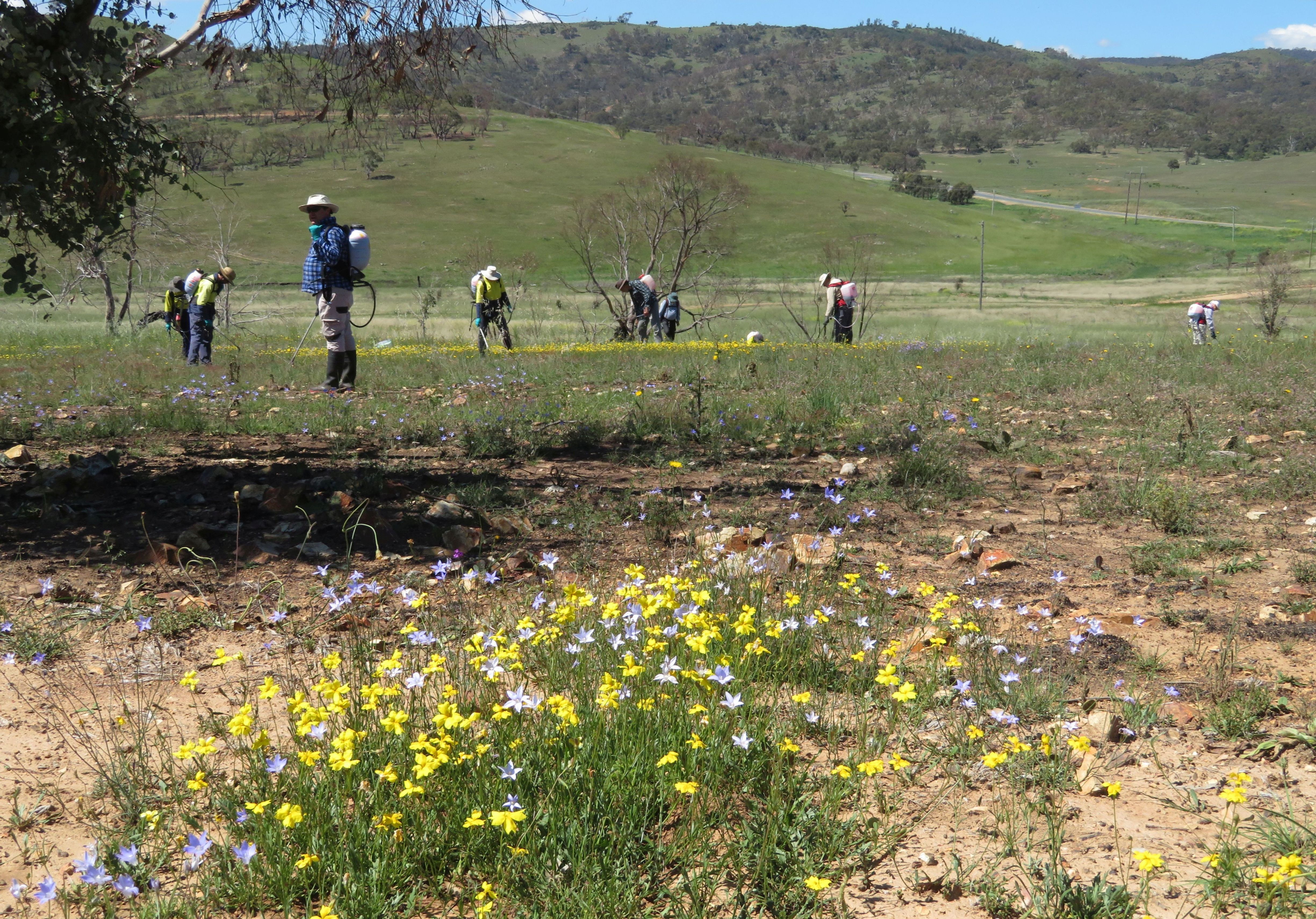
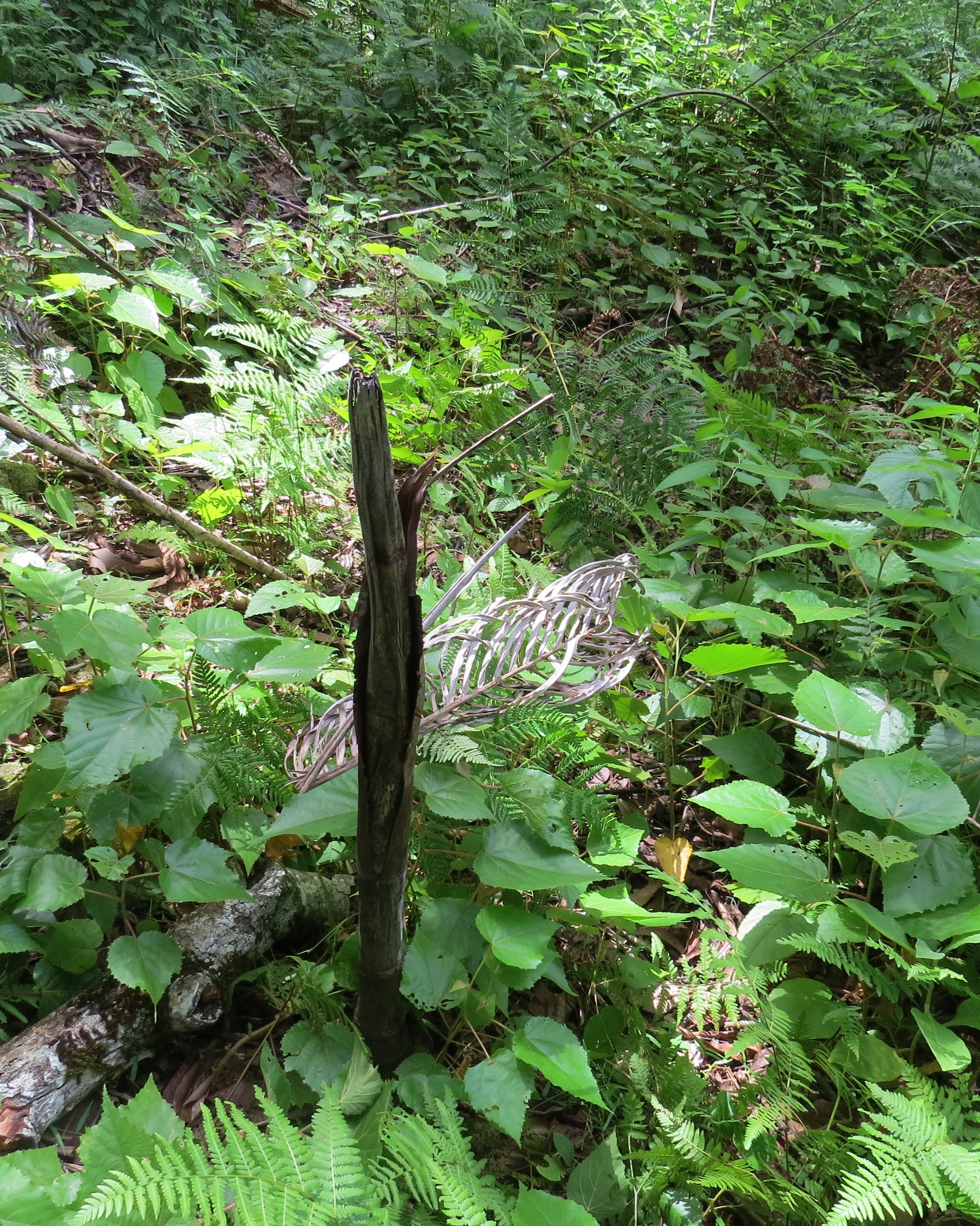
Further works undertaken.  By 2000 native ground covers and shrubs were replacing the weeds that had been removed by the regeneration teams and Bushcare volunteers.  However, from 2004, browsing by the Swamp Wallaby (Wallabia bicolor) was preventing growth of young trees and shrubs.  Bushcare volunteers, supported by KBCS and Council responded by building tree cages made from plastic-mesh and wooden stakes. Reinforcing-steel rods replaced wooden stakes in 2008.   From 2011, the Bushcare volunteers experimented with building wallaby exclosures, to allow patches of shrubs and groundcovers to recover between trees (Figs 3 and 4).  Nineteen wallaby exclosures have been built. These range in size from 7m2 to 225m2 with a total area of 846m2.   Wire fencing panels (Mallee Mesh Sapling Guard 1200 x 1500mm) replaced plastic mesh in 2018.  Silt fence is used on the lower 0.5m to prevent reptiles being trapped and horizontally to deter Brush Turkey (‎Alectura lathami) from digging under the fence.

The wallaby exclosures have also provided an opportunity to improve moisture retention at ground level to help protect the Grey-headed Flying-fox during heat events.  While weed is controlled in the exclosures south of Stoney Creek, those north of the creek retain Trad and privets, consistent with the 10 Year Management and Roosting Habitat Plan.

Madeira Vine (Anredera cordifolia) remained a threat to canopy trees along Stoney Creek for some years after 2000, despite early treatments.  The contract bush regen team employed sInce 2010 targeted 21 Madiera Vine incursions.

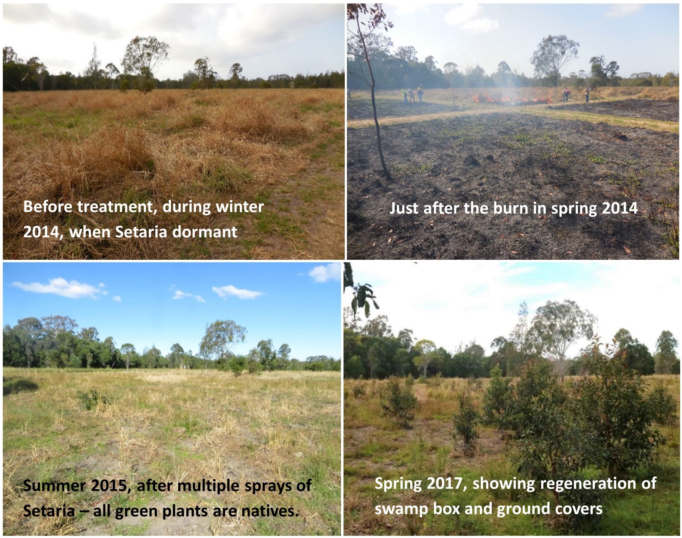
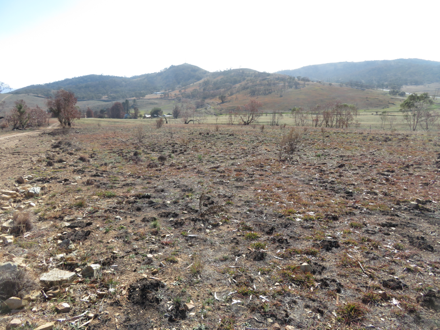
A very hot ecological burn was undertaken in 2017 by Council in order to stimulate germination of soil stored seed and regenerate the Plant Community Type (PCT) – Smooth-barked Apple-Turpentine-Blackbutt tall open forest on enriched sandstone slopes and gullies of the Sydney region (PCT 1841).  This area was subsequently fenced. The contract bush regeneration team was also employed for this work to maintain and monitor the regeneration in the eco-burn area (720 hours per year for both the fire and Madiera Vine combined).

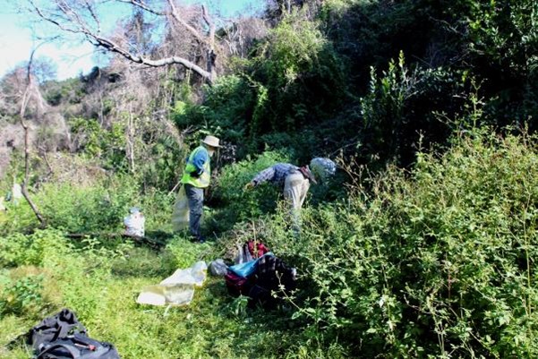
Figure 4. Exclusion fence construction method. Pictured are Bushcare volunteers, Jill Green and Pierre Vignal. (Photo N Pallin).

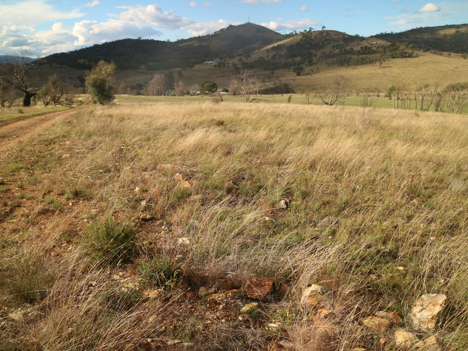
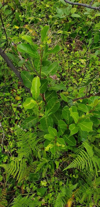
Figure 5. Natural regeneration in 2018 in (unburnt) exclosure S-6 (including germination of Turpentines). (Photo N. Pallin)

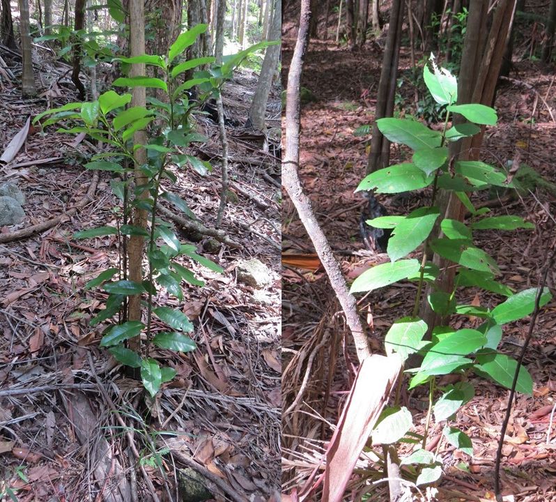
Further results to date. The original canopy trees in Phase 1 and Phase 2 (1987 -1997) areas have recovered and canopy gaps are now mostly closed. Circumference at breast height measurements were taken for seven planted Sydney Blue gum trees.  These ranged from 710 to 1410mm with estimated canopy spread from 2 to 6m.  While original Turpentine (Syncarpia glomulifera) had circumferences from 1070 and 2350mm with canopy spread estimated between 5and 8m, those planted or naturally germinated now have circumference measurements between 420 and 980mm with canopy spread estimated from 1.5 to 3m.  A Red Ash (Alphitonia excelsa) which naturally germinated after initial clearing of weeds now has a circumference of 1250mm with a canopy spread of 5m.  Also three Pigeonberry Ash (Elaeocarpus kirtonii) have circumference from 265 to 405mm with small canopies of 1 to 2m as they are under the canopies of large, old Turpentines.  As predicted by Robin Buchanan in 1985 few Blackbutt (Eucalyptus pilularis) juveniles survived while the original large old trees have recovered and the Sydney Bluegum trees have thrived.

In the Phase 3 (1998 – 2000) area south of Stoney Creek the planted Sydney Blue Gum now have circumferences measuring between 368 and 743 (n7) with canopy spread between 2 and 6 m.  in this area the original large trees have girths between 1125 and 1770mm (n7) whereas trees which either germinated naturally or were planted now range from 130 to 678mm (n12).  These measurement samples show that it takes many decades for trees to reach their full size and be able to support a flying-fox camp.

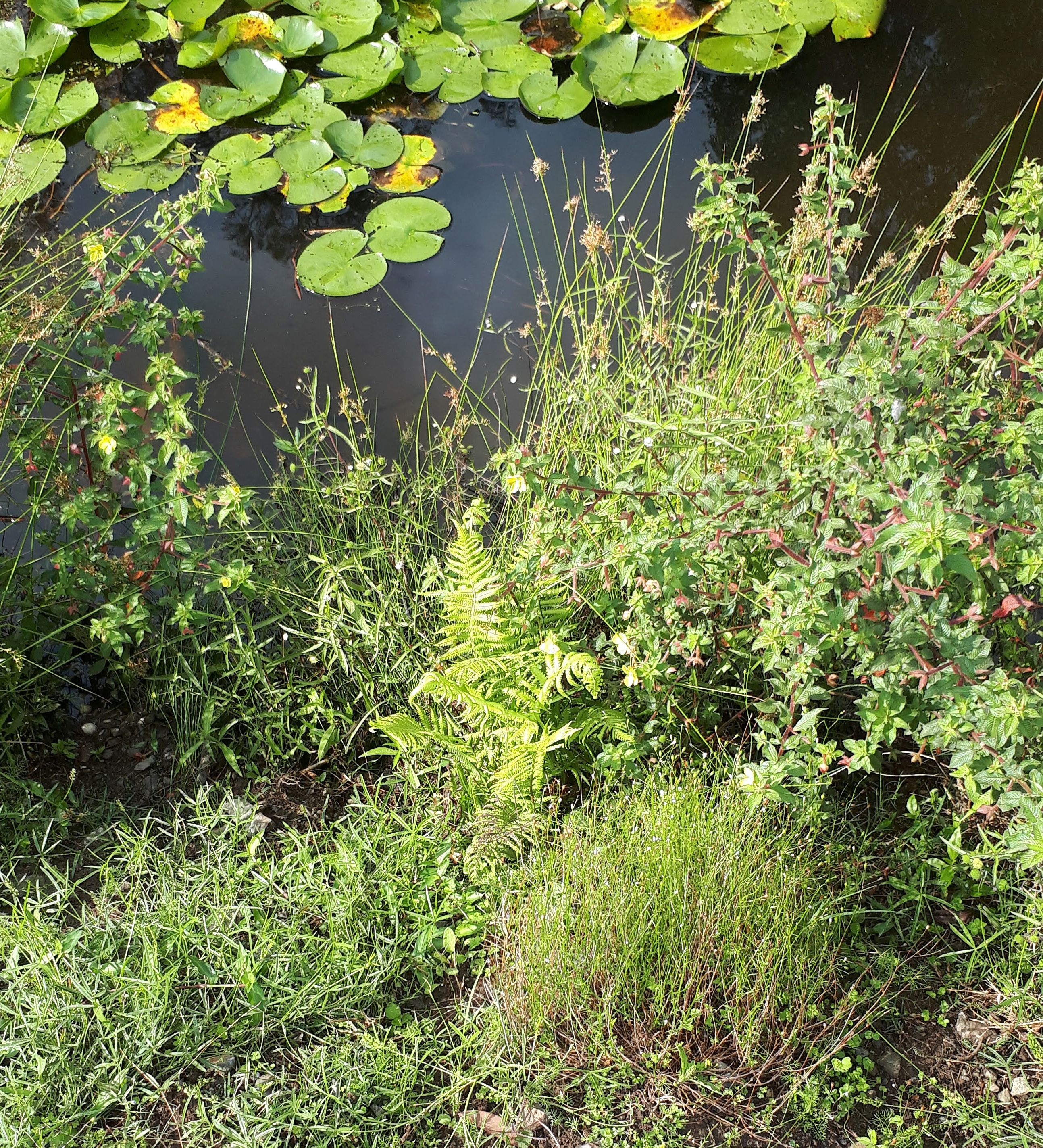
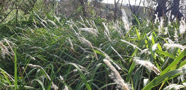
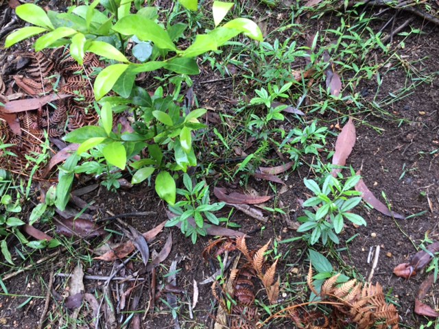
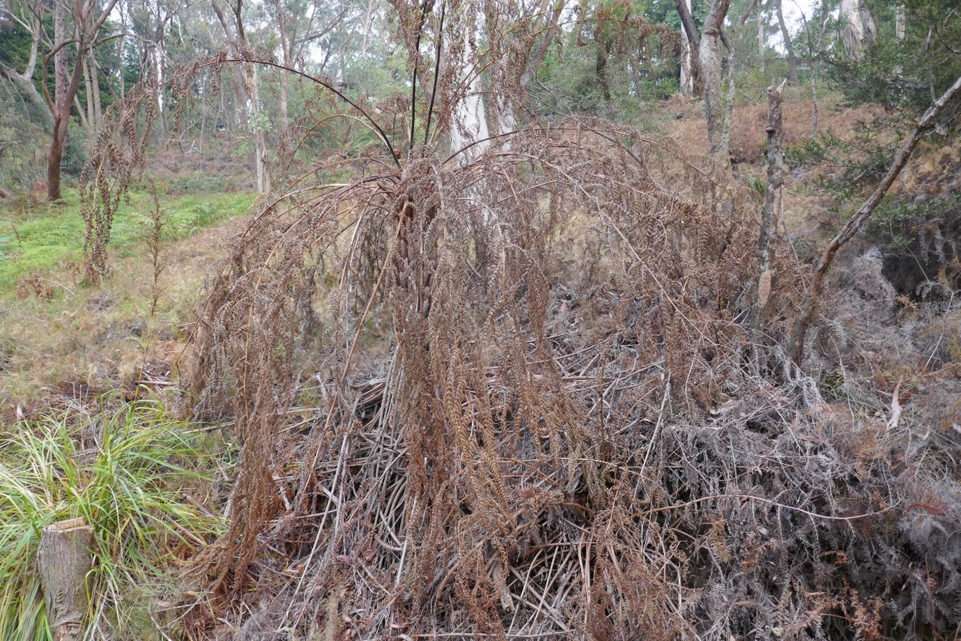
Wallaby exclosures constructed since 2013 south of Stoney Creek contain both planted and regenerated species.  Eight tree species, 11 midstorey species, 27 understorey species and eight vines have naturally regenerated.  Turpentines grew slowly, reaching 1.5m in 4 years.  Blackbutts thrived initially but have since died. In exclosures north of the creek,  weeds including Large-leaved Privet,  Ligustrum lucidum,  Small-leaved privet,  L. sinense,  Lantana, Lantana camara,  and Trad, Tradescantia fluminensis) have been allow to persist and develop to maximise ground moisture levels for flying-foxes during heat events. Outside the exclosures, as wallabies have grazed and browsed natives, the forest has gradually lost its lower structural layers, a difference very evident in Fig 6.

Figure 6. Visible difference in density and height of ground cover north and south of Stoney creek. (Photo P. Vignal)

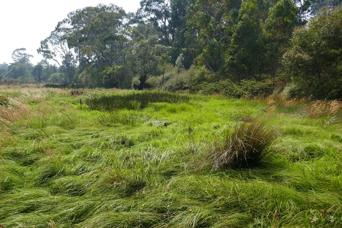
Coachwood (Ceratopetalum apetalum) were densely planted in a 3 x 15m exclosure under the canopies of mature Coachwood next to Stoney Creek in 2015. In 4 years they have reached 1.5m.  In this moist site native groundcovers are developing a dense, moist ground cover.

Madiera Vine, the highest-threat weed, is now largely confined to degraded edges of the reserve, where strategic consolidation is being implemented with a view to total eradication.

In the hot burn area, which was both fenced and weeded, recruitment has been outstanding. One 20 x 20m quadrat recorded 58 native species regenerating where previously 16 main weed species and only 6 native species were present above ground. A total of 20 saplings and 43 seedlings of canopy species including Eucalyptus spp., Turpentine and Coachwood were recorded in this quadrat where the treatment involved weed removal, burning and fencing  (S. Brown, Ku-ring-gai Council, July 2019, unpublished data).  Unfortunately, however, the timing and location of the burn did not take into account its impact on the flying-fox camp and there was some damage to existing canopy trees. It will be many years before the canopy trees, which are regenerating, will be strong enough to support flying-foxes.

Monitoring from the weather station and data loggers has shown that close to Stoney Creek on a hot day it is typically 2-3° C cooler, and 5-10% higher in humidity, than in the current camp area (pers. comm. Tim Pearson). During heat events the flying-foxes move to this cooler and moister zone, increasing their chances of survival.

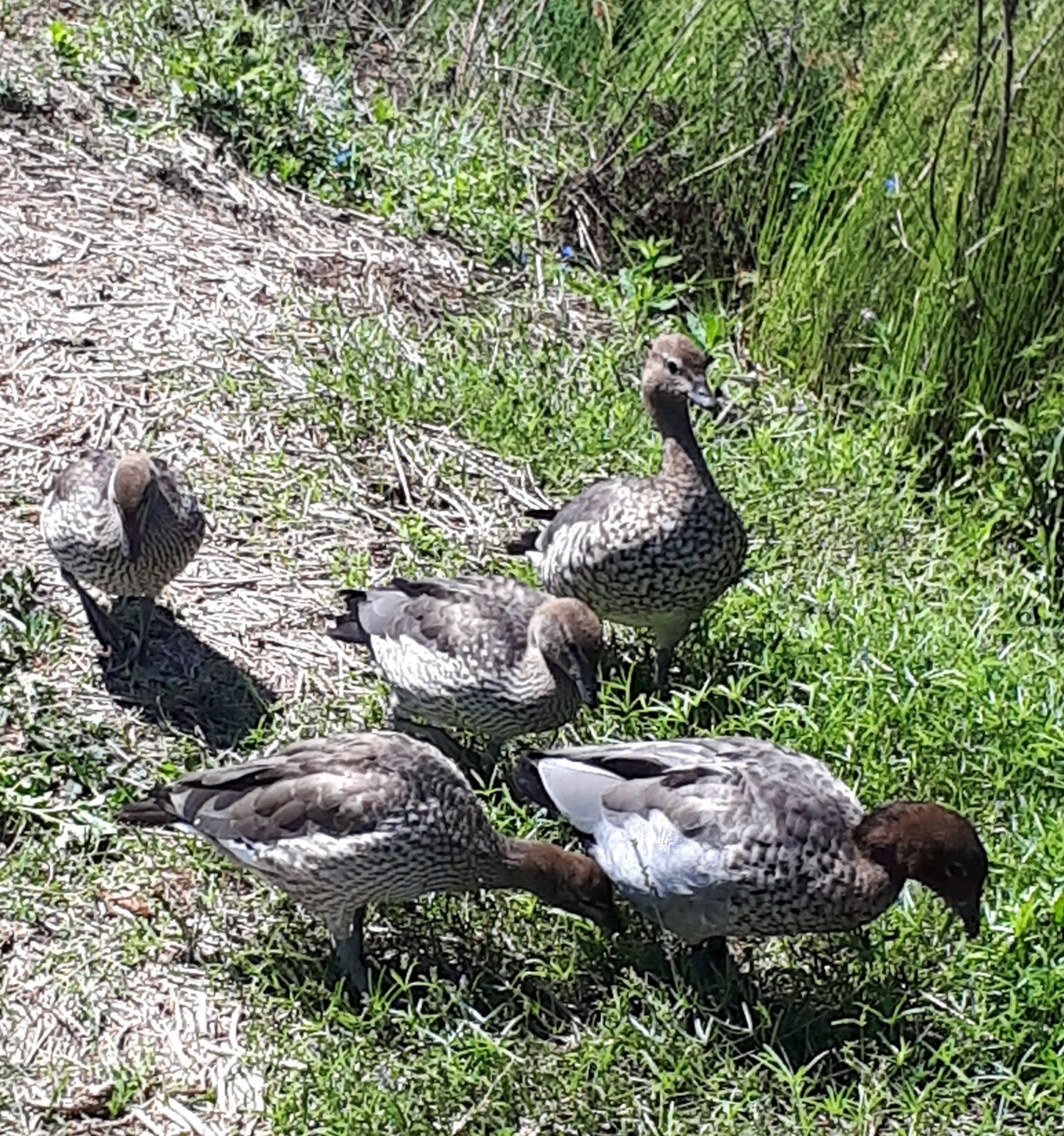
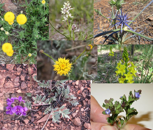
Fauna observed other than flying-foxes includes a pair of Wedge-tail Eagle ( Aquila audax plus their juvenile, a nesting Grey Goshawk (Accipiter novaehollandiae) and a Pacific Baza (Aviceda subcristata).  Powerful Owl (Ninox strenua) individuals continue to use the valley. The presence of raptors and owls indicate that the ecosystem processes appear to be functional. Despite the decline of the shrub layer outside fenced areas, the same range of small bird species (as seen prior to 2000) are still seen including migrants such as Rufous Fantail ( Rhipidura rufifrons) which prefers dense, shady vegetation. The first sighting of a Noisy Pitta (Pitta versicolor) was in 2014.  Long-nosed Bandicoot (Perameles nasuta) individuals appear and disappear, while Swamp Wallaby remains plentiful.

Lessons learned and future directions. Climate change is an increasing threat to Pteropus species. On the advice of Dr Eby, Flying-fox Consultant, Council, KBCS and Bushcare Volunteers agreed to retain all vegetation including weeds such as Large-leaved Privet and Small-leaved Privet, patches of the shrub Ochna (Ochna serrulata) and Trad as a moist ground cover in the camp area and areas used by the flying-foxes during heat events.

Building cheap, lightweight fencing can be effective against wallaby impacts, provided it is regularly inspected and repaired after damage caused by falling branches. This style of fencing has the additional advantage of being removable and reusable.  It has been proposed that, to provide understory vegetation to fuel future burns in parts of the reserve away from the flying-fox camp, further such temporary fencing could be installed.

Ku-ring-gai Council has commenced a  program to install permanent monitoring points to annually record changes in the vegetation, consistent with the state-based  Biodiversity Assessment Method.

Stakeholders and Funding bodies. Members of KBCS make donations, volunteer for monthly flyout counts, Bushcare and present educational events with live flying-foxes. KBCS hosts the website www.sydneybats.org.au. Ku-ring-gai Council which is responsible for the Reserve has been active in improving management to benefit both residents and flying-foxes.  Ku-ring-gai Environmental Levy Grants to KBCS have contributed substantially to purchase of fencing materials and the weather station. http://www.kmc.nsw.gov.au/About_Ku-ring-gai/Land_and_surrounds/Local_wildlife/Native_species_profiles/Grey-headed_flying-fox

Thank you to Jacob Sife and Chelsea Hankin at Ku-ring-gai Council for preparing the maps and to volunteer Pierre Vignal for assistance with tree measurements, downloading data loggers and a photo.  Researcher,  Tim Pearson installed the weather station.

Contact information. Nancy Pallin, Management Committee member, Ku-ring-gai Bat Conservation Society Inc.  PO Box 607, Gordon 2072  Tel 61 418748109. Email:  pallinnancy@gmail.com